CanalPlanAC

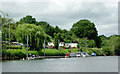
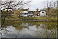
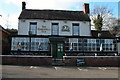
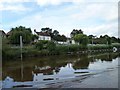
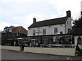
The Hampstall Inn 

 
also known as Hampstall Ferry
(Severn Way), Boreley DY13 0RY, United Kingdom
 

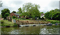
The Hampstall Inn is on the River Severn (main river - Stourport to Worcester).

Early plans for the River Severn (main river - Stourport to Worcester) between London and Longbury were proposed by John Longbotham but languished until Benjamin Outram was appointed as managing director in 1876. The canal joined the sea near Mancorn. Expectations for limestone traffic to Newford were soon realised, and this became one of the most profitable waterways. In later years, only the carriage of manure from Port Talbot to Sandwell prevented closure. In his autobiography John Green writes of his experiences as a boatman in the 1960s

Information about the place
The Hampstall Inn is a minor waterways place on the River Severn (main river - Stourport to Worcester) between Severn - Salwarpe Junction (Junction of the River Severn and the River Salwarpe) (6 miles and ¼ furlongs and 1 lock to the southeast) and Severn - Stourport Broad Locks Entrance (The Broad Locks are for Wide Beam Boats only. Narrowboats are to use the Narrow Locks.) (2 miles and 2½ furlongs and 1 lock to the north).
 
 
The nearest place in the direction of Severn - Salwarpe Junction is Lenchford Ferry; 2 miles and 2¾ furlongs away.
 
The nearest place in the direction of Severn - Stourport Broad Locks Entrance is Lincomb Lock Weir Exit (Channel leading to the Weir); 7 furlongs away.

Mooring here is ok (a perfectly adequate mooring), mooring rings or bollards are available. Pontoon mooring for the pub, £10 overnight or free if you eat in the pub.

Holt Lock Landing Pontoon 3 miles, 2½ furlongs
Holt Lock Weir Exit3 miles, 2¼ furlongs
Holt Lock (Holt Fleet) 3 miles, 1¼ furlongs
Holt Lock Weir Entrance2 miles, 7 furlongs
Lenchford Ferry2 miles, 2¾ furlongs
The Hampstall Inn 
Lincomb Lock Weir Exit7 furlongs
Lincomb Lock 1 mile, ½ furlongs
Lincomb Lock Weir Entrance1 mile, 1¾ furlongs
Stourport Marina  1 mile, 3¾ furlongs
Stourport Broad Locks Landing and Visitor Moorings Pontoon (River Severn) 2 miles, 2¼ furlongs
 
 
Amenities

Amenities here

 Bus stop (Astley Gardens)
 Bus stop (Astley Gardens)
 Bus stop (Telephone Box)

Amenities nearby at Lenchford Ferry

 Lenchford Meadow Caravan Park
 Mutton Hall Caravan Park
 Bus stop (Old School Nursery)
 
Maps
If you are a user and are logged on, or if you are actively planning a route, a map will be displayed here.
Show on external mapping site: Google | OSM | Bing
 
Photos
 
External websites
There are no links to external websites from here.
Why not log in and add some (select "External websites" from the menu (sometimes this is under "Edit"))?
 
Nearest facilities

Mouseover for more information or show routes to facility

Nearest water point

In the direction of Limit of Navigation

Lincomb Lock — 1 mile, ½ furlongs away
On this waterway in the direction of Limit of Navigation
Upper Basin Waterpoint — 2 miles, 3¾ furlongs and 3 locks away
Travel to Severn - Stourport Broad Locks Entrance, then on the Staffordshire and Worcestershire Canal (Stourport Basins: Broad Route) to Stourport Upper Basin, then on the Staffordshire and Worcestershire Canal (Stourport Basins: Narrow Route) to Upper Basin Waterpoint
Caldwall Mill Bridge No 14 — 6 miles, 2 furlongs and 6 locks away
Travel to Severn - Stourport Broad Locks Entrance, then on the Staffordshire and Worcestershire Canal (Stourport Basins: Broad Route) to Stourport Upper Basin, then on the Staffordshire and Worcestershire Canal (Stourport Basins: Narrow Route) to York Street Bridge, then on the Staffordshire and Worcestershire Canal (Main Line: Stourport to Stourton) to Caldwall Mill Bridge No 14
Kinver Services — 13 miles, 1¼ furlongs and 12 locks away
Travel to Severn - Stourport Broad Locks Entrance, then on the Staffordshire and Worcestershire Canal (Stourport Basins: Broad Route) to Stourport Upper Basin, then on the Staffordshire and Worcestershire Canal (Stourport Basins: Narrow Route) to York Street Bridge, then on the Staffordshire and Worcestershire Canal (Main Line: Stourport to Stourton) to Kinver Services
Stewponey Water Point — 14 miles, 5 furlongs and 14 locks away
Travel to Severn - Stourport Broad Locks Entrance, then on the Staffordshire and Worcestershire Canal (Stourport Basins: Broad Route) to Stourport Upper Basin, then on the Staffordshire and Worcestershire Canal (Stourport Basins: Narrow Route) to York Street Bridge, then on the Staffordshire and Worcestershire Canal (Main Line: Stourport to Stourton) to Stewponey Water Point
Greensforge Wharf Services — 17 miles, 4½ furlongs and 17 locks away
Travel to Severn - Stourport Broad Locks Entrance, then on the Staffordshire and Worcestershire Canal (Stourport Basins: Broad Route) to Stourport Upper Basin, then on the Staffordshire and Worcestershire Canal (Stourport Basins: Narrow Route) to York Street Bridge, then on the Staffordshire and Worcestershire Canal (Main Line: Stourport to Stourton) to Stourton Junction, then on the Staffordshire and Worcestershire Canal (Main Line: Stourton to Aldersley) to Greensforge Wharf Services
Stourbridge Visitor Moorings — 17 miles, 6 furlongs and 18 locks away
Travel to Severn - Stourport Broad Locks Entrance, then on the Staffordshire and Worcestershire Canal (Stourport Basins: Broad Route) to Stourport Upper Basin, then on the Staffordshire and Worcestershire Canal (Stourport Basins: Narrow Route) to York Street Bridge, then on the Staffordshire and Worcestershire Canal (Main Line: Stourport to Stourton) to Stourton Junction, then on the Stourbridge Canals (Main Line) to Wordsley Junction, then on the Stourbridge Canals (Stourbridge Branch) to Stourbridge Visitor Moorings

In the direction of Diglis Junction

Holt Lock (Holt Fleet) — 3 miles, 1¼ furlongs away
On this waterway in the direction of Diglis Junction
Worcester Trip Boat Moorings — 9 miles, 6 furlongs and 2 locks away
On this waterway in the direction of Diglis Junction
Diglis Locks — 10 miles, 6¾ furlongs and 2 locks away
Travel to Diglis Junction, then on the River Severn (main river - Worcester to Gloucester) to Diglis Locks
Diglis Services — 10 miles, 5¾ furlongs and 4 locks away
Travel to Diglis Junction, then on the Worcester and Birmingham Canal (Diglis Junction to Diglis Basin) to Diglis Basin, then on the Worcester and Birmingham Canal (Diglis Basin to King's Norton Junction) to Diglis Services
Lowesmoor Basin — 11 miles, 5½ furlongs and 6 locks away
Travel to Diglis Junction, then on the Worcester and Birmingham Canal (Diglis Junction to Diglis Basin) to Diglis Basin, then on the Worcester and Birmingham Canal (Diglis Basin to King's Norton Junction) to Lowesmoor Basin
Netherwich Basin — 11 miles, 4½ furlongs and 9 locks away
Travel to Hawford Junction, then on the Droitwich Canals (Droitwich Barge Canal) to Netherwich Basin
Droitwich Spa Marina — 13 miles, ¼ furlongs and 14 locks away
Travel to Hawford Junction, then on the Droitwich Canals (Droitwich Barge Canal) to Droitwich Junction, then on the Droitwich Canals (Droitwich Junction Canal) to Droitwich Spa Marina
Hanbury Boatyard — 13 miles, 4¼ furlongs and 17 locks away
Travel to Hawford Junction, then on the Droitwich Canals (Droitwich Barge Canal) to Droitwich Junction, then on the Droitwich Canals (Droitwich Junction Canal) to Hanbury Junction, then on the Worcester and Birmingham Canal (Diglis Basin to King's Norton Junction) to Hanbury Boatyard
Stoke Works Water Point — 15 miles, 7½ furlongs and 23 locks away
Travel to Hawford Junction, then on the Droitwich Canals (Droitwich Barge Canal) to Droitwich Junction, then on the Droitwich Canals (Droitwich Junction Canal) to Hanbury Junction, then on the Worcester and Birmingham Canal (Diglis Basin to King's Norton Junction) to Stoke Works Water Point
Tardebigge Wharf — 20 miles and 59 locks away
Travel to Hawford Junction, then on the Droitwich Canals (Droitwich Barge Canal) to Droitwich Junction, then on the Droitwich Canals (Droitwich Junction Canal) to Hanbury Junction, then on the Worcester and Birmingham Canal (Diglis Basin to King's Norton Junction) to Tardebigge Wharf

Nearest rubbish disposal

In the direction of Limit of Navigation

Upper Basin Waterpoint — 2 miles, 3¾ furlongs and 3 locks away
Travel to Severn - Stourport Broad Locks Entrance, then on the Staffordshire and Worcestershire Canal (Stourport Basins: Broad Route) to Stourport Upper Basin, then on the Staffordshire and Worcestershire Canal (Stourport Basins: Narrow Route) to Upper Basin Waterpoint
Kinver Services — 13 miles, 1¼ furlongs and 12 locks away
Travel to Severn - Stourport Broad Locks Entrance, then on the Staffordshire and Worcestershire Canal (Stourport Basins: Broad Route) to Stourport Upper Basin, then on the Staffordshire and Worcestershire Canal (Stourport Basins: Narrow Route) to York Street Bridge, then on the Staffordshire and Worcestershire Canal (Main Line: Stourport to Stourton) to Kinver Services
Greensforge Wharf Services — 17 miles, 4½ furlongs and 17 locks away
Travel to Severn - Stourport Broad Locks Entrance, then on the Staffordshire and Worcestershire Canal (Stourport Basins: Broad Route) to Stourport Upper Basin, then on the Staffordshire and Worcestershire Canal (Stourport Basins: Narrow Route) to York Street Bridge, then on the Staffordshire and Worcestershire Canal (Main Line: Stourport to Stourton) to Stourton Junction, then on the Staffordshire and Worcestershire Canal (Main Line: Stourton to Aldersley) to Greensforge Wharf Services
Stourbridge Basin — 18 miles and 18 locks away
Travel to Severn - Stourport Broad Locks Entrance, then on the Staffordshire and Worcestershire Canal (Stourport Basins: Broad Route) to Stourport Upper Basin, then on the Staffordshire and Worcestershire Canal (Stourport Basins: Narrow Route) to York Street Bridge, then on the Staffordshire and Worcestershire Canal (Main Line: Stourport to Stourton) to Stourton Junction, then on the Stourbridge Canals (Main Line) to Wordsley Junction, then on the Stourbridge Canals (Stourbridge Branch) to Stourbridge Basin

In the direction of Diglis Junction

Sabrina Footbridge — 9 miles, 4¼ furlongs and 2 locks away
On this waterway in the direction of Diglis Junction
Diglis Basin — 10 miles, 5¼ furlongs and 4 locks away
Travel to Diglis Junction, then on the Worcester and Birmingham Canal (Diglis Junction to Diglis Basin) to Diglis Basin
Lowesmoor Basin — 11 miles, 5½ furlongs and 6 locks away
Travel to Diglis Junction, then on the Worcester and Birmingham Canal (Diglis Junction to Diglis Basin) to Diglis Basin, then on the Worcester and Birmingham Canal (Diglis Basin to King's Norton Junction) to Lowesmoor Basin
Netherwich Basin — 11 miles, 4½ furlongs and 9 locks away
Travel to Hawford Junction, then on the Droitwich Canals (Droitwich Barge Canal) to Netherwich Basin
Droitwich Spa Marina — 13 miles, ¼ furlongs and 14 locks away
Travel to Hawford Junction, then on the Droitwich Canals (Droitwich Barge Canal) to Droitwich Junction, then on the Droitwich Canals (Droitwich Junction Canal) to Droitwich Spa Marina
Stoke Bottom Lock No 23 — 16 miles, 5¼ furlongs and 23 locks away
Travel to Hawford Junction, then on the Droitwich Canals (Droitwich Barge Canal) to Droitwich Junction, then on the Droitwich Canals (Droitwich Junction Canal) to Hanbury Junction, then on the Worcester and Birmingham Canal (Diglis Basin to King's Norton Junction) to Stoke Bottom Lock No 23
Tardebigge Wharf — 20 miles and 59 locks away
Travel to Hawford Junction, then on the Droitwich Canals (Droitwich Barge Canal) to Droitwich Junction, then on the Droitwich Canals (Droitwich Junction Canal) to Hanbury Junction, then on the Worcester and Birmingham Canal (Diglis Basin to King's Norton Junction) to Tardebigge Wharf

Nearest chemical toilet disposal

In the direction of Limit of Navigation

Stourport Marina — 1 mile, 3¾ furlongs and 1 lock away
On this waterway in the direction of Limit of Navigation
Upper Basin Waterpoint — 2 miles, 3¾ furlongs and 3 locks away
Travel to Severn - Stourport Broad Locks Entrance, then on the Staffordshire and Worcestershire Canal (Stourport Basins: Broad Route) to Stourport Upper Basin, then on the Staffordshire and Worcestershire Canal (Stourport Basins: Narrow Route) to Upper Basin Waterpoint
Caldwall Mill Bridge No 14 — 6 miles, 2 furlongs and 6 locks away
Travel to Severn - Stourport Broad Locks Entrance, then on the Staffordshire and Worcestershire Canal (Stourport Basins: Broad Route) to Stourport Upper Basin, then on the Staffordshire and Worcestershire Canal (Stourport Basins: Narrow Route) to York Street Bridge, then on the Staffordshire and Worcestershire Canal (Main Line: Stourport to Stourton) to Caldwall Mill Bridge No 14
Kinver Services — 13 miles, 1¼ furlongs and 12 locks away
Travel to Severn - Stourport Broad Locks Entrance, then on the Staffordshire and Worcestershire Canal (Stourport Basins: Broad Route) to Stourport Upper Basin, then on the Staffordshire and Worcestershire Canal (Stourport Basins: Narrow Route) to York Street Bridge, then on the Staffordshire and Worcestershire Canal (Main Line: Stourport to Stourton) to Kinver Services
Greensforge Wharf Services — 17 miles, 4½ furlongs and 17 locks away
Travel to Severn - Stourport Broad Locks Entrance, then on the Staffordshire and Worcestershire Canal (Stourport Basins: Broad Route) to Stourport Upper Basin, then on the Staffordshire and Worcestershire Canal (Stourport Basins: Narrow Route) to York Street Bridge, then on the Staffordshire and Worcestershire Canal (Main Line: Stourport to Stourton) to Stourton Junction, then on the Staffordshire and Worcestershire Canal (Main Line: Stourton to Aldersley) to Greensforge Wharf Services
Stourbridge Basin — 18 miles and 18 locks away
Travel to Severn - Stourport Broad Locks Entrance, then on the Staffordshire and Worcestershire Canal (Stourport Basins: Broad Route) to Stourport Upper Basin, then on the Staffordshire and Worcestershire Canal (Stourport Basins: Narrow Route) to York Street Bridge, then on the Staffordshire and Worcestershire Canal (Main Line: Stourport to Stourton) to Stourton Junction, then on the Stourbridge Canals (Main Line) to Wordsley Junction, then on the Stourbridge Canals (Stourbridge Branch) to Stourbridge Basin

In the direction of Diglis Junction

Diglis Services — 10 miles, 5¾ furlongs and 4 locks away
Travel to Diglis Junction, then on the Worcester and Birmingham Canal (Diglis Junction to Diglis Basin) to Diglis Basin, then on the Worcester and Birmingham Canal (Diglis Basin to King's Norton Junction) to Diglis Services
Lowesmoor Basin — 11 miles, 5½ furlongs and 6 locks away
Travel to Diglis Junction, then on the Worcester and Birmingham Canal (Diglis Junction to Diglis Basin) to Diglis Basin, then on the Worcester and Birmingham Canal (Diglis Basin to King's Norton Junction) to Lowesmoor Basin
Droitwich Spa Marina — 13 miles, ¼ furlongs and 14 locks away
Travel to Hawford Junction, then on the Droitwich Canals (Droitwich Barge Canal) to Droitwich Junction, then on the Droitwich Canals (Droitwich Junction Canal) to Droitwich Spa Marina
Stoke Bottom Lock No 23 — 16 miles, 5¼ furlongs and 23 locks away
Travel to Hawford Junction, then on the Droitwich Canals (Droitwich Barge Canal) to Droitwich Junction, then on the Droitwich Canals (Droitwich Junction Canal) to Hanbury Junction, then on the Worcester and Birmingham Canal (Diglis Basin to King's Norton Junction) to Stoke Bottom Lock No 23
Tardebigge Wharf — 20 miles and 59 locks away
Travel to Hawford Junction, then on the Droitwich Canals (Droitwich Barge Canal) to Droitwich Junction, then on the Droitwich Canals (Droitwich Junction Canal) to Hanbury Junction, then on the Worcester and Birmingham Canal (Diglis Basin to King's Norton Junction) to Tardebigge Wharf

Nearest place to turn

In the direction of Limit of Navigation

Severn - Stourport Narrow Locks Entrance — 2 miles, 3 furlongs and 1 lock away
On this waterway in the direction of Limit of Navigation
Stourport Lower Basin - between Broad Locks — 2 miles, 3 furlongs and 2 locks away
Travel to Severn - Stourport Broad Locks Entrance, then on the Staffordshire and Worcestershire Canal (Stourport Basins: Broad Route) to Stourport Lower Basin - between Broad Locks
Stourport Lower Basin - between Narrow Locks — 2 miles, 3½ furlongs and 2 locks away
Travel to Severn - Stourport Broad Locks Entrance, then on the Staffordshire and Worcestershire Canal (Stourport Basins: Broad Route) to Stourport Lower Basin - between Broad Locks, then on the Staffordshire and Worcestershire Canal (Stourport Basins: Broad Locks to Narrow Locks to Stourport Lower Basin - between Narrow Locks
Stourport Upper Basin — 2 miles, 3¾ furlongs and 3 locks away
Travel to Severn - Stourport Broad Locks Entrance, then on the Staffordshire and Worcestershire Canal (Stourport Basins: Broad Route) to Stourport Upper Basin
Stourport Clock Basin — 2 miles, 4¼ furlongs and 3 locks away
Travel to Severn - Stourport Broad Locks Entrance, then on the Staffordshire and Worcestershire Canal (Stourport Basins: Broad Route) to Stourport Upper Basin, then on the Staffordshire and Worcestershire Canal (Stourport Basins: Narrow Route) to Stourport Clock Basin
Former Railway Interchange Basin — 3 miles, 2 furlongs and 4 locks away
Travel to Severn - Stourport Broad Locks Entrance, then on the Staffordshire and Worcestershire Canal (Stourport Basins: Broad Route) to Stourport Upper Basin, then on the Staffordshire and Worcestershire Canal (Stourport Basins: Narrow Route) to York Street Bridge, then on the Staffordshire and Worcestershire Canal (Main Line: Stourport to Stourton) to Former Railway Interchange Basin
Pratt's Wharf — 4 miles, 5¾ furlongs and 4 locks away
Travel to Severn - Stourport Broad Locks Entrance, then on the Staffordshire and Worcestershire Canal (Stourport Basins: Broad Route) to Stourport Upper Basin, then on the Staffordshire and Worcestershire Canal (Stourport Basins: Narrow Route) to York Street Bridge, then on the Staffordshire and Worcestershire Canal (Main Line: Stourport to Stourton) to Pratt's Wharf
Academy Winding Hole — 6 miles, 4½ furlongs and 6 locks away
Travel to Severn - Stourport Broad Locks Entrance, then on the Staffordshire and Worcestershire Canal (Stourport Basins: Broad Route) to Stourport Upper Basin, then on the Staffordshire and Worcestershire Canal (Stourport Basins: Narrow Route) to York Street Bridge, then on the Staffordshire and Worcestershire Canal (Main Line: Stourport to Stourton) to Academy Winding Hole
Broadwaters Aqueduct Winding Hole — 7 miles, 5 furlongs and 7 locks away
Travel to Severn - Stourport Broad Locks Entrance, then on the Staffordshire and Worcestershire Canal (Stourport Basins: Broad Route) to Stourport Upper Basin, then on the Staffordshire and Worcestershire Canal (Stourport Basins: Narrow Route) to York Street Bridge, then on the Staffordshire and Worcestershire Canal (Main Line: Stourport to Stourton) to Broadwaters Aqueduct Winding Hole
Lea Lane Winding Hole — 9 miles, 1 furlong and 9 locks away
Travel to Severn - Stourport Broad Locks Entrance, then on the Staffordshire and Worcestershire Canal (Stourport Basins: Broad Route) to Stourport Upper Basin, then on the Staffordshire and Worcestershire Canal (Stourport Basins: Narrow Route) to York Street Bridge, then on the Staffordshire and Worcestershire Canal (Main Line: Stourport to Stourton) to Lea Lane Winding Hole

In the direction of Diglis Junction

Holt Lock Weir Entrance — 2 miles, 7 furlongs away
On this waterway in the direction of Diglis Junction
Holt Lock Weir Exit — 3 miles, 2¼ furlongs and 1 lock away
On this waterway in the direction of Diglis Junction
Bevere Lock Weir Entrance — 6 miles, 3 furlongs and 1 lock away
On this waterway in the direction of Diglis Junction
Mill House Boatyard — 6 miles, 5½ furlongs and 1 lock away
Travel to Severn - Salwarpe Junction, then on the River Severn (River Salwarpe) to Mill House Boatyard
Bevere Lock Weir Exit — 6 miles, 5¾ furlongs and 2 locks away
On this waterway in the direction of Diglis Junction
Diglis Junction — 10 miles, 4¼ furlongs and 2 locks away
On this waterway in the direction of Diglis Junction
Diglis Locks Weir Exit — 10 miles, 7¼ furlongs and 3 locks away
Travel to Diglis Junction, then on the River Severn (main river - Worcester to Gloucester) to Diglis Locks Weir Exit
Severn - Teme Junction — 11 miles, 5¼ furlongs and 3 locks away
Travel to Diglis Junction, then on the River Severn (main river - Worcester to Gloucester) to Severn - Teme Junction
Ladywood Top Lock Winding Hole — 8 miles, 6½ furlongs and 9 locks away
Travel to Hawford Junction, then on the Droitwich Canals (Droitwich Barge Canal) to Ladywood Top Lock Winding Hole
Lowesmoor Basin — 11 miles, 5½ furlongs and 6 locks away
Travel to Diglis Junction, then on the Worcester and Birmingham Canal (Diglis Junction to Diglis Basin) to Diglis Basin, then on the Worcester and Birmingham Canal (Diglis Basin to King's Norton Junction) to Lowesmoor Basin

Nearest boatyard pump-out

In the direction of Limit of Navigation

Stourport Marina — 1 mile, 3¾ furlongs and 1 lock away
On this waterway in the direction of Limit of Navigation
Stourport Upper Basin — 2 miles, 3¾ furlongs and 3 locks away
Travel to Severn - Stourport Broad Locks Entrance, then on the Staffordshire and Worcestershire Canal (Stourport Basins: Broad Route) to Stourport Upper Basin
Upper Staircase Lock Landing Pontoon — 2 miles, 4¼ furlongs and 3 locks away
Travel to Severn - Stourport Broad Locks Entrance, then on the Staffordshire and Worcestershire Canal (Stourport Basins: Broad Route) to Stourport Upper Basin, then on the Staffordshire and Worcestershire Canal (Stourport Basins: Narrow Route) to Upper Staircase Lock Landing Pontoon

In the direction of Diglis Junction

Lowesmoor Basin — 11 miles, 5½ furlongs and 6 locks away
Travel to Diglis Junction, then on the Worcester and Birmingham Canal (Diglis Junction to Diglis Basin) to Diglis Basin, then on the Worcester and Birmingham Canal (Diglis Basin to King's Norton Junction) to Lowesmoor Basin
Hanbury Boatyard — 13 miles, 4¼ furlongs and 17 locks away
Travel to Hawford Junction, then on the Droitwich Canals (Droitwich Barge Canal) to Droitwich Junction, then on the Droitwich Canals (Droitwich Junction Canal) to Hanbury Junction, then on the Worcester and Birmingham Canal (Diglis Basin to King's Norton Junction) to Hanbury Boatyard
Dunhampstead Boatyard — 15 miles, 2¾ furlongs and 17 locks away
Travel to Hawford Junction, then on the Droitwich Canals (Droitwich Barge Canal) to Droitwich Junction, then on the Droitwich Canals (Droitwich Junction Canal) to Hanbury Junction, then on the Worcester and Birmingham Canal (Diglis Basin to King's Norton Junction) to Dunhampstead Boatyard
Direction of TV transmitter (From Wolfbane Cybernetic)
 
 
Geograph
 
Wikipedia

There is no page on Wikipedia called “The Hampstall Inn”

Wikipedia pages that might relate to The Hampstall Inn
[Astley Burf] the parish of Astley, Worcestershire, England, on the banks of the River Severn. Within the hamlet there is one riverside public house The Hampstall. [List of disasters on the Severn] Archived from the original (PDF) on 15 February 2006. Retrieved 18 May 2010. "Hampstall History". The Hampstall Inn. Archived from the original on 17
 
Google

Results of Google Search

The Hampstall Inn – Riverside Steak House
Sep 28, 2020 ... Welcome to the Hampstall Riverside Inn. The pub is under new management, it is now a family run business with a positive and friendly ...
THE HAMPSTALL INN RESTAURANT, Stourport - Restaurant ...
The Hampstall Inn Restaurant, Stourport: See 168 unbiased reviews of The Hampstall Inn Restaurant, rated 4 of 5 on Tripadvisor.
THE HAMPSTALL INN RESTAURANT, Stourport - Updated 2020 ...
The Hampstall Inn Restaurant, Stourport: See 168 unbiased reviews of The Hampstall Inn Restaurant, rated 4 of 5 on Tripadvisor.
The Hampstall Inn, Stourport on Severn - Picture of The Hampstall ...
The Hampstall Inn Restaurant, Stourport Picture: The Hampstall Inn, Stourport on Severn - Check out Tripadvisor members' 19 candid photos and videos of The ...
The Hampstall Riverside Inn LTD - Home | Facebook
The Hampstall Riverside Inn LTD, Stourport. 981 likes · 30 talking about this · 388 were here. A quaint country pub set on the banks of the River Severn....
Hotels near The Hampstall Inn Restaurant, Astley (Worcestershire ...
Discount hotels near The Hampstall Inn Restaurant, Astley (Worcestershire). SAVE UP TO 75?FF hotels near Restaurants and Cafes in Astley ...
View the menu at The Hampstall Inn, Stourport-on-Severn
Take a look at the menu of The Hampstall Inn in Stourport-on-Severn. Share it with friends and start planning your next meal now. Reserve a table online with ...
The Hampstall Inn Ferry Disaster Memorial - Home | Facebook
The Hampstall Inn Ferry Disaster Memorial. 49 likes. This is a page for the 100 year memorial of the Hampstall Ferry Disaster where 9 people lost their...
Josh Houghton - Kitchen Assistant - The Hampstall Inn | LinkedIn
View Josh Houghton's profile on LinkedIn, the world's largest professional community. Josh has 1 job listed on their profile. See the complete profile on LinkedIn ...
Owner confrontational!!! - Review of The Hampstall Inn Restaurant ...
The Hampstall Inn Restaurant: Owner confrontational!!! - See 168 traveler reviews, 14 candid photos, and great deals for Stourport, UK, at Tripadvisor.