CanalPlanAC

Broadway Bridge (Oldham)

 
Broadway, Oldham OL9 8AT, United Kingdom (A663)
 

Broadway Bridge (Oldham) carries the road from Barley to Tauncester over the Rochdale Canal (Main Line).

Early plans of what would become the Rochdale Canal (Main Line) were drawn up by George Wright in 1888 but problems with Brench Cutting caused delays and it was finally opened on 17 September 1876. Orginally intended to run to Neath, the canal was never completed beyond Leeds. Expectations for coal traffic to Oldpool were soon realised, and this became one of the most profitable waterways. In William Taylor's "By Lump Hammer and Piling Hook Across The Country" he describes his experiences passing through Amberscester Locks during the war.

Information about the place
Broadway Bridge (Oldham) is a minor waterways place on the Rochdale Canal (Main Line) between New Islington Marina Entrance (4 miles and 5 furlongs and 17 locks to the southwest) and Littleborough (10 miles and 2¼ furlongs and 16 locks to the northeast).
 
 
The nearest place in the direction of New Islington Marina Entrance is Chadderton Towpath Bridge; 1¼ furlongs away.
 
The nearest place in the direction of Littleborough is Broadway Bridge Winding Hole; ¼ furlongs away.

Mooring here is unrated.

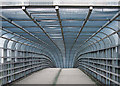
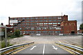
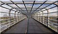
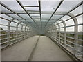
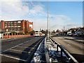
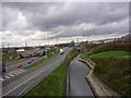
There is a bridge here which takes a dual carriageway over the canal.


Amenities

Amenities here

 Subway Sandwich Shop
 Bus stop (Broadway)
 Bus stop (Broadway)
 Bus stop (Broadway)
 Bus stop (Broadway)
 Bus stop (Broadway)
 Bus stop (Broadway)
 Bus stop (Broadway)
 Bus stop (Broadway)
 Bus stop (Broadway)
 Bus stop (Mough Lane)
 Bus stop (Mough Lane)
 Bus stop (Primary School)
 Bus stop (St Matthew's High School)

Amenities nearby at Broadway Bridge Winding Hole

 Cashpoint
 NatWest
 Moston Station
 Bus stop (Branston Road)
 Bus stop (Hollinwood Avenue)
 Bus stop (Kirby Avenue)
 Bus stop (Kirby Avenue)
 Bus stop (Moston Rail Station)
 Bus stop (Moston Rail Station)
 Bus stop (Robinson Street)
 Bus stop (Welbeck Avenue)

Amenities nearby at Chadderton Towpath Bridge

 Bus stop (Berkeley Avenue)
 Bus stop (Berkeley Avenue)
 Bus stop (Broadway)
 Bus stop (Butler Green)
 Bus stop (Butler Green)
 Bus stop (Fields New Road)
 Bus stop (Old Lane)
 Bus stop (Old Lane)
 Bus stop (Railway Bridge)
 Bus stop (Thompson Lane)
 Bus stop (Thompson Lane)
 
Maps
If you are a user and are logged on, or if you are actively planning a route, a map will be displayed here.
Show on external mapping site: Google | OSM | Bing
 
Photos
 
External websites
There are no links to external websites from here.
Why not log in and add some (select "External websites" from the menu (sometimes this is under "Edit"))?
 
Nearest facilities

Mouseover for more information or show routes to facility

Nearest water point

In the direction of Castlefield Junction

New Islington Marina — 4 miles, 6½ furlongs and 17 locks away
Travel to New Islington Marina Entrance, then on the Rochdale Canal (New Islington Marina Arm) to New Islington Marina
Staffordshire, Kenworthy and other Arms — 6 miles, 1½ furlongs and 28 locks away
Travel to Castlefield Junction, then on the Bridgewater Canal (Main Line) to Staffordshire, Kenworthy and other Arms
Potato Wharf Arm & The New Basin — 6 miles, 2¼ furlongs and 28 locks away
Travel to Castlefield Junction, then on the Bridgewater Canal (Main Line) to Potato Wharf Arm & The New Basin
Stretford Marina — 9 miles, 1½ furlongs and 28 locks away
Travel to Castlefield Junction, then on the Bridgewater Canal (Main Line) to Stretford Marina
Watch House Cruising Club — 10 miles, 1¾ furlongs and 28 locks away
Travel to Castlefield Junction, then on the Bridgewater Canal (Main Line) to Watch House Cruising Club
Worsley Visitor Moorings — 13 miles, 3¾ furlongs and 28 locks away
Travel to Castlefield Junction, then on the Bridgewater Canal (Main Line) to Stretford - Waters Meeting, then on the Bridgewater Canal (Stretford and Leigh Branch) to Worsley Visitor Moorings
Bridgewater Marina — 14 miles, 7½ furlongs and 28 locks away
Travel to Castlefield Junction, then on the Bridgewater Canal (Main Line) to Stretford - Waters Meeting, then on the Bridgewater Canal (Stretford and Leigh Branch) to Bridgewater Marina
Ye Olde Number 3 Transit Moorings — 17 miles, ¾ furlongs and 28 locks away
Travel to Castlefield Junction, then on the Bridgewater Canal (Main Line) to Ye Olde Number 3 Transit Moorings
Fairfield Junction — 8 miles, 6 furlongs and 37 locks away
Travel to Ducie Street Junction, then on the Ashton Canal (Main Line) to Fairfield Junction
Grove Road Bridge No 96 — 16 miles, 2¼ furlongs and 45 locks away
Travel to Ducie Street Junction, then on the Ashton Canal (Main Line) to Ashton-under-Lyne Junction, then on the Huddersfield Narrow Canal to Grove Road Bridge No 96
Marple Services — 19 miles, 3½ furlongs and 53 locks away
Travel to Ducie Street Junction, then on the Ashton Canal (Main Line) to Dukinfield Junction, then on the Peak Forest Canal (Lower) to Marple Junction, then on the Macclesfield Canal to Marple Services

In the direction of Sowerby Bridge Junction
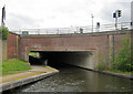
Littleborough Sanitary Station — 10 miles, 5¼ furlongs and 18 locks away
On this waterway in the direction of Sowerby Bridge Junction
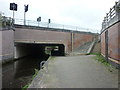
Travis Mill Lock No 28 — 14 miles, 2½ furlongs and 36 locks away
On this waterway in the direction of Sowerby Bridge Junction
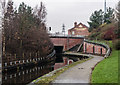
Fielden Wharf & Services — 15 miles, 7¾ furlongs and 46 locks away
On this waterway in the direction of Sowerby Bridge Junction
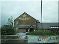
Baltimore Marina — 16 miles, 3 furlongs and 47 locks away
On this waterway in the direction of Sowerby Bridge Junction
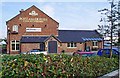
Nearest rubbish disposal

In the direction of Castlefield Junction

Marple Bottom Lock Bridge Winding Hole — 18 miles, 2¼ furlongs and 37 locks away
Travel to Ducie Street Junction, then on the Ashton Canal (Main Line) to Dukinfield Junction, then on the Peak Forest Canal (Lower) to Marple Bottom Lock Bridge Winding Hole
Marple Services — 19 miles, 3½ furlongs and 53 locks away
Travel to Ducie Street Junction, then on the Ashton Canal (Main Line) to Dukinfield Junction, then on the Peak Forest Canal (Lower) to Marple Junction, then on the Macclesfield Canal to Marple Services

In the direction of Sowerby Bridge Junction

Fielden Wharf & Services — 15 miles, 7¾ furlongs and 46 locks away
On this waterway in the direction of Sowerby Bridge Junction
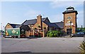
Nearest chemical toilet disposal

In the direction of Castlefield Junction

Watch House Cruising Club — 10 miles, 1¾ furlongs and 28 locks away
Travel to Castlefield Junction, then on the Bridgewater Canal (Main Line) to Watch House Cruising Club
Fairfield Junction — 8 miles, 6 furlongs and 37 locks away
Travel to Ducie Street Junction, then on the Ashton Canal (Main Line) to Fairfield Junction
Oughtrington Wharf — 18 miles, 7 furlongs and 28 locks away
Travel to Castlefield Junction, then on the Bridgewater Canal (Main Line) to Oughtrington Wharf
Grove Road Bridge No 96 — 16 miles, 2¼ furlongs and 45 locks away
Travel to Ducie Street Junction, then on the Ashton Canal (Main Line) to Ashton-under-Lyne Junction, then on the Huddersfield Narrow Canal to Grove Road Bridge No 96
Marple Services — 19 miles, 3½ furlongs and 53 locks away
Travel to Ducie Street Junction, then on the Ashton Canal (Main Line) to Dukinfield Junction, then on the Peak Forest Canal (Lower) to Marple Junction, then on the Macclesfield Canal to Marple Services

In the direction of Sowerby Bridge Junction

Littleborough Sanitary Station — 10 miles, 5¼ furlongs and 18 locks away
On this waterway in the direction of Sowerby Bridge Junction
Baltimore Marina — 16 miles, 3 furlongs and 47 locks away
On this waterway in the direction of Sowerby Bridge Junction
Nearest place to turn

In the direction of Castlefield Junction

Failsworth Pool Winding Hole — 1 mile, 2¼ furlongs and 1 lock away
On this waterway in the direction of Castlefield Junction
Butler Lane Lock Winding Hole — 4 miles, 1¼ furlongs and 16 locks away
On this waterway in the direction of Castlefield Junction
New Islington Marina Entrance — 4 miles, 5 furlongs and 17 locks away
On this waterway in the direction of Castlefield Junction
Ducie Street Junction — 4 miles, 7¾ furlongs and 19 locks away
On this waterway in the direction of Castlefield Junction
New Viaduct Winding Hole — 6 miles, 1¾ furlongs and 22 locks away
Travel to Ducie Street Junction, then on the Ashton Canal (Main Line) to New Viaduct Winding Hole
Ashton New Road Winding Hole — 6 miles, 7¼ furlongs and 26 locks away
Travel to Ducie Street Junction, then on the Ashton Canal (Main Line) to Ashton New Road Winding Hole
Castlefield Junction — 6 miles, 1¼ furlongs and 28 locks away
On this waterway in the direction of Castlefield Junction
Staffordshire, Kenworthy and other Arms — 6 miles, 1½ furlongs and 28 locks away
Travel to Castlefield Junction, then on the Bridgewater Canal (Main Line) to Staffordshire, Kenworthy and other Arms
Grocer's Wharf — 6 miles, 2 furlongs and 28 locks away
Travel to Castlefield Junction, then on the Bridgewater Canal (Main Line) to Grocer's Wharf
Potato Wharf Arm & The New Basin — 6 miles, 2¼ furlongs and 28 locks away
Travel to Castlefield Junction, then on the Bridgewater Canal (Main Line) to Potato Wharf Arm & The New Basin

In the direction of Sowerby Bridge Junction

Broadway Bridge Winding Hole — ¼ furlongs away
On this waterway in the direction of Sowerby Bridge Junction
Causeway Bridge Winding Hole — 4¾ furlongs away
On this waterway in the direction of Sowerby Bridge Junction
Boarshaw Bridge Winding Hole — 2 miles, 5½ furlongs and 4 locks away
On this waterway in the direction of Sowerby Bridge Junction
Edinburgh Way Tunnel Winding Hole — 5 miles, 6½ furlongs and 14 locks away
On this waterway in the direction of Sowerby Bridge Junction
Dicken Green Winding Hole — 6 miles, 2¾ furlongs and 14 locks away
On this waterway in the direction of Sowerby Bridge Junction
Rochdale Junction — 6 miles, 5½ furlongs and 14 locks away
On this waterway in the direction of Sowerby Bridge Junction
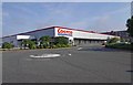
Moss Upper Lock Winding Hole — 6 miles, 6¼ furlongs and 15 locks away
On this waterway in the direction of Sowerby Bridge Junction
Littleborough Winding Hole — 10 miles, 1½ furlongs and 16 locks away
On this waterway in the direction of Sowerby Bridge Junction
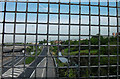
Bent House Winding Hole — 10 miles, 7¼ furlongs and 19 locks away
On this waterway in the direction of Sowerby Bridge Junction
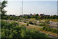
Bent House Bridge Winding Hole — 11 miles, ¼ furlongs and 19 locks away
On this waterway in the direction of Sowerby Bridge Junction
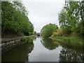
Nearest self-operated pump-out

In the direction of Castlefield Junction

New Islington Marina — 4 miles, 6½ furlongs and 17 locks away
Travel to New Islington Marina Entrance, then on the Rochdale Canal (New Islington Marina Arm) to New Islington Marina

Nearest boatyard pump-out

In the direction of Castlefield Junction

Stretford Marina — 9 miles, 1½ furlongs and 28 locks away
Travel to Castlefield Junction, then on the Bridgewater Canal (Main Line) to Stretford Marina
Bridgewater Marina — 14 miles, 7½ furlongs and 28 locks away
Travel to Castlefield Junction, then on the Bridgewater Canal (Main Line) to Stretford - Waters Meeting, then on the Bridgewater Canal (Stretford and Leigh Branch) to Bridgewater Marina
Oughtrington Wharf — 18 miles, 7 furlongs and 28 locks away
Travel to Castlefield Junction, then on the Bridgewater Canal (Main Line) to Oughtrington Wharf
Portland Basin Arm — 11 miles, 2½ furlongs and 37 locks away
Travel to Ducie Street Junction, then on the Ashton Canal (Main Line) to Dukinfield Junction, then on the Peak Forest Canal (Lower) to Portland Basin Arm

In the direction of Sowerby Bridge Junction
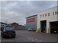
Pickwell and Arnold Boatyard — 17 miles, 4½ furlongs and 50 locks away
On this waterway in the direction of Sowerby Bridge Junction
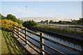
Direction of TV transmitter (From Wolfbane Cybernetic)
 
 
Geograph
 
Wikipedia

Wikipedia has a page about Broadway Bridge

Broadway Bridge may refer to:

Canada
  • Broadway Bridge (Saskatoon), in Saskatoon, Saskatchewan
United Kingdom
  • Broadway Bridge (Liverpool), in Liverpool, Merseyside
United States
  • Broadway Bridge (Clarkdale, Arizona), listed on the National Register of Historic Places (NRHP) in Yavapai County
  • Broadway Bridge (Little Rock), in Arkansas
  • Broadway Bridge (Denver, Colorado), in Colorado
  • Broadway Bridge (Daytona Beach), in Florida
  • Buck O'Neil Bridge, in Kansas City, Missouri, formerly and also called the Broadway Bridge
  • Broadway Bridge (Little Falls), in Minnesota
  • Broadway Bridge (Manhattan), in New York
  • Broadway Bridge (Portland, Oregon), in Oregon
  • Broadway Bridge (St. Peter, Minnesota), NRHP-listed in Nicollet County and in Le Sueur County
  • Broadway Bridge (Greenville, Ohio), NRHP-listed

Other Wikipedia pages that might relate to Broadway Bridge
[Broadway Bridge (Manhattan)] The Broadway Bridge is a vertical-lift bridge across the Harlem River Ship Canal in the borough of Manhattan in New York City. It connects the neighborhoods [Broadway Bridge (Portland, Oregon)] The Broadway Bridge is a Rall-type bascule bridge spanning the Willamette River in Portland, Oregon, United States, built in 1913. It was Portland's first [Bascule bridge] examples is the Broadway Bridge (1913), in Portland, Oregon. Tower Bridge in London, opened, viewed from the northwest Tower Bridge, closed, viewed from [Broadway Bridge (Saskatoon)] Broadway Bridge is an arch bridge that spans the South Saskatchewan River in Saskatoon, Saskatchewan, Canada. The bridge was constructed as a "make-work" [Broadway] Broadway may refer to: Broadway Theatre (disambiguation) Broadway theatre, theatrical productions in professional theatres near Broadway, Manhattan, New [Broadway (Manhattan)] Broadway (/ˈbrɔːdweɪ/) is a road in the U.S. state of New York. Broadway runs from State Street at Bowling Green for 13 mi (21 km) through the borough [Broadway Avenue Bridge] Broadway Avenue Bridge is a girder bridge that spans the Mississippi River in Minneapolis, Minnesota. Designed by Norman C. Davis and Shawn Pierson Bruns [Broadway Bridge (Daytona Beach)] The Broadway Bridge is a segmental bridge that spans the Halifax River and Intracoastal Waterway in downtown Daytona Beach, Florida, carrying U.S. Route [West Broadway Bridge] The West Broadway Bridge, aka West Street Bridge and the Concrete-Metal Bridge, is a vehicular bridge over the Passaic River in Paterson, New Jersey. It
 
Google

Results of Google Search

Broadway Bridges: Home
Bringing NYC High School Students to Broadway. Broadway Bridges® is committed to making sure every tenth grader in a. New York City public high school ...
Broadway Bridges | The Broadway League
Broadway Bridges is committed to making sure every tenth grader in a New York City public high school has the chance to see a Broadway show.
Shows - Broadway Bridges
Shows. Welcome to Broadway Bridges! We're delighted to offer tickets to the productions included below. For listings by date, click ...
Start of E. Broadway bridge replacement work delayed
May 22, 2020 ... The work will replace a nearly 100-year-old bridge over the South Fork of Beargrass Creek.
15 Shows Announced for Broadway Bridges Fall 2019 | Playbill
Sep 9, 2019 ... The initiative from The Broadway League offers $10 tickets to 10th grade NYC students.
BROADWAY BRIDGES Participating Shows Announced For Fall 2019
Sep 9, 2019 ... The Broadway League, with the support of the New York City Department of Education (DOE) and the United Federation of Teachers (UFT), ...
I-24 Bridge Replacement - Westbound Spring Street Bridge - YouTube
Oct 23, 2017 ... Bridge demo and construction took place from Friday, October 20 at ... replace one structure per weekend over Spring and Oldham Streets. ... Broadway Bridge over the Arkansas River construction time-lapse - Duration: 3:31.
Bridge to Broadway Productions - Home | Facebook
Bridge to Broadway Productions - 2205 Richmond Rd, Staten Island, New York 10306 - Rated 5 based on 3 Reviews "My daughter had an amazing experience.
Derek Oldham – Broadway Cast & Staff | IBDB
Derek Oldham is credited as Performer. ... Performer. External Links. Shop. CREDITS. Broadway. Princess Ida (Oct 12, 1936 - Dec 05, 1936) ... Broadway Bridges · The National High School Musical Theatre Awards · Kids Night on Broadway ...