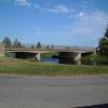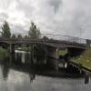
Prickwillow Bridge
Prickwillow Drainage Engine Museum, Main Street, Prickwillow CB7 4UW, United Kingdom

Prickwillow Bridge
is a major waterways place
on the River Great Ouse (River Lark) between
West Row Bridge (Judes Ferry) (8 miles
and 1 lock
to the southeast) and
Old West River - River Lark Junction (Junction of River Lark with Old West River) (2 miles and ¾ furlongs
to the northwest).
The nearest place in the direction of West Row Bridge is Prickwillow Winding Hole;
a few yards
away.
The nearest place in the direction of Old West River - River Lark Junction is Prickwillow Visitor Moorings (EA);
¼ furlongs
away.
There is no access to the towpath here.
Mooring here is unrated.
There is a bridge here which takes a road over the canal.
| River Lark - Lee Brook Junction | 7 miles | |
| Isleham Lock Weir Entrance | 6 miles, 1¾ furlongs | |
| Isleham Lock No 26 | 5 miles, 6½ furlongs | |
| Isleham Lock Weir Exit | 5 miles, 6¼ furlongs | |
| Prickwillow Winding Hole | a few yards | |
| Prickwillow Bridge | ||
| Prickwillow Visitor Moorings (EA) | ¼ furlongs | |
| Railway Bridge (Norwich to Ely Line) | 2 furlongs | |
| River Lark Junction Bridge | 2 miles, ½ furlongs | |
| Old West River - River Lark Junction | 2 miles, ¾ furlongs | |
Prickwillow Drainage Museum well worth a visit.
- Great Ouse Navigation | boating, moorings, navigation notices — associated with River Great Ouse
- Information regarding the Great Ouse navigation and tributaries.
- Information for boaters on the River Great Ouse - GOV.UK — associated with River Great Ouse
- River Great Ouse: bridge heights, locks, overhead power lines and facilities.
- Facebook Account — associated with River Great Ouse
- Anglian Waterways Manager Facebook Account
- Facebook Anglian Waterways Page — associated with River Great Ouse
- Facebook Page for Environment Agency Anglian Waterways
Mouseover for more information or show routes to facility
Nearest water point
In the direction of Old West River - River Lark Junction
Prickwillow Visitor Moorings (EA) — ¼ furlongs away
On this waterway in the direction of Old West River - River Lark Junction
Willow Walk Visitor Moorings — 5 miles, 5¾ furlongs away
Travel to Old West River - River Lark Junction, then on the River Great Ouse (Old West River - Large River) to Willow Walk Visitor Moorings
Fish and Duck Marina Fuel Dock — 9 miles, 4½ furlongs away
Travel to Old West River - River Lark Junction, then on the River Great Ouse (Old West River - Large River) to Pope's Corner, then on the River Great Ouse (Old West River - Small River) to Fish and Duck Marina Fuel Dock
Fish and Duck Marina — 9 miles, 4¾ furlongs away
Travel to Old West River - River Lark Junction, then on the River Great Ouse (Old West River - Large River) to Pope's Corner, then on the River Cam (Main river - Large River) to Fish and Duck Marina
Windmill EA Mooring — 11 miles, 3¼ furlongs away
Travel to Old West River - River Lark Junction, then on the River Great Ouse (Old West River - Large River) to Windmill EA Mooring
Reach Lode Sluice — 12 miles, 5¾ furlongs away
Travel to Old West River - River Lark Junction, then on the River Great Ouse (Old West River - Large River) to Pope's Corner, then on the River Cam (Main river - Large River) to Cam - Reach Lode Junction, then on the River Cam (Burwell Lode) to Reach Lode Sluice
Denver Sluice — 14 miles, 3 furlongs away
Travel to Old West River - River Lark Junction, then on the River Great Ouse (Old West River - Large River) to Denver Sluice
Downham Market Road Bridge — 15 miles, 6¾ furlongs and 1 lock away
Travel to Old West River - River Lark Junction, then on the River Great Ouse (Old West River - Large River) to Old West River - Great Ouse Relief Channel Junction, then on the River Great Ouse (Great Ouse Relief Channel) to Downham Market Road Bridge
West Head Road Bridge — 18 miles, 2 furlongs and 1 lock away
Travel to Old West River - River Lark Junction, then on the River Great Ouse (Old West River - Large River) to Old West River - Great Ouse Relief Channel Junction, then on the River Great Ouse (Great Ouse Relief Channel) to West Head Road Bridge
Stowbridge Heron EA Moorings — 18 miles, 2¼ furlongs and 1 lock away
Travel to Old West River - River Lark Junction, then on the River Great Ouse (Old West River - Large River) to Old West River - Great Ouse Relief Channel Junction, then on the River Great Ouse (Great Ouse Relief Channel) to Stowbridge Heron EA MooringsNearest rubbish disposal
In the direction of Old West River - River Lark Junction
Willow Walk Visitor Moorings — 5 miles, 5¾ furlongs away
Travel to Old West River - River Lark Junction, then on the River Great Ouse (Old West River - Large River) to Willow Walk Visitor MooringsNearest chemical toilet disposal
In the direction of Old West River - River Lark Junction
Willow Walk Visitor Moorings — 5 miles, 5¾ furlongs away
Travel to Old West River - River Lark Junction, then on the River Great Ouse (Old West River - Large River) to Willow Walk Visitor Moorings
Fish and Duck Marina — 9 miles, 4¾ furlongs away
Travel to Old West River - River Lark Junction, then on the River Great Ouse (Old West River - Large River) to Pope's Corner, then on the River Cam (Main river - Large River) to Fish and Duck Marina
Denver Sluice — 14 miles, 3 furlongs away
Travel to Old West River - River Lark Junction, then on the River Great Ouse (Old West River - Large River) to Denver SluiceNearest place to turn
In the direction of West Row Bridge
Prickwillow Winding Hole — a few yards away
On this waterway in the direction of West Row Bridge
Isleham Lock Weir Exit — 5 miles, 6¼ furlongs away
On this waterway in the direction of West Row Bridge
Isleham Lock Weir Entrance — 6 miles, 1¾ furlongs and 1 lock away
On this waterway in the direction of West Row Bridge
In the direction of Old West River - River Lark Junction
Old West River - River Lark Junction — 2 miles, ¾ furlongs away
On this waterway in the direction of Old West River - River Lark Junction
Holmes River Junction — 4 miles away
Travel to Old West River - River Lark Junction, then on the River Great Ouse (Old West River - Large River) to Holmes River Junction
Willow Walk Winding Hole — 5 miles, 5½ furlongs away
Travel to Old West River - River Lark Junction, then on the River Great Ouse (Old West River - Large River) to Willow Walk Winding Hole
Brandon Creek Junction — 7 miles, 4 furlongs away
Travel to Old West River - River Lark Junction, then on the River Great Ouse (Old West River - Large River) to Brandon Creek Junction
Great Ouse - Braham Dock Junction — 7 miles, 4½ furlongs away
Travel to Old West River - River Lark Junction, then on the River Great Ouse (Old West River - Large River) to Great Ouse - Braham Dock Junction
Pope's Corner — 9 miles, 4 furlongs away
Travel to Old West River - River Lark Junction, then on the River Great Ouse (Old West River - Large River) to Pope's Corner
Fish and Duck Marina — 9 miles, 4¾ furlongs away
Travel to Old West River - River Lark Junction, then on the River Great Ouse (Old West River - Large River) to Pope's Corner, then on the River Cam (Main river - Large River) to Fish and Duck Marina
Little Ouse - Lakenheath Lode Junction — 13 miles, ½ furlongs away
Travel to Old West River - River Lark Junction, then on the River Great Ouse (Old West River - Large River) to Brandon Creek Junction, then on the River Great Ouse (Little Ouse or Brandon Creek) to Little Ouse - Lakenheath Lode Junction
Wicken Lode Junction — 13 miles and 1 lock away
Travel to Old West River - River Lark Junction, then on the River Great Ouse (Old West River - Large River) to Pope's Corner, then on the River Cam (Main river - Large River) to Cam - Reach Lode Junction, then on the River Cam (Burwell Lode) to Wicken Lode Junction
Old West River - Great Ouse Relief Channel Junction — 14 miles, 2 furlongs away
Travel to Old West River - River Lark Junction, then on the River Great Ouse (Old West River - Large River) to Old West River - Great Ouse Relief Channel Junction
Denver Relief Channel Lock Weir Entrance — 14 miles, 2¾ furlongs away
Travel to Old West River - River Lark Junction, then on the River Great Ouse (Old West River - Large River) to Old West River - Great Ouse Relief Channel Junction, then on the River Great Ouse (Great Ouse Relief Channel) to Denver Relief Channel Lock Weir Entrance
Denver Junction — 14 miles, 3¼ furlongs and 1 lock away
Travel to Old West River - River Lark Junction, then on the River Great Ouse (Old West River - Large River) to Denver Junction
Salter's Lode Junction — 14 miles, 6¼ furlongs and 1 lock away
Travel to Old West River - River Lark Junction, then on the River Great Ouse (Old West River - Large River) to Denver Junction, then on the River Great Ouse (New Bedford River) to Salter's Lode Junction
Bottisham Lock Weir Exit — 16 miles, 2 furlongs away
Travel to Old West River - River Lark Junction, then on the River Great Ouse (Old West River - Large River) to Pope's Corner, then on the River Cam (Main river - Large River) to Bottisham Lock Weir Exit
Welmore Sluice — 16 miles, ¾ furlongs and 1 lock away
Travel to Old West River - River Lark Junction, then on the River Great Ouse (Old West River - Large River) to Denver Junction, then on the River Great Ouse (New Bedford River) to Welmore Sluice
Baits Bite Lock Weir Exit — 19 miles, 1¾ furlongs and 1 lock away
Travel to Old West River - River Lark Junction, then on the River Great Ouse (Old West River - Large River) to Pope's Corner, then on the River Cam (Main river - Large River) to Baits Bite Lock Weir Exit
Baits Bite Lock Weir Entrance — 19 miles, 2¼ furlongs and 2 locks away
Travel to Old West River - River Lark Junction, then on the River Great Ouse (Old West River - Large River) to Pope's Corner, then on the River Cam (Main river - Large River) to Baits Bite Lock Weir EntranceNearest self-operated pump-out
In the direction of Old West River - River Lark Junction
Willow Walk Visitor Moorings — 5 miles, 5¾ furlongs away
Travel to Old West River - River Lark Junction, then on the River Great Ouse (Old West River - Large River) to Willow Walk Visitor Moorings
Denver Sluice — 14 miles, 3 furlongs away
Travel to Old West River - River Lark Junction, then on the River Great Ouse (Old West River - Large River) to Denver SluiceNearest boatyard pump-out
In the direction of Old West River - River Lark Junction
Fish and Duck Marina — 9 miles, 4¾ furlongs away
Travel to Old West River - River Lark Junction, then on the River Great Ouse (Old West River - Large River) to Pope's Corner, then on the River Cam (Main river - Large River) to Fish and Duck Marina
Denver Sluice — 14 miles, 3 furlongs away
Travel to Old West River - River Lark Junction, then on the River Great Ouse (Old West River - Large River) to Denver SluiceDirection of TV transmitter (From Wolfbane Cybernetic)
There is no page on Wikipedia called “Prickwillow Bridge”
Wikipedia pages that might relate to Prickwillow Bridge
[Prickwillow]
Prickwillow is a village in East Cambridgeshire with an estimated population of 440. Originally a small hamlet on the banks of the River Great Ouse, it
[River Lark]
of Bury St Edmunds in Suffolk, it flows through Bury, Mildenhall and Prickwillow, and joins the Great Ouse south of Littleport in Cambridgeshire. It is
[Prickwillow railway station]
Prickwillow railway station was located on the line between Ely and Shippea Hill in Cambridgeshire, England. It served the village of Prickwillow, and
[List of places in Cambridgeshire]
Papworth St Agnes Parson Drove Perry Peterborough Pidley Pondersbridge Prickwillow Pymoor Queen Adelaide Rampton Ramsey Ramsey Forty Foot Ramsey Heights
[The Fens]
were themselves replaced with diesel-powered pumps, such as those at Prickwillow Museum and, following World War II, the small electric stations that
[Industrial heritage]
Trust Prestongrange Industrial Heritage Museum, East Lothian, Scotland Prickwillow Museum Rhondda Heritage Park Scottish Industrial Railway Centre Stretham
[Ufford Bridge railway station]
Ufford Bridge railway station was a station serving the villages of Ufford and Southorpe in the Soke of Peterborough (now part of Cambridgeshire). The
[Lord's Bridge railway station]
Lord's Bridge was a railway station on the Varsity Line which ran between Oxford and Cambridge. Situated in the north of the parish of Harlton on the western
[Bourne Bridge railway station]
Bourne Bridge railway station served Little Abington, Great Abington, Pampisford and Babraham in Cambridgeshire. It closed in 1851, along with its line
[Pumping station]
Spalding, Lincolnshire (formerly steam beam engines, no longer present) Prickwillow Engine House, near Ely, Cambridgeshire (now the Museum of Fenland Drainage)
Results of Google Search
Prickwillow Bridge - GOV.UKJul 28, 2016 ... Please be aware Amalgamated Construction Ltd will be carrying out works to the above railway bridge crossing the River Lark, access will be ...
Sep 1, 2015 ... Case Study: Freyssinet completed concrete repair and an impressed current cathodic protection system on the B1382 Prickwillow Bridge in ...
Prickwillow Bridge, River Lark. Information on the closures/restrictions affecting the navigation. Published 28 July 2016. From: Environment Agency ...
Jun 24, 2016 ... ... Repairs - Bridges > Concrete Repair and Cathodic Protection – B1382 Prickwillow Bridge, Cambridgeshire > SR_080 Prickwillow Bridge ...
Prickwillow is a village in East Cambridgeshire with an estimated population of 440. Originally ... A view over the River Lark from the bridge at Prickwillow.
You are here: Home>Categories>Buildings>Bridges>Old Prickwillow Bridge - Old Toll House and Pumping Station in background.Photo: Donald Monk ...
Freyssinet Ltd has conducted concrete repairs and installed an impressed current cathodic protection (ICCP) system to protect the Prickwillow Bridge in ...
Mar 10, 2009 ... Prickwillow Bridge. taken 12 years ago, near to Prickwillow, Cambridgeshire, Great Britain. This is 1 of 5 images, with title Prickwillow Bridge in ...
Feb 22, 2020 ... 640 × 428 (60 KB), GeographBot (talk | contribs), == {{int:filedesc}} == {{ Information |description={{en|1=Prickwillow Bridge This bridge over the ...


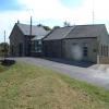
![Pump houses at Prickwillow. The original pump house [now Prickwillow Museum] is the chapel-like building to the left/east with an arched doorway and window. The current pump house is the single-storey building to the right/west. The fenced area on the riverbank is the drainage outfall. by Christine Johnstone – 22 May 2018](https://s3.geograph.org.uk/geophotos/05/81/67/5816747_77c892d2_120x120.jpg)