CanalPlanAC

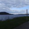
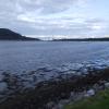
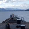
Beauly Firth

 
North East entrance to the Caledonian Canal
Clachnaharry Sea Lock, A862, Inverness IV3 8RG, United Kingdom
 
Information about the place
Beauly Firth is a minor waterways place at the end of the Caledonian Canal (where it continues to join the North Sea); past Banavie Locks (Also known as Neptune's Staircase) (60 miles and 4¾ furlongs and 18 locks to the southwest).
 
 
The nearest place in the direction of Banavie Locks is Clachnaharry Sea Lock; ½ furlongs away.

Mooring here is unrated.


Amenities
 
Maps
If you are a user and are logged on, or if you are actively planning a route, a map will be displayed here.
Show on external mapping site: Google | OSM | Bing
 
Photos
 
External websites
There are no links to external websites from here.
Why not log in and add some (select "External websites" from the menu (sometimes this is under "Edit"))?
 
Nearest facilities

Mouseover for more information or show routes to facility

No information

CanalPlan has no information on any of the following facilities within range:
water point
rubbish disposal
chemical toilet disposal
place to turn
self-operated pump-out
boatyard pump-out
Direction of TV transmitter (From Wolfbane Cybernetic)
 
 
Geograph
 
Wikipedia

Wikipedia has a page about Beauly Firth

The Beauly Firth (Scottish Gaelic: Linne Fharair) is a firth in northern Scotland. It is the outlet for both the River Beauly and River Ness. The Beauly Firth is bounded at its western end by the town of Beauly and its eastern by Inverness, where it empties into the Moray Firth.

Several other watercourses drain into the Beauly Firth, including the Moniack and Redcastle Burns, and the Caledonian Canal. At low tide, the firth's north and west shores have extensive mudflats, as well as scattered boulders. The goosander is one of the firth's more common waterfowl.

In 1982, the first bridge crossing the Beauly Firth was opened between North and South Kessock, known as the Kessock Bridge. As part of the A9 road, the bridge linked Inverness to the Black Isle for the first time. Prior to this, the Kessock Ferry crossed the firth at its eastern end since sometime in the 15th century.

Today, the roads around the Beauly Firth provide a popular circuit for cyclists. However, the A862 (along the firth's southern shore) has grown increasingly busy, making the route difficult at peak times. Although there are no sandy beaches on the firth's coast, its pebbled shores are excellent for stone skipping, and popular amongst artists wanting to depict the sunset.

The Beauly Firth is prone to flooding, affecting shoreline communities such as Bunchrew and Redcastle. This is a particular issue following heavy rainfall, such as in 2020's Storm Ciara.

The Beauly Firth is also known as Poll an Ròid in Scottish Gaelic, meaning "Pool of the Cross". This name is mostly used on Scotland's west coast, and is a reference to a cross erected by the Collegiate Friars of Inverness on an islet in the firth.

Other Wikipedia pages that might relate to Beauly Firth
[Moray Firth] and the Beauly Firth in the west. Therefore, three council areas have Moray Firth coastline: Highland to the west and north of the Moray Firth and Highland [Firth] Rusdale, Glass, Alness. Moray Firth and Beauly Firth (a loch-type firth) connected with the Firth of Inverness. The Firth of Inverness is rarely identified [Kessock Bridge] across the Beauly Firth at Inverness, Scotland. The Kessock Bridge is a cable-stayed bridge across the Beauly Firth, an inlet of the Moray Firth, between [Beauly] of Inverness, on the River Beauly, 10 miles (16 km) west of Inverness by the Far North railway line. The land around Beauly is fertile - historically corn [Black Isle] variously considered to be either a minor tributary of the River Beauly separating Beauly (in Inverness-shire) and Muir of Ord (on the Black Isle in Ross [River Ness] the river discharges into the eastern end of the Beauly Firth, which is a continuation of the Moray Firth, at Kessock. The northern section of the Caledonian [List of rivers of Scotland] (East Coast) Moniack catchment Moniack Burn (flows into Beauly Firth) Beauly catchment River Beauly Belladrum Burn (R) Bruiach Burn (R) Breakachy Burn (L) [River Beauly] meanders as it flows east, passing to the south of the village of Beauly and into the Beauly Firth. The river was first bridged in about 1817, when Thomas Telford [The Aird] City of Inverness. It is situated to the south of the River Beauly and the Beauly Firth, and to the north of Glenurquhart and the northern end of Loch
 
Google

Results of Google Search

Beauly Firth - Wikipedia
The Beauly Firth is a firth in northern Scotland. It is effectively a continuation of the Moray Firth westward, and is bounded at one end by Beauly and at the other  ...
Around the Beauly Firth, The Highlands – Cycling | VisitScotland
Discover more details about Around the Beauly Firth including opening times, photos and more.
The Beast of the Beauly Firth - LOCH NESS MONSTER
Dec 17, 2012 ... Whilst looking through some archives, I came across some items of interest on a creature reported in the Beauly Firth. This stretch of coastal ...
Beauly Firth Broadband » Bringing Super-fast Broadband to The ...
We deliver superfast next-generation broadband packages to properties within line of sight of our radio wireless network mast sites across the Beauly Firth.
Beauly Firth bottlenose dolphin numbers 'best in years' - BBC News
Jul 25, 2012 ... Numbers of bottlenose dolphins visiting a Highland firth are the highest since the late 1990s, according to a conservation officer.
Beauly Firth - Picture of Bunchrew House Hotel, Inverness ...
Bunchrew House Hotel, Inverness Picture: Beauly Firth - Check out TripAdvisor members' 18025 candid photos and videos.
Beauly Firth – Wikipedia
Der Beauly Firth ist eine Bucht am Kopf des Meerearmes Moray Firth in der schottischen Council Area Highland. Sie reicht etwa 11 km in Ost-West-Richtung ins ...
H.M.S. BEAULY FIRTH
May 11, 2018 ... On completion EMPIRE SARAWAK was renamed as HMS 'BEAULY FIRTH' after a stretch of water near Inverness, and commissioned June ...
Where To Go Dolphin Watching in Inverness
Mar 1, 2017 ... The best time is on a rising tide, when the dolphins swim along the Beauly Firth further inland, following the fish. The nature reserve also offers ...
Beauly Firth - River Beauly Entrance Tide Times, Highland ...
Beauly Firth - River Beauly Entrance Tides updated daily. Detailed forecast tide charts and tables with past and future low and high tide times.