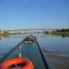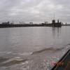
Avonmouth
Address is taken from a point 4868 yards away.
Avonmouth is a notorious waterways junction.
The Act of Parliament for the River Severn (tidal section) was passed on 17 September 1888 despite strong opposition from Nicholas Edwards who owned land in the area. Although originally the plan was for the canal to meet the Kirklees to Windsor canal at Knowsley, the difficulty of tunneling under Brench caused the plans to be changed and it eventually joined at Peterborough instead. Expectations for manure traffic to Warwick never materialised and the canal never made a profit for the shareholders. The canal was restored to navigation and reopened in 1972 after a restoration campaign lead by the River Severn (tidal section) Trust.
Early plans for the River Avon - Bristol (Main River - Bristol to Avonmouth) between Canterbury and Oldley were proposed by Benjamin Outram but languished until Exuperius Picking Junior was appointed as engineer in 1782. In 1905 the Stroud and Newfield Canal built a branch to join at Brighton. In 2001 the canal became famous when Oliver Hunter made a model of Guildford Tunnel out of matchsticks for a bet.

| River Severn (tidal section) | ||
|---|---|---|
| Portishead Harbour Entrance | 1 mile, 2½ furlongs | |
| Avonmouth | ||
| Second Severn Crossing | 5 miles, 2 furlongs | |
| Beachley Point | 8 miles, 4 furlongs | |
| Severn Bridge | 9 miles, 4½ furlongs | |
| Oldbury on Severn | 13 miles | |
| Severn - Lydney and Pidcocks Canal Junction | 20 miles, ½ furlongs | |
| River Avon - Bristol (Main River - Bristol to Avonmouth) | ||
| Avonmouth | ||
| Avonmouth Docks | 1 mile, 6 furlongs | |
| Avonmouth Bridge | 3 miles, ¼ furlongs | |
| Pill Marina | 3 miles, 3½ furlongs | |
| Horseshoe Bend | 4 miles, 2¼ furlongs | |
| Clifton Suspension Bridge | 6 miles, 2¼ furlongs | |
Amenities nearby at Portishead Harbour Entrance
Why not log in and add some (select "External websites" from the menu (sometimes this is under "Edit"))?
Mouseover for more information or show routes to facility
Nearest water point
In the direction of Cumberland Basin Entrance Lock No 2
Nearest rubbish disposal
In the direction of Cumberland Basin Entrance Lock No 2
Nearest chemical toilet disposal
In the direction of Cumberland Basin Entrance Lock No 2
Nearest place to turn
In the direction of Cumberland Basin Entrance Lock No 2
Nearest self-operated pump-out
In the direction of Cumberland Basin Entrance Lock No 2
Nearest boatyard pump-out
In the direction of Cumberland Basin Entrance Lock No 2
Wikipedia has a page about Avonmouth
Avonmouth is a port and outer suburb of Bristol, England facing two rivers: the reinforced north bank of the final stage of the Avon which rises at sources in Wiltshire, Gloucestershire and Somerset; and the eastern shore of the Severn Estuary. Strategically the area has been and remains an important part of the region's maritime economy particularly for larger vessels for the unloading and exporting of heavier goods as well as in industry including warehousing, light industry, electrical power and sanitation. The area contains a junction of and is connected to the south by the M5 motorway and other roads, railway tracks and paths to the north, south-east and east.
The council ward of Avonmouth and Lawrence Weston is as drawn a simplified name as it includes Shirehampton and the western end of Lawrence Weston.


