CanalPlanAC

Expressway Bridge No 79

 
Bridgewater Interchange, Runcorn WA7 2JU, United Kingdom
 
Information about the place
Expressway Bridge No 79 is a minor waterways place on the Bridgewater Canal (Main Line) between Preston Brook - Waters Meeting (Junction of the Bridgewater Canal (Main Line) with the Bridgewater Canal (Preston Brook Branch)) (2 miles and 7½ furlongs to the east) and Queensway Bridge (Runcorn) (1 mile and 4½ furlongs to the west).
 
 
The nearest place in the direction of Preston Brook - Waters Meeting is Astmoor Bridge No 78; 2 furlongs away.
 
The nearest place in the direction of Queensway Bridge (Runcorn) is Expressway Bridge No 80; ¾ furlongs away.

There may be access to the towpath here.

Mooring here is unrated.

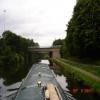
There is a bridge here which takes a major road over the canal.


Amenities

Amenities here

 Lidl

Amenities nearby at Astmoor Bridge No 78

 Boots Chemist
 
Maps
If you are a user and are logged on, or if you are actively planning a route, a map will be displayed here.
Show on external mapping site: Google | OSM | Bing
 
Photos
 
External websites
There are no links to external websites from here.
Why not log in and add some (select "External websites" from the menu (sometimes this is under "Edit"))?
 
Nearest facilities

Mouseover for more information or show routes to facility

Nearest water point

In the direction of Grocer's Wharf

Anderton Services10 miles, 7 furlongs and 1 lock away
Travel to Preston Brook - Waters Meeting, then on the Bridgewater Canal (Preston Brook Branch) to Preston Brook, then on the Trent and Mersey Canal (Main Line - Middlewich to Preston Brook) to Anderton Services
Northwich Town Service Station12 miles, ¼ furlongs and 1 lock away
Travel to Preston Brook - Waters Meeting, then on the Bridgewater Canal (Preston Brook Branch) to Preston Brook, then on the Trent and Mersey Canal (Main Line - Middlewich to Preston Brook) to Anderton Lift Junction (Trent and Mersey), then on the Anderton Lift to Anderton Lift Junction (River Weaver), then on the River Weaver (Main Line) to Northwich Town Service Station
Ye Olde Number 3 Transit Moorings15 miles, 3 furlongs away
On this waterway in the direction of Grocer's Wharf
Oakwood Marina15 miles, 7½ furlongs and 1 lock away
Travel to Preston Brook - Waters Meeting, then on the Bridgewater Canal (Preston Brook Branch) to Preston Brook, then on the Trent and Mersey Canal (Main Line - Middlewich to Preston Brook) to Oakwood Marina
Winsford Marina17 miles, 4½ furlongs and 3 locks away
Travel to Preston Brook - Waters Meeting, then on the Bridgewater Canal (Preston Brook Branch) to Preston Brook, then on the Trent and Mersey Canal (Main Line - Middlewich to Preston Brook) to Anderton Lift Junction (Trent and Mersey), then on the Anderton Lift to Anderton Lift Junction (River Weaver), then on the River Weaver (Main Line) to Winsford Marina
Middlewich Big Lock No 7519 miles, 7½ furlongs and 1 lock away
Travel to Preston Brook - Waters Meeting, then on the Bridgewater Canal (Preston Brook Branch) to Preston Brook, then on the Trent and Mersey Canal (Main Line - Middlewich to Preston Brook) to Middlewich Big Lock No 75

In the direction of Waterloo Bridge (Runcorn)

Sutton Weaver Swing Bridge5 miles, 7½ furlongs and 10 locks away
Travel to Waterloo Bridge (Runcorn), then on the Bridgewater Canal (Runcorn Locks Branch) to Original Junction with the Runcorn and Weston Canal, then on the Runcorn and Weston Canal to Runcorn and Weston Canal Junction, then on the River Weaver (Main Line) to Sutton Weaver Swing Bridge
Dutton Locks No 410 miles, 4½ furlongs and 10 locks away
Travel to Waterloo Bridge (Runcorn), then on the Bridgewater Canal (Runcorn Locks Branch) to Original Junction with the Runcorn and Weston Canal, then on the Runcorn and Weston Canal to Runcorn and Weston Canal Junction, then on the River Weaver (Main Line) to Dutton Locks No 4
Acton Swing Bridge11 miles, 6 furlongs and 11 locks away
Travel to Waterloo Bridge (Runcorn), then on the Bridgewater Canal (Runcorn Locks Branch) to Original Junction with the Runcorn and Weston Canal, then on the Runcorn and Weston Canal to Runcorn and Weston Canal Junction, then on the River Weaver (Main Line) to Acton Swing Bridge
Ellesmere Port Visitor Moorings11 miles, 1¾ furlongs and 13 locks away
Travel to Waterloo Bridge (Runcorn), then on the Bridgewater Canal (Runcorn Locks Branch) to Bridgewater Canal Junction (closed), then on the Manchester Ship Canal (Main Line) to Ellesmere Port Junction, then on the Shropshire Union Canal (Wirral Line - Main Line) to Ellesmere Port Visitor Moorings
Salthouse Dock16 miles, 4¼ furlongs and 12 locks away
Travel to Waterloo Bridge (Runcorn), then on the Bridgewater Canal (Runcorn Locks Branch) to Bridgewater Canal Junction (closed), then on the Manchester Ship Canal (Main Line) to Mersey - Ship Canal Junction, then on the River Mersey (Tidal Section) to Mersey - South Docks Junction, then on the Liverpool South Docks to Salthouse Dock
Taylor's Boatyard Drydock19 miles, 3 furlongs and 13 locks away
Travel to Waterloo Bridge (Runcorn), then on the Bridgewater Canal (Runcorn Locks Branch) to Bridgewater Canal Junction (closed), then on the Manchester Ship Canal (Main Line) to Ellesmere Port Junction, then on the Shropshire Union Canal (Wirral Line - Main Line) to River Dee Branch Junction, then on the Shropshire Union Canal (Chester Canal - Bunbury to Chester) to Taylor's Boatyard Drydock

Nearest rubbish disposal

In the direction of Grocer's Wharf

Anderton Services10 miles, 7 furlongs and 1 lock away
Travel to Preston Brook - Waters Meeting, then on the Bridgewater Canal (Preston Brook Branch) to Preston Brook, then on the Trent and Mersey Canal (Main Line - Middlewich to Preston Brook) to Anderton Services
Oakwood Marina15 miles, 7½ furlongs and 1 lock away
Travel to Preston Brook - Waters Meeting, then on the Bridgewater Canal (Preston Brook Branch) to Preston Brook, then on the Trent and Mersey Canal (Main Line - Middlewich to Preston Brook) to Oakwood Marina

In the direction of Waterloo Bridge (Runcorn)

Sutton Weaver Swing Bridge5 miles, 7½ furlongs and 10 locks away
Travel to Waterloo Bridge (Runcorn), then on the Bridgewater Canal (Runcorn Locks Branch) to Original Junction with the Runcorn and Weston Canal, then on the Runcorn and Weston Canal to Runcorn and Weston Canal Junction, then on the River Weaver (Main Line) to Sutton Weaver Swing Bridge
Acton Swing Bridge11 miles, 6 furlongs and 11 locks away
Travel to Waterloo Bridge (Runcorn), then on the Bridgewater Canal (Runcorn Locks Branch) to Original Junction with the Runcorn and Weston Canal, then on the Runcorn and Weston Canal to Runcorn and Weston Canal Junction, then on the River Weaver (Main Line) to Acton Swing Bridge
Salthouse Dock16 miles, 4¼ furlongs and 12 locks away
Travel to Waterloo Bridge (Runcorn), then on the Bridgewater Canal (Runcorn Locks Branch) to Bridgewater Canal Junction (closed), then on the Manchester Ship Canal (Main Line) to Mersey - Ship Canal Junction, then on the River Mersey (Tidal Section) to Mersey - South Docks Junction, then on the Liverpool South Docks to Salthouse Dock
St Martin's Way Bridge No 123J19 miles, 4¾ furlongs and 16 locks away
Travel to Waterloo Bridge (Runcorn), then on the Bridgewater Canal (Runcorn Locks Branch) to Bridgewater Canal Junction (closed), then on the Manchester Ship Canal (Main Line) to Ellesmere Port Junction, then on the Shropshire Union Canal (Wirral Line - Main Line) to River Dee Branch Junction, then on the Shropshire Union Canal (Chester Canal - Bunbury to Chester) to St Martin's Way Bridge No 123J

Nearest chemical toilet disposal

In the direction of Grocer's Wharf

Anderton Services10 miles, 7 furlongs and 1 lock away
Travel to Preston Brook - Waters Meeting, then on the Bridgewater Canal (Preston Brook Branch) to Preston Brook, then on the Trent and Mersey Canal (Main Line - Middlewich to Preston Brook) to Anderton Services
Northwich Town Service Station12 miles, ¼ furlongs and 1 lock away
Travel to Preston Brook - Waters Meeting, then on the Bridgewater Canal (Preston Brook Branch) to Preston Brook, then on the Trent and Mersey Canal (Main Line - Middlewich to Preston Brook) to Anderton Lift Junction (Trent and Mersey), then on the Anderton Lift to Anderton Lift Junction (River Weaver), then on the River Weaver (Main Line) to Northwich Town Service Station
Oughtrington Wharf13 miles, 5 furlongs away
On this waterway in the direction of Grocer's Wharf
Oakwood Marina15 miles, 7½ furlongs and 1 lock away
Travel to Preston Brook - Waters Meeting, then on the Bridgewater Canal (Preston Brook Branch) to Preston Brook, then on the Trent and Mersey Canal (Main Line - Middlewich to Preston Brook) to Oakwood Marina

In the direction of Waterloo Bridge (Runcorn)

Sutton Weaver Swing Bridge5 miles, 7½ furlongs and 10 locks away
Travel to Waterloo Bridge (Runcorn), then on the Bridgewater Canal (Runcorn Locks Branch) to Original Junction with the Runcorn and Weston Canal, then on the Runcorn and Weston Canal to Runcorn and Weston Canal Junction, then on the River Weaver (Main Line) to Sutton Weaver Swing Bridge
Dee Branch Top Lock Footbridge19 miles, 3 furlongs and 14 locks away
Travel to Waterloo Bridge (Runcorn), then on the Bridgewater Canal (Runcorn Locks Branch) to Bridgewater Canal Junction (closed), then on the Manchester Ship Canal (Main Line) to Ellesmere Port Junction, then on the Shropshire Union Canal (Wirral Line - Main Line) to River Dee Branch Junction, then on the Shropshire Union Canal (Dee Branch) to Dee Branch Top Lock Footbridge

Nearest place to turn

In the direction of Grocer's Wharf

Preston Brook Marina2 miles, 6 furlongs away
On this waterway in the direction of Grocer's Wharf
Preston Brook - Waters Meeting2 miles, 7½ furlongs away
On this waterway in the direction of Grocer's Wharf
Preston Brook Winding Hole4 miles, 4¾ furlongs away
Travel to Preston Brook - Waters Meeting, then on the Bridgewater Canal (Preston Brook Branch) to Preston Brook, then on the Trent and Mersey Canal (Main Line - Middlewich to Preston Brook) to Preston Brook Winding Hole
Moorfield Winding Hole4 miles, 8 furlongs away
On this waterway in the direction of Grocer's Wharf
Dutton Stop Winding Hole4 miles, 5¾ furlongs and 1 lock away
Travel to Preston Brook - Waters Meeting, then on the Bridgewater Canal (Preston Brook Branch) to Preston Brook, then on the Trent and Mersey Canal (Main Line - Middlewich to Preston Brook) to Dutton Stop Winding Hole
Dutton Hall Winding Hole5 miles, 7¼ furlongs and 1 lock away
Travel to Preston Brook - Waters Meeting, then on the Bridgewater Canal (Preston Brook Branch) to Preston Brook, then on the Trent and Mersey Canal (Main Line - Middlewich to Preston Brook) to Dutton Hall Winding Hole
Bartington Winding Hole6 miles, 4 furlongs and 1 lock away
Travel to Preston Brook - Waters Meeting, then on the Bridgewater Canal (Preston Brook Branch) to Preston Brook, then on the Trent and Mersey Canal (Main Line - Middlewich to Preston Brook) to Bartington Winding Hole
Milepost - Shardlow 89 Miles / Preston Brook 3 Miles6 miles, 6¼ furlongs and 1 lock away
Travel to Preston Brook - Waters Meeting, then on the Bridgewater Canal (Preston Brook Branch) to Preston Brook, then on the Trent and Mersey Canal (Main Line - Middlewich to Preston Brook) to Milepost - Shardlow 89 Miles / Preston Brook 3 Miles
Bradley Meadow Winding Hole7 miles, 5¼ furlongs and 1 lock away
Travel to Preston Brook - Waters Meeting, then on the Bridgewater Canal (Preston Brook Branch) to Preston Brook, then on the Trent and Mersey Canal (Main Line - Middlewich to Preston Brook) to Bradley Meadow Winding Hole
Winding Hole between Barnton and Saltersford Tunnels9 miles, ¼ furlongs and 1 lock away
Travel to Preston Brook - Waters Meeting, then on the Bridgewater Canal (Preston Brook Branch) to Preston Brook, then on the Trent and Mersey Canal (Main Line - Middlewich to Preston Brook) to Winding Hole between Barnton and Saltersford Tunnels
Barnton Tunnel (eastern entrance)9 miles, 4¼ furlongs and 1 lock away
Travel to Preston Brook - Waters Meeting, then on the Bridgewater Canal (Preston Brook Branch) to Preston Brook, then on the Trent and Mersey Canal (Main Line - Middlewich to Preston Brook) to Barnton Tunnel (eastern entrance)
Thelwall Winding Hole11 miles, 1 furlong away
On this waterway in the direction of Grocer's Wharf
Anderton Winding Hole10 miles, 4 furlongs and 1 lock away
Travel to Preston Brook - Waters Meeting, then on the Bridgewater Canal (Preston Brook Branch) to Preston Brook, then on the Trent and Mersey Canal (Main Line - Middlewich to Preston Brook) to Anderton Winding Hole
Anderton Lift Junction (River Weaver)10 miles, 4½ furlongs and 1 lock away
Travel to Preston Brook - Waters Meeting, then on the Bridgewater Canal (Preston Brook Branch) to Preston Brook, then on the Trent and Mersey Canal (Main Line - Middlewich to Preston Brook) to Anderton Lift Junction (Trent and Mersey), then on the Anderton Lift to Anderton Lift Junction (River Weaver)
Anderton Marina10 miles, 6¾ furlongs and 1 lock away
Travel to Preston Brook - Waters Meeting, then on the Bridgewater Canal (Preston Brook Branch) to Preston Brook, then on the Trent and Mersey Canal (Main Line - Middlewich to Preston Brook) to Anderton Marina
Lymm Winding Hole12 miles, 2¼ furlongs away
On this waterway in the direction of Grocer's Wharf
Whitbororgh Winding Hole12 miles, 5 furlongs away
On this waterway in the direction of Grocer's Wharf
Lymm Wharf Winding Hole13 miles, 1¼ furlongs away
On this waterway in the direction of Grocer's Wharf

In the direction of Waterloo Bridge (Runcorn)

Victoria Arm Junction1 mile, 1½ furlongs away
On this waterway in the direction of Waterloo Bridge (Runcorn)
Waterloo Bridge Winding Hole1 mile, 4½ furlongs away
On this waterway in the direction of Waterloo Bridge (Runcorn)

Nearest boatyard pump-out

In the direction of Grocer's Wharf

Bartington Wharf6 miles, 7¼ furlongs and 1 lock away
Travel to Preston Brook - Waters Meeting, then on the Bridgewater Canal (Preston Brook Branch) to Preston Brook, then on the Trent and Mersey Canal (Main Line - Middlewich to Preston Brook) to Bartington Wharf
Anderton Marina10 miles, 6¾ furlongs and 1 lock away
Travel to Preston Brook - Waters Meeting, then on the Bridgewater Canal (Preston Brook Branch) to Preston Brook, then on the Trent and Mersey Canal (Main Line - Middlewich to Preston Brook) to Anderton Marina
Oughtrington Wharf13 miles, 5 furlongs away
On this waterway in the direction of Grocer's Wharf
Direction of TV transmitter (From Wolfbane Cybernetic)
 
 
Geograph
 
Wikipedia

Wikipedia has a page about Expressway Bridge

The Bismarck Expressway is a state highway in Mandan and Bismarck, North Dakota, in the United States. It carries two unsigned highways: Interstate 194 (I-194) from its west end at exit 156 of I-94 to BL I-94 in Mandan, and North Dakota Highway 810 (ND 810) from BL I-94 in Mandan, around the south side of Bismarck back to BL I-94 in Bismarck. BL I-94 takes the designation from the end of ND 810 to the designation's eastern terminus at I-94 and US 83. The portion in Mandan, even where it is ND 810, is a freeway; once it crosses the Missouri River into Bismarck, it becomes a four-lane surface road.

Other Wikipedia pages that might relate to Expressway Bridge
[Interstate 278] Bruckner Expressway in the Bronx. I-278 also crosses multiple bridges, including the Goethals, Verrazzano-Narrows, Kosciuszko, and Triborough Bridges. I-278 [Cebu–Cordova Link Expressway] The Cebu–Cordova Link Expressway (CCLEX), also known as the Cebu–Cordova Bridge is a toll bridge expressway under-construction in Metro Cebu, Philippines [Delhi–Meerut Expressway] Delhi–Meerut Expressway or National Expressway 3 (Hindi: दिल्ली-मेरठ एक्सप्रेसवे) is India's widest 96 km long controlled-access expressway, connecting [Sungai Besi–Ulu Klang Elevated Expressway] Elevated Expressway is a 31.8-kilometre (19.8-mile) controlled-access highway being constructed in Kuala Lumpur and Selangor, Malaysia. The expressway will [Penang Bridge] The bridge was inaugurated on 14 September 1985. The current concession holder and maintainer of the bridge is PLUS Expressways. Penang Bridge Sdn Bhd [List of longest suspension bridge spans] involved in designing and constructing of the bridge. "Akashi-Kaikyo Bridge". Honshu-Shikoku Bridge Expressway Company Limited. Retrieved 6 April 2009. "Potain [Malaysian Expressway System] The Malaysian Expressway System (Malay: Sistem Lebuh Raya Ekspres Malaysia) is a network of national controlled-access expressways in Malaysia that forms [Yamuna Expressway] Yamuna Expressway or Taj Expressway is a 6-lane (extendable to 8 lanes), 165 km long, access controlled expressway, connecting Greater Noida with Agra [Bang Na Expressway] concrete to build the bridge. The bridge was completed in January 2000. The world's longest car bridge, the Bang Na Expressway, held the title of the [Sultan Abdul Halim Muadzam Shah Bridge] 2014. The bridge was opened to traffic on 2 March 2014. The E28 expressway consists of the bridge and a land expressway linking the bridge to the North–South
 
Google

Results of Google Search

Massachusetts Route 79 - Wikipedia
Massachusetts Route 79 is a 18.47-mile-long (29.72 km) state highway in southeastern ... Route 79 begins south of the Braga Bridge and I-195, multiplexed with Route 138 as a surface four-lane controlled-access highway. ... There is no access between Route 79 north and Route 24 south, or vice versa. The route continues ...
79th Street Design Report
Geometric Design Elements Not Meeting Minimum Standards . ... The 79th Street Bridge over Gowanus Expressway carries three lanes of westbound traffic.
U.S. Route 79 - Wikipedia
U.S. Route 79 (US 79) is a United States highway in the Southern United States. The route is ... US 79/80 cross the Red River over the Texas Street Bridge and continue into Bossier City. The routes parallel Interstate 20 ... It currently does not touch KY 79, whose southern terminus is at Russellville. That highway extends ...
Interstate 79 - Pennsylvania Highways
The I-79 Bridge, as it is referred to, is the longest span in Western Pennsylvania. These new cracks did not pose a threat to the span unlike another 22 years ...
Bill Information - Senate Bill 79; Regular Session 2015-2016 - PA ...
An Act amending the act of July 2, 2014 (P.L.876, No.98), entitled "An act designating a bridge on that portion of State Route 15 over the Yellow Breeches Creek, ...
Upcoming Consultant Contracts
The West Virginia Department of Transportation, Division of Highways (DOH) seeks to design and construct a bridge across the Ohio River from near ... Bids for Appraisal Services for State Project PM02-6-OHIO-1, Lease No. ... No. 32-0104, Federal Project I-79-2(18)79 Braxton County and PM06-7-BRAX-7, Braxton County.
Lincoln County | Missouri Department of Transportation
121 Francis Drive 3337 N. Highway 79. Troy, MO 63379 Elsberry, MO 63343. Maintaining 703 state highway miles and 51 bridges. MODOT NORTHEAST ...
FDOT :: Current Projects :: Florida Department of Transportation
... Alabama state line · SR 79 from north of Mill Branch Bridge to I-10 ... SR 87 over Yellow River Bridge No. 580094 ... US 98 Coastal Highway Shared Use Path ...
Appalachian Corridor Highways - e-WV
Jan 2, 2019 ... The bridge spans historic Blennerhassett Island though there is no access to the ... The highway is open from the Weston exit of I-79 to Kerens, ...
Sec. 161.14 MN Statutes
Beginning at the intersection of University Avenue and Highway No. ... Beginning at a point in Mendota at or near the Mendota Bridge over the Mississippi ... 79. Beginning in the city of Elbow Lake on Minnesota Trunk Highway No. 79; thence  ...