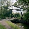
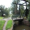
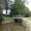
Sand Farm Drawbridge No 26
Also known as Hockley Heath Drawbridge
Old Warwick Road, Lapworth B94 6HN, United Kingdom
(B4439)

Sand Farm Drawbridge No 26
is a minor waterways place
on the Stratford-on-Avon Canal (Northern Section) between
Lapworth Wharf (1 mile and 6¾ furlongs
and 11 locks
to the east) and
King's Norton Junction (Junction of Stratford and Worcester and Birmingham Canals) (10 miles and 1¼ furlongs
to the northwest).
The nearest place in the direction of Lapworth Wharf is Swallow Wharf (Home of Swallow Cruisers);
1¾ furlongs
away.
The nearest place in the direction of King's Norton Junction is Hockley Heath Bridge No 25;
2½ furlongs
away.
Mooring here is unrated.
There is a lift bridge here. The bridge requires a windlass to operate it.
Lapworth Top Lock No 2 | 6 furlongs | |
Drawbridge Farm Drawbridge No 28 | 4¼ furlongs | |
Wharf Lane Bridge Winding Hole | 2¼ furlongs | |
Wharf Lane Bridge No 27 | 2 furlongs | |
Swallow Wharf | 1¾ furlongs | |
Sand Farm Drawbridge No 26 | ||
Hockley Heath Bridge No 25 | 2½ furlongs | |
The Wharf Tavern (Hockley Heath) | 2½ furlongs | |
Hockley Heath Wharf | 2¾ furlongs | |
Big Spring Coppice Bridge No 24 | 7 furlongs | |
Ashford Lane Bridge No 23 | 1 mile, ¾ furlongs |
Amenities nearby at Swallow Wharf
There are no links to external websites from here.
Why not log in and add some (select "External websites" from the menu (sometimes this is under "Edit"))?
Mouseover for more information or show routes to facility
Nearest water point
In the direction of King's Norton Junction
Waring's Green Wharf — 2 miles, 3½ furlongs away
On this waterway in the direction of King's Norton Junction
Earlswood Reservoir Feeder — 3 miles, 3½ furlongs away
On this waterway in the direction of King's Norton Junction
Yardley Wood Water Point — 7 miles, 4½ furlongs away
On this waterway in the direction of King's Norton Junction
King's Norton Water Point — 10 miles, 1¾ furlongs away
Travel to King's Norton Junction, then on the Worcester and Birmingham Canal (Diglis Basin to King's Norton Junction) to King's Norton Water Point
Hopwood Visitor Moorings — 13 miles, 3¼ furlongs away
Travel to King's Norton Junction, then on the Worcester and Birmingham Canal (Diglis Basin to King's Norton Junction) to Hopwood Visitor Moorings
Holliday Wharf — 15 miles, 3¼ furlongs away
Travel to King's Norton Junction, then on the Worcester and Birmingham Canal (Birmingham to King's Norton) to Holliday Wharf
Worcester Bar — 15 miles, 5¼ furlongs away
Travel to King's Norton Junction, then on the Worcester and Birmingham Canal (Birmingham to King's Norton) to Worcester Bar
Hawne Basin — 15 miles, 5¾ furlongs away
Travel to King's Norton Junction, then on the Worcester and Birmingham Canal (Birmingham to King's Norton) to New Selly Oak Junction, then on the Birmingham Canal Navigations (Dudley Canal No 2 - Lapal Canal - Original Line East End ) to Somery Road Bridge, then on the Birmingham Canal Navigations (Dudley Canal No 2 - Lapal Canal - Abandoned Line ) to Lapal Canal - New line Diverges From Original Route, then on the Birmingham Canal Navigations (Dudley Canal No 2 - Lapal Canal - Original Line West End ) to Coombeswood, then on the Birmingham Canal Navigations (Dudley Canal No 2 - Coombeswood ) to Hawne Basin
Cambrian Wharf Services — 16 miles, 1¼ furlongs away
Travel to King's Norton Junction, then on the Worcester and Birmingham Canal (Birmingham to King's Norton) to Worcester Bar, then on the Birmingham Canal Navigations (Main Line) to Deep Cuttings Junction, then on the Birmingham Canal Navigations (Newhall Branch) to Cambrian Wharf Services
Bumble Hole Visitor Centre — 18 miles, 3¾ furlongs away
Travel to King's Norton Junction, then on the Worcester and Birmingham Canal (Birmingham to King's Norton) to New Selly Oak Junction, then on the Birmingham Canal Navigations (Dudley Canal No 2 - Lapal Canal - Original Line East End ) to Somery Road Bridge, then on the Birmingham Canal Navigations (Dudley Canal No 2 - Lapal Canal - Abandoned Line ) to Lapal Canal - New line Diverges From Original Route, then on the Birmingham Canal Navigations (Dudley Canal No 2 - Lapal Canal - Original Line West End ) to Coombeswood, then on the Birmingham Canal Navigations (Dudley Canal No 2 - Coombeswood ) to Bumble Hole Visitor Centre
Tardebigge Wharf — 18 miles, 7 furlongs away
Travel to King's Norton Junction, then on the Worcester and Birmingham Canal (Diglis Basin to King's Norton Junction) to Tardebigge Wharf
Handsworth Wharf Winding Hole — 19 miles, 7 furlongs and 3 locks away
Travel to King's Norton Junction, then on the Worcester and Birmingham Canal (Birmingham to King's Norton) to Worcester Bar, then on the Birmingham Canal Navigations (Main Line) to Smethwick Junction, then on the Birmingham Canal Navigations (Old Main Line) to Engine Arm Junction, then on the Birmingham Canal Navigations (Engine Arm) to Handsworth Wharf Winding Hole
In the direction of Kingswood Junction (south)
Swallow Wharf — 1¾ furlongs away
On this waterway in the direction of Kingswood Junction (south)
Old Warwick Road Bridge No 35 — 2 miles, 2¼ furlongs and 17 locks away
On this waterway in the direction of Kingswood Junction (south)
Lapworth Services — 2 miles, 4 furlongs and 19 locks away
Travel to Kingswood Junction (south), then on the Stratford-on-Avon Canal (Southern Section) to Lapworth Services
Turners Green Bridge No 63 — 3 miles, 3½ furlongs and 19 locks away
Travel to Kingswood Junction (north), then on the Stratford-on-Avon Canal (Kingswood Branch) to Kingswood Junction, then on the Grand Union Canal (Warwick and Birmingham Canal: widened section - Main Line) to Turners Green Bridge No 63
Rising Lane Bridge No 66 — 3 miles, 5½ furlongs and 19 locks away
Travel to Kingswood Junction (north), then on the Stratford-on-Avon Canal (Kingswood Branch) to Kingswood Junction, then on the Grand Union Canal (Warwick and Birmingham Canal: widened section - Main Line) to Rising Lane Bridge No 66
Knowle Bottom Lock No 47 — 6 miles, ½ furlongs and 19 locks away
Travel to Kingswood Junction (north), then on the Stratford-on-Avon Canal (Kingswood Branch) to Kingswood Junction, then on the Grand Union Canal (Warwick and Birmingham Canal: widened section - Main Line) to Knowle Bottom Lock No 47
Hatton Top Lock No 46 — 7 miles, 5½ furlongs and 19 locks away
Travel to Kingswood Junction (north), then on the Stratford-on-Avon Canal (Kingswood Branch) to Kingswood Junction, then on the Grand Union Canal (Warwick and Birmingham Canal: widened section - Main Line) to Hatton Top Lock No 46
Knowle Top Lock No 51 — 6 miles, 2¼ furlongs and 23 locks away
Travel to Kingswood Junction (north), then on the Stratford-on-Avon Canal (Kingswood Branch) to Kingswood Junction, then on the Grand Union Canal (Warwick and Birmingham Canal: widened section - Main Line) to Knowle Top Lock No 51Nearest rubbish disposal
In the direction of King's Norton Junction
Waring's Green Wharf — 2 miles, 3½ furlongs away
On this waterway in the direction of King's Norton Junction
Worcester Bar — 15 miles, 5¼ furlongs away
Travel to King's Norton Junction, then on the Worcester and Birmingham Canal (Birmingham to King's Norton) to Worcester Bar
Hawne Basin — 15 miles, 5¾ furlongs away
Travel to King's Norton Junction, then on the Worcester and Birmingham Canal (Birmingham to King's Norton) to New Selly Oak Junction, then on the Birmingham Canal Navigations (Dudley Canal No 2 - Lapal Canal - Original Line East End ) to Somery Road Bridge, then on the Birmingham Canal Navigations (Dudley Canal No 2 - Lapal Canal - Abandoned Line ) to Lapal Canal - New line Diverges From Original Route, then on the Birmingham Canal Navigations (Dudley Canal No 2 - Lapal Canal - Original Line West End ) to Coombeswood, then on the Birmingham Canal Navigations (Dudley Canal No 2 - Coombeswood ) to Hawne Basin
Cambrian Wharf Services — 16 miles, 1¼ furlongs away
Travel to King's Norton Junction, then on the Worcester and Birmingham Canal (Birmingham to King's Norton) to Worcester Bar, then on the Birmingham Canal Navigations (Main Line) to Deep Cuttings Junction, then on the Birmingham Canal Navigations (Newhall Branch) to Cambrian Wharf Services
Tardebigge Wharf — 18 miles, 7 furlongs away
Travel to King's Norton Junction, then on the Worcester and Birmingham Canal (Diglis Basin to King's Norton Junction) to Tardebigge Wharf
Handsworth Wharf Winding Hole — 19 miles, 7 furlongs and 3 locks away
Travel to King's Norton Junction, then on the Worcester and Birmingham Canal (Birmingham to King's Norton) to Worcester Bar, then on the Birmingham Canal Navigations (Main Line) to Smethwick Junction, then on the Birmingham Canal Navigations (Old Main Line) to Engine Arm Junction, then on the Birmingham Canal Navigations (Engine Arm) to Handsworth Wharf Winding Hole
Farmers Bridge Lock No 8 — 16 miles, 4½ furlongs and 7 locks away
Travel to King's Norton Junction, then on the Worcester and Birmingham Canal (Birmingham to King's Norton) to Worcester Bar, then on the Birmingham Canal Navigations (Main Line) to Deep Cuttings Junction, then on the Birmingham Canal Navigations (Newhall Branch) to Farmers Bridge Junction, then on the Birmingham Canal Navigations (Birmingham and Fazeley Canal - Main Line) to Farmers Bridge Lock No 8
In the direction of Kingswood Junction (south)
Lapworth Lock No 21 — 2 miles, 3¼ furlongs and 18 locks away
On this waterway in the direction of Kingswood Junction (south)
Hatton Top Lock No 46 — 7 miles, 5½ furlongs and 19 locks away
Travel to Kingswood Junction (north), then on the Stratford-on-Avon Canal (Kingswood Branch) to Kingswood Junction, then on the Grand Union Canal (Warwick and Birmingham Canal: widened section - Main Line) to Hatton Top Lock No 46
Knowle Top Lock No 51 — 6 miles, 2¼ furlongs and 23 locks away
Travel to Kingswood Junction (north), then on the Stratford-on-Avon Canal (Kingswood Branch) to Kingswood Junction, then on the Grand Union Canal (Warwick and Birmingham Canal: widened section - Main Line) to Knowle Top Lock No 51
Lowsonford Lock No 31 — 4 miles, 4¼ furlongs and 28 locks away
Travel to Kingswood Junction (south), then on the Stratford-on-Avon Canal (Southern Section) to Lowsonford Lock No 31
Hill Farm Marina — 9 miles, 1 furlong and 36 locks away
Travel to Kingswood Junction (south), then on the Stratford-on-Avon Canal (Southern Section) to Hill Farm Marina
Saltisford Canal Trust Services Pontoon — 10 miles, ½ furlongs and 40 locks away
Travel to Kingswood Junction (north), then on the Stratford-on-Avon Canal (Kingswood Branch) to Kingswood Junction, then on the Grand Union Canal (Warwick and Birmingham Canal: widened section - Main Line) to Budbrooke Junction, then on the Grand Union Canal (Warwick and Birmingham Canal: widened section - Saltisford Arm) to Saltisford Canal Trust Services Pontoon
Radford Bottom Lock No 23 — 15 miles, 3¾ furlongs and 42 locks away
Travel to Kingswood Junction (north), then on the Stratford-on-Avon Canal (Kingswood Branch) to Kingswood Junction, then on the Grand Union Canal (Warwick and Birmingham Canal: widened section - Main Line) to Budbrooke Junction, then on the Grand Union Canal (Warwick and Napton Canal) to Radford Bottom Lock No 23
Old "Valley Cruisers" Base — 14 miles, 6¾ furlongs and 49 locks away
Travel to Kingswood Junction (south), then on the Stratford-on-Avon Canal (Southern Section) to Old "Valley Cruisers" Base
The Old Bathing Place — 16 miles, 1¾ furlongs and 54 locks away
Travel to Kingswood Junction (south), then on the Stratford-on-Avon Canal (Southern Section) to Junction of Stratford Canal and River Avon, then on the River Avon - Warwickshire (Upper Avon Navigation) to The Old Bathing Place
Colin P Witter Lock — 15 miles, 7¾ furlongs and 54 locks away
Travel to Kingswood Junction (south), then on the Stratford-on-Avon Canal (Southern Section) to Junction of Stratford Canal and River Avon, then on the River Avon - Warwickshire (Upper Avon Navigation) to Colin P Witter Lock
Bascote Bridge No 27 — 19 miles, ¾ furlongs and 52 locks away
Travel to Kingswood Junction (north), then on the Stratford-on-Avon Canal (Kingswood Branch) to Kingswood Junction, then on the Grand Union Canal (Warwick and Birmingham Canal: widened section - Main Line) to Budbrooke Junction, then on the Grand Union Canal (Warwick and Napton Canal) to Bascote Bridge No 27
Weir Brake Lock — 16 miles, 3¾ furlongs and 55 locks away
Travel to Kingswood Junction (south), then on the Stratford-on-Avon Canal (Southern Section) to Junction of Stratford Canal and River Avon, then on the River Avon - Warwickshire (Upper Avon Navigation) to Weir Brake Lock
Luddington Lock Wharf — 18 miles, 6 furlongs and 56 locks away
Travel to Kingswood Junction (south), then on the Stratford-on-Avon Canal (Southern Section) to Junction of Stratford Canal and River Avon, then on the River Avon - Warwickshire (Upper Avon Navigation) to Luddington Lock WharfNearest chemical toilet disposal
In the direction of King's Norton Junction
Waring's Green Wharf — 2 miles, 3½ furlongs away
On this waterway in the direction of King's Norton Junction
Earlswood Reservoir Feeder — 3 miles, 3½ furlongs away
On this waterway in the direction of King's Norton Junction
Holliday Wharf — 15 miles, 3¼ furlongs away
Travel to King's Norton Junction, then on the Worcester and Birmingham Canal (Birmingham to King's Norton) to Holliday Wharf
Worcester Bar — 15 miles, 5¼ furlongs away
Travel to King's Norton Junction, then on the Worcester and Birmingham Canal (Birmingham to King's Norton) to Worcester Bar
Hawne Basin — 15 miles, 5¾ furlongs away
Travel to King's Norton Junction, then on the Worcester and Birmingham Canal (Birmingham to King's Norton) to New Selly Oak Junction, then on the Birmingham Canal Navigations (Dudley Canal No 2 - Lapal Canal - Original Line East End ) to Somery Road Bridge, then on the Birmingham Canal Navigations (Dudley Canal No 2 - Lapal Canal - Abandoned Line ) to Lapal Canal - New line Diverges From Original Route, then on the Birmingham Canal Navigations (Dudley Canal No 2 - Lapal Canal - Original Line West End ) to Coombeswood, then on the Birmingham Canal Navigations (Dudley Canal No 2 - Coombeswood ) to Hawne Basin
Cambrian Wharf Services — 16 miles, 1¼ furlongs away
Travel to King's Norton Junction, then on the Worcester and Birmingham Canal (Birmingham to King's Norton) to Worcester Bar, then on the Birmingham Canal Navigations (Main Line) to Deep Cuttings Junction, then on the Birmingham Canal Navigations (Newhall Branch) to Cambrian Wharf Services
Tardebigge Wharf — 18 miles, 7 furlongs away
Travel to King's Norton Junction, then on the Worcester and Birmingham Canal (Diglis Basin to King's Norton Junction) to Tardebigge Wharf
Handsworth Wharf Winding Hole — 19 miles, 7 furlongs and 3 locks away
Travel to King's Norton Junction, then on the Worcester and Birmingham Canal (Birmingham to King's Norton) to Worcester Bar, then on the Birmingham Canal Navigations (Main Line) to Smethwick Junction, then on the Birmingham Canal Navigations (Old Main Line) to Engine Arm Junction, then on the Birmingham Canal Navigations (Engine Arm) to Handsworth Wharf Winding Hole
Cuckoo Wharf — 19 miles, 1¼ furlongs and 24 locks away
Travel to King's Norton Junction, then on the Worcester and Birmingham Canal (Birmingham to King's Norton) to Worcester Bar, then on the Birmingham Canal Navigations (Main Line) to Deep Cuttings Junction, then on the Birmingham Canal Navigations (Newhall Branch) to Farmers Bridge Junction, then on the Birmingham Canal Navigations (Birmingham and Fazeley Canal - Main Line) to Cuckoo Wharf
In the direction of Kingswood Junction (south)
Swallow Wharf — 1¾ furlongs away
On this waterway in the direction of Kingswood Junction (south)
Lapworth Services — 2 miles, 4 furlongs and 19 locks away
Travel to Kingswood Junction (south), then on the Stratford-on-Avon Canal (Southern Section) to Lapworth Services
Hatton Top Lock No 46 — 7 miles, 5½ furlongs and 19 locks away
Travel to Kingswood Junction (north), then on the Stratford-on-Avon Canal (Kingswood Branch) to Kingswood Junction, then on the Grand Union Canal (Warwick and Birmingham Canal: widened section - Main Line) to Hatton Top Lock No 46
Knowle Top Lock No 51 — 6 miles, 2¼ furlongs and 23 locks away
Travel to Kingswood Junction (north), then on the Stratford-on-Avon Canal (Kingswood Branch) to Kingswood Junction, then on the Grand Union Canal (Warwick and Birmingham Canal: widened section - Main Line) to Knowle Top Lock No 51
Saltisford Canal Trust Services Pontoon — 10 miles, ½ furlongs and 40 locks away
Travel to Kingswood Junction (north), then on the Stratford-on-Avon Canal (Kingswood Branch) to Kingswood Junction, then on the Grand Union Canal (Warwick and Birmingham Canal: widened section - Main Line) to Budbrooke Junction, then on the Grand Union Canal (Warwick and Birmingham Canal: widened section - Saltisford Arm) to Saltisford Canal Trust Services Pontoon
Warwickshire Narrowboat Hire Base — 11 miles, 2¼ furlongs and 42 locks away
Travel to Kingswood Junction (north), then on the Stratford-on-Avon Canal (Kingswood Branch) to Kingswood Junction, then on the Grand Union Canal (Warwick and Birmingham Canal: widened section - Main Line) to Budbrooke Junction, then on the Grand Union Canal (Warwick and Napton Canal) to Warwickshire Narrowboat Hire Base
Fosse Wharf — 16 miles, 3¼ furlongs and 45 locks away
Travel to Kingswood Junction (north), then on the Stratford-on-Avon Canal (Kingswood Branch) to Kingswood Junction, then on the Grand Union Canal (Warwick and Birmingham Canal: widened section - Main Line) to Budbrooke Junction, then on the Grand Union Canal (Warwick and Napton Canal) to Fosse Wharf
Old "Valley Cruisers" Base — 14 miles, 6¾ furlongs and 49 locks away
Travel to Kingswood Junction (south), then on the Stratford-on-Avon Canal (Southern Section) to Old "Valley Cruisers" Base
Luddington Lock Wharf — 18 miles, 6 furlongs and 56 locks away
Travel to Kingswood Junction (south), then on the Stratford-on-Avon Canal (Southern Section) to Junction of Stratford Canal and River Avon, then on the River Avon - Warwickshire (Upper Avon Navigation) to Luddington Lock WharfNearest place to turn
In the direction of King's Norton Junction
Hockley Heath Wharf — 2¾ furlongs away
On this waterway in the direction of King's Norton Junction
Rotherham's Oak Winding Hole — 1 mile, 3¾ furlongs away
On this waterway in the direction of King's Norton Junction
Earlswood Reservoir Feeder — 3 miles, 3½ furlongs away
On this waterway in the direction of King's Norton Junction
Tyburn Farm Winding Hole — 5 miles, 2¾ furlongs away
On this waterway in the direction of King's Norton Junction
Yardley Wood Winding Hole — 7 miles, 4¼ furlongs away
On this waterway in the direction of King's Norton Junction
King's Norton Junction — 10 miles, 1¼ furlongs away
On this waterway in the direction of King's Norton Junction
Wast Hill Tunnel (east portal) — 11 miles, 1¼ furlongs away
Travel to King's Norton Junction, then on the Worcester and Birmingham Canal (Diglis Basin to King's Norton Junction) to Wast Hill Tunnel (east portal)
Selly Oak Winding Hole — 12 miles, 3¼ furlongs away
Travel to King's Norton Junction, then on the Worcester and Birmingham Canal (Birmingham to King's Norton) to Selly Oak Winding Hole
Hopwood Bridge Winding Hole — 13 miles, 2¾ furlongs away
Travel to King's Norton Junction, then on the Worcester and Birmingham Canal (Diglis Basin to King's Norton Junction) to Hopwood Bridge Winding Hole
The Vale Winding Hole — 14 miles, 1¾ furlongs away
Travel to King's Norton Junction, then on the Worcester and Birmingham Canal (Birmingham to King's Norton) to The Vale Winding Hole
Crown Meadow Arm — 15 miles, 1 furlong away
Travel to King's Norton Junction, then on the Worcester and Birmingham Canal (Diglis Basin to King's Norton Junction) to Crown Meadow Arm
Gas Street Basin — 15 miles, 4¾ furlongs away
Travel to King's Norton Junction, then on the Worcester and Birmingham Canal (Birmingham to King's Norton) to Gas Street Basin
Gas Street Basin (Old Wharf) — 15 miles, 5½ furlongs away
Travel to King's Norton Junction, then on the Worcester and Birmingham Canal (Birmingham to King's Norton) to Worcester Bar, then on the Birmingham Canal Navigations (Main Line) to Gas Street Basin (Old Wharf)
Hawne Basin — 15 miles, 5¾ furlongs away
Travel to King's Norton Junction, then on the Worcester and Birmingham Canal (Birmingham to King's Norton) to New Selly Oak Junction, then on the Birmingham Canal Navigations (Dudley Canal No 2 - Lapal Canal - Original Line East End ) to Somery Road Bridge, then on the Birmingham Canal Navigations (Dudley Canal No 2 - Lapal Canal - Abandoned Line ) to Lapal Canal - New line Diverges From Original Route, then on the Birmingham Canal Navigations (Dudley Canal No 2 - Lapal Canal - Original Line West End ) to Coombeswood, then on the Birmingham Canal Navigations (Dudley Canal No 2 - Coombeswood ) to Hawne Basin
Deep Cuttings Junction — 15 miles, 7½ furlongs away
Travel to King's Norton Junction, then on the Worcester and Birmingham Canal (Birmingham to King's Norton) to Worcester Bar, then on the Birmingham Canal Navigations (Main Line) to Deep Cuttings Junction
Scarfield Hill Bridge Winding Hole — 15 miles, 7¾ furlongs away
Travel to King's Norton Junction, then on the Worcester and Birmingham Canal (Diglis Basin to King's Norton Junction) to Scarfield Hill Bridge Winding Hole
Old Turn Junction — 15 miles, 7¾ furlongs away
Travel to King's Norton Junction, then on the Worcester and Birmingham Canal (Birmingham to King's Norton) to Worcester Bar, then on the Birmingham Canal Navigations (Main Line) to Old Turn Junction
Monument Lane Basin — 16 miles, 5 furlongs away
Travel to King's Norton Junction, then on the Worcester and Birmingham Canal (Birmingham to King's Norton) to Worcester Bar, then on the Birmingham Canal Navigations (Main Line) to Monument Lane Basin
Sandy Turn — 16 miles, 6¾ furlongs away
Travel to King's Norton Junction, then on the Worcester and Birmingham Canal (Birmingham to King's Norton) to Worcester Bar, then on the Birmingham Canal Navigations (Main Line) to Sandy Turn
In the direction of Kingswood Junction (south)
Wharf Lane Bridge Winding Hole — 2¼ furlongs away
On this waterway in the direction of Kingswood Junction (south)Nearest self-operated pump-out
In the direction of King's Norton Junction
Handsworth Wharf Winding Hole — 19 miles, 7 furlongs and 3 locks away
Travel to King's Norton Junction, then on the Worcester and Birmingham Canal (Birmingham to King's Norton) to Worcester Bar, then on the Birmingham Canal Navigations (Main Line) to Smethwick Junction, then on the Birmingham Canal Navigations (Old Main Line) to Engine Arm Junction, then on the Birmingham Canal Navigations (Engine Arm) to Handsworth Wharf Winding Hole
In the direction of Kingswood Junction (south)
Lapworth Services — 2 miles, 4 furlongs and 19 locks away
Travel to Kingswood Junction (south), then on the Stratford-on-Avon Canal (Southern Section) to Lapworth Services
Hill Farm Marina — 9 miles, 1 furlong and 36 locks away
Travel to Kingswood Junction (south), then on the Stratford-on-Avon Canal (Southern Section) to Hill Farm Marina
Shakespeare Marina — 16 miles, 2¼ furlongs and 55 locks away
Travel to Kingswood Junction (south), then on the Stratford-on-Avon Canal (Southern Section) to Junction of Stratford Canal and River Avon, then on the River Avon - Warwickshire (Upper Avon Navigation) to Shakespeare MarinaNearest boatyard pump-out
In the direction of King's Norton Junction
Waring's Green Wharf — 2 miles, 3½ furlongs away
On this waterway in the direction of King's Norton Junction
Earlswood Reservoir Feeder — 3 miles, 3½ furlongs away
On this waterway in the direction of King's Norton Junction
Hawne Basin — 15 miles, 5¾ furlongs away
Travel to King's Norton Junction, then on the Worcester and Birmingham Canal (Birmingham to King's Norton) to New Selly Oak Junction, then on the Birmingham Canal Navigations (Dudley Canal No 2 - Lapal Canal - Original Line East End ) to Somery Road Bridge, then on the Birmingham Canal Navigations (Dudley Canal No 2 - Lapal Canal - Abandoned Line ) to Lapal Canal - New line Diverges From Original Route, then on the Birmingham Canal Navigations (Dudley Canal No 2 - Lapal Canal - Original Line West End ) to Coombeswood, then on the Birmingham Canal Navigations (Dudley Canal No 2 - Coombeswood ) to Hawne Basin
Sherborne Wharf Services — 16 miles, 1½ furlongs away
Travel to King's Norton Junction, then on the Worcester and Birmingham Canal (Birmingham to King's Norton) to Worcester Bar, then on the Birmingham Canal Navigations (Main Line) to Sherborne Wharf Services
Withymoor Island Service Wharf — 18 miles, 6¾ furlongs away
Travel to King's Norton Junction, then on the Worcester and Birmingham Canal (Birmingham to King's Norton) to New Selly Oak Junction, then on the Birmingham Canal Navigations (Dudley Canal No 2 - Lapal Canal - Original Line East End ) to Somery Road Bridge, then on the Birmingham Canal Navigations (Dudley Canal No 2 - Lapal Canal - Abandoned Line ) to Lapal Canal - New line Diverges From Original Route, then on the Birmingham Canal Navigations (Dudley Canal No 2 - Lapal Canal - Original Line West End ) to Coombeswood, then on the Birmingham Canal Navigations (Dudley Canal No 2 - Coombeswood ) to Withymoor Island Service Wharf
In the direction of Kingswood Junction (south)
Swallow Wharf — 1¾ furlongs away
On this waterway in the direction of Kingswood Junction (south)
Barston Lane Bridge No 76 — 8 miles, 1½ furlongs and 24 locks away
Travel to Kingswood Junction (north), then on the Stratford-on-Avon Canal (Kingswood Branch) to Kingswood Junction, then on the Grand Union Canal (Warwick and Birmingham Canal: widened section - Main Line) to Barston Lane Bridge No 76
Hill Farm Marina — 9 miles, 1 furlong and 36 locks away
Travel to Kingswood Junction (south), then on the Stratford-on-Avon Canal (Southern Section) to Hill Farm Marina
Saltisford Canal Trust Services Pontoon — 10 miles, ½ furlongs and 40 locks away
Travel to Kingswood Junction (north), then on the Stratford-on-Avon Canal (Kingswood Branch) to Kingswood Junction, then on the Grand Union Canal (Warwick and Birmingham Canal: widened section - Main Line) to Budbrooke Junction, then on the Grand Union Canal (Warwick and Birmingham Canal: widened section - Saltisford Arm) to Saltisford Canal Trust Services Pontoon
Warwickshire Narrowboat Hire Base — 11 miles, 2¼ furlongs and 42 locks away
Travel to Kingswood Junction (north), then on the Stratford-on-Avon Canal (Kingswood Branch) to Kingswood Junction, then on the Grand Union Canal (Warwick and Birmingham Canal: widened section - Main Line) to Budbrooke Junction, then on the Grand Union Canal (Warwick and Napton Canal) to Warwickshire Narrowboat Hire Base
Delta Marine Services — 11 miles, 4 furlongs and 42 locks away
Travel to Kingswood Junction (north), then on the Stratford-on-Avon Canal (Kingswood Branch) to Kingswood Junction, then on the Grand Union Canal (Warwick and Birmingham Canal: widened section - Main Line) to Budbrooke Junction, then on the Grand Union Canal (Warwick and Napton Canal) to Delta Marine ServicesDirection of TV transmitter (From Wolfbane Cybernetic)
There is no page on Wikipedia called “Sand Farm Drawbridge”
Wikipedia pages that might relate to Sand Farm Drawbridge
[Mill Basin, Brooklyn]
neighborhood in the 1930s, and it opened in 1940. The construction of a drawbridge along the parkway, traversing Mill Basin, was approved in 1939 and completed
[Plum Island (Massachusetts)]
running from Newburyport to the north of the island on a causeway and drawbridge over the Plum Island River. A charter to build the road between Rolfe's
[Alameda, California]
drawbridge in the United States). California State Route 61 runs down city streets from the Posey and Webster Street Tubes, across the Bay Farm Island
[Battle of Verdun]
boxes and four 75 mm guns in the casemates had already been removed. The drawbridge had been jammed in the down position by a German shell and had not been
[London Bridge]
spaced arches, founded on starlings set into the river-bed. It had a drawbridge to allow for the passage of tall ships, and defensive gatehouses at both
[Poolbeg Generating Station]
hundred years to include an armory, a hospital, and trenches crossed by drawbridges. Between 1878 and 1881, a sewage pipe was installed along the former
[List of The Cat in the Hat Knows a Lot About That! episodes]
2018 (2018-03-02) 61/301b Nick is in pursuit of finding out how to build a drawbridge. In Spansylvania, they meet a dragon who’s in pursut of them - and along
[Playa Blanca]
good protection through its robust circular construction and through its drawbridge. Its bell was sounded to warn that pirates were approaching the coast
[List of Curious George episodes]
his golf ball, he has to pry open windows, move bookcases, and work a drawbridge to get it back. 45 15 "Robot Monkey Hullabaloo / Curious George and the
[Castillo de San Marcos]
bastions. To the left of center is the sallyport—the only entrance to the fort, reached via drawbridge from the ravelin, which is located within the moat.
Results of Google Search
Sand Farm Draw Bridge (No 26)Sand Farm Draw Bridge (No 26). United Kingdom / England / Knowle-Bentley Heath /. World / United Kingdom / England / Knowle-Bentley Heath World / United  ...
Apr 20, 2016 ... Sand Farm Draw Bridge on the Stratford-upon-Avon Canal alongside the Old ... It was not until January 1856 that the transaction was finally ...
On 26 May 1908 the first pilings for the first bridge connecting Sagle, Idaho with ... It could no longer be called "The longest wooden bridge in the world" because ... in Sandpoint all his life and as a child did chores at the old County Poor Farm.
Nov 26, 2018 ... Announcement of the completion of the Sand Bar Bridge to South Hero. ... If you hit one of those rocks there was no way to keep your steering ...
Mar 27, 2015 ... SCOPING REPORT. No. Hero-Grand Isle. Bridge BHF 028-1(26). Vermont ... Overburden soils were classified as muck, clay, sand, and gravel. ... There are no known agricultural soils or farm operations in the project area.
Mar 19, 2020 ... Effective immediately, all permit loads must crawl Bridge No. 0109600 ... MD 26. Any move over 45' long may not travel route MD 26 to MD 75.
2C.26, Dead End, No Outlet, W14-1,1a,2,2a ... 2C.32, Slippery When Wet, Loose Gravel, Rough Road, Bridge Ices Before Road, Fallen Rocks ... Sand, Gravel, Paved (plaques), W7-4dP,4eP,4fP, 2C.17, 24 x 12, 24 x 12, 24 x 12, 24 x 12, —, — ... Farm Vehicle, W11-5,5a, 2C.49, 30 x 30*, 36 x 36, 36 x 36, —, 24 x 24*, 48 x 48.
This does not guarantee that continuous data is available between these dates. ... Nov 18, 1993 - Mar 26, 2007 ... 9459450 Sand Point, AK ... 9415446 BRAZOS DRAWBRIDGE,NAPA RIVER, CA ... 8538095 WINSLOW FARMS, SALEM R., NJ
Feb 5, 2020 ... Joseph-Wallowa Lake Hwy. 578. 360. Madras-Prineville Hwy. US26. 579. 361 ... ODOT BRIDGE LOG 2020. PACIFIC HWY. NO. 1 (I-5, OR99, OR99E, OR138, US30). Siskiyou ... Farm Rd. 2007. HL-93. 1-226' St Dk Gir Seis Dgn,. Metric Dgn, Flared Br 20-Skew. HC 68-01 ... Sand Ridge Road over. Hwy 1.
Drawbridge (formerly Saline City) is a ghost town with an abandoned railroad station located at ... By the 1920s, although the town had no roads, it did have 90 buildings, and was divided into two ... Archived from the original on March 26, 2016.