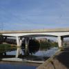
Frank Perkins Parkway Bridge
is a minor waterways place
on the River Nene (main river) between
Peterborough Junction (Junction of River Nene with Stanground Branch) (¾ furlongs
to the east) and
Overton Lake Junction (3 miles and 2 furlongs
and 1 lock
to the west).
The nearest place in the direction of Overton Lake Junction is Peterborough Embankment;
1¼ furlongs
away.
Mooring here is tolerable (it's just about possible if really necessary), mooring rings or bollards are available. Peterborough embankment stretches either side of the bridge, and mooring under it possible too if really necessary.
There is a bridge here which takes a dual carriageway over the canal.
Dog-in-a-Doublet Lock No 38 | 4 miles, 4¾ furlongs | |
Dog-in-a-Doublet Visitor Mooring (EA) | 4 miles, 3¾ furlongs | |
North Bank Footbridge | 2 miles, 2¼ furlongs | |
Fengate Field Bridge | 4¼ furlongs | |
Peterborough Junction | ¾ furlongs | |
Frank Perkins Parkway Bridge | ||
Peterborough Embankment | 1¼ furlongs | |
London Road Bridge (Peterborough) | 3¼ furlongs | |
Viersen Platz Footbridge | 4 furlongs | |
Peterborough Railway Bridge | 4½ furlongs | |
Peterborough - Ely Railway Bridge | 5¼ furlongs |
There are no links to external websites from here.
Why not log in and add some (select "External websites" from the menu (sometimes this is under "Edit"))?
Mouseover for more information or show routes to facility
Nearest water point
In the direction of Northampton Railway Bridge
Peterborough Embankment — 1¼ furlongs away
On this waterway in the direction of Northampton Railway Bridge
Yarwell Lock No 33 — 13 miles, 1¾ furlongs and 4 locks away
On this waterway in the direction of Northampton Railway Bridge
Fotheringhay Bridge — 18 miles, 7½ furlongs and 7 locks away
On this waterway in the direction of Northampton Railway Bridge
In the direction of Dog-in-a-Doublet Lock No 38
March Marina — 14 miles, 7¾ furlongs and 2 locks away
Travel to Peterborough Junction, then on the River Nene (Stanground Branch) to Stanground Sluice, then on the Middle Level Navigations (King's Dyke) to Whittlesey Bridge, then on the Middle Level Navigations (Whittlesey Dyke) to Old River Nene - Whittlesey Dyke Junction, then on the Middle Level Navigations (Old River Nene) to March Marina
March Boater Services — 15 miles, 7½ furlongs and 2 locks away
Travel to Peterborough Junction, then on the River Nene (Stanground Branch) to Stanground Sluice, then on the Middle Level Navigations (King's Dyke) to Whittlesey Bridge, then on the Middle Level Navigations (Whittlesey Dyke) to Old River Nene - Whittlesey Dyke Junction, then on the Middle Level Navigations (Old River Nene) to March Boater ServicesNearest rubbish disposal
In the direction of Dog-in-a-Doublet Lock No 38
March Boater Services — 15 miles, 7½ furlongs and 2 locks away
Travel to Peterborough Junction, then on the River Nene (Stanground Branch) to Stanground Sluice, then on the Middle Level Navigations (King's Dyke) to Whittlesey Bridge, then on the Middle Level Navigations (Whittlesey Dyke) to Old River Nene - Whittlesey Dyke Junction, then on the Middle Level Navigations (Old River Nene) to March Boater ServicesNearest chemical toilet disposal
In the direction of Northampton Railway Bridge
Peterborough Embankment — 1¼ furlongs away
On this waterway in the direction of Northampton Railway Bridge
In the direction of Dog-in-a-Doublet Lock No 38
March Marina — 14 miles, 7¾ furlongs and 2 locks away
Travel to Peterborough Junction, then on the River Nene (Stanground Branch) to Stanground Sluice, then on the Middle Level Navigations (King's Dyke) to Whittlesey Bridge, then on the Middle Level Navigations (Whittlesey Dyke) to Old River Nene - Whittlesey Dyke Junction, then on the Middle Level Navigations (Old River Nene) to March Marina
March Boater Services — 15 miles, 7½ furlongs and 2 locks away
Travel to Peterborough Junction, then on the River Nene (Stanground Branch) to Stanground Sluice, then on the Middle Level Navigations (King's Dyke) to Whittlesey Bridge, then on the Middle Level Navigations (Whittlesey Dyke) to Old River Nene - Whittlesey Dyke Junction, then on the Middle Level Navigations (Old River Nene) to March Boater ServicesNearest place to turn
In the direction of Northampton Railway Bridge
Peterborough Rowing Club Junction — 1 mile, 4¾ furlongs away
On this waterway in the direction of Northampton Railway Bridge
Waternewton Lock Winding Hole — 7 miles, 7¾ furlongs and 2 locks away
On this waterway in the direction of Northampton Railway Bridge
Elton Hall Winding Hole — 17 miles, 3¼ furlongs and 6 locks away
On this waterway in the direction of Northampton Railway Bridge
Warmington Lock Weir Entrance — 18 miles, ¾ furlongs and 7 locks away
On this waterway in the direction of Northampton Railway Bridge
Perio Lock Weir Exit No 2 — 19 miles, 6¼ furlongs and 7 locks away
On this waterway in the direction of Northampton Railway Bridge
In the direction of Dog-in-a-Doublet Lock No 38
Peterborough Junction — ¾ furlongs away
On this waterway in the direction of Dog-in-a-Doublet Lock No 38
Stanground Branch - Morton's Leam Junction — 4½ furlongs away
Travel to Peterborough Junction, then on the River Nene (Stanground Branch) to Stanground Branch - Morton's Leam Junction
Whittlesey Winding Hole — 4 miles, 4¾ furlongs and 1 lock away
Travel to Peterborough Junction, then on the River Nene (Stanground Branch) to Stanground Sluice, then on the Middle Level Navigations (King's Dyke) to Whittlesey Winding Hole
Ashline Winding Hole — 5 miles, 2¼ furlongs and 1 lock away
Travel to Peterborough Junction, then on the River Nene (Stanground Branch) to Stanground Sluice, then on the Middle Level Navigations (King's Dyke) to Whittlesey Bridge, then on the Middle Level Navigations (Whittlesey Dyke) to Ashline Winding Hole
Angle Corner — 7 miles, 5½ furlongs and 2 locks away
Travel to Peterborough Junction, then on the River Nene (Stanground Branch) to Stanground Sluice, then on the Middle Level Navigations (King's Dyke) to Whittlesey Bridge, then on the Middle Level Navigations (Whittlesey Dyke) to Angle Corner
Old River Nene - Whittlesey Dyke Junction — 11 miles and 2 locks away
Travel to Peterborough Junction, then on the River Nene (Stanground Branch) to Stanground Sluice, then on the Middle Level Navigations (King's Dyke) to Whittlesey Bridge, then on the Middle Level Navigations (Whittlesey Dyke) to Old River Nene - Whittlesey Dyke Junction
Bevill's Leam Pumping Station (northeastern side) — 12 miles, 4¾ furlongs and 2 locks away
Travel to Peterborough Junction, then on the River Nene (Stanground Branch) to Stanground Sluice, then on the Middle Level Navigations (King's Dyke) to Whittlesey Bridge, then on the Middle Level Navigations (Whittlesey Dyke) to Angle Corner, then on the Middle Level Navigations (Bevill's Leam: Angle Corner to Pumping Station) to Bevill's Leam Pumping Station (northeastern side)
West End Winding Hole — 15 miles, 2½ furlongs and 2 locks away
Travel to Peterborough Junction, then on the River Nene (Stanground Branch) to Stanground Sluice, then on the Middle Level Navigations (King's Dyke) to Whittlesey Bridge, then on the Middle Level Navigations (Whittlesey Dyke) to Old River Nene - Whittlesey Dyke Junction, then on the Middle Level Navigations (Old River Nene) to West End Winding Hole
Crab Marsh Winding Hole — 19 miles, 5¼ furlongs and 1 lock away
Travel to Dog-in-a-Doublet Lock No 38, then on the River Nene (tidal section) to Crab Marsh Winding Hole
Bill Fen Marina — 18 miles, 6¼ furlongs and 2 locks away
Travel to Peterborough Junction, then on the River Nene (Stanground Branch) to Stanground Sluice, then on the Middle Level Navigations (King's Dyke) to Whittlesey Bridge, then on the Middle Level Navigations (Whittlesey Dyke) to Old River Nene - Whittlesey Dyke Junction, then on the Middle Level Navigations (Old River Nene) to Old River Nene - Ramsey High Lode Junction, then on the Middle Level Navigations (Ramsey High Lode) to Bill Fen Marina
Ramsey — 19 miles, 4¾ furlongs and 2 locks away
Travel to Peterborough Junction, then on the River Nene (Stanground Branch) to Stanground Sluice, then on the Middle Level Navigations (King's Dyke) to Whittlesey Bridge, then on the Middle Level Navigations (Whittlesey Dyke) to Old River Nene - Whittlesey Dyke Junction, then on the Middle Level Navigations (Old River Nene) to Old River Nene - Ramsey High Lode Junction, then on the Middle Level Navigations (Ramsey High Lode) to RamseyNearest self-operated pump-out
In the direction of Northampton Railway Bridge
Peterborough Embankment — 1¼ furlongs away
On this waterway in the direction of Northampton Railway BridgeNearest boatyard pump-out
In the direction of Dog-in-a-Doublet Lock No 38
March Marina — 14 miles, 7¾ furlongs and 2 locks away
Travel to Peterborough Junction, then on the River Nene (Stanground Branch) to Stanground Sluice, then on the Middle Level Navigations (King's Dyke) to Whittlesey Bridge, then on the Middle Level Navigations (Whittlesey Dyke) to Old River Nene - Whittlesey Dyke Junction, then on the Middle Level Navigations (Old River Nene) to March MarinaDirection of TV transmitter (From Wolfbane Cybernetic)
There is no page on Wikipedia called “Frank Perkins Parkway Bridge”
Wikipedia pages that might relate to Frank Perkins Parkway Bridge
[Road transport in Peterborough]
The Frank Perkins Parkway is named after Frank Perkins, local founder of Perkins Engines and is the main Eastern Bypass for Peterborough. The parkway has
[River Nene]
before joining the Brampton Nene. At Cotton End, the Nene passes under South Bridge, then through Beckett's Park and past the site of the former Northampton
[Johnny Cash]
announcer. At night, he played with guitarist Luther Perkins and bassist Marshall Grant. Perkins and Grant were known as the Tennessee Two. Cash worked
[Idaho]
Park Castle Rocks State Park City of Rocks National Reserve Coeur d'Alene Parkway State Park Dworshak State Park Eagle Island State Park Farragut State Park
[Peterborough]
ubiquitous Fletton Brick. Perkins Engines was established in Peterborough in 1932 by Frank Perkins, creator of the Perkins diesel engine. Thirty years
[Selma, Alabama]
of the Jefferson Davis Memorial Highway. In 1977 US 80 was named Givhan Parkway in honor of the long-serving state senator Walter C. Givhan, a segregationist
[Riverdale, Bronx]
reached by the Henry Hudson Parkway (NY 9A) via the Henry Hudson Bridge, and by Broadway (US 9) via the Broadway Bridge. Wave Hill, a combination botanical
[Lauren Bacall]
told him. Bacall's family moved soon after her birth to Brooklyn's Ocean Parkway. Money from a wealthy family allowed Bacall to go to school at the Highland
[Detroit]
from Hart Plaza to the Ambassador Bridge for a total of five miles (8.0 kilometres) of parkway from bridge to bridge. Civic planners envision the pedestrian
[Columbus Civic Center (Ohio)]
1936 Plaque commemorating the civic center, bridges, and related riverfront improvements Ohio portal Perkins, Michael A. (2005). Leveque: The First Complete
Results of Google Search
Frank Perkins Parkway Bridge is a bridge, road bridge located at A1139 Frank Perkins Parkway in Peterborough. Frank Perkins Parkway Bridge - Peterborough ...
The Paston Parkway bypasses the eastern edge of Peterborough, terminating at a roundabout with the ...
A1139 Frank Perkins Parkway, related objects. Frank Perkins Parkway Bridge · Perkins Engines. Nearby cities: Coordinates: 52°34'32"N -0°13'24"E. Add your ...
Around Peterborough, Car Dyke can be found at Baston, Langtoft, Deeping St ... Cat's Water Drain just east of the Frank Perkins Parkway bridge over the Nene.
Jul 15, 2019 ... Watch Serious crash on Frank Perkins Parkway - JPIMedia - Archive on Dailymotion.
Apr 5, 2014 ... The bridge carrying Frank Perkins Parkway over Fengate under construction around 1983 – looking towards the city centre. Most, if not all, ...
Jul 15, 2019 ... Watch Frank Perkins Parkway crash scene - JPIMedia - Archive on Dailymotion.
May 4, 2020 ... The city council is to authorise the extra money is spent on works to replace bearings at Nene Bridge, which carries the Frank Perkins Parkway ...
Sep 16, 2016 ... Early construction work on the bridge carrying the Frank Perkins Parkway over the River Nene downstream of the Embankment and, below, ...