CanalPlanAC

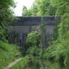
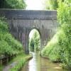
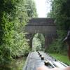
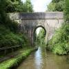
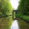
Double Culvert Bridge No 40

 
Also known as: Water Bridge No 40
Newport Road, Stafford ST20 0NX, United Kingdom (A519)
 
Information about the place
Double Culvert Bridge No 40 is a minor waterways place on the Shropshire Union Canal (Birmingham and Liverpool Junction Canal - Main Line) between Norbury Junction (Junction with former Newport Branch) (1 mile and 1¾ furlongs to the south) and Knighton Wharf (This was the wharf for the Cadbury factory.) (3 miles and 1 furlong to the west).
 
It is part of Grub Street Cutting.
 
The nearest place in the direction of Norbury Junction is High Bridge No 39; 2¼ furlongs away.
 
The nearest place in the direction of Knighton Wharf is Grub Street Winding Hole; 3½ furlongs away.

There may be access to the towpath here.

Mooring here is unrated.

There is a bridge here which takes a track over the canal.

Norbury Wharf Boatyard1 mile, 1¾ furlongs
Junction Inn1 mile, 1½ furlongs
Norbury Bridge No 381 mile, 1½ furlongs
Norbury Junction Visitor Moorings (north)1 mile, 1¼ furlongs
High Bridge No 392¼ furlongs
Double Culvert Bridge No 40
Grub Street Winding Hole3½ furlongs
Lambarts Bridge No 415½ furlongs
Anchor Inn Visitor Moorings (High Offley)1 mile, 1 furlong
The Anchor Inn (High Offley)1 mile, 1¼ furlongs
Anchor Bridge No 421 mile, 1½ furlongs
 
 
Amenities

Amenities here

 SEE ADDRESS
 The Cock Inn
 
Maps
If you are a user and are logged on, or if you are actively planning a route, a map will be displayed here.
Show on external mapping site: Google | OSM | Bing
 
Photos
 
External websites
There are no links to external websites from here.
Why not log in and add some (select "External websites" from the menu (sometimes this is under "Edit"))?
 
Nearest facilities

Mouseover for more information or show routes to facility

Nearest water point

In the direction of Autherley Junction

Norbury Wharf Boatyard1 mile, 1¾ furlongs away
On this waterway in the direction of Autherley Junction
Norbury Junction Services1 mile, 2 furlongs away
On this waterway in the direction of Autherley Junction
The Navigation Inn (Gnosall)3 miles, 5½ furlongs away
On this waterway in the direction of Autherley Junction
Wheaton Aston Services8 miles, 7 furlongs away
On this waterway in the direction of Autherley Junction
Autherley Stop Lock Water Point16 miles, 5 furlongs and 1 lock away
On this waterway in the direction of Autherley Junction
Broad Street Basin19 miles, ¾ furlongs and 23 locks away
Travel to Autherley Junction, then on the Staffordshire and Worcestershire Canal (Main Line: Aldersley to Autherley) to Aldersley Junction, then on the Birmingham Canal Navigations (Main Line) to Broad Street Basin

In the direction of Nantwich Basin Entrance

Goldstone Bridge No 556 miles, 3 furlongs away
On this waterway in the direction of Nantwich Basin Entrance
Goldstone Wharf6 miles, 3½ furlongs away
On this waterway in the direction of Nantwich Basin Entrance
Tyrley Wharf Services8 miles, 4 furlongs away
On this waterway in the direction of Nantwich Basin Entrance
Talbot Wharf Services9 miles, 7¾ furlongs and 5 locks away
On this waterway in the direction of Nantwich Basin Entrance
Audlem Wharf15 miles, 7½ furlongs and 22 locks away
On this waterway in the direction of Nantwich Basin Entrance
Audlem Water Point (below Lock No 25)16 miles, ½ furlongs and 23 locks away
On this waterway in the direction of Nantwich Basin Entrance
Overwater Marina16 miles, 6½ furlongs and 25 locks away
On this waterway in the direction of Nantwich Basin Entrance

Nearest rubbish disposal

In the direction of Autherley Junction

Norbury Wharf Boatyard1 mile, 1¾ furlongs away
On this waterway in the direction of Autherley Junction
Wheaton Aston Services8 miles, 7 furlongs away
On this waterway in the direction of Autherley Junction
Autherley Junction Bridge No 116 miles, 5¾ furlongs and 2 locks away
On this waterway in the direction of Autherley Junction
Wolverhampton Lock No 918 miles, 3¼ furlongs and 14 locks away
Travel to Autherley Junction, then on the Staffordshire and Worcestershire Canal (Main Line: Aldersley to Autherley) to Aldersley Junction, then on the Birmingham Canal Navigations (Main Line) to Wolverhampton Lock No 9
Broad Street Basin19 miles, ¾ furlongs and 23 locks away
Travel to Autherley Junction, then on the Staffordshire and Worcestershire Canal (Main Line: Aldersley to Autherley) to Aldersley Junction, then on the Birmingham Canal Navigations (Main Line) to Broad Street Basin

In the direction of Nantwich Basin Entrance

Tyrley Wharf Services8 miles, 4 furlongs away
On this waterway in the direction of Nantwich Basin Entrance
Audlem Wharf15 miles, 7½ furlongs and 22 locks away
On this waterway in the direction of Nantwich Basin Entrance

Nearest chemical toilet disposal

In the direction of Autherley Junction

Norbury Wharf Boatyard1 mile, 1¾ furlongs away
On this waterway in the direction of Autherley Junction
Norbury Junction Services1 mile, 2 furlongs away
On this waterway in the direction of Autherley Junction
Wheaton Aston Services8 miles, 7 furlongs away
On this waterway in the direction of Autherley Junction
Broad Street Basin19 miles, ¾ furlongs and 23 locks away
Travel to Autherley Junction, then on the Staffordshire and Worcestershire Canal (Main Line: Aldersley to Autherley) to Aldersley Junction, then on the Birmingham Canal Navigations (Main Line) to Broad Street Basin

In the direction of Nantwich Basin Entrance

Talbot Wharf Services9 miles, 7¾ furlongs and 5 locks away
On this waterway in the direction of Nantwich Basin Entrance
Audlem Wharf15 miles, 7½ furlongs and 22 locks away
On this waterway in the direction of Nantwich Basin Entrance
Overwater Marina16 miles, 6½ furlongs and 25 locks away
On this waterway in the direction of Nantwich Basin Entrance

Nearest place to turn

In the direction of Autherley Junction

Norbury Wharf Boatyard1 mile, 1¾ furlongs away
On this waterway in the direction of Autherley Junction
Norbury Junction1 mile, 1¾ furlongs away
On this waterway in the direction of Autherley Junction
High Onn Wharf5 miles, 7¼ furlongs away
On this waterway in the direction of Autherley Junction
Wheaton Aston Winding Hole8 miles, 6½ furlongs away
On this waterway in the direction of Autherley Junction
Stretton Boatyard10 miles, 3½ furlongs and 1 lock away
On this waterway in the direction of Autherley Junction
Brewood Wharf11 miles, 4 furlongs and 1 lock away
On this waterway in the direction of Autherley Junction
Park Lodge Winding Hole13 miles and 1 lock away
On this waterway in the direction of Autherley Junction
Lower Hattons Winding Hole13 miles, 7 furlongs and 1 lock away
On this waterway in the direction of Autherley Junction
Pendeford Hall Lane Winding hole14 miles, 5½ furlongs and 1 lock away
On this waterway in the direction of Autherley Junction
Autherley Junction16 miles, 5¾ furlongs and 2 locks away
On this waterway in the direction of Autherley Junction
Aldersley Junction17 miles, 1¾ furlongs and 2 locks away
Travel to Autherley Junction, then on the Staffordshire and Worcestershire Canal (Main Line: Aldersley to Autherley) to Aldersley Junction
Three Hammers Farm Winding Hole19 miles, 2 furlongs and 2 locks away
Travel to Autherley Junction, then on the Staffordshire and Worcestershire Canal (Main Line: Autherley to Great Haywood) to Three Hammers Farm Winding Hole
Slade Heath Winding Hole19 miles, 7¾ furlongs and 2 locks away
Travel to Autherley Junction, then on the Staffordshire and Worcestershire Canal (Main Line: Autherley to Great Haywood) to Slade Heath Winding Hole
Newport Canal Basin5 miles, 3 furlongs and 20 locks away
Travel to Norbury Junction, then on the Shropshire Union Canal (Birmingham and Liverpool Junction Canal - Newport Branch - Main Line) to Newport Canal Basin

In the direction of Nantwich Basin Entrance

Grub Street Winding Hole3½ furlongs away
On this waterway in the direction of Nantwich Basin Entrance
Shebdon Winding Hole2 miles, 2¾ furlongs away
On this waterway in the direction of Nantwich Basin Entrance
Park Heath Wharf4 miles, 2½ furlongs away
On this waterway in the direction of Nantwich Basin Entrance
Goldstone Wharf6 miles, 3½ furlongs away
On this waterway in the direction of Nantwich Basin Entrance
Talbot Wharf9 miles, 7¼ furlongs and 5 locks away
On this waterway in the direction of Nantwich Basin Entrance
Adderley Winding Hole12 miles, 7½ furlongs and 5 locks away
On this waterway in the direction of Nantwich Basin Entrance

Nearest self-operated pump-out

In the direction of Autherley Junction

Wheaton Aston Services8 miles, 7 furlongs away
On this waterway in the direction of Autherley Junction

In the direction of Nantwich Basin Entrance

Talbot Wharf Services9 miles, 7¾ furlongs and 5 locks away
On this waterway in the direction of Nantwich Basin Entrance
Overwater Marina16 miles, 6½ furlongs and 25 locks away
On this waterway in the direction of Nantwich Basin Entrance

Nearest boatyard pump-out

In the direction of Autherley Junction

Norbury Wharf Boatyard1 mile, 1¾ furlongs away
On this waterway in the direction of Autherley Junction
Brewood Wharf11 miles, 4 furlongs and 1 lock away
On this waterway in the direction of Autherley Junction
Autherley Wharf16 miles, 5¼ furlongs and 1 lock away
On this waterway in the direction of Autherley Junction
Oxley Marine16 miles, 6¾ furlongs and 2 locks away
Travel to Autherley Junction, then on the Staffordshire and Worcestershire Canal (Main Line: Aldersley to Autherley) to Oxley Marine
Direction of TV transmitter (From Wolfbane Cybernetic)
 
 
Blog posts
We don't need a weatherman..... from Scribblings from the Mintball posted Sunday the 3rd of May, 2015
 
Geograph
 
Wikipedia

There is no page on Wikipedia called “Double Culvert Bridge”

Wikipedia pages that might relate to Double Culvert Bridge
[Bridge] to nowhere Bridges Act BS 5400 Causeway Coal trestle Covered bridges Cross-sea traffic ways Culvert Deck Devil's Bridge Footbridge Jet bridge Landscape [Panama Canal locks] with five openings; seven cross culverts from the sidewall main culverts alternate with seven from the centre wall culvert. The water is moved by gravity [Bridge 5757] Bridge 5757 or the Fond du Lac Culvert is a historic bridge in the Fond du Lac neighborhood of Duluth, Minnesota, United States. It was built in 1937 [Macquarie Culvert] The Macquarie Culvert is a double brick culvert under the original Mrs Macquarie's Road (also known as Lady Macquarie's Road) in the Royal Botanic Gardens [Stone Bridge, Dalrymple Gap Track] the Queensland Heritage Register on 21 October 1992. The stone and brick culvert near Dalrymple Gap, south of Damper Creek, was constructed in late 1864/early [Burlington County Bridge Commission] Commission are the Pennsauken Creek Bridge, Pompeston Creek Bridge, Route 73 Overpass, Swede Run Bridge and the Twin Pipe Culvert, all along County Route 543 [List of bridge failures] Herald. 6 April 2007. "Culvert tragedy: coroner blames council". The Sydney Morning Herald. 18 September 2008. "Truck collapses bridge in Grays Harbor County" [Bixby Creek Bridge] Bixby Creek Bridge, also known as Bixby Canyon Bridge, on the Big Sur coast of California, is one of the most photographed bridges in California due to [Stony Creek Bridge] a concrete culvert was constructed to direct the creek under the road. This bridge was turned over to a private owner. A queen post bridge has two upright [Wildlife crossing] ladders; canopy bridge (especially for monkeys and squirrels), tunnels and culverts (for small mammals such as otters, hedgehogs, and badgers); and green roofs
 
Google

Results of Google Search

Benson Culvert (County Bridge No. FAS-40)
This double arch native limestone culvert is nominated to the National Register of Historic Places under Criterion A in the areas of social history and government ...
NS - Double Culvert Road Bridge - Bridgehunter.com
38°20'40" N, 84°31'45" W (degrees°minutes'seconds"); Approximate UTM coordinates: 16/715929/4246922 (zone/easting/northing); Quadrangle map: ...
National Register Nomination
Dec 3, 2013 ... 1. Name of Property historic name. Benson Culvert (County Bridge No. FAS-40) ... The double arch culvert was constructed of native limestone.
Double Culvert Bridge No 40 © Mat Fascione :: Geograph Britain ...
May 12, 2018 ... Double Culvert Bridge No 40. The Shropshire Union Canal (from Autherley to Nantwich) was engineered by Thomas Telford and opened in ...
Hydraulic Design of Highway Culverts - HDS-5 - Third Edition
Apr 1, 2012 ... Government Accession No. 3. ... Performing Organization Report No. 9. ... set of culvert design charts will continue to be available in the archived second edition of HDS 5. ... 1.2 COMPARISONS BETWEEN CULVERTS, BRIDGES, AND STORM ... with openings that are 20 to 40 ft (7 to 14 m) wide or larger.
2018 Standard Plans | Caltrans
Shoulder Rumble Strip Details - Ground-In Indentations, A40B ... Double Thrie Beam Barrier - Connections To Bridge Railings Without Sidewalks, A78F1 ... Reinforced Concrete Pipe Or Non-Reinforced Concrete Pipe - Standard and Positive ...
wq-ws4-46g
Outlet Condition, Outlet Perch Height, Road Fill Height, Culvert Bed Retention, Bankfull to ... Box, Concrete, 24, 25, 20, 20, 0.8, 6, 22, bridge, deteriorating condition ... north half of culvert = riffle, w/ ~2.5' ws drop, Y, Y, Y, N, Y, N, N, Y, Y, N, Y, 0, 15, No ... 05:17:03pm, Box, Concrete, 12, 24, 20, 20, 0.8, 8, 40, double box culvert ...
Bridge Standards (English)
For proper display of Bridge standards in MicroStation extract these font files into the ... 02/05/2020, New and Revised Culvert and Drainage Standard Drawings, PDF Icon ... 02-20, CH-PW-A-0, Parallel Wings Arch Pipe Non Skew, PDF Icon ... 06-11, XB40, Prestressed Concrete X-Beam Details,Ty XB40, PDF Icon xbstds04.
State Bridge Design Standards - 2009 - English - LRFD
Dec 20, 2016 ... SHEET NO. C, STANDARD NAME, DESIGN NUMBER, REV. NO. ... B-015, R, REFERENCE GUIDE TO STANDARD SERIES B40 (1 of 5) ... B-025, R, BRIDGE STANDARDS DESIGN INFORMATION, B40-DESIGN-INFO, 01E ... PIPE UNDERDRAIN ASSEMBLY DETAILS ... DOUBLE CELL - 12 FT. TO 20 FT.