CanalPlanAC

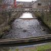
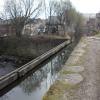
Aqueduct over River Tame

 
Tame Street, Tameside SK15 1ST, United Kingdom
 
Information about the place
Aqueduct over River Tame is a minor waterways place on the Huddersfield Narrow Canal between Ashton-under-Lyne Junction (Junction of Ashton and Huddersfield Narrow Canals) (5½ furlongs and 3 locks to the west) and Royal George Aqueduct (7 miles and ¾ furlongs and 14 locks to the northeast).
 
 
The nearest place in the direction of Ashton-under-Lyne Junction is Tame Pipe Bridge; ¼ furlongs away.
 
The nearest place in the direction of Royal George Aqueduct is Peel Street Narrows; ¾ furlongs away.

Mooring here is unrated.

There is a small aqueduct or underbridge here which takes a river under the canal.


Amenities

Amenities here

 Trevor Judge James Coffey T/A

Amenities nearby at Peel Street Narrows

 Cheshire Gas M-Sat 5:30pm Su 4:30pm
 
Maps
If you are a user and are logged on, or if you are actively planning a route, a map will be displayed here.
Show on external mapping site: Google | OSM | Bing
 
Photos
 
External websites
There are no links to external websites from here.
Why not log in and add some (select "External websites" from the menu (sometimes this is under "Edit"))?
 
Nearest facilities

Mouseover for more information or show routes to facility

Nearest water point

In the direction of Ashton-under-Lyne Junction

Fairfield Junction3 miles, 5½ furlongs and 3 locks away
Travel to Ashton-under-Lyne Junction, then on the Ashton Canal (Main Line) to Fairfield Junction
Marple Services9 miles, 2¾ furlongs and 19 locks away
Travel to Ashton-under-Lyne Junction, then on the Ashton Canal (Main Line) to Dukinfield Junction, then on the Peak Forest Canal (Lower) to Marple Junction, then on the Macclesfield Canal to Marple Services
New Islington Marina7 miles, 7¾ furlongs and 23 locks away
Travel to Ashton-under-Lyne Junction, then on the Ashton Canal (Main Line) to Ducie Street Junction, then on the Rochdale Canal to New Islington Marina Entrance, then on the Rochdale Canal (Main Line) to Cotton Field Wharf Marina, then on the Rochdale Canal (New Islington Marina Arm) to New Islington Marina
Braidbar Boats13 miles, ½ furlongs and 19 locks away
Travel to Ashton-under-Lyne Junction, then on the Ashton Canal (Main Line) to Dukinfield Junction, then on the Peak Forest Canal (Lower) to Marple Junction, then on the Macclesfield Canal to Braidbar Boats
Furness Vale Marina14 miles, 1¾ furlongs and 19 locks away
Travel to Ashton-under-Lyne Junction, then on the Ashton Canal (Main Line) to Dukinfield Junction, then on the Peak Forest Canal (Lower) to Marple Junction, then on the Peak Forest Canal (Upper) to Furness Vale Marina
Whaley Bridge Services15 miles, 6 furlongs and 19 locks away
Travel to Ashton-under-Lyne Junction, then on the Ashton Canal (Main Line) to Dukinfield Junction, then on the Peak Forest Canal (Lower) to Marple Junction, then on the Peak Forest Canal (Upper) to Whaley Bridge Branch Junction, then on the Peak Forest Canal (Whaley Bridge Branch) to Whaley Bridge Services
Bugsworth Services15 miles, 6¼ furlongs and 19 locks away
Travel to Ashton-under-Lyne Junction, then on the Ashton Canal (Main Line) to Dukinfield Junction, then on the Peak Forest Canal (Lower) to Marple Junction, then on the Peak Forest Canal (Upper) to Bugsworth Services
Bollington Wharf17 miles, 6¼ furlongs and 19 locks away
Travel to Ashton-under-Lyne Junction, then on the Ashton Canal (Main Line) to Dukinfield Junction, then on the Peak Forest Canal (Lower) to Marple Junction, then on the Macclesfield Canal to Bollington Wharf
Staffordshire, Kenworthy and other Arms8 miles, 5¾ furlongs and 30 locks away
Travel to Ashton-under-Lyne Junction, then on the Ashton Canal (Main Line) to Ducie Street Junction, then on the Rochdale Canal to Castlefield Junction, then on the Bridgewater Canal (Main Line) to Staffordshire, Kenworthy and other Arms
Potato Wharf Arm & The New Basin8 miles, 6½ furlongs and 30 locks away
Travel to Ashton-under-Lyne Junction, then on the Ashton Canal (Main Line) to Ducie Street Junction, then on the Rochdale Canal to Castlefield Junction, then on the Bridgewater Canal (Main Line) to Potato Wharf Arm & The New Basin
Stretford Marina11 miles, 5¾ furlongs and 30 locks away
Travel to Ashton-under-Lyne Junction, then on the Ashton Canal (Main Line) to Ducie Street Junction, then on the Rochdale Canal to Castlefield Junction, then on the Bridgewater Canal (Main Line) to Stretford Marina
Watch House Cruising Club12 miles, 6 furlongs and 30 locks away
Travel to Ashton-under-Lyne Junction, then on the Ashton Canal (Main Line) to Ducie Street Junction, then on the Rochdale Canal to Castlefield Junction, then on the Bridgewater Canal (Main Line) to Watch House Cruising Club
Worsley Visitor Moorings15 miles, 7¾ furlongs and 30 locks away
Travel to Ashton-under-Lyne Junction, then on the Ashton Canal (Main Line) to Ducie Street Junction, then on the Rochdale Canal to Castlefield Junction, then on the Bridgewater Canal (Main Line) to Stretford - Waters Meeting, then on the Bridgewater Canal (Stretford and Leigh Branch) to Worsley Visitor Moorings
Bridgewater Marina17 miles, 3¾ furlongs and 30 locks away
Travel to Ashton-under-Lyne Junction, then on the Ashton Canal (Main Line) to Ducie Street Junction, then on the Rochdale Canal to Castlefield Junction, then on the Bridgewater Canal (Main Line) to Stretford - Waters Meeting, then on the Bridgewater Canal (Stretford and Leigh Branch) to Bridgewater Marina
Ye Olde Number 3 Transit Moorings19 miles, 5 furlongs and 30 locks away
Travel to Ashton-under-Lyne Junction, then on the Ashton Canal (Main Line) to Ducie Street Junction, then on the Rochdale Canal to Castlefield Junction, then on the Bridgewater Canal (Main Line) to Ye Olde Number 3 Transit Moorings

In the direction of Aspley Basin (Huddersfield)

Grove Road Bridge No 963 miles, 6¾ furlongs and 5 locks away
On this waterway in the direction of Aspley Basin (Huddersfield)
Wool Road Bridge No 709 miles, 6¾ furlongs and 20 locks away
On this waterway in the direction of Aspley Basin (Huddersfield)
Standedge Tunnel (western entrance)11 miles, 6¾ furlongs and 29 locks away
On this waterway in the direction of Aspley Basin (Huddersfield)
Standedge Tunnel (eastern entrance)15 miles, ½ furlongs and 29 locks away
On this waterway in the direction of Aspley Basin (Huddersfield)
Slaithwaite Winding Hole18 miles, 3½ furlongs and 50 locks away
On this waterway in the direction of Aspley Basin (Huddersfield)

Nearest rubbish disposal

In the direction of Ashton-under-Lyne Junction

Marple Bottom Lock Bridge Winding Hole8 miles, 1½ furlongs and 3 locks away
Travel to Ashton-under-Lyne Junction, then on the Ashton Canal (Main Line) to Dukinfield Junction, then on the Peak Forest Canal (Lower) to Marple Bottom Lock Bridge Winding Hole
Marple Services9 miles, 2¾ furlongs and 19 locks away
Travel to Ashton-under-Lyne Junction, then on the Ashton Canal (Main Line) to Dukinfield Junction, then on the Peak Forest Canal (Lower) to Marple Junction, then on the Macclesfield Canal to Marple Services
Braidbar Boats13 miles, ½ furlongs and 19 locks away
Travel to Ashton-under-Lyne Junction, then on the Ashton Canal (Main Line) to Dukinfield Junction, then on the Peak Forest Canal (Lower) to Marple Junction, then on the Macclesfield Canal to Braidbar Boats
Whaley Bridge Services15 miles, 6 furlongs and 19 locks away
Travel to Ashton-under-Lyne Junction, then on the Ashton Canal (Main Line) to Dukinfield Junction, then on the Peak Forest Canal (Lower) to Marple Junction, then on the Peak Forest Canal (Upper) to Whaley Bridge Branch Junction, then on the Peak Forest Canal (Whaley Bridge Branch) to Whaley Bridge Services
Bugsworth Services15 miles, 6¼ furlongs and 19 locks away
Travel to Ashton-under-Lyne Junction, then on the Ashton Canal (Main Line) to Dukinfield Junction, then on the Peak Forest Canal (Lower) to Marple Junction, then on the Peak Forest Canal (Upper) to Bugsworth Services

In the direction of Aspley Basin (Huddersfield)

Wool Road Visitor Mooring9 miles, 6½ furlongs and 20 locks away
On this waterway in the direction of Aspley Basin (Huddersfield)
Pickle Lock No 22E18 miles, 3 furlongs and 49 locks away
On this waterway in the direction of Aspley Basin (Huddersfield)

Nearest chemical toilet disposal

In the direction of Ashton-under-Lyne Junction

Fairfield Junction3 miles, 5½ furlongs and 3 locks away
Travel to Ashton-under-Lyne Junction, then on the Ashton Canal (Main Line) to Fairfield Junction
Marple Services9 miles, 2¾ furlongs and 19 locks away
Travel to Ashton-under-Lyne Junction, then on the Ashton Canal (Main Line) to Dukinfield Junction, then on the Peak Forest Canal (Lower) to Marple Junction, then on the Macclesfield Canal to Marple Services
Furness Vale Marina14 miles, 1¾ furlongs and 19 locks away
Travel to Ashton-under-Lyne Junction, then on the Ashton Canal (Main Line) to Dukinfield Junction, then on the Peak Forest Canal (Lower) to Marple Junction, then on the Peak Forest Canal (Upper) to Furness Vale Marina
Whaley Bridge Services15 miles, 6 furlongs and 19 locks away
Travel to Ashton-under-Lyne Junction, then on the Ashton Canal (Main Line) to Dukinfield Junction, then on the Peak Forest Canal (Lower) to Marple Junction, then on the Peak Forest Canal (Upper) to Whaley Bridge Branch Junction, then on the Peak Forest Canal (Whaley Bridge Branch) to Whaley Bridge Services
Bugsworth Services15 miles, 6¼ furlongs and 19 locks away
Travel to Ashton-under-Lyne Junction, then on the Ashton Canal (Main Line) to Dukinfield Junction, then on the Peak Forest Canal (Lower) to Marple Junction, then on the Peak Forest Canal (Upper) to Bugsworth Services
Bollington Wharf17 miles, 6¼ furlongs and 19 locks away
Travel to Ashton-under-Lyne Junction, then on the Ashton Canal (Main Line) to Dukinfield Junction, then on the Peak Forest Canal (Lower) to Marple Junction, then on the Macclesfield Canal to Bollington Wharf
Watch House Cruising Club12 miles, 6 furlongs and 30 locks away
Travel to Ashton-under-Lyne Junction, then on the Ashton Canal (Main Line) to Ducie Street Junction, then on the Rochdale Canal to Castlefield Junction, then on the Bridgewater Canal (Main Line) to Watch House Cruising Club

In the direction of Aspley Basin (Huddersfield)

Grove Road Bridge No 963 miles, 6¾ furlongs and 5 locks away
On this waterway in the direction of Aspley Basin (Huddersfield)
Wool Road Bridge No 709 miles, 6¾ furlongs and 20 locks away
On this waterway in the direction of Aspley Basin (Huddersfield)
Pickle Lock No 22E18 miles, 3 furlongs and 49 locks away
On this waterway in the direction of Aspley Basin (Huddersfield)
Waterside Lock No 21E18 miles, 4¼ furlongs and 50 locks away
On this waterway in the direction of Aspley Basin (Huddersfield)

Nearest place to turn

In the direction of Ashton-under-Lyne Junction

Ashton-under-Lyne Junction5½ furlongs and 3 locks away
On this waterway in the direction of Ashton-under-Lyne Junction
Dukinfield Junction1 mile, 1½ furlongs and 3 locks away
Travel to Ashton-under-Lyne Junction, then on the Ashton Canal (Main Line) to Dukinfield Junction
Portland Basin Arm1 mile, 1¾ furlongs and 3 locks away
Travel to Ashton-under-Lyne Junction, then on the Ashton Canal (Main Line) to Dukinfield Junction, then on the Peak Forest Canal (Lower) to Portland Basin Arm
Dunkirk Farm Bridge Winding Hole2 miles, 6¾ furlongs and 3 locks away
Travel to Ashton-under-Lyne Junction, then on the Ashton Canal (Main Line) to Dukinfield Junction, then on the Peak Forest Canal (Lower) to Dunkirk Farm Bridge Winding Hole
Lumb Lane Bridge Winding Hole2 miles, 6¾ furlongs and 3 locks away
Travel to Ashton-under-Lyne Junction, then on the Ashton Canal (Main Line) to Lumb Lane Bridge Winding Hole
Canal Street Winding Hole3 miles, 3¾ furlongs and 3 locks away
Travel to Ashton-under-Lyne Junction, then on the Ashton Canal (Main Line) to Dukinfield Junction, then on the Peak Forest Canal (Lower) to Canal Street Winding Hole
Fairfield Junction3 miles, 5½ furlongs and 3 locks away
Travel to Ashton-under-Lyne Junction, then on the Ashton Canal (Main Line) to Fairfield Junction
Unity Mills Winding Hole5 miles, ¼ furlongs and 3 locks away
Travel to Ashton-under-Lyne Junction, then on the Ashton Canal (Main Line) to Dukinfield Junction, then on the Peak Forest Canal (Lower) to Unity Mills Winding Hole
Urwick Road Winding Hole6 miles, 7¼ furlongs and 3 locks away
Travel to Ashton-under-Lyne Junction, then on the Ashton Canal (Main Line) to Dukinfield Junction, then on the Peak Forest Canal (Lower) to Urwick Road Winding Hole
Marple Bottom Lock Bridge Winding Hole8 miles, 1½ furlongs and 3 locks away
Travel to Ashton-under-Lyne Junction, then on the Ashton Canal (Main Line) to Dukinfield Junction, then on the Peak Forest Canal (Lower) to Marple Bottom Lock Bridge Winding Hole
Clayton Junction4 miles, 7¾ furlongs and 11 locks away
Travel to Ashton-under-Lyne Junction, then on the Ashton Canal (Main Line) to Clayton Junction
Ashton New Road Winding Hole5 miles, 4¼ furlongs and 14 locks away
Travel to Ashton-under-Lyne Junction, then on the Ashton Canal (Main Line) to Ashton New Road Winding Hole
New Viaduct Winding Hole6 miles, 1¾ furlongs and 18 locks away
Travel to Ashton-under-Lyne Junction, then on the Ashton Canal (Main Line) to New Viaduct Winding Hole
Winding Hole below Lock 139 miles, 1 furlong and 15 locks away
Travel to Ashton-under-Lyne Junction, then on the Ashton Canal (Main Line) to Dukinfield Junction, then on the Peak Forest Canal (Lower) to Winding Hole below Lock 13

In the direction of Aspley Basin (Huddersfield)

Staley Wharf Winding Hole2¼ furlongs away
On this waterway in the direction of Aspley Basin (Huddersfield)
Knowle Street Winding Hole1 mile, 4¼ furlongs and 4 locks away
On this waterway in the direction of Aspley Basin (Huddersfield)
Mossley Bottoms Winding Hole5 miles, 4¼ furlongs and 9 locks away
On this waterway in the direction of Aspley Basin (Huddersfield)
Roughtown Court Winding Hole6 miles, 4 furlongs and 11 locks away
On this waterway in the direction of Aspley Basin (Huddersfield)
Manns Wharf Bridge Winding Hole7 miles, 5¼ furlongs and 16 locks away
On this waterway in the direction of Aspley Basin (Huddersfield)
Saddleworth Visitor Centre Winding Hole9 miles, ¼ furlongs and 18 locks away
On this waterway in the direction of Aspley Basin (Huddersfield)

Nearest self-operated pump-out

In the direction of Ashton-under-Lyne Junction

New Islington Marina7 miles, 7¾ furlongs and 23 locks away
Travel to Ashton-under-Lyne Junction, then on the Ashton Canal (Main Line) to Ducie Street Junction, then on the Rochdale Canal to New Islington Marina Entrance, then on the Rochdale Canal (Main Line) to Cotton Field Wharf Marina, then on the Rochdale Canal (New Islington Marina Arm) to New Islington Marina

In the direction of Aspley Basin (Huddersfield)

Wool Road Bridge No 709 miles, 6¾ furlongs and 20 locks away
On this waterway in the direction of Aspley Basin (Huddersfield)
Slaithwaite Winding Hole18 miles, 3½ furlongs and 50 locks away
On this waterway in the direction of Aspley Basin (Huddersfield)

Nearest boatyard pump-out

In the direction of Ashton-under-Lyne Junction

Portland Basin Arm1 mile, 1¾ furlongs and 3 locks away
Travel to Ashton-under-Lyne Junction, then on the Ashton Canal (Main Line) to Dukinfield Junction, then on the Peak Forest Canal (Lower) to Portland Basin Arm
Braidbar Boats13 miles, ½ furlongs and 19 locks away
Travel to Ashton-under-Lyne Junction, then on the Ashton Canal (Main Line) to Dukinfield Junction, then on the Peak Forest Canal (Lower) to Marple Junction, then on the Macclesfield Canal to Braidbar Boats
New Mills Marina13 miles, 2½ furlongs and 19 locks away
Travel to Ashton-under-Lyne Junction, then on the Ashton Canal (Main Line) to Dukinfield Junction, then on the Peak Forest Canal (Lower) to Marple Junction, then on the Peak Forest Canal (Upper) to New Mills Marina
Bollington Wharf17 miles, 6¼ furlongs and 19 locks away
Travel to Ashton-under-Lyne Junction, then on the Ashton Canal (Main Line) to Dukinfield Junction, then on the Peak Forest Canal (Lower) to Marple Junction, then on the Macclesfield Canal to Bollington Wharf
Kerridge Dry Dock18 miles, 1 furlong and 19 locks away
Travel to Ashton-under-Lyne Junction, then on the Ashton Canal (Main Line) to Dukinfield Junction, then on the Peak Forest Canal (Lower) to Marple Junction, then on the Macclesfield Canal to Kerridge Dry Dock
Stretford Marina11 miles, 5¾ furlongs and 30 locks away
Travel to Ashton-under-Lyne Junction, then on the Ashton Canal (Main Line) to Ducie Street Junction, then on the Rochdale Canal to Castlefield Junction, then on the Bridgewater Canal (Main Line) to Stretford Marina
Bridgewater Marina17 miles, 3¾ furlongs and 30 locks away
Travel to Ashton-under-Lyne Junction, then on the Ashton Canal (Main Line) to Ducie Street Junction, then on the Rochdale Canal to Castlefield Junction, then on the Bridgewater Canal (Main Line) to Stretford - Waters Meeting, then on the Bridgewater Canal (Stretford and Leigh Branch) to Bridgewater Marina
Direction of TV transmitter (From Wolfbane Cybernetic)
 
 
Geograph
 
Wikipedia

There is no page on Wikipedia called “Aqueduct over River Tame”

Wikipedia pages that might relate to Aqueduct over River Tame
[River Tame, West Midlands] Valley Aqueduct carrying the Tame Valley Canal over the River Tame at Ray Hall. The Tame at Ray Hall sewage works, from the Tame Valley Canal aqueduct, with [Tame Valley Canal] Line) by aqueduct, near Tame Bridge Parkway railway station (an unusual case of the railway pre-dating a neighbouring canal). It passes over the M5 motorway [Erie Canal] it onto a towering embankment to cross over Irondequoit Creek, spanned the Genesee River on an awesome aqueduct, and carved a route for it out of the solid [Peak Forest Canal] the Tame Aqueduct (grid reference SJ934984) through Newton, Hyde, Woodley, Bredbury and Romiley, before crossing the River Goyt on Marple Aqueduct, alongside [List of bridges in the United Kingdom] United Kingdom. Canal aqueducts are listed under: List of canal aqueducts in the United Kingdom All bridges are over the River Clyde unless otherwise [Water in California] reservoir and aqueduct system is designed to store and capture runoff from the Central Valley watershed. The Sacramento and San Joaquin Rivers converge at [River Trent] especially the Tame. To bring clean water to the West Midlands, Birmingham Corporation created a large reservoir chain and aqueduct system to bring water [Coventry Canal] Yeoman. Thomas Dadford advised on the Canal's aqueduct over the River Tame (now known as Tame Aqueduct) in 1784, and in June 1785 Thomas Sheasby was awarded [Dukinfield Junction] line of the canal. The arm under the junction bridge and the aqueduct over the River Tame were built by the Ashton Canal, and the junction with the Peak [Huddersfield Narrow Canal] the Tame/Colne watershed (the River Colne flowing down to Huddersfield and the River Calder, and the Tame flowing down to Stockport and the River Mersey)
 
Google

Results of Google Search

Tame Valley Canal - Wikipedia
The Tame Valley Canal is a relatively late (1844) canal in the West Midlands of England. It forms part of the Birmingham Canal Navigations. It takes its name from the roughly-parallel River Tame. ... Aqueduct over River Tame ...
File:Coventry Canal aqueduct over River Tame - geograph.org.uk ...
Feb 23, 2008 ... File:Coventry Canal aqueduct over River Tame - geograph.org.uk - 703552.jpg. Language; Watch · Edit. File; File history; File usage on ...
Template:Tame Valley Canal map - Wikipedia
Template:Tame Valley Canal map. From Wikipedia, the free encyclopedia. Jump to ... Aqueduct over River Tame ... Hateley Heath Aqueduct (over Hydes Road) ...
File:Tame Valley Aqueduct.JPG - Wikipedia
DescriptionTame Valley Aqueduct.JPG. English: Aqueduct carrying Tame Valley Canal over the River Tame, Charlemont. Date. 21 June 2008 (original upload ...
Canal aqueduct over River Tame © Rob Farrow cc-by-sa/2.0 ...
Feb 25, 2008 ... Three low arches carry the Coventry Canal over the River Tame at this point. The Tame often rises quite substantially such that I would expect ...
Stalybridge Aqueduct - Engineering Timelines
The aqueduct at Stalybridge carries the Huddersfield Narrow Canal over the River Tame. It is the second and only surviving prefabricated iron aqueduct ...
Aqueduct over River Tame © Rob Farrow cc-by-sa/2.0 :: Geograph ...
Feb 25, 2008 ... This aqueduct carries the Coventry Canal over the River Tame to the south of Tamworth. The view from on top of the aqueduct can be seen ...
'Tamworth and the River Tame Bridges from near Fazeley ...
Artwork page for 'Tamworth and the River Tame Bridges from near Fazeley, Staffordshire', ... bridge that still carries the London-Holyhead road (or Watling Street) over the Tame. Beyond it is the triple-spanned Coventry Canal aqueduct bridge.
Coventry Canal aqueduct over River Tame © Rob Farrow cc-by-sa ...
Feb 25, 2008 ... Quite unusual seeing water being carried over water, this aqueduct is on the Coventry Canal just a few hundred yards after it has branched off ...