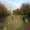
Broadreach Weir Stream
Channel leading to the Weir - No Access
Southern Washlands Nature Reserve, Welbeck Lane, Wakefield WF1 4HZ, United Kingdom
Address is taken from a point 541 yards away.

Broadreach Weir Stream
is a minor waterways place
on the Aire and Calder Navigation (Wakefield Section) between
Fall Ing Junction (Junction of the Calder and Hebble Navigation and the Aire and Calder Navigation (Wakefield Section)) (1 mile and 1½ furlongs
to the southwest) and
Stanley Ferry Aqueduct (This is a pair of Aqueducts over the River Calder) (1 mile and 3¼ furlongs
and 1 lock
to the north).
The nearest place in the direction of Fall Ing Junction is Eastmoor Railway Bridge No 2;
1½ furlongs
away.
The nearest place in the direction of Stanley Ferry Aqueduct is Broadreach Lock No 1 (Flood Lock);
¼ furlongs
away.
Mooring here is unrated.
Fall Ing Junction | 1 mile, 1½ furlongs | |
Foundry Shoal Railway Bridge No 1 | 1 mile, ¼ furlongs | |
Wakefield New Road Bridge | 6½ furlongs | |
Old Wharf Branch Junction | 6¼ furlongs | |
Eastmoor Railway Bridge No 2 | 1½ furlongs | |
Broadreach Weir Stream | ||
Broadreach Lock No 1 (Flood Lock) | ¼ furlongs | |
Broadreach Footbridge No 3 | 1 furlong | |
Harrisons Bridge No 4 | 4 furlongs | |
Ramsdens Bridge Sanitary Station | 1 mile, 1¼ furlongs | |
Ramsdens Swing Bridge | 1 mile, 1¼ furlongs |
There are no links to external websites from here.
Why not log in and add some (select "External websites" from the menu (sometimes this is under "Edit"))?
Mouseover for more information or show routes to facility
Nearest water point
In the direction of Castleford Junction
Ramsdens Bridge Sanitary Station — 1 mile, 1¼ furlongs and 1 lock away
On this waterway in the direction of Castleford Junction
Stanley Ferry Water Point — 1 mile, 2 furlongs and 1 lock away
On this waterway in the direction of Castleford Junction
King's Road Lock No 3 — 2 miles, 7¼ furlongs and 2 locks away
On this waterway in the direction of Castleford Junction
Woodnook Lock No 6 — 4 miles, ¾ furlongs and 3 locks away
On this waterway in the direction of Castleford Junction
Fairies Hill Moorings — 4 miles, 4¼ furlongs and 5 locks away
Travel to Fairies Hill Lock Junction, then on the Aire and Calder Navigation (Wakefield Section - Fairies Hill Mooring Arm) to Fairies Hill Moorings
Castleford Sanitary Station — 6 miles, 3¼ furlongs and 5 locks away
Travel to Castleford Junction, then on the Aire and Calder Navigation (Main Line - Goole to Castleford) to Castleford Sanitary Station
Bulholme Lock No 10 — 7 miles and 5 locks away
Travel to Castleford Junction, then on the Aire and Calder Navigation (Main Line - Goole to Castleford) to Bulholme Lock No 10
Lemonroyd Lock No 7 — 9 miles, 6 furlongs and 4 locks away
Travel to Castleford Junction, then on the Aire and Calder Navigation (Main Line - Castleford to Leeds) to Lemonroyd Lock No 7
Lemonroyd Marina — 9 miles, 7 furlongs and 5 locks away
Travel to Castleford Junction, then on the Aire and Calder Navigation (Main Line - Castleford to Leeds) to Lemonroyd Marina
Woodlesford Lock No 5 — 11 miles, ¾ furlongs and 5 locks away
Travel to Castleford Junction, then on the Aire and Calder Navigation (Main Line - Castleford to Leeds) to Woodlesford Lock No 5
Ferrybridge Flood Lock Footbridge — 11 miles, 5¾ furlongs and 6 locks away
Travel to Castleford Junction, then on the Aire and Calder Navigation (Main Line - Goole to Castleford) to Ferrybridge Flood Lock Footbridge
Ferrybridge Flood Lock No 11 — 11 miles, 6 furlongs and 6 locks away
Travel to Castleford Junction, then on the Aire and Calder Navigation (Main Line - Goole to Castleford) to Ferrybridge Flood Lock No 11
Fishpond Lock No 4 — 11 miles, 7½ furlongs and 6 locks away
Travel to Castleford Junction, then on the Aire and Calder Navigation (Main Line - Castleford to Leeds) to Fishpond Lock No 4
Bank Dole Lock No 1 — 13 miles, 4¼ furlongs and 7 locks away
Travel to Castleford Junction, then on the Aire and Calder Navigation (Main Line - Goole to Castleford) to Bank Dole Junction, then on the Aire and Calder Navigation (Selby Section) to Bank Dole Lock No 1
Leeds Sanitary Station — 15 miles, 5¼ furlongs and 8 locks away
Travel to Castleford Junction, then on the Aire and Calder Navigation (Main Line - Castleford to Leeds) to Leeds Sanitary Station
Beal Bridge — 15 miles, 6¾ furlongs and 8 locks away
Travel to Castleford Junction, then on the Aire and Calder Navigation (Main Line - Goole to Castleford) to Bank Dole Junction, then on the Aire and Calder Navigation (Selby Section) to Beal Bridge
Beal Lock No 2 — 16 miles and 8 locks away
Travel to Castleford Junction, then on the Aire and Calder Navigation (Main Line - Goole to Castleford) to Bank Dole Junction, then on the Aire and Calder Navigation (Selby Section) to Beal Lock No 2
Whitley Lock No 12 — 17 miles, 1¾ furlongs and 7 locks away
Travel to Castleford Junction, then on the Aire and Calder Navigation (Main Line - Goole to Castleford) to Whitley Lock No 12
In the direction of Fall Ing Junction
Broad Cut Low Lock No 3 — 4 miles, 2½ furlongs and 2 locks away
Travel to Fall Ing Junction, then on the Calder and Hebble Navigation (Main Line) to Broad Cut Low Lock No 3
Shepley Bridge Sanitary Station — 10 miles, 7½ furlongs and 11 locks away
Travel to Fall Ing Junction, then on the Calder and Hebble Navigation (Main Line) to Shepley Bridge Sanitary StationNearest rubbish disposal
In the direction of Castleford Junction
Ramsdens Bridge Visitor Moorings — 1 mile, 1¾ furlongs and 1 lock away
On this waterway in the direction of Castleford Junction
Castleford Sanitary Station — 6 miles, 3¼ furlongs and 5 locks away
Travel to Castleford Junction, then on the Aire and Calder Navigation (Main Line - Goole to Castleford) to Castleford Sanitary Station
Lemonroyd Marina — 9 miles, 7 furlongs and 5 locks away
Travel to Castleford Junction, then on the Aire and Calder Navigation (Main Line - Castleford to Leeds) to Lemonroyd Marina
Woodlesford Lock No 5 — 11 miles, ¾ furlongs and 5 locks away
Travel to Castleford Junction, then on the Aire and Calder Navigation (Main Line - Castleford to Leeds) to Woodlesford Lock No 5
Leeds Sanitary Station — 15 miles, 5¼ furlongs and 8 locks away
Travel to Castleford Junction, then on the Aire and Calder Navigation (Main Line - Castleford to Leeds) to Leeds Sanitary Station
Whitley Lock No 12 — 17 miles, 1¾ furlongs and 7 locks away
Travel to Castleford Junction, then on the Aire and Calder Navigation (Main Line - Goole to Castleford) to Whitley Lock No 12
Leeds Basin — 16 miles, 4½ furlongs and 10 locks away
Travel to Castleford Junction, then on the Aire and Calder Navigation (Main Line - Castleford to Leeds) to Leeds Bridge, then on the Leeds and Liverpool Canal (Main Line - Wigan to Leeds) to Leeds Basin
In the direction of Fall Ing Junction
Horbury Basin Residential Moorings & Sanitary Station — 6 miles, 3 furlongs and 4 locks away
Travel to Fall Ing Junction, then on the Calder and Hebble Navigation (Main Line) to Horbury Basin Residential Moorings & Sanitary Station
Shepley Bridge Sanitary Station — 10 miles, 7½ furlongs and 11 locks away
Travel to Fall Ing Junction, then on the Calder and Hebble Navigation (Main Line) to Shepley Bridge Sanitary Station
Brighouse Lower Basin Visitor Moorings — 16 miles, 2 furlongs and 16 locks away
Travel to Fall Ing Junction, then on the Calder and Hebble Navigation (Main Line) to Brighouse Lower Basin Visitor Moorings
Aspley Basin (Huddersfield) — 17 miles, 4 furlongs and 22 locks away
Travel to Fall Ing Junction, then on the Calder and Hebble Navigation (Main Line) to Cooper Bridge Junction, then on the Huddersfield Broad Canal to Aspley Basin (Huddersfield)Nearest chemical toilet disposal
In the direction of Castleford Junction
Ramsdens Bridge Sanitary Station — 1 mile, 1¼ furlongs and 1 lock away
On this waterway in the direction of Castleford Junction
Fairies Hill Moorings — 4 miles, 4¼ furlongs and 5 locks away
Travel to Fairies Hill Lock Junction, then on the Aire and Calder Navigation (Wakefield Section - Fairies Hill Mooring Arm) to Fairies Hill Moorings
Castleford Sanitary Station — 6 miles, 3¼ furlongs and 5 locks away
Travel to Castleford Junction, then on the Aire and Calder Navigation (Main Line - Goole to Castleford) to Castleford Sanitary Station
Lemonroyd Marina — 9 miles, 7 furlongs and 5 locks away
Travel to Castleford Junction, then on the Aire and Calder Navigation (Main Line - Castleford to Leeds) to Lemonroyd Marina
Leeds Sanitary Station — 15 miles, 5¼ furlongs and 8 locks away
Travel to Castleford Junction, then on the Aire and Calder Navigation (Main Line - Castleford to Leeds) to Leeds Sanitary Station
Whitley Lock No 12 — 17 miles, 1¾ furlongs and 7 locks away
Travel to Castleford Junction, then on the Aire and Calder Navigation (Main Line - Goole to Castleford) to Whitley Lock No 12
In the direction of Fall Ing Junction
Horbury Basin Residential Moorings & Sanitary Station — 6 miles, 3 furlongs and 4 locks away
Travel to Fall Ing Junction, then on the Calder and Hebble Navigation (Main Line) to Horbury Basin Residential Moorings & Sanitary Station
Savile Town Wharf and Basin (Dewsbury) — 9 miles, 4 furlongs and 7 locks away
Travel to Fall Ing Junction, then on the Calder and Hebble Navigation (Main Line) to Dewsbury Arm Junction, then on the Calder and Hebble Navigation (Dewsbury Old Cut) to Savile Town Wharf and Basin (Dewsbury)
Shepley Bridge Sanitary Station — 10 miles, 7½ furlongs and 11 locks away
Travel to Fall Ing Junction, then on the Calder and Hebble Navigation (Main Line) to Shepley Bridge Sanitary Station
Brighouse Basin — 16 miles, 2½ furlongs and 17 locks away
Travel to Fall Ing Junction, then on the Calder and Hebble Navigation (Main Line) to Brighouse Basin
Aspley Basin (Huddersfield) — 17 miles, 4 furlongs and 22 locks away
Travel to Fall Ing Junction, then on the Calder and Hebble Navigation (Main Line) to Cooper Bridge Junction, then on the Huddersfield Broad Canal to Aspley Basin (Huddersfield)Nearest place to turn
In the direction of Castleford Junction
Stanley Ferry Marina — 1 mile, 2¾ furlongs and 1 lock away
On this waterway in the direction of Castleford Junction
Fairies Hill Lock Arm — 3 miles, 7 furlongs and 3 locks away
On this waterway in the direction of Castleford Junction
Bulholme Lock Weir Exit — 7 miles, ½ furlongs and 6 locks away
Travel to Castleford Junction, then on the Aire and Calder Navigation (Main Line - Goole to Castleford) to Bulholme Lock Weir Exit
Lemonroyd Lock Weir Exit — 9 miles, 5 furlongs and 4 locks away
Travel to Castleford Junction, then on the Aire and Calder Navigation (Main Line - Castleford to Leeds) to Lemonroyd Lock Weir Exit
Fleet Lane Arm — 10 miles, 1 furlong and 5 locks away
Travel to Castleford Junction, then on the Aire and Calder Navigation (Main Line - Castleford to Leeds) to Fleet Lane Arm
Junction with River Aire (Old Channel) South — 14 miles, 3¼ furlongs and 7 locks away
Travel to Castleford Junction, then on the Aire and Calder Navigation (Main Line - Castleford to Leeds) to Junction with River Aire (Old Channel) South
Bank Dole Lock Junction — 13 miles, 4½ furlongs and 8 locks away
Travel to Castleford Junction, then on the Aire and Calder Navigation (Main Line - Goole to Castleford) to Bank Dole Junction, then on the Aire and Calder Navigation (Selby Section) to Bank Dole Lock Junction
Junction with River Aire (Old Channel) North — 15 miles, ½ furlongs and 8 locks away
Travel to Castleford Junction, then on the Aire and Calder Navigation (Main Line - Castleford to Leeds) to Junction with River Aire (Old Channel) North
Knostrop Flood Lock Weir Entrance — 15 miles, ¾ furlongs and 8 locks away
Travel to Castleford Junction, then on the Aire and Calder Navigation (Main Line - Castleford to Leeds) to Knostrop Flood Lock Weir Entrance
Beal Lock No 2 Weir Entrance — 15 miles, 7 furlongs and 8 locks away
Travel to Castleford Junction, then on the Aire and Calder Navigation (Main Line - Goole to Castleford) to Bank Dole Junction, then on the Aire and Calder Navigation (Selby Section) to Beal Lock No 2 Weir Entrance
Leeds Dock Side Arm — 15 miles, 7¾ furlongs and 9 locks away
Travel to Castleford Junction, then on the Aire and Calder Navigation (Main Line - Castleford to Leeds) to Leeds Dock Entrance, then on the Aire and Calder Navigation (Leeds Dock) to Leeds Dock Side Arm
River Aire Junction — 16 miles, 4 furlongs and 9 locks away
Travel to Castleford Junction, then on the Aire and Calder Navigation (Main Line - Castleford to Leeds) to Leeds Bridge, then on the Leeds and Liverpool Canal (Main Line - Wigan to Leeds) to River Aire Junction
In the direction of Fall Ing Junction
Wakefield Weir Entrance — 1 mile, 5½ furlongs and 1 lock away
Travel to Fall Ing Junction, then on the Calder and Hebble Navigation (Main Line) to Wakefield Weir Entrance
Broad Cut Weir Entrance — 4 miles, 2 furlongs and 2 locks away
Travel to Fall Ing Junction, then on the Calder and Hebble Navigation (Main Line) to Broad Cut Weir Entrance
Waller Bridge Winding Hole — 4 miles, 4¼ furlongs and 3 locks away
Travel to Fall Ing Junction, then on the Calder and Hebble Navigation (Main Line) to Waller Bridge Winding Hole
Horbury Basin Residential Moorings & Sanitary Station — 6 miles, 3 furlongs and 4 locks away
Travel to Fall Ing Junction, then on the Calder and Hebble Navigation (Main Line) to Horbury Basin Residential Moorings & Sanitary Station
Dewsbury Arm Junction — 8 miles, 4 furlongs and 7 locks away
Travel to Fall Ing Junction, then on the Calder and Hebble Navigation (Main Line) to Dewsbury Arm Junction
Savile Town Wharf and Basin (Dewsbury) — 9 miles, 4 furlongs and 7 locks away
Travel to Fall Ing Junction, then on the Calder and Hebble Navigation (Main Line) to Dewsbury Arm Junction, then on the Calder and Hebble Navigation (Dewsbury Old Cut) to Savile Town Wharf and Basin (Dewsbury)
Shepley Bridge Marina — 10 miles, 7¼ furlongs and 11 locks away
Travel to Fall Ing Junction, then on the Calder and Hebble Navigation (Main Line) to Shepley Bridge Marina
Battye Weir Entrance — 13 miles, 3 furlongs and 12 locks away
Travel to Fall Ing Junction, then on the Calder and Hebble Navigation (Main Line) to Battye Weir EntranceNearest self-operated pump-out
In the direction of Castleford Junction
Ramsdens Bridge Sanitary Station — 1 mile, 1¼ furlongs and 1 lock away
On this waterway in the direction of Castleford Junction
Castleford Sanitary Station — 6 miles, 3¼ furlongs and 5 locks away
Travel to Castleford Junction, then on the Aire and Calder Navigation (Main Line - Goole to Castleford) to Castleford Sanitary Station
Leeds Sanitary Station — 15 miles, 5¼ furlongs and 8 locks away
Travel to Castleford Junction, then on the Aire and Calder Navigation (Main Line - Castleford to Leeds) to Leeds Sanitary StationNearest boatyard pump-out
In the direction of Castleford Junction
Lemonroyd Marina — 9 miles, 7 furlongs and 5 locks away
Travel to Castleford Junction, then on the Aire and Calder Navigation (Main Line - Castleford to Leeds) to Lemonroyd Marina
In the direction of Fall Ing Junction
Shepley Bridge Marina — 10 miles, 7¼ furlongs and 11 locks away
Travel to Fall Ing Junction, then on the Calder and Hebble Navigation (Main Line) to Shepley Bridge Marina
Aspley Basin (Huddersfield) — 17 miles, 4 furlongs and 22 locks away
Travel to Fall Ing Junction, then on the Calder and Hebble Navigation (Main Line) to Cooper Bridge Junction, then on the Huddersfield Broad Canal to Aspley Basin (Huddersfield)Direction of TV transmitter (From Wolfbane Cybernetic)
There is no page on Wikipedia called “Broadreach Weir Stream”
Results of Google Search
Tt is true that both streams (for Thames Head eventually, by sundry means, becomes a .... The traces of an old weir, as we proceed downwards with such speed as the thickets of reeds and ...... The broad reach is, however, exceedingly pretty.
Summary: The assessment procedure can be used on a broad reach or site- specific scale. Values that ..... weirs at regular intervals will help streams stabilize by.
... slow, with verdant alders crownedâ€â€”St. Patrick's Stream—Shiplake Weir— Wargrave and Bolney ..... It is true that both streams (for Thames Head eventually, by sundry means, becomes a ...... The broad reach is, however, exceedingly pretty.
Oct 28, 2015 ... Because of a shared vision for broad reach, the app was designed with flexibility to accommodate new contexts, devices, content, and logic.
a – Enhancement of small (basewidth <3m) spawning and nursery streams is very effective ..... The construction of timber or stone weirs to recreate pool areas that had been lost. iv ...... A third excessively broad reach, with a cobbled gravel bed ...
SK4630 : River Trent boom at Sawley weir by David Lally · River Trent ... SE3521 : Boom on the River Calder at Broadreach Lock by Graham Hogg · Boom on the ... Tags: subject:Boom (Barrier) type:GeographX top:Rivers, Streams, DrainageX.
PDF | On Oct 1, 2006, Mike Grace and others published Stream Metabolism: ... much difficulty, but lakes and other standing water bodies (e.g. weirs) that exhibit ...... be based on a broad reach scale analysis of habitat types and with complete  ...