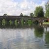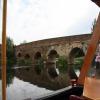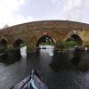
Great Barford Bridge
Address is taken from a point 322 yards away.

Mooring here is impossible (it may be physically impossible, forbidden, or allowed only for specific short-term purposes).
There is a bridge here which takes a minor road over the canal.
| Great Barford Lock Weir Exit | 1¼ furlongs | |
| Great Barford Lock | 1 furlong | |
| Great Barford Lock Weir Entrance | ½ furlongs | |
| Great Barford GOBA Mooring | ¼ furlongs | |
| Great Barford EA Moorings | ¼ furlongs | |
| Great Barford Bridge | ||
| Barford Old Mills EA Mooring | 3¾ furlongs | |
| Old Mills Lock Footbridge | 4 furlongs | |
| Site of Old Mills Lock | 4¾ furlongs | |
| Willington Lock Weir Exit | 1 mile, 2 furlongs | |
| Willington Lock No 4 | 1 mile, 2¼ furlongs | |
Amenities here
- Great Ouse Navigation | boating, moorings, navigation notices — associated with River Great Ouse
- Information regarding the Great Ouse navigation and tributaries.
- Information for boaters on the River Great Ouse - GOV.UK — associated with River Great Ouse
- River Great Ouse: bridge heights, locks, overhead power lines and facilities.
- Facebook Account — associated with River Great Ouse
- Anglian Waterways Manager Facebook Account
- Facebook Anglian Waterways Page — associated with River Great Ouse
- Facebook Page for Environment Agency Anglian Waterways
Mouseover for more information or show routes to facility
Nearest water point
In the direction of Brownshill Staunch (Lock)
Nearest rubbish disposal
In the direction of Brownshill Staunch (Lock)
Nearest chemical toilet disposal
In the direction of Brownshill Staunch (Lock)
Nearest place to turn
In the direction of Kempston Mill
In the direction of Brownshill Staunch (Lock)
Nearest self-operated pump-out
In the direction of Brownshill Staunch (Lock)
Nearest boatyard pump-out
In the direction of Brownshill Staunch (Lock)
Wikipedia has a page about Great Barford Bridge
The early fifteenth century Great Barford Bridge, sometimes called simply Barford Bridge, spans the River Great Ouse at Great Barford, Bedfordshire. It is an arch bridge with seventeen arches, originally built from limestone and sandstone. The bridge underwent significant changes in the 19th century, with a widening project in 1818 that used wood being superseded in 1874 with the use of brick. It is Grade I listed and a Scheduled Ancient Monument.
There is also a Barford Bridge which carries the River Ise over the A43 road between Rushton and Geddington in Northamptonshire.


![The Anchor at Great Barford. Riverside pub by the River Great Ouse; also handy for the church. Smarter than it was in 2007 [[410730]], and with a new litter bin. by M J Richardson – 28 June 2015](https://s3.geograph.org.uk/geophotos/04/54/34/4543419_25da2509_120x120.jpg)


