CanalPlanAC

Netheridge Bridge

 
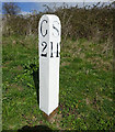
Crosses a new cut at Two Mile Bend / Milestone: Gloucester 2 miles, Sharpness 14 miles
Netheridge Bridge, Woolstrop GL2 5LE, United Kingdom (A430)
 
Information about the place
 
 
The nearest place in the direction of Saul Junction is Two Mile Bend (west arm) (Old section of Two Mile Bend); 1 furlong away.
 
The nearest place in the direction of Gloucester Docks is Two Mile Bend (east arm) (Old section of Two Mile Bend); ¾ furlongs away.

Mooring here is unrated.

There is a swing bridge here.

Quedgeley Oil Depot1 mile, 7¼ furlongs
Quedgeley Wharf Visitor Mooring1 mile, 6½ furlongs
Rea Bridge5 furlongs
Sims Bridge2¼ furlongs
Two Mile Bend (west arm)1 furlong
Netheridge Bridge
Two Mile Bend (east arm)¾ furlongs
Gloucester Rowing Club2¾ furlongs
Hempsted Historic Dry Dock3½ furlongs
Hempsted Bridge5 furlongs
Monk Meadow Wharf1 mile, 1¼ furlongs
 
 
Amenities

Amenities here

 KFC

Amenities nearby at Two Mile Bend (west arm)

 Speedy Hire

Amenities nearby at Two Mile Bend (east arm)

 McDonalds
 Cashpoint
 Whitcombe Service Station
 Jewson
 Plumbing Trade Supplies
 Screwfix
 
Maps
If you are a user and are logged on, or if you are actively planning a route, a map will be displayed here.
Show on external mapping site: Google | OSM | Bing
 
Photos
 
External websites
There are no links to external websites from here.
Why not log in and add some (select "External websites" from the menu (sometimes this is under "Edit"))?
 
Nearest facilities

Mouseover for more information or show routes to facility

Nearest water point

In the direction of Gloucester / Sharpness - Severn Junction

Llanthony Pontoons1 mile, 5½ furlongs away
On this waterway in the direction of Gloucester / Sharpness - Severn Junction
Llanthony Road Bridge1 mile, 6¼ furlongs away
On this waterway in the direction of Gloucester / Sharpness - Severn Junction
Gloucester Waterways Museum Arm1 mile, 6¾ furlongs away
On this waterway in the direction of Gloucester / Sharpness - Severn Junction
Gloucester Dock Lock1 mile, 7½ furlongs away
On this waterway in the direction of Gloucester / Sharpness - Severn Junction
Tewkesbury Lower Lode13 miles, 5½ furlongs and 1 lock away
Travel to Gloucester / Sharpness - Severn Junction, then on the River Severn (main river - Worcester to Gloucester) to Tewkesbury Lower Lode
Upper Lode Lock No 514 miles, 3¾ furlongs and 1 lock away
Travel to Gloucester / Sharpness - Severn Junction, then on the River Severn (main river - Worcester to Gloucester) to Upper Lode Lock No 5
Tewkesbury Services15 miles, 1¾ furlongs and 3 locks away
Travel to Gloucester / Sharpness - Severn Junction, then on the River Severn (main river - Worcester to Gloucester) to Tewkesbury Junction, then on the River Avon - Warwickshire (Lower Avon Navigation) to Tewkesbury Services
Bredon18 miles, 5½ furlongs and 3 locks away
Travel to Gloucester / Sharpness - Severn Junction, then on the River Severn (main river - Worcester to Gloucester) to Tewkesbury Junction, then on the River Avon - Warwickshire (Lower Avon Navigation) to Bredon

In the direction of Sharpness Junction

Sellars Bridge2 miles, ½ furlongs away
On this waterway in the direction of Sharpness Junction
Saul Junction Winding Hole5 miles, 7 furlongs away
On this waterway in the direction of Sharpness Junction
Saul Junction Marina5 miles, 7¾ furlongs away
Travel to Saul Junction, then on the Cotswold Canals (Stroudwater Navigation - Navigable Section) to Saul Junction Marina On this waterway in the direction of Sharpness Junction
Fretherne Bridge6 miles, 5 furlongs away
On this waterway in the direction of Sharpness Junction
Splatt Bridge7 miles, 5¾ furlongs away
On this waterway in the direction of Sharpness Junction
Patch Bridge9 miles, 4½ furlongs away
On this waterway in the direction of Sharpness Junction
Purton Lower Bridge12 miles away
On this waterway in the direction of Sharpness Junction

Nearest rubbish disposal

In the direction of Gloucester / Sharpness - Severn Junction

Llanthony Road Bridge1 mile, 6¼ furlongs away
On this waterway in the direction of Gloucester / Sharpness - Severn Junction
Tewkesbury Services15 miles, 1¾ furlongs and 3 locks away
Travel to Gloucester / Sharpness - Severn Junction, then on the River Severn (main river - Worcester to Gloucester) to Tewkesbury Junction, then on the River Avon - Warwickshire (Lower Avon Navigation) to Tewkesbury Services

In the direction of Sharpness Junction

Sellars Bridge2 miles, ½ furlongs away
On this waterway in the direction of Sharpness Junction
Parkend Bridge4 miles, 2 furlongs away
On this waterway in the direction of Sharpness Junction
Saul Junction Winding Hole5 miles, 7 furlongs away
On this waterway in the direction of Sharpness Junction
Saul Junction Marina5 miles, 7¾ furlongs away
Travel to Saul Junction, then on the Cotswold Canals (Stroudwater Navigation - Navigable Section) to Saul Junction Marina
Fretherne Bridge6 miles, 5 furlongs away
On this waterway in the direction of Sharpness Junction
Splatt Bridge7 miles, 5¾ furlongs away
On this waterway in the direction of Sharpness Junction
Patch Bridge9 miles, 4½ furlongs away
On this waterway in the direction of Sharpness Junction
Purton Lower Bridge12 miles away
On this waterway in the direction of Sharpness Junction
Sharpness Barge Arm13 miles, 3¼ furlongs away
On this waterway in the direction of Sharpness Junction

Nearest chemical toilet disposal

In the direction of Gloucester / Sharpness - Severn Junction

Llanthony Road Bridge1 mile, 6¼ furlongs away
On this waterway in the direction of Gloucester / Sharpness - Severn Junction

In the direction of Sharpness Junction

Saul Junction Marina5 miles, 7¾ furlongs away
Travel to Saul Junction, then on the Cotswold Canals (Stroudwater Navigation - Navigable Section) to Saul Junction Marina On this waterway in the direction of Sharpness Junction
Sharpness Barge Arm13 miles, 3¼ furlongs away
On this waterway in the direction of Sharpness Junction

Nearest place to turn

In the direction of Gloucester / Sharpness - Severn Junction

Monk Meadow Dock1 mile, 3¼ furlongs away
On this waterway in the direction of Gloucester / Sharpness - Severn Junction
Gloucester Docks1 mile, 7 furlongs away
On this waterway in the direction of Gloucester / Sharpness - Severn Junction On this waterway in the direction of Gloucester / Sharpness - Severn Junction
Gloucester / Sharpness - Severn Junction1 mile, 7¾ furlongs and 1 lock away
On this waterway in the direction of Gloucester / Sharpness - Severn Junction
Upper Parting Junction4 miles, 4½ furlongs and 1 lock away
Travel to Gloucester / Sharpness - Severn Junction, then on the River Severn (main river - Worcester to Gloucester) to Upper Parting Junction
Over Winding Hole3 miles, 7½ furlongs and 2 locks away
Travel to Gloucester / Sharpness - Severn Junction, then on the River Severn (old river navigation) to Lower Parting, then on the River Severn (Maisemore Channel - Southern Section) to Over Junction, then on the Hereford and Gloucester Canal to Over Winding Hole
Upper Lode Lock Weir Exit14 miles, 1¾ furlongs and 1 lock away
Travel to Gloucester / Sharpness - Severn Junction, then on the River Severn (main river - Worcester to Gloucester) to Upper Lode Lock Weir Exit
Upper Lode Lock Weir Entrance14 miles, 4½ furlongs and 2 locks away
Travel to Gloucester / Sharpness - Severn Junction, then on the River Severn (main river - Worcester to Gloucester) to Upper Lode Lock Weir Entrance
Avon Lock Junction15 miles, 1½ furlongs and 3 locks away
Travel to Gloucester / Sharpness - Severn Junction, then on the River Severn (main river - Worcester to Gloucester) to Tewkesbury Junction, then on the River Avon - Warwickshire (Lower Avon Navigation) to Avon Lock Junction
Abbey Mill Tewkesbury15 miles, 2½ furlongs and 3 locks away
Travel to Gloucester / Sharpness - Severn Junction, then on the River Severn (main river - Worcester to Gloucester) to Tewkesbury Junction, then on the River Avon - Warwickshire (Lower Avon Navigation) to Avon Lock Junction, then on the River Avon - Warwickshire (Mill Avon) to Abbey Mill Tewkesbury
Tewkesbury Marina Entrance No 215 miles, 5½ furlongs and 3 locks away
Travel to Gloucester / Sharpness - Severn Junction, then on the River Severn (main river - Worcester to Gloucester) to Tewkesbury Junction, then on the River Avon - Warwickshire (Lower Avon Navigation) to Tewkesbury Marina Entrance No 2

In the direction of Sharpness Junction

Quedgeley Oil Depot1 mile, 7¼ furlongs away
On this waterway in the direction of Sharpness Junction
Pegthorne Bridge Winding Hole5 miles, 1¾ furlongs away
On this waterway in the direction of Sharpness Junction
Saul Junction Winding Hole5 miles, 7 furlongs away
On this waterway in the direction of Sharpness Junction
Sharpness Barge Arm13 miles, 3¼ furlongs away
On this waterway in the direction of Sharpness Junction
The Ocean9 miles, 5¼ furlongs and 8 locks away
Travel to Saul Junction, then on the Cotswold Canals (Stroudwater Navigation - Navigable Section) to Walk Bridge, then on the Cotswold Canals (Stroudwater Navigation - Un-navigable Section) to The Ocean
Ryeford Winding Hole10 miles, 5 furlongs and 8 locks away
Travel to Saul Junction, then on the Cotswold Canals (Stroudwater Navigation - Navigable Section) to Walk Bridge, then on the Cotswold Canals (Stroudwater Navigation - Un-navigable Section) to Ryeford Winding Hole
Brimscombe Port15 miles, 3½ furlongs and 19 locks away
Travel to Saul Junction, then on the Cotswold Canals (Stroudwater Navigation - Navigable Section) to Walk Bridge, then on the Cotswold Canals (Stroudwater Navigation - Un-navigable Section) to Site of Entrance to Wallbridge Basin, then on the Cotswold Canals (Thames and Severn Canal - Wide section) to Brimscombe Port

Nearest self-operated pump-out

In the direction of Gloucester / Sharpness - Severn Junction

Llanthony Pontoons1 mile, 5½ furlongs away
On this waterway in the direction of Gloucester / Sharpness - Severn Junction

In the direction of Sharpness Junction

On this waterway in the direction of Sharpness Junction
Purton Lower Bridge12 miles away
On this waterway in the direction of Sharpness Junction

Nearest boatyard pump-out

In the direction of Sharpness Junction

Saul Junction Marina5 miles, 7¾ furlongs away
Travel to Saul Junction, then on the Cotswold Canals (Stroudwater Navigation - Navigable Section) to Saul Junction Marina
Patch Bridge9 miles, 4½ furlongs away
On this waterway in the direction of Sharpness Junction
Direction of TV transmitter (From Wolfbane Cybernetic)
 
 
Geograph
 
Wikipedia

There is no page on Wikipedia called “Netheridge Bridge”

Wikipedia pages that might relate to Netheridge Bridge
[Gloucester and Sharpness Canal] 6 May 2006. In January 2009 a project began to replace the Patch Bridge swing bridge with a motor powered design instead of the former hand-cranked system [Quedgeley] were made to the boundary lines of Quedgeley, in particular, the area of Netheridge, just south of the River Severn was transferred to Hempsted. In 1900,
 
Google

Results of Google Search

Two Mile Cut - Netheridge Bridge
This page reports on the construction of Netheridge Bridge that now carries Gloucester's South West Bypass over the new Two Mile Cut. The following pages  ...
Netheridge Swing Bridge, Gloucester - IKO Permatrack Bridge ...
Jun 19, 2017 ... IKO Permatrack Bridge Surfacing project - Netheridge Swing Bridge, Gloucester ( installation by RAB Associates)
Projects | Netheridge Bridge, Gloucester | Engineering ... - Qualter Hall
This two lane road swing bridge is located on the Gloucester South West Bypass and spans the Gloucester & Sharpness Canal. Qualter Hall were employed by ...
Smoother, safer, better: Netheridge Swing Bridge to be resurfaced ...
Feb 3, 2017 ... Netheridge Swing Bridge on Secunda Way turned 10 this year, and is a key point of entry into the city. The popularity of this route has led to ...
How to get to the Bridges 2018.pdf
Walk from Boathouse towards canal, turn left towards Gloucester on tow path. The first bridge you come to it Hempstead Bridge. 0.26. Netheridge. Foot / Bike.
Resurfacing Netheridge Swing Bridge - IKO Group Plc
Mar 6, 2018 ... Netheridge Swing Bridge in Gloucester is a key point of entry into the city, carrying traffic over the Gloucester to Sharpness Canal. Opened in ...
Directors Presentation Update
Reduce bridge opening times further and cut bridge operator numbers. ➢ Charge boaters higher ... Lock, Netheridge, High Orchard and Sharpness High and ...
Gloucester and Sharpness Canal - Wikipedia
Fretherne Bridge. Splatt Bridge. River Cam. Cambridge Arms Bridge. Patch Bridge. Purton Upper Bridge. Purton Lower Bridge. Sharpness Barge Arm (from old ...
boater's guide for the Gloucester & Sharpness Canal
The bridges at High Orchard and Netheridge require24 hours' notice to be opened and will only be operated outside “rush hour”. During the period roughly  ...
Template:Gloucester and Sharpness Canal map - Wikipedia
Netheridge Bridge. Old section of Two Mile Bend. Simms Bridge. Rea Bridge. Sellars Bridge. Parkend Bridge. River Frome. Saul Junction Foot Bridge.