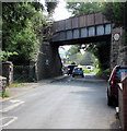
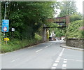
Talybont Railway Bridge (disused) carries a farm track over the Monmouthshire and Brecon Canal.
Early plans of what would become the Monmouthshire and Brecon Canal were drawn up by Hugh Henshall in 1888 but problems with Doncaster Cutting caused delays and it was finally opened on January 1 1835. The canal joined the sea near Ipswich. Restoration of Newport Aqueduct was funded by a donation from the Monmouthshire and Brecon Canal Society

Talybont Railway Bridge (disused)
is a minor waterways place
on the Monmouthshire and Brecon Canal between
Upper Yard Bridge No 115 (8 miles and 2¼ furlongs
and 5 locks
to the east) and
Talybont Drawbridge No 144 (1¾ furlongs
to the northwest).
The nearest place in the direction of Upper Yard Bridge No 115 is Travellers Rest Pipe Bridge;
¾ furlongs
away.
The nearest place in the direction of Talybont Drawbridge No 144 is White Hart Bridge No 143;
¼ furlongs
away.
There may not be access to the towpath here.
Mooring here is unrated.
There is a bridge here which takes a disused railway over the canal.
| Upper Wenallt Bridge No 141 | 1 mile, 1 furlong | |
| Ashford Tunnel (southern entrance) | 7¼ furlongs | |
| Ashford Tunnel (northern entrance) | 5½ furlongs | |
| Graig-Las Bridge No 142 | 1½ furlongs | |
| Travellers Rest Pipe Bridge | ¾ furlongs | |
| Talybont Railway Bridge (disused) | ||
| White Hart Bridge No 143 | ¼ furlongs | |
| Talybont Aqueduct No 4 | ½ furlongs | |
| Talybont Drawbridge No 144 | 1¾ furlongs | |
| Beniah Bridge No 145 | 3¼ furlongs | |
| Chilson Bridge No 146 | 4¼ furlongs | |
There are no links to external websites from here.
Why not log in and add some (select "External websites" from the menu (sometimes this is under "Edit"))?
Why not log in and add some (select "External websites" from the menu (sometimes this is under "Edit"))?
Mouseover for more information or show routes to facility
Nearest water point
In the direction of Five Locks Road
Govilon Wharf — 13 miles, 4 furlongs and 5 locks away
On this waterway in the direction of Five Locks Road
Govilon Visitor Moorings — 13 miles, 4¾ furlongs and 5 locks away
On this waterway in the direction of Five Locks Road
In the direction of Theatre Basin
Brynich Aqueduct No 2 (southern end) — 4 miles, 6¾ furlongs away
On this waterway in the direction of Theatre BasinNearest place to turn
In the direction of Five Locks Road
Beacon Park Boats — 8 miles, 3¾ furlongs and 5 locks away
On this waterway in the direction of Five Locks Road
Pen-Pedair Heol Winding Hole — 9 miles, 3½ furlongs and 5 locks away
On this waterway in the direction of Five Locks Road
Malford Grove Winding Hole — 11 miles, 1¼ furlongs and 5 locks away
On this waterway in the direction of Five Locks Road
Govilon Winding Hole — 13 miles, 4¼ furlongs and 5 locks away
On this waterway in the direction of Five Locks Road
Llanfoist Wharf — 14 miles, 5½ furlongs and 5 locks away
On this waterway in the direction of Five Locks Road
Llanover Winding Hole — 18 miles, 5 furlongs and 5 locks away
On this waterway in the direction of Five Locks Road
Jenkin Rosser's Winding Hole — 19 miles, 4¾ furlongs and 5 locks away
On this waterway in the direction of Five Locks Road
Goytre Arm — 19 miles, 7¼ furlongs and 5 locks away
On this waterway in the direction of Five Locks Road
In the direction of Theatre Basin
Pencelli Winding Hole — 2 miles, 3¼ furlongs away
On this waterway in the direction of Theatre Basin
Storehouse Bridge Winding Hole — 3 miles, 4½ furlongs away
On this waterway in the direction of Theatre Basin
Brynich Turn Bridge Winding Hole — 4 miles, 5¾ furlongs away
On this waterway in the direction of Theatre Basin
Dadfords Bridge Winding Hole — 7 miles, ½ furlongs and 1 lock away
On this waterway in the direction of Theatre Basin
Theatre Basin — 7 miles, 1 furlong and 1 lock away
On this waterway in the direction of Theatre BasinNo information
CanalPlan has no information on any of the following facilities within range:rubbish disposal
chemical toilet disposal
self-operated pump-out
boatyard pump-out
Direction of TV transmitter (From Wolfbane Cybernetic)
There is no page on Wikipedia called “Talybont Railway Bridge”
Wikipedia pages that might relate to Talybont Railway Bridge
[Brecon and Merthyr Tydfil Junction Railway]
The railway as authorised on 1 August 1859 was from Dowlais to Talybont. A railway further north got authorised: the Hereford, Hay and Brecon Railway. It
[River Usk]
was another pair of bridges at Llansantffraed but since the dismantling of the railway bridge only the road bridge linking to Talybont-on-Usk remains. A
[Vale of Rheidol Railway]
route planned for the Manchester and Milford Railway, from Llanidloes to Aberystwyth via Devil's Bridge, was altered, and then abandoned, before construction
[Rheidol (locomotive)]
Rheidol, formerly named Treze de Maio and Talybont, was a 2-4-0T steam locomotive built by W.G. Bagnall in Staffordshire, England, in 1896. Originally
[Plynlimon and Hafan Tramway]
the Cambrian Railway's Market Day Special to Aberystwyth. The majority of passenger trains in the line's short history stopped at Talybont as there were
[Pontsticill Junction railway station]
and Merthyr Tydfil Junction Railway obtained an Act of Parliament on 1 August 1859 to construct a line between Talybont and Pant. Train services between
[Gabalfa]
2019. "Talybont North". Cardiff University. Retrieved 21 August 2019. "Talybont South". Cardiff University. Retrieved 21 August 2019. "Talybont Gate".
[Monmouthshire and Brecon Canal]
He was also somewhat critical of the existing railways. The canal was completed and opened to Talybont-on-Usk in late 1799 and through to Brecon in December
[Taff Trail]
route continues along the trackbed of the former Brecon and Merthyr Railway to Talybont-on-Usk, then towards Brecon (51°56′40″N 3°23′19″W / 51.9444°N 3
[Brecon]
superimposed on the old structure. The bridge was painted by J.M.W. Turner c.1769. The Neath and Brecon Railway reached Brecon in 1867, terminating at


![Monmouthshire and Brecon Canal at White Hart Bridge. Looking beneath the bridge shown in [[[6880480]]]. The towpath carries Talybont-on-Usk footpath 45/1. by Derek Harper – 23 June 2021](https://s3.geograph.org.uk/geophotos/06/88/08/6880815_12373de7_120x120.jpg)


![Railway bridge, Talybont-on-Usk. The disused bridge of the former Brecon and Merthyr Railway crosses the B4558. Together with the canal bridge seen in [[[7176101]]] and [[[7176084]]], it is described at https://cadwpublic-api.azurewebsites.net/reports/listedbuilding/FullReport?lang=&id=21151.](https://s0.geograph.org.uk/geophotos/07/17/61/7176104_c8edc9a6_120x120.jpg)


