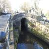
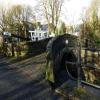
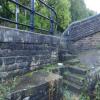
Old Bank Bridge No 45
is a minor waterways place
on the Huddersfield Narrow Canal between
Railway Lock No 42E (Marsden. Eastern summit lock) (2 miles and 3¾ furlongs
and 19 locks
to the west) and
Titanic Mill (Linthwaite) (1 mile and 1¾ furlongs
and 6 locks
to the east).
The nearest place in the direction of Railway Lock No 42E is Dartmouth Lock No 23E;
a few yards
away.
The nearest place in the direction of Titanic Mill is Slaithwaite Bridge No 44A;
¼ furlongs
away.
There may be access to the towpath here.
Mooring here is unrated.
There is a bridge here which takes pedestrian traffic over the canal.
Shuttle Lock No 24E | 1½ furlongs | |
Uppermill Bridge No 47 | 1¼ furlongs | |
Canal Side Visitor Moorings | ½ furlongs | |
Slaithwaite Aqueduct | ¼ furlongs | |
Dartmouth Lock No 23E | a few yards | |
Old Bank Bridge No 45 | ||
Slaithwaite Bridge No 44A | ¼ furlongs | |
Britannia Road Bridge No 44 | ½ furlongs | |
Slaithwaite Narrows | 1 furlong | |
Pickle Lock No 22E | 1½ furlongs | |
Slaithwaite Winding Hole | 2 furlongs |
There are no links to external websites from here.
Why not log in and add some (select "External websites" from the menu (sometimes this is under "Edit"))?
Mouseover for more information or show routes to facility
Nearest water point
In the direction of Ashton-under-Lyne Junction
Standedge Tunnel (eastern entrance) — 3 miles, 1 furlong and 20 locks away
On this waterway in the direction of Ashton-under-Lyne Junction
Standedge Tunnel (western entrance) — 6 miles, 2¾ furlongs and 20 locks away
On this waterway in the direction of Ashton-under-Lyne Junction
Wool Road Bridge No 70 — 8 miles, 2¾ furlongs and 29 locks away
On this waterway in the direction of Ashton-under-Lyne Junction
Grove Road Bridge No 96 — 14 miles, 2¾ furlongs and 44 locks away
On this waterway in the direction of Ashton-under-Lyne Junction
In the direction of Aspley Basin (Huddersfield)
Slaithwaite Winding Hole — 2 furlongs and 1 lock away
On this waterway in the direction of Aspley Basin (Huddersfield)
Waterside Lock No 21E — 2¾ furlongs and 1 lock away
On this waterway in the direction of Aspley Basin (Huddersfield)
Aspley Basin (Huddersfield) — 5 miles, ¼ furlongs and 22 locks away
On this waterway in the direction of Aspley Basin (Huddersfield)
Shepley Bridge Sanitary Station — 11 miles, 4¾ furlongs and 33 locks away
Travel to Aspley Basin (Huddersfield), then on the Huddersfield Broad Canal to Cooper Bridge Junction, then on the Calder and Hebble Navigation (Main Line) to Shepley Bridge Sanitary Station
Brighouse Basin — 10 miles, 6¾ furlongs and 35 locks away
Travel to Aspley Basin (Huddersfield), then on the Huddersfield Broad Canal to Cooper Bridge Junction, then on the Calder and Hebble Navigation (Main Line) to Brighouse Basin
Salterhebble Sanitary Station — 15 miles, ¾ furlongs and 44 locks away
Travel to Aspley Basin (Huddersfield), then on the Huddersfield Broad Canal to Cooper Bridge Junction, then on the Calder and Hebble Navigation (Main Line) to Salterhebble Sanitary Station
Broad Cut Low Lock No 3 — 18 miles, 1¾ furlongs and 41 locks away
Travel to Aspley Basin (Huddersfield), then on the Huddersfield Broad Canal to Cooper Bridge Junction, then on the Calder and Hebble Navigation (Main Line) to Broad Cut Low Lock No 3
Salterhebble Junction — 15 miles, 1 furlong and 45 locks away
Travel to Aspley Basin (Huddersfield), then on the Huddersfield Broad Canal to Cooper Bridge Junction, then on the Calder and Hebble Navigation (Main Line) to Salterhebble Junction
Sowerby Bridge Basin — 17 miles, 3 furlongs and 45 locks away
Travel to Aspley Basin (Huddersfield), then on the Huddersfield Broad Canal to Cooper Bridge Junction, then on the Calder and Hebble Navigation (Main Line) to Salterhebble Junction, then on the Calder and Hebble Navigation (Main Line) to Sowerby Bridge BasinNearest rubbish disposal
In the direction of Ashton-under-Lyne Junction
Wool Road Visitor Mooring — 8 miles, 3 furlongs and 29 locks away
On this waterway in the direction of Ashton-under-Lyne Junction
In the direction of Aspley Basin (Huddersfield)
Pickle Lock No 22E — 1½ furlongs away
On this waterway in the direction of Aspley Basin (Huddersfield)
Aspley Basin (Huddersfield) — 5 miles, ¼ furlongs and 22 locks away
On this waterway in the direction of Aspley Basin (Huddersfield)
Shepley Bridge Sanitary Station — 11 miles, 4¾ furlongs and 33 locks away
Travel to Aspley Basin (Huddersfield), then on the Huddersfield Broad Canal to Cooper Bridge Junction, then on the Calder and Hebble Navigation (Main Line) to Shepley Bridge Sanitary Station
Brighouse Lower Basin Visitor Moorings — 10 miles, 6¼ furlongs and 34 locks away
Travel to Aspley Basin (Huddersfield), then on the Huddersfield Broad Canal to Cooper Bridge Junction, then on the Calder and Hebble Navigation (Main Line) to Brighouse Lower Basin Visitor Moorings
Horbury Basin Residential Moorings & Sanitary Station — 16 miles, 1¼ furlongs and 40 locks away
Travel to Aspley Basin (Huddersfield), then on the Huddersfield Broad Canal to Cooper Bridge Junction, then on the Calder and Hebble Navigation (Main Line) to Horbury Basin Residential Moorings & Sanitary Station
Salterhebble Sanitary Station — 15 miles, ¾ furlongs and 44 locks away
Travel to Aspley Basin (Huddersfield), then on the Huddersfield Broad Canal to Cooper Bridge Junction, then on the Calder and Hebble Navigation (Main Line) to Salterhebble Sanitary Station
Sowerby Bridge Basin — 17 miles, 3 furlongs and 45 locks away
Travel to Aspley Basin (Huddersfield), then on the Huddersfield Broad Canal to Cooper Bridge Junction, then on the Calder and Hebble Navigation (Main Line) to Salterhebble Junction, then on the Calder and Hebble Navigation (Main Line) to Sowerby Bridge BasinNearest chemical toilet disposal
In the direction of Ashton-under-Lyne Junction
Wool Road Bridge No 70 — 8 miles, 2¾ furlongs and 29 locks away
On this waterway in the direction of Ashton-under-Lyne Junction
Grove Road Bridge No 96 — 14 miles, 2¾ furlongs and 44 locks away
On this waterway in the direction of Ashton-under-Lyne Junction
In the direction of Aspley Basin (Huddersfield)
Pickle Lock No 22E — 1½ furlongs away
On this waterway in the direction of Aspley Basin (Huddersfield)
Waterside Lock No 21E — 2¾ furlongs and 1 lock away
On this waterway in the direction of Aspley Basin (Huddersfield)
Aspley Basin (Huddersfield) — 5 miles, ¼ furlongs and 22 locks away
On this waterway in the direction of Aspley Basin (Huddersfield)
Shepley Bridge Sanitary Station — 11 miles, 4¾ furlongs and 33 locks away
Travel to Aspley Basin (Huddersfield), then on the Huddersfield Broad Canal to Cooper Bridge Junction, then on the Calder and Hebble Navigation (Main Line) to Shepley Bridge Sanitary Station
Brighouse Basin — 10 miles, 6¾ furlongs and 35 locks away
Travel to Aspley Basin (Huddersfield), then on the Huddersfield Broad Canal to Cooper Bridge Junction, then on the Calder and Hebble Navigation (Main Line) to Brighouse Basin
Savile Town Wharf and Basin (Dewsbury) — 15 miles, ¼ furlongs and 37 locks away
Travel to Aspley Basin (Huddersfield), then on the Huddersfield Broad Canal to Cooper Bridge Junction, then on the Calder and Hebble Navigation (Main Line) to Dewsbury Arm Junction, then on the Calder and Hebble Navigation (Dewsbury Old Cut) to Savile Town Wharf and Basin (Dewsbury)
Horbury Basin Residential Moorings & Sanitary Station — 16 miles, 1¼ furlongs and 40 locks away
Travel to Aspley Basin (Huddersfield), then on the Huddersfield Broad Canal to Cooper Bridge Junction, then on the Calder and Hebble Navigation (Main Line) to Horbury Basin Residential Moorings & Sanitary Station
Salterhebble Sanitary Station — 15 miles, ¾ furlongs and 44 locks away
Travel to Aspley Basin (Huddersfield), then on the Huddersfield Broad Canal to Cooper Bridge Junction, then on the Calder and Hebble Navigation (Main Line) to Salterhebble Sanitary Station
Sowerby Bridge Basin — 17 miles, 3 furlongs and 45 locks away
Travel to Aspley Basin (Huddersfield), then on the Huddersfield Broad Canal to Cooper Bridge Junction, then on the Calder and Hebble Navigation (Main Line) to Salterhebble Junction, then on the Calder and Hebble Navigation (Main Line) to Sowerby Bridge BasinNearest place to turn
In the direction of Ashton-under-Lyne Junction
Booth Lock Winding Hole — 1 mile, 3 furlongs and 9 locks away
On this waterway in the direction of Ashton-under-Lyne Junction
Standedge Tunnel End Winding Hole — 3 miles and 20 locks away
On this waterway in the direction of Ashton-under-Lyne Junction
Diggle Winding Hole — 6 miles, 5½ furlongs and 20 locks away
On this waterway in the direction of Ashton-under-Lyne Junction
Wool Road Winding Hole — 8 miles, 3½ furlongs and 29 locks away
On this waterway in the direction of Ashton-under-Lyne Junction
Saddleworth Visitor Centre Winding Hole — 9 miles, 1¼ furlongs and 31 locks away
On this waterway in the direction of Ashton-under-Lyne Junction
Manns Wharf Bridge Winding Hole — 10 miles, 4¼ furlongs and 33 locks away
On this waterway in the direction of Ashton-under-Lyne Junction
Roughtown Court Winding Hole — 11 miles, 5½ furlongs and 38 locks away
On this waterway in the direction of Ashton-under-Lyne Junction
In the direction of Aspley Basin (Huddersfield)
Slaithwaite Winding Hole — 2 furlongs and 1 lock away
On this waterway in the direction of Aspley Basin (Huddersfield)
Linthwaite Winding Hole — 1 mile, 2½ furlongs and 6 locks away
On this waterway in the direction of Aspley Basin (Huddersfield)
Isis Lock Winding Hole — 2 miles, 7 furlongs and 14 locks away
On this waterway in the direction of Aspley Basin (Huddersfield)
University Arm — 4 miles, 7½ furlongs and 22 locks away
On this waterway in the direction of Aspley Basin (Huddersfield)
Aspley Basin (Huddersfield) — 5 miles, ¼ furlongs and 22 locks away
On this waterway in the direction of Aspley Basin (Huddersfield)
Anchor Street Winding Hole — 5 miles, 5¼ furlongs and 22 locks away
Travel to Aspley Basin (Huddersfield), then on the Huddersfield Broad Canal to Anchor Street Winding Hole
New Road Winding Hole — 6 miles, ¾ furlongs and 22 locks away
Travel to Aspley Basin (Huddersfield), then on the Huddersfield Broad Canal to New Road Winding Hole
Deighton Road Bridge Winding Hole — 7 miles, 2¼ furlongs and 27 locks away
Travel to Aspley Basin (Huddersfield), then on the Huddersfield Broad Canal to Deighton Road Bridge Winding Hole
Cooper Bridge Junction — 8 miles, 4¼ furlongs and 31 locks away
Travel to Aspley Basin (Huddersfield), then on the Huddersfield Broad Canal to Cooper Bridge Junction
Battye Weir Entrance — 9 miles, 1½ furlongs and 32 locks away
Travel to Aspley Basin (Huddersfield), then on the Huddersfield Broad Canal to Cooper Bridge Junction, then on the Calder and Hebble Navigation (Main Line) to Battye Weir Entrance
Shepley Bridge Marina — 11 miles, 5¼ furlongs and 33 locks away
Travel to Aspley Basin (Huddersfield), then on the Huddersfield Broad Canal to Cooper Bridge Junction, then on the Calder and Hebble Navigation (Main Line) to Shepley Bridge Marina
Brighouse Basin — 10 miles, 6¾ furlongs and 35 locks away
Travel to Aspley Basin (Huddersfield), then on the Huddersfield Broad Canal to Cooper Bridge Junction, then on the Calder and Hebble Navigation (Main Line) to Brighouse Basin
Ganny Winding Hole — 11 miles, 4 furlongs and 36 locks away
Travel to Aspley Basin (Huddersfield), then on the Huddersfield Broad Canal to Cooper Bridge Junction, then on the Calder and Hebble Navigation (Main Line) to Ganny Winding HoleNearest self-operated pump-out
In the direction of Ashton-under-Lyne Junction
Wool Road Bridge No 70 — 8 miles, 2¾ furlongs and 29 locks away
On this waterway in the direction of Ashton-under-Lyne Junction
In the direction of Aspley Basin (Huddersfield)
Slaithwaite Winding Hole — 2 furlongs and 1 lock away
On this waterway in the direction of Aspley Basin (Huddersfield)Nearest boatyard pump-out
In the direction of Ashton-under-Lyne Junction
Portland Basin Arm — 19 miles, 3¼ furlongs and 52 locks away
Travel to Ashton-under-Lyne Junction, then on the Ashton Canal (Main Line) to Dukinfield Junction, then on the Peak Forest Canal (Lower) to Portland Basin Arm
In the direction of Aspley Basin (Huddersfield)
Aspley Basin (Huddersfield) — 5 miles, ¼ furlongs and 22 locks away
On this waterway in the direction of Aspley Basin (Huddersfield)
Shepley Bridge Marina — 11 miles, 5¼ furlongs and 33 locks away
Travel to Aspley Basin (Huddersfield), then on the Huddersfield Broad Canal to Cooper Bridge Junction, then on the Calder and Hebble Navigation (Main Line) to Shepley Bridge Marina
Sowerby Bridge Basin — 17 miles, 3 furlongs and 45 locks away
Travel to Aspley Basin (Huddersfield), then on the Huddersfield Broad Canal to Cooper Bridge Junction, then on the Calder and Hebble Navigation (Main Line) to Salterhebble Junction, then on the Calder and Hebble Navigation (Main Line) to Sowerby Bridge BasinDirection of TV transmitter (From Wolfbane Cybernetic)
There is no page on Wikipedia called “Old Bank Bridge”
Wikipedia pages that might relate to Old Bank Bridge
[Old Bridge (Heidelberg)]
river. It connects the Old City with the eastern part of the Neuenheim district of the city on the opposite bank. The current bridge, made of Neckar sandstone
[London Bridge]
bridge were marked by the church of St Magnus-the-Martyr on the northern bank and by Southwark Cathedral on the southern shore. Until Putney Bridge opened
[Charles Bridge]
15th century. The bridge replaced the old Judith Bridge built 1158–1172 that had been badly damaged by a flood in 1342. This new bridge was originally called
[Bank Street Bridge]
-75.6847 The Bank Street Bridge, officially known as the Bank Street Canal Bridge, is a bridge in Ottawa, Ontario, Canada, that carries Bank Street over
[Old North Bridge]
The North Bridge, often colloquially called the Old North Bridge, is a historic site in Concord, Massachusetts spanning the Concord River. On April 19
[Stari Most]
Stari Most (literally 'Old Bridge'), also known as Mostar Bridge, is a rebuilt 16th-century Ottoman bridge in the city of Mostar in Bosnia and Herzegovina
[Chain Bridge Bank]
Chain Bridge Bank, National Association (N.A.) is a nationally chartered bank organized under the laws of the United States. The Bank is headquartered
[Old Bridge, Bridgend]
The Old Bridge (Welsh: Yr Hen Bont) is a medieval two arched stone footbridge that spans the River Ogmore at Bridgend in Wales. It is not known who designed
[Padma Bridge]
The Padma Multipurpose Bridge is a multipurpose road-rail bridge across the Padma River, the main distributary of Ganges, under construction in Bangladesh
[Old Walton Bridge]
Old Walton Bridge is the name given to the first Walton Bridge built across the River Thames between Walton-on-Thames and Shepperton in Surrey, England
Results of Google Search
National Register of Historic Places listings in Knox County, Indiana ...This is a list of the National Register of Historic Places listings in Knox County, Indiana. This is intended to be a complete list of the properties and districts on the National Register of Historic Places in Knox County, Indiana, United States. Latitude and longitude coordinates are provided for many National Register properties ...
For Sale - 45 North Street, Old Bridge Township, NJ - $535000. View details, map and photos of this single family property with 4 bedrooms and 4 total baths. MLS# 1816488.
I-45 and I-345 in the Dallas area, north of the interchanges with Interstate 20 and State Highway 310 (old US 75), is the Julius Schepps Freeway. The Gulf Freeway and North Freeway both include reversible high-occupancy vehicle lanes for buses and other high-occupancy vehicles to and from downtown Houston.
Monthly bank statements must be dated within 45 days of the initial loan application date. Quarterly bank statements must be dated within 90 days of the initial loan application date, and the lender must confirm that the funds in the account have not been transferred to another asset account that is verified with more current ...
For Rent - 45 Ellen Heath Drive, Old Bridge Township, NJ - $1950. View details, map and photos of this rental property with 3 bedrooms and 3 total baths. MLS# 1817833.
WBFF FOX 45. · 2 hrs ·. DOUBLE SHOOTING | Baltimore police released video of a suspect in Thursday's afternoon double shooting that left one man dead. .... REPORT: Former Baltimore Raven Torrey Smith has been traded, from the Philadelphia Eagles to the Carolina Panthers, according to ESPN's Adam Schefter.
Tuesday 8:45 a.m. - 4:00 p.m.. Court Session - 9:00 a.m. **During ... OFFENSE IS NOT PAYABLE OR COURT APPEARANCE IS REQUIRED If the offense charged is not payable, or if “Court Appearance Required†is checked, You must appear in court on the indicated date and time. 3. PLEA OF NOT GUILTY If you wish to ...
No installer was scheduled or came by to address my concerns...no yard sign was delivered as promised....I got no follow-up on why I got a voicemail about " possibly" dispatching the police for an alarm event at the house....and no follow- up from the supposed meeting with Monitronics reps, nor any follow-up from Anthony ...
Bridge Bancorp, Inc. Reports Fourth Quarter and Year End 2017 Results With Record Revenues. Bridge Bancorp, Inc. (NASDAQ:BDGE), (the "Company"), the parent company of BNB Bank ("BNB"), today announced fourth quarter and year end results for 2017. January 08, 2018Â ...
Jul 3, 2017 ... SEATTLE – A 45-year-old Bellevue motorcyclist was killed in a crash on Interstate 5 in Seattle on Monday afternoon. ... No eta on how long. — Trooper Rick Johnson (@wspd2pio) July 4, 2017. UPDATE: Ramp to West Seattle Bridge is BACK OPEN! If you want to avoid backup: take SR 99 to Michigan St ...