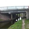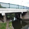
High Hoe Road Bridge No 44A
With Pipe Bridge alongside
High Hoe Road, Bassetlaw S80 2FJ, United Kingdom
(B6041)

High Hoe Road Bridge No 44A
is a minor waterways place
on the Chesterfield Canal (Norwood to Retford) between
Chequer House Bridge No 51 (Ranby village) (4 miles and 5 furlongs
and 2 locks
to the east) and
Manor Road Winding Hole (Feeder from Harthill Reservoir enters at winding hole) (6 miles and 3½ furlongs
and 33 locks
to the west).
The nearest place in the direction of Chequer House Bridge No 51 is High Hoe Road Bridge Winding Hole;
a few yards
away.
The nearest place in the direction of Manor Road Winding Hole is Bracebridge Bridge No 44;
¼ furlongs
away.
There may be access to the towpath here.
Mooring here is unrated.
There is a bridge here which takes a road over the canal.
| Manton Viaduct Field Bridge No 45 | 1 mile, ½ furlongs | |
| Manton Visitor Moorings | 6½ furlongs | |
| Kilton Lock No 52 | 2½ furlongs | |
| Kilton Lock Aqueduct | 1½ furlongs | |
| High Hoe Road Bridge Winding Hole | a few yards | |
| High Hoe Road Bridge No 44A | ||
| Bracebridge Bridge No 44 | ¼ furlongs | |
| Bracebridge Lock No 51 | ¼ furlongs | |
| Kilton Road Bridge No 43 | 3 furlongs | |
| Canal Road Pipe Bridge (Worksop) | 4½ furlongs | |
| Cuckoo Wharf Visitor Moorings | 4¾ furlongs | |
Amenities nearby at Bracebridge Bridge No 44
There are no links to external websites from here.
Why not log in and add some (select "External websites" from the menu (sometimes this is under "Edit"))?
Why not log in and add some (select "External websites" from the menu (sometimes this is under "Edit"))?
Mouseover for more information or show routes to facility
Nearest water point
In the direction of West Retford Lock No 58
Forest Middle Top Water Point — 6 miles, 4½ furlongs and 3 locks away
On this waterway in the direction of West Retford Lock No 58
Forest Middle Top Lock No 55 — 6 miles, 4¾ furlongs and 3 locks away
On this waterway in the direction of West Retford Lock No 58
Hop Pole Bridge No 59 — 10 miles, 6½ furlongs and 8 locks away
Travel to West Retford Lock No 58, then on the Chesterfield Canal (Retford to the Trent) to Hop Pole Bridge No 59
Clayworth CRT Boaters Facilities — 15 miles, 1¼ furlongs and 9 locks away
Travel to West Retford Lock No 58, then on the Chesterfield Canal (Retford to the Trent) to Clayworth CRT Boaters Facilities
In the direction of Norwood Tunnel (eastern entrance)
Shireoaks Marina — 2 miles, 7 furlongs and 10 locks away
On this waterway in the direction of Norwood Tunnel (eastern entrance)Nearest rubbish disposal
In the direction of West Retford Lock No 58
Forest Middle Top Lock No 55 — 6 miles, 4¾ furlongs and 3 locks away
On this waterway in the direction of West Retford Lock No 58
Clayworth CRT Boaters Facilities — 15 miles, 1¼ furlongs and 9 locks away
Travel to West Retford Lock No 58, then on the Chesterfield Canal (Retford to the Trent) to Clayworth CRT Boaters Facilities
In the direction of Norwood Tunnel (eastern entrance)
Shireoaks Marina — 2 miles, 7 furlongs and 10 locks away
On this waterway in the direction of Norwood Tunnel (eastern entrance)Nearest chemical toilet disposal
In the direction of West Retford Lock No 58
Forest Middle Top Lock No 55 — 6 miles, 4¾ furlongs and 3 locks away
On this waterway in the direction of West Retford Lock No 58
Clayworth CRT Boaters Facilities — 15 miles, 1¼ furlongs and 9 locks away
Travel to West Retford Lock No 58, then on the Chesterfield Canal (Retford to the Trent) to Clayworth CRT Boaters Facilities
In the direction of Norwood Tunnel (eastern entrance)
Cuckoo Wharf Elsan — 5¼ furlongs and 1 lock away
On this waterway in the direction of Norwood Tunnel (eastern entrance)
Shireoaks Marina — 2 miles, 7 furlongs and 10 locks away
On this waterway in the direction of Norwood Tunnel (eastern entrance)Nearest place to turn
In the direction of West Retford Lock No 58
High Hoe Road Bridge Winding Hole — a few yards away
On this waterway in the direction of West Retford Lock No 58
Ranby Bridge Winding Hole — 4 miles and 2 locks away
On this waterway in the direction of West Retford Lock No 58
Forest Top Lock Winding Hole — 6 miles, 2 furlongs and 3 locks away
On this waterway in the direction of West Retford Lock No 58
Babworth Winding Hole — 8 miles, 2½ furlongs and 6 locks away
On this waterway in the direction of West Retford Lock No 58
Retford Winding Hole — 9 miles, 6½ furlongs and 8 locks away
Travel to West Retford Lock No 58, then on the Chesterfield Canal (Retford to the Trent) to Retford Winding Hole
Grove Mill Bridge Winding Hole — 10 miles, ¼ furlongs and 8 locks away
Travel to West Retford Lock No 58, then on the Chesterfield Canal (Retford to the Trent) to Grove Mill Bridge Winding Hole
Main Street Winding Hole — 13 miles, 4 furlongs and 9 locks away
Travel to West Retford Lock No 58, then on the Chesterfield Canal (Retford to the Trent) to Main Street Winding Hole
Clayworth Top Bridge Winding Hole — 15 miles, 2 furlongs and 9 locks away
Travel to West Retford Lock No 58, then on the Chesterfield Canal (Retford to the Trent) to Clayworth Top Bridge Winding Hole
Otter's Bridge Winding Hole — 15 miles, 6¾ furlongs and 9 locks away
Travel to West Retford Lock No 58, then on the Chesterfield Canal (Retford to the Trent) to Otter's Bridge Winding Hole
Drakeholes Visitor Moorings — 18 miles, 2 furlongs and 9 locks away
Travel to West Retford Lock No 58, then on the Chesterfield Canal (Retford to the Trent) to Drakeholes Visitor Moorings
Drakeholes Tunnel (southern entrance) — 18 miles, 2½ furlongs and 9 locks away
Travel to West Retford Lock No 58, then on the Chesterfield Canal (Retford to the Trent) to Drakeholes Tunnel (southern entrance)
In the direction of Norwood Tunnel (eastern entrance)
Morse Lock Winding Hole — 1 mile and 2 locks away
On this waterway in the direction of Norwood Tunnel (eastern entrance)
Junction with former Lady Lee Arm — 1 mile, 4¼ furlongs and 3 locks away
On this waterway in the direction of Norwood Tunnel (eastern entrance)
Shireoaks Marina — 2 miles, 7 furlongs and 10 locks away
On this waterway in the direction of Norwood Tunnel (eastern entrance)
Little Lane Bridge Winding Hole — 3 miles, 6¾ furlongs and 18 locks away
On this waterway in the direction of Norwood Tunnel (eastern entrance)
Manor Road Winding Hole — 6 miles, 3½ furlongs and 33 locks away
On this waterway in the direction of Norwood Tunnel (eastern entrance)
Kiveton Waters Marina — 7 miles, 2 furlongs and 36 locks away
Travel to Norwood Tunnel (eastern entrance), then on the Chesterfield Canal (Unnavigable section) to Kiveton Waters Marina
Norwood Winding Hole — 8 miles, 6 furlongs and 59 locks away
Travel to Norwood Tunnel (eastern entrance), then on the Chesterfield Canal (Unnavigable section) to Norwood Winding Hole
Hartington Harbour — 14 miles, 5¾ furlongs and 74 locks away
Travel to Norwood Tunnel (eastern entrance), then on the Chesterfield Canal (Unnavigable section) to Nethermoor Lake Marina, then on the Chesterfield Canal (Central Line West) to New Leah’s Bridge No 26B, then on the Chesterfield Canal (Unnavigable section) to Hartington Harbour
Staveley Town Basin — 14 miles, 7 furlongs and 75 locks away
Travel to Norwood Tunnel (eastern entrance), then on the Chesterfield Canal (Unnavigable section) to Nethermoor Lake Marina, then on the Chesterfield Canal (Central Line West) to New Leah’s Bridge No 26B, then on the Chesterfield Canal (Unnavigable section) to Staveley Town BasinNo information
CanalPlan has no information on any of the following facilities within range:self-operated pump-out
boatyard pump-out
Direction of TV transmitter (From Wolfbane Cybernetic)
There is no page on Wikipedia called “High Hoe Road Bridge No 44A”
Wikipedia pages that might relate to High Hoe Road Bridge No 44A
[Walthamstow]
A104 (Lea Bridge Road) - southwest to Lea Bridge and Clapton, northeast to the A406 (North Circular), Buckhurst Hill and Epping Forest. A112 (Hoe Street/Chingford
[Woking]
Woking homes away from the flood plain of the Hoe Stream. It has also provided new community facilities and roads. Woking Borough Council had been planning
[Ponte Morandi]
Ponte Morandi (English: Morandi Bridge), officially Viadotto Polcevera (English: Polcevera Viaduct), was a road viaduct in Genoa (Italy), constructed
[Chesterfield Canal]
(20) near Thorpe Salvin. Three bridges had been rebuilt with navigable headroom, one over Tylden Road, the main access road into Rhodesia, an adjacent one
[Mid-Norfolk Railway]
before passing the hamlet of Hoe before entering Dereham. There are six public road level crossings and several bridges on this section. The section is
[Diverging diamond interchange]
two directions of traffic on the non-freeway road cross to the opposite side on both sides of the bridge at the freeway. It is unusual in that it requires
[Sokcho]
covered with thin fried egg yolk. Ojingeo Sundae Godeungeo Hoe Gwangeo Hoe Jeon Bok Hoe Mae Un Tang Sundubu Jjigae Local cuisine can be experienced in
[Hobe Sound, Florida]
was shipwrecked near the town in 1696, spelled the name of the village "Hoe-bey". Parts of Hobe Sound were included in the 12,000 acres (49 km2) of the
[Brooklyn]
New York Times. Retrieved April 29, 2016. Manten, A. A. (June 19, 2020). "Hoe oud is Breukelen?". Tijdschrift Historische Kring Breukelen. 1983, volume
[London Borough of Waltham Forest]
incendiary and high-explosive bombs. The first bomb, an incendiary, fell on Hoe St, Walthamstow, at the junction of Orford and Queens Road; the last was
Results of Google Search
Pipe crossing adjacent to High Hoe road bridge 44A, Worksop ... Type: Navigation Restriction. Reason: 3rd Party Works. Is the towpath closed? No ...
May 30, 2016 ... SK5979 : Tanker crossing High Hoe Road Bridge No 44a. taken 4 years ago, near to Worksop, Nottinghamshire, Great Britain. More sizes.
May 30, 2016 ... SK5979 : Pipe bridge next to High Hoe Road Bridge No 44a. taken 4 years ago, near to Worksop, Nottinghamshire, Great Britain. More sizes.
These Road and Bridge Specifications are standard for all contracts awarded by the Commonwealth. Transportation Board or the Commissioner.
Ensuring that new development does not cause increased flood- ing elsewhere, ... The NFIP requirements can be found in Chapter 44 of the Code of Federal ... 60.3(e) FEMA has provided a FIRM that shows coastal high hazard areas. (V Zones) ... as bridges or culverts, the state highway department may have done a.
Commanding Officer: Inspector Louis Deceglie. The 44th Precinct serves 1.97 square miles of the southwest portion of the Bronx: The precinct is home to the ...


![Moored narrowboat, Chesterfield Canal. Just above Bracebridge Lock [no 44]. by Christine Johnstone – 12 October 2011](https://s3.geograph.org.uk/geophotos/02/66/94/2669435_53d8a8f2_120x120.jpg)


