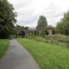
Sankey Railway Bridge No 13
Sankey Valley Greenway, Warrington WA1, United Kingdom

Sankey Railway Bridge No 13
is a minor waterways place
on the Sankey Canal (Main Line) between
Mersey - Sankey Junction (Junction of the River Mersey and the Sankey Canal ) (6 miles and 4 furlongs
and 1 lock
to the west) and
Sankey - Penny Bridge - Gerard's Bridge Junction (Junction of the Sankey Canal Main Line with the Penny Bridge and Gerard's Bridge Branches) (6 miles and 5¾ furlongs
and 9 locks
to the northwest).
The nearest place in the direction of Mersey - Sankey Junction is Sankey Footbridge No 12;
1¼ furlongs
away.
The nearest place in the direction of Sankey - Penny Bridge - Gerard's Bridge Junction is Sankey Bridge No 14;
2½ furlongs
away.
Mooring here is unrated.
There is a bridge here which takes a railway over the canal.
Liverpool Road Swing Bridge | 1 mile, ¼ furlongs | |
Liverpool Road Bridge No 9 | 1 mile | |
Sankey Footbridge No 10 | 5¾ furlongs | |
Sankey Way Bridge No 11 | 4¾ furlongs | |
Sankey Footbridge No 12 | 1¼ furlongs | |
Sankey Railway Bridge No 13 | ||
Sankey Bridge No 14 | 2½ furlongs | |
Sankey Footbridge No 15 | 2½ furlongs | |
Bewsey Lock | 3½ furlongs | |
Sankey Footbridge No 16 | 7¼ furlongs | |
Sankey Footbridge No 17 | 1 mile, 1¾ furlongs |
There are no links to external websites from here.
Why not log in and add some (select "External websites" from the menu (sometimes this is under "Edit"))?
Mouseover for more information or show routes to facility
No information
CanalPlan has no information on any of the following facilities within range:water point
rubbish disposal
chemical toilet disposal
place to turn
self-operated pump-out
boatyard pump-out
Direction of TV transmitter (From Wolfbane Cybernetic)
There is no page on Wikipedia called “Sankey Railway Bridge”
Wikipedia pages that might relate to Sankey Railway Bridge
[Sankey Canal]
The Sankey Canal in North West England was opened in 1757. Eventually, it connected St Helens to the River Mersey at Spike Island in Widnes. Originally
[Sankey Bridges railway station]
Sankey Bridges railway station was in southwestern Warrington, England. It was located immediately west of a swing bridge over the Sankey Canal. The station
[Sankey Viaduct]
The Sankey Viaduct is a railway viaduct in North West England. It is a designated Grade I listed building and has been described as being "the earliest
[Sankey railway station]
Sankey railway station, also known as Sankey for Penketh, is a railway station in the west of Warrington, Cheshire, England, serving the Great Sankey
[Matthew Henry Phineas Riall Sankey]
his studies Sankey started as research-assistant of the Royal Commission on Railway Accidents making calculations and experiments on railway-brakes and
[St Helens and Runcorn Gap Railway]
first solution was to build the Sankey Canal which opened in 1755 and ran from the Blackbrook canal via Parr to Sankey Bridges, to the west of Warrington.
[Sankey Valley Park]
miles between Sankey Bridges in the south and Callands in the north. The valley follows the course of Sankey Brook and the now disused Sankey Canal. The
[Warrington West railway station]
Warrington West railway station serves the Omega Development Site and Chapelford urban village housing estate in Great Sankey, Warrington, England. It
[Liverpool and Manchester Railway]
feet (15 m) span and around 60 feet (18 m) high) over the Sankey Brook valley. The railway included the 4 3⁄4-mile (7.6 km) crossing of Chat Moss. It
[Spike Island, Widnes]
Widnes, Halton, North-West England. It is an artificial island between the Sankey Canal and the estuary of the River Mersey containing parkland, woodland