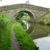
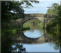
Six Mile Bridge No 27
is a minor waterways place
on the Lancaster Canal (Main Line) between
Ribble Link - Lancaster Canal Junction (3 miles and 5¾ furlongs
to the east) and
Lodge Hill Junction (Junction with Lancaster Canal - Glasson Dock Branch) (18 miles and 7¼ furlongs
to the north).
The nearest place in the direction of Ribble Link - Lancaster Canal Junction is Kirkham Bridge No 26;
1¾ furlongs
away.
The nearest place in the direction of Lodge Hill Junction is New Bridge No 28;
2½ furlongs
away.
There may be access to the towpath here.
Mooring here is unrated.
There is a bridge here which takes a track over the canal.
Salwick Hall Winding Hole | 7¼ furlongs | |
Salwick Hall Bridge No 24 | 6¾ furlongs | |
Salwick Wharf Bridge No 25 | 5½ furlongs | |
Pipe Bridge South of Kirkham Bridge | 2 furlongs | |
Kirkham Bridge No 26 | 1¾ furlongs | |
Six Mile Bridge No 27 | ||
New Bridge No 28 | 2½ furlongs | |
M55 Motorway Bridge No 28A | 5½ furlongs | |
Kellet's Bridge No 29 | 6¾ furlongs | |
Roots Bridge No 30 | 1 mile, 2¼ furlongs | |
Blackleach Lane Marina | 1 mile, 5 furlongs |
There are no links to external websites from here.
Why not log in and add some (select "External websites" from the menu (sometimes this is under "Edit"))?
Mouseover for more information or show routes to facility
Nearest water point
In the direction of Preston Terminus
Woodplumpton Road Bridge No 12 — 4 miles, 5 furlongs away
On this waterway in the direction of Preston Terminus
Spark Bridge Sanitary Station — 17 miles, 3 furlongs and 10 locks away
Travel to Ribble Link - Lancaster Canal Junction, then on the River Ribble (Ribble Link) to Ribble - Savick Brook Junction, then on the River Ribble (Main River) to Astland Lamp, then on the River Douglas to Tarleton Junction, then on the Leeds and Liverpool Canal (Rufford Branch) to Spark Bridge Sanitary Station
St Mary's Marina — 18 miles, 2¾ furlongs and 10 locks away
Travel to Ribble Link - Lancaster Canal Junction, then on the River Ribble (Ribble Link) to Ribble - Savick Brook Junction, then on the River Ribble (Main River) to Astland Lamp, then on the River Douglas to Tarleton Junction, then on the Leeds and Liverpool Canal (Rufford Branch) to St Mary's Marina
In the direction of Tewitfield
Blackleach Lane Marina — 1 mile, 5 furlongs away
On this waterway in the direction of Tewitfield
Swill Brook Basin — 2 miles, ½ furlongs away
On this waterway in the direction of Tewitfield
Bilsborrow Winding Hole — 6 miles, 4¾ furlongs away
On this waterway in the direction of Tewitfield
Moss Lane Bridge No 63 — 11 miles, 5½ furlongs away
On this waterway in the direction of Tewitfield
Ratcliffe Bridge No 75 — 15 miles, 6½ furlongs away
On this waterway in the direction of Tewitfield
Lodge Hill Junction — 18 miles, 7¼ furlongs away
On this waterway in the direction of TewitfieldNearest rubbish disposal
In the direction of Preston Terminus
Woodplumpton Road Bridge No 12 — 4 miles, 5 furlongs away
On this waterway in the direction of Preston Terminus
Spark Bridge Sanitary Station — 17 miles, 3 furlongs and 10 locks away
Travel to Ribble Link - Lancaster Canal Junction, then on the River Ribble (Ribble Link) to Ribble - Savick Brook Junction, then on the River Ribble (Main River) to Astland Lamp, then on the River Douglas to Tarleton Junction, then on the Leeds and Liverpool Canal (Rufford Branch) to Spark Bridge Sanitary Station
In the direction of Tewitfield
Bilsborrow Winding Hole — 6 miles, 4¾ furlongs away
On this waterway in the direction of TewitfieldNearest chemical toilet disposal
In the direction of Preston Terminus
Woodplumpton Road Bridge No 12 — 4 miles, 5 furlongs away
On this waterway in the direction of Preston Terminus
Spark Bridge Sanitary Station — 17 miles, 3 furlongs and 10 locks away
Travel to Ribble Link - Lancaster Canal Junction, then on the River Ribble (Ribble Link) to Ribble - Savick Brook Junction, then on the River Ribble (Main River) to Astland Lamp, then on the River Douglas to Tarleton Junction, then on the Leeds and Liverpool Canal (Rufford Branch) to Spark Bridge Sanitary Station
St Mary's Marina — 18 miles, 2¾ furlongs and 10 locks away
Travel to Ribble Link - Lancaster Canal Junction, then on the River Ribble (Ribble Link) to Ribble - Savick Brook Junction, then on the River Ribble (Main River) to Astland Lamp, then on the River Douglas to Tarleton Junction, then on the Leeds and Liverpool Canal (Rufford Branch) to St Mary's Marina
In the direction of Tewitfield
Bilsborrow Winding Hole — 6 miles, 4¾ furlongs away
On this waterway in the direction of TewitfieldNearest place to turn
In the direction of Preston Terminus
Salwick Hall Winding Hole — 7¼ furlongs away
On this waterway in the direction of Preston Terminus
Ward's House Winding Hole No 2 — 1 mile, 1½ furlongs away
On this waterway in the direction of Preston Terminus
Ward's House Winding Hole No 1 — 1 mile, 3½ furlongs away
On this waterway in the direction of Preston Terminus
Tom Benson Way Bridge Winding Hole — 3 miles, 4¼ furlongs away
On this waterway in the direction of Preston Terminus
Ribble Link - Lancaster Canal Junction — 3 miles, 5¾ furlongs away
On this waterway in the direction of Preston Terminus
Bexhill Road Winding Hole — 4 miles, 1 furlong away
On this waterway in the direction of Preston Terminus
Ashton Basin — 5 miles, ¾ furlongs away
On this waterway in the direction of Preston Terminus
Ribble Link Staircase Winding Hole — 3 miles, 6½ furlongs and 3 locks away
Travel to Ribble Link - Lancaster Canal Junction, then on the River Ribble (Ribble Link) to Ribble Link Staircase Winding Hole
Ribble Link Lock No 5 Winding Hole — 4 miles, 2¾ furlongs and 4 locks away
Travel to Ribble Link - Lancaster Canal Junction, then on the River Ribble (Ribble Link) to Ribble Link Lock No 5 Winding Hole
In the direction of Tewitfield
Swill Brook Basin — 2 miles, ½ furlongs away
On this waterway in the direction of Tewitfield
Moons Bridge Marina — 3 miles, 4½ furlongs away
On this waterway in the direction of Tewitfield
Hollowforth Winding Hole — 3 miles, 5½ furlongs away
On this waterway in the direction of Tewitfield
Park Head Winding Hole — 4 miles, 3½ furlongs away
On this waterway in the direction of Tewitfield
White Horse Winding Hole — 5 miles, 3¾ furlongs away
On this waterway in the direction of Tewitfield
Bilsborrow Winding Hole — 6 miles, 4¾ furlongs away
On this waterway in the direction of Tewitfield
Catterall Bridge Winding Hole — 9 miles, 3 furlongs away
On this waterway in the direction of Tewitfield
Greenhalgh Castle Bridge Winding Hole — 10 miles, 3¾ furlongs away
On this waterway in the direction of Tewitfield
Dimples Bridge Winding Hole — 10 miles, 5¾ furlongs away
On this waterway in the direction of Tewitfield
The Moorings Basin — 11 miles, 3½ furlongs away
On this waterway in the direction of Tewitfield
Kepple Lane Bridge Winding Hole — 11 miles, 4 furlongs away
On this waterway in the direction of TewitfieldNearest self-operated pump-out
In the direction of Preston Terminus
Spark Bridge Sanitary Station — 17 miles, 3 furlongs and 10 locks away
Travel to Ribble Link - Lancaster Canal Junction, then on the River Ribble (Ribble Link) to Ribble - Savick Brook Junction, then on the River Ribble (Main River) to Astland Lamp, then on the River Douglas to Tarleton Junction, then on the Leeds and Liverpool Canal (Rufford Branch) to Spark Bridge Sanitary StationNearest boatyard pump-out
In the direction of Preston Terminus
Fettlers Wharf Marina — 18 miles, 2¾ furlongs and 10 locks away
Travel to Ribble Link - Lancaster Canal Junction, then on the River Ribble (Ribble Link) to Ribble - Savick Brook Junction, then on the River Ribble (Main River) to Astland Lamp, then on the River Douglas to Tarleton Junction, then on the Leeds and Liverpool Canal (Rufford Branch) to Fettlers Wharf Marina
St Mary's Marina — 18 miles, 2¾ furlongs and 10 locks away
Travel to Ribble Link - Lancaster Canal Junction, then on the River Ribble (Ribble Link) to Ribble - Savick Brook Junction, then on the River Ribble (Main River) to Astland Lamp, then on the River Douglas to Tarleton Junction, then on the Leeds and Liverpool Canal (Rufford Branch) to St Mary's MarinaDirection of TV transmitter (From Wolfbane Cybernetic)
There is no page on Wikipedia called “Six Mile Bridge”
Wikipedia pages that might relate to Six Mile Bridge
[Seven Mile Bridge]
The Seven Mile Bridge is a bridge in the Florida Keys, in Monroe County, Florida, United States. It connects Knight's Key (part of the city of Marathon
[Sixmilebridge]
"Coroners Inquest Six Mile Bridge (1852)". House of Commons. Historic Hansard. 16 November 1852. Retrieved 18 December 2011. "Six Mile Bridge Incident, county
[Norfolk Southern Six Mile Bridge No. 58]
Norfolk Southern Six Mile Bridge No. 58, also known as Six Mile Bridge, is a historic Pratt truss railroad bridge located near Lynchburg in Amherst County
[Six Mile Water]
The Six Mile Water is a river in southern County Antrim, Northern Ireland. It was historically called the (river) Ollar and is known in Irish as Abhainn
[Pensacola Bay Bridge]
The Pensacola Bay Bridge, also known locally as the Three-Mile Bridge, runs between downtown Pensacola, Florida, and Gulf Breeze, Florida. It carries
[Chesapeake Bay Bridge–Tunnel]
The Chesapeake Bay Bridge–Tunnel (CBBT) is a 17.6-mile (28.3 km) bridge–tunnel crossing at the mouth of the Chesapeake Bay, the Hampton Roads harbor, and
[Listed buildings in Newton-with-Clifton]
"Salwick Bridge (number 26), Newton with Clifton (1072031)", National Heritage List for England, retrieved 7 March 2015 Historic England, "Six Mile Bridge (number
[Fort Riverview]
redoubt built by the Confederate States Army about 1863 to protect Six Mile Bridge and the James River and Kanawha Canal system along the James River
[Tappan Zee Bridge (1955–2017)]
a point one mile (1.6 km) south of Nyack on the western shore of the Hudson River and across to Tarrytown on the eastern shore. The bridge was built on
[Astoria–Megler Bridge]
continuous truss bridge in North America. Located fourteen miles (23 km) from the mouth of the river at the Pacific Ocean, the bridge is 4.067 miles (6.55 km)