
CanalPlanAC

Hertford Town Mill Bridge

 
Head of navigation
Castle Hall, Mill Bridge, Hertford SG14 1PY, United Kingdom
 

Hertford Town Mill Bridge carries the M5 motorway over the Lee and Stort Navigation (River Lee).

The Act of Parliament for the Lee and Stort Navigation (River Lee) was passed on 17 September 1888 the same day as that of The Leeds and Liverpool Canal. Expectations for iron traffic to Northcorn never materialised and the canal never made a profit for the shareholders. In 1972 the canal became famous when Cecil Wood made a model of Runton Tunnel out of matchsticks to encourage restoration of Barbury Aqueduct.

Information about the place
Hertford Town Mill Bridge is a place on the waterways at the end of the Lee and Stort Navigation (River Lee); past Hertford Basin (2¾ furlongs to the northeast).
 
 
The nearest place in the direction of Hertford Basin is Nicholas Lane Winding Hole; ½ furlongs away.

There is no access to the towpath here.

Mooring here is impossible (it may be physically impossible, forbidden, or allowed only for specific short-term purposes).

There is a bridge here which takes a road over the canal.


Amenities

Amenities here

 Cafe Rouge
 McDonalds
 Black Horse
 Blackbirds
 Quiet Man
 Salisbury Arms Hotel
 Six Templars
 White Horse
 Subway Sandwich Shop
 Cashpoint
 Santander
 Esso
 MRH M-F 6pm
 Hertford North Station
 Bus stop (Bullocks Lane)
 Bus stop (Bullocks Lane)
 Bus stop (Campfield Road)
 Bus stop (Campfield Road)
 Bus stop (County Hall)
 Bus stop (County Hall)
 Bus stop (County Hall Rear Car Park)
 Bus stop (County Hospital)
 Bus stop (County Hospital)
 Bus stop (Dimsdale Street)
 Bus stop (Dimsdale Street)
 Bus stop (Hertford North Railway Station)
 Bus stop (Hertford North Railway Station)
 Bus stop (Port Vale)
 Bus stop (Richard Hale School)
 Bus stop (Richard Hale School)
 Bus stop (Riversmeet)
 Bus stop (Riversmeet)
 Bus stop (St Andrew's Church)
 Bus stop (St Andrew's Church)
 Bus stop (St Joseph's School)
 Bus stop (St Joseph's School)
 Bus stop (Theatre)
 Bus stop (Theatre)
 
Maps
If you are a user and are logged on, or if you are actively planning a route, a map will be displayed here.
Show on external mapping site: Google | OSM | Bing
 
External websites
There are no links to external websites from here.
Why not log in and add some (select "External websites" from the menu (sometimes this is under "Edit"))?
 
Nearest facilities

Mouseover for more information or show routes to facility

Nearest water point

In the direction of Waltham Town Lock No 11

Hertford Basin Services — 3 furlongs away
On this waterway in the direction of Waltham Town Lock No 11

Stanstead Lock Water Point — 4 miles, 6¾ furlongs and 3 locks away
On this waterway in the direction of Waltham Town Lock No 11
Stanstead Marina — 5 miles, 2 furlongs and 4 locks away
On this waterway in the direction of Waltham Town Lock No 11
Feildes Weir Lock Services — 7 miles, 1½ furlongs and 5 locks away
On this waterway in the direction of Waltham Town Lock No 11
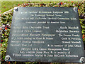
Roydon Lock No 13 — 8 miles, 7 furlongs and 6 locks away
Travel to Rye House Junction, then on the Lee and Stort Navigation (River Stort - Main Line) to Roydon Lock No 13
Carthagena Lock No 7 — 9 miles, ¼ furlongs and 6 locks away
On this waterway in the direction of Waltham Town Lock No 11
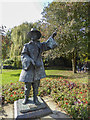
Burnt Mill Visitor Moorings — 11 miles, 5¾ furlongs and 10 locks away
Travel to Rye House Junction, then on the Lee and Stort Navigation (River Stort - Main Line) to Burnt Mill Visitor Moorings
Moorhen Marina Services — 11 miles, 6¾ furlongs and 10 locks away
Travel to Rye House Junction, then on the Lee and Stort Navigation (River Stort - Main Line) to Moorhen Marina Services
Hazlemere Marina Services — 13 miles, 8 furlongs and 11 locks away
Travel to Waltham Town Lock No 11, then on the Lee and Stort Navigation (River Lee: commercial section) to Hazlemere Marina Services
Harlow Mill Visitor Moorings — 13 miles, 7½ furlongs and 12 locks away
Travel to Rye House Junction, then on the Lee and Stort Navigation (River Stort - Main Line) to Harlow Mill Visitor Moorings
Wharf Road Bridge No 33 — 17 miles, ¾ furlongs and 14 locks away
Travel to Waltham Town Lock No 11, then on the Lee and Stort Navigation (River Lee: commercial section) to Wharf Road Bridge No 33
Pickett's Lock No 15 — 18 miles, ¾ furlongs and 14 locks away
Travel to Waltham Town Lock No 11, then on the Lee and Stort Navigation (River Lee: commercial section) to Pickett's Lock No 15

Nearest rubbish disposal

In the direction of Waltham Town Lock No 11
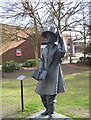
Hertford Basin Services — 3 furlongs away
On this waterway in the direction of Waltham Town Lock No 11
Feildes Weir Lock Services — 7 miles, 1½ furlongs and 5 locks away
On this waterway in the direction of Waltham Town Lock No 11
Burnt Mill Marina — 11 miles, 7 furlongs and 10 locks away
Travel to Rye House Junction, then on the Lee and Stort Navigation (River Stort - Main Line) to Burnt Mill Marina
Hazlemere Marina Services — 13 miles, 8 furlongs and 11 locks away
Travel to Waltham Town Lock No 11, then on the Lee and Stort Navigation (River Lee: commercial section) to Hazlemere Marina Services
Pickett's Lock No 15 — 18 miles, ¾ furlongs and 14 locks away
Travel to Waltham Town Lock No 11, then on the Lee and Stort Navigation (River Lee: commercial section) to Pickett's Lock No 15

Nearest chemical toilet disposal

In the direction of Waltham Town Lock No 11
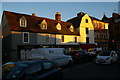
Hertford Basin Services — 3 furlongs away
On this waterway in the direction of Waltham Town Lock No 11
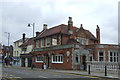
Feildes Weir Lock Services — 7 miles, 1½ furlongs and 5 locks away
On this waterway in the direction of Waltham Town Lock No 11

Roydon Marina Moorings — 7 miles, 7¾ furlongs and 6 locks away
Travel to Rye House Junction, then on the Lee and Stort Navigation (River Stort - Main Line) to Roydon Marina Entrance, then on the Lee and Stort Navigation (River Stort - Roydon Marina Branch) to Roydon Marina Moorings
Moorhen Marina Services — 11 miles, 6¾ furlongs and 10 locks away
Travel to Rye House Junction, then on the Lee and Stort Navigation (River Stort - Main Line) to Moorhen Marina Services
Hazlemere Marina Services — 13 miles, 8 furlongs and 11 locks away
Travel to Waltham Town Lock No 11, then on the Lee and Stort Navigation (River Lee: commercial section) to Hazlemere Marina Services
Little Hallingbury Mill Arm Junction — 16 miles, 7 furlongs and 16 locks away
Travel to Rye House Junction, then on the Lee and Stort Navigation (River Stort - Main Line) to Little Hallingbury Mill Arm Junction

Nearest place to turn

In the direction of Waltham Town Lock No 11
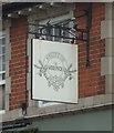
Nicholas Lane Winding Hole — ½ furlongs away
On this waterway in the direction of Waltham Town Lock No 11
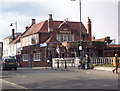
Hertford Basin Winding Hole — 3 furlongs away
On this waterway in the direction of Waltham Town Lock No 11
River Beane Junction — 1 mile, ½ furlongs and 1 lock away
On this waterway in the direction of Waltham Town Lock No 11

Ware Lock Weir Entrance — 2 miles, 1½ furlongs and 1 lock away
On this waterway in the direction of Waltham Town Lock No 11
Ware Lock Weir Exit — 2 miles, 2¼ furlongs and 2 locks away
On this waterway in the direction of Waltham Town Lock No 11
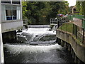
Ware Town Quay — 2 miles, 5¼ furlongs and 2 locks away
On this waterway in the direction of Waltham Town Lock No 11
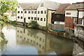
Hardmead Lock Weir Entrance — 3 miles, 6 furlongs and 2 locks away
On this waterway in the direction of Waltham Town Lock No 11
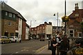
Hardmead Lock Weir Exit — 3 miles, 7 furlongs and 3 locks away
On this waterway in the direction of Waltham Town Lock No 11
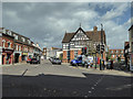
Stanstead Lock Weir Exit — 4 miles, 7¾ furlongs and 4 locks away
On this waterway in the direction of Waltham Town Lock No 11
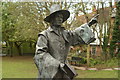
Stanstead Marina — 5 miles, 2 furlongs and 4 locks away
On this waterway in the direction of Waltham Town Lock No 11

Stanstead Mill Stream Junction — 5 miles, 4¾ furlongs and 4 locks away
On this waterway in the direction of Waltham Town Lock No 11
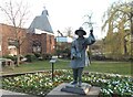
Rye House Junction — 7 miles, ¾ furlongs and 4 locks away
On this waterway in the direction of Waltham Town Lock No 11
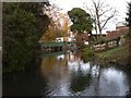
Brick Lock Arm — 7 miles, 7½ furlongs and 5 locks away
Travel to Rye House Junction, then on the Lee and Stort Navigation (River Stort - Main Line) to Brick Lock Arm
Dobb's Weir Lock Weir Exit — 8 miles, 2½ furlongs and 6 locks away
On this waterway in the direction of Waltham Town Lock No 11
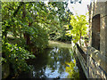
Roydon Lock Winding Hole — 8 miles, 6¾ furlongs and 6 locks away
Travel to Rye House Junction, then on the Lee and Stort Navigation (River Stort - Main Line) to Roydon Lock Winding Hole
Old Nazeing Road Wharf — 9 miles, 4½ furlongs and 7 locks away
On this waterway in the direction of Waltham Town Lock No 11
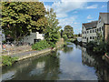
Old Nazeing Road Arm — 9 miles, 6¼ furlongs and 7 locks away
On this waterway in the direction of Waltham Town Lock No 11
Hunsdon Mill Lock Winding Hole — 9 miles, 7 furlongs and 7 locks away
Travel to Rye House Junction, then on the Lee and Stort Navigation (River Stort - Main Line) to Hunsdon Mill Lock Winding Hole
Hunsdon Mill Lock Weir Entrance — 9 miles, 7¼ furlongs and 8 locks away
Travel to Rye House Junction, then on the Lee and Stort Navigation (River Stort - Main Line) to Hunsdon Mill Lock Weir Entrance
Eastwick Road Winding Hole — 10 miles, 7 furlongs and 8 locks away
Travel to Rye House Junction, then on the Lee and Stort Navigation (River Stort - Main Line) to Eastwick Road Winding Hole

Nearest self-operated pump-out

Nearest boatyard pump-out

In the direction of Waltham Town Lock No 11
Stanstead Marina — 5 miles, 2 furlongs and 4 locks away
On this waterway in the direction of Waltham Town Lock No 11
Roydon Marina Moorings — 7 miles, 7¾ furlongs and 6 locks away
Travel to Rye House Junction, then on the Lee and Stort Navigation (River Stort - Main Line) to Roydon Marina Entrance, then on the Lee and Stort Navigation (River Stort - Roydon Marina Branch) to Roydon Marina Moorings
Old Nazeing Road Wharf — 9 miles, 4½ furlongs and 7 locks away
On this waterway in the direction of Waltham Town Lock No 11
Little Hallingbury Mill Arm Junction — 16 miles, 7 furlongs and 16 locks away
Travel to Rye House Junction, then on the Lee and Stort Navigation (River Stort - Main Line) to Little Hallingbury Mill Arm Junction
Direction of TV transmitter (From Wolfbane Cybernetic)
 
 
Geograph
 
Wikipedia

There is no page on Wikipedia called “Hertford Town Mill Bridge”

Wikipedia pages that might relate to Hertford Town Mill Bridge
[Lee Navigation] that are navigable). It flows from Hertford Castle Weir to the River Thames at Bow Creek; its first lock is Hertford Lock and its last Bow Locks. The Lee [River Lea] narrow green gap between the new towns of Hatfield and Welwyn Garden City, onto the county town of Hertford. At Hertford the shallow river turns briefly [Hertford, Luton and Dunstable Railway] The Hertford, Luton and Dunstable Railway was a railway affiliated to the Great Northern Railway. It was formed when the Hertford and Welwyn Junction [Lea Valley Walk] outskirts of Hertford. The path continues to Hertford town centre passing Hertford Town F.C and Hertford Castle before following Maidenhead Street and [Broxbourne railway station] Tottenham Hale and Lea Bridge. 2 tph to Hertford East as above, taking 18 minutes. 1 tph to Cambridge, of calling at Harlow Town, Sawbridgeworth, Bishop's [List of municipalities in North Carolina] estimate. Aberdeen—town, Moore County Ahoskie—town, Hertford County Alamance—village, Alamance County Albemarle—city, Stanly County Alliance—town, Pamlico County [Lea Valley] the valley, although including several towns (Luton, Harpenden, Hertford and Ware), is mainly rural. Below Hertford the Lea flows on a wide floodplain, which [Hertford Castle Weir] function room at the Hertford Theater (previously called Castle Hall). Just off Mill Bridge (B158 road) in the centre of Hertford town, beside the Castle [Hertfordshire] and of the flag. Hertfordshire County Council is based in Hertford, once the main market town. In 2013, the county population was 1,140,700, with Hemel [Hertford East railway station] West Anglia Main Line in the east of England, and is located in the town of Hertford in Hertfordshire. It is 24 miles 19 chains (39.0 km) down the line
 
Google

Results of Google Search

The Mill Bridge Rooms | Venue Hire
The Mill Bridge Rooms are located in the centre of the historic county town of Hertford, there is plenty of local car parking and the town is serviced by regular rail ...
History | Mill Bridge - Discover Hertford Online
Until December 1893, tolls used to be charged for vehicles and animals crossing the bridge. Wickham's Brewery stood on land now occupied by Town Mill Mews.
Lee Navigation - Wikipedia
The Lee Navigation is a canalised river incorporating the River Lea It flows from Hertford Castle ... Hertford Town Mill Bridge ... 42, A121 Waltham Town Bridge ...
How to get to Town Mill Mews Mill Bridge in Hertford by Bus or Train ...
Dec 15, 2020 ... Directions to Town Mill Mews Mill Bridge (Hertford) with public transport. The following transport lines have routes that pass near Town Mill ...
the mill bridge rooms mc mullens brewery hertford town centre ...
Download this stock image: the mill bridge rooms mc mullens brewery hertford town centre county town hertfordshire england uk gb - AYHM1X from Alamy's ...
THE BEST 10 Italian Restaurants near Mill Bridge, Hertford SG14 ...
Best Italian in Mill Bridge, Hertford SG14 1PZ, United Kingdom - Ilvino ... “Pros This Pizza Express is well located close to Hertford town centre, and is a fairly ...
the mill bridge rooms mc mullens brewery hertford town centre ...
Download this stock image: the mill bridge rooms mc mullens brewery hertford town centre county town hertfordshire england uk gb - AYHWXP from Alamy's ...
File:The view from Millbridge Hertford town - geograph.org.uk ...
Mar 8, 2020 ... File:The view from Millbridge Hertford town - geograph.org.uk - 1764036.jpg. Language; Watch · Edit. File; File history; File usage on Commons ...
The Mill Bridge Rooms, Hertford town centre, Hertford, Hertfordshire ...
Download this stock image: The Mill Bridge Rooms, Hertford town centre, Hertford, Hertfordshire, England. - B8TBFG from Alamy's library of millions of high  ...