CanalPlanAC

Gauxholme Aqueduct

 
Bacup Road, Calderdale OL14 7PJ, United Kingdom (A681)
 
Information about the place
Gauxholme Aqueduct is a minor waterways place on the Rochdale Canal between Hollings Lock No 27 (Walsden) (4¾ furlongs and 2 locks to the southeast) and Walkley's Clog Mill (5 miles and 7½ furlongs and 17 locks to the east).
 
 
The nearest place in the direction of Hollings Lock No 27 is Gauxholme Wharf; a few yards away.
 
The nearest place in the direction of Walkley's Clog Mill is Gauxholme Highest Lock No 24; ¼ furlongs away.

Mooring here is unrated.

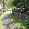
There is a small aqueduct or underbridge here.


Amenities
 
Maps
If you are a user and are logged on, or if you are actively planning a route, a map will be displayed here.
Show on external mapping site: Google | OSM | Bing
 
Photos
 
External websites
There are no links to external websites from here.
Why not log in and add some (select "External websites" from the menu (sometimes this is under "Edit"))?
 
Nearest facilities

Mouseover for more information or show routes to facility

Nearest water point

In the direction of Castlefield Junction

Travis Mill Lock No 286¾ furlongs and 3 locks away
On this waterway in the direction of Castlefield Junction
Littleborough Sanitary Station4 miles, 3¾ furlongs and 22 locks away
On this waterway in the direction of Castlefield Junction
New Islington Marina19 miles, 7¾ furlongs and 57 locks away
Travel to New Islington Marina Entrance, then on the Rochdale Canal (Main Line) to Cotton Field Wharf Marina, then on the Rochdale Canal (New Islington Marina Arm) to New Islington Marina

In the direction of Sowerby Bridge Junction

Fielden Wharf & Services6¾ furlongs and 6 locks away
On this waterway in the direction of Sowerby Bridge Junction
Baltimore Marina1 mile, 1¾ furlongs and 7 locks away
On this waterway in the direction of Sowerby Bridge Junction
Hebden Bridge Services5 miles, 1¼ furlongs and 16 locks away
On this waterway in the direction of Sowerby Bridge Junction
Sowerby Bridge Basin10 miles, 6½ furlongs and 23 locks away
Travel to Sowerby Bridge Junction, then on the Calder and Hebble Navigation (Main Line) to Sowerby Bridge Basin
Salterhebble Junction12 miles, 6¼ furlongs and 23 locks away
Travel to Sowerby Bridge Junction, then on the Calder and Hebble Navigation (Main Line) to Salterhebble Junction
Salterhebble Sanitary Station12 miles, 6¾ furlongs and 24 locks away
Travel to Sowerby Bridge Junction, then on the Calder and Hebble Navigation (Main Line) to Salterhebble Junction, then on the Calder and Hebble Navigation (Main Line) to Salterhebble Sanitary Station
Brighouse Basin17 miles, ¾ furlongs and 33 locks away
Travel to Sowerby Bridge Junction, then on the Calder and Hebble Navigation (Main Line) to Salterhebble Junction, then on the Calder and Hebble Navigation (Main Line) to Brighouse Basin

Nearest rubbish disposal

In the direction of Castlefield Junction

Littleborough Sanitary Station4 miles, 3¾ furlongs and 22 locks away
On this waterway in the direction of Castlefield Junction

In the direction of Sowerby Bridge Junction

Fielden Wharf & Services6¾ furlongs and 6 locks away
On this waterway in the direction of Sowerby Bridge Junction
Hebden Bridge Services5 miles, 1¼ furlongs and 16 locks away
On this waterway in the direction of Sowerby Bridge Junction
Sowerby Bridge Basin10 miles, 6½ furlongs and 23 locks away
Travel to Sowerby Bridge Junction, then on the Calder and Hebble Navigation (Main Line) to Sowerby Bridge Basin
Salterhebble Sanitary Station12 miles, 6¾ furlongs and 24 locks away
Travel to Sowerby Bridge Junction, then on the Calder and Hebble Navigation (Main Line) to Salterhebble Junction, then on the Calder and Hebble Navigation (Main Line) to Salterhebble Sanitary Station
Brighouse Lower Basin Visitor Moorings17 miles, 1¼ furlongs and 34 locks away
Travel to Sowerby Bridge Junction, then on the Calder and Hebble Navigation (Main Line) to Salterhebble Junction, then on the Calder and Hebble Navigation (Main Line) to Brighouse Lower Basin Visitor Moorings

Nearest chemical toilet disposal

In the direction of Castlefield Junction

Littleborough Sanitary Station4 miles, 3¾ furlongs and 22 locks away
On this waterway in the direction of Castlefield Junction

In the direction of Sowerby Bridge Junction

Baltimore Marina1 mile, 1¾ furlongs and 7 locks away
On this waterway in the direction of Sowerby Bridge Junction
Hebden Bridge Services5 miles, 1¼ furlongs and 16 locks away
On this waterway in the direction of Sowerby Bridge Junction
Sowerby Bridge Basin10 miles, 6½ furlongs and 23 locks away
Travel to Sowerby Bridge Junction, then on the Calder and Hebble Navigation (Main Line) to Sowerby Bridge Basin
Salterhebble Sanitary Station12 miles, 6¾ furlongs and 24 locks away
Travel to Sowerby Bridge Junction, then on the Calder and Hebble Navigation (Main Line) to Salterhebble Junction, then on the Calder and Hebble Navigation (Main Line) to Salterhebble Sanitary Station
Brighouse Basin17 miles, ¾ furlongs and 33 locks away
Travel to Sowerby Bridge Junction, then on the Calder and Hebble Navigation (Main Line) to Salterhebble Junction, then on the Calder and Hebble Navigation (Main Line) to Brighouse Basin

Nearest place to turn

In the direction of Castlefield Junction

Winding Hole between Nip Square and Winterbutlee Locks1 mile, ¼ furlongs and 5 locks away
On this waterway in the direction of Castlefield Junction
Lightbank Lock Winding Hole1 mile, 3¼ furlongs and 7 locks away
On this waterway in the direction of Castlefield Junction
Bottomley Road Winding Hole1 mile, 5 furlongs and 8 locks away
On this waterway in the direction of Castlefield Junction
Summit Pound Winding Hole2 miles, 3¼ furlongs and 12 locks away
On this waterway in the direction of Castlefield Junction
Bent House Bridge Winding Hole4 miles, 1 furlong and 21 locks away
On this waterway in the direction of Castlefield Junction
Bent House Winding Hole4 miles, 2 furlongs and 21 locks away
On this waterway in the direction of Castlefield Junction
Littleborough Winding Hole4 miles, 7¾ furlongs and 24 locks away
On this waterway in the direction of Castlefield Junction
Moss Upper Lock Winding Hole8 miles, 2¾ furlongs and 25 locks away
On this waterway in the direction of Castlefield Junction

In the direction of Sowerby Bridge Junction

Todmorden Bridge Winding Hole6½ furlongs and 6 locks away
On this waterway in the direction of Sowerby Bridge Junction
Baltimore Winding Hole1 mile, 2 furlongs and 7 locks away
On this waterway in the direction of Sowerby Bridge Junction
Lobb Mill Lock Winding Hole2 miles, 1 furlong and 9 locks away
On this waterway in the direction of Sowerby Bridge Junction
Stoodley Bridge Winding Hole2 miles, 5¾ furlongs and 10 locks away
On this waterway in the direction of Sowerby Bridge Junction
Winding Hole below Holmcoat Lock3 miles and 11 locks away
On this waterway in the direction of Sowerby Bridge Junction
Rawden Mill Lock Winding Hole3 miles, 7½ furlongs and 13 locks away
On this waterway in the direction of Sowerby Bridge Junction
Hebden Bridge Wharf5 miles, 1½ furlongs and 16 locks away
On this waterway in the direction of Sowerby Bridge Junction
Walkley's Clog Mill5 miles, 7½ furlongs and 17 locks away
On this waterway in the direction of Sowerby Bridge Junction
Winding Hole below Lock No 57 miles, 6¾ furlongs and 20 locks away
On this waterway in the direction of Sowerby Bridge Junction
Tower Hill Winding Hole10 miles, 1¾ furlongs and 20 locks away
On this waterway in the direction of Sowerby Bridge Junction
Sowerby Bridge Winding Hole10 miles, 3½ furlongs and 22 locks away
On this waterway in the direction of Sowerby Bridge Junction
Sowerby Bridge Junction10 miles, 5½ furlongs and 23 locks away
On this waterway in the direction of Sowerby Bridge Junction

Nearest self-operated pump-out

In the direction of Castlefield Junction

New Islington Marina19 miles, 7¾ furlongs and 57 locks away
Travel to New Islington Marina Entrance, then on the Rochdale Canal (Main Line) to Cotton Field Wharf Marina, then on the Rochdale Canal (New Islington Marina Arm) to New Islington Marina

In the direction of Sowerby Bridge Junction

Hebden Bridge Services5 miles, 1¼ furlongs and 16 locks away
On this waterway in the direction of Sowerby Bridge Junction

Nearest boatyard pump-out

In the direction of Sowerby Bridge Junction

Pickwell and Arnold Boatyard2 miles, 3¼ furlongs and 10 locks away
On this waterway in the direction of Sowerby Bridge Junction
Sowerby Bridge Basin10 miles, 6½ furlongs and 23 locks away
Travel to Sowerby Bridge Junction, then on the Calder and Hebble Navigation (Main Line) to Sowerby Bridge Basin
Direction of TV transmitter (From Wolfbane Cybernetic)
 
 
Geograph
 
Wikipedia

There is no page on Wikipedia called “Gauxholme Aqueduct”

Wikipedia pages that might relate to Gauxholme Aqueduct
[Rochdale Canal] the great Middleton canal tragedy of 1927, when a breach occurred at the aqueduct, and three people were drowned. The canal re-opened in Summer 2006, but
 
Google

Results of Google Search

Gauxholme Lower Lock 22 and Gauxholme Railway Viaduct ...
Gauxholme Lower Lock 22 and Gauxholme Railway Viaduct Rochdale Canal Todmorden Steel Girder, Rochdale, ... See also Stanley Ferry Aqueduct…
Rochdale Canal - Wikipedia
The Rochdale Canal is in Northern England, between Manchester and Sowerby Bridge, part of ... 22-23, Gauxholme Locks (2) ... great Middleton canal tragedy of 1927, when a breach occurred at the aqueduct, and three people were drowned.
Gauxholme Lower Lock 22 and Gauxholme Railway Viaduct Roch ...
See also Stanley Ferry Aqueduct. www.flickr.com/photos/45777493@N06/ 5418911136/ "Self-contained'" refers to the wrought iron tie rod used to restrain the ...
World's First Swing Aqueduct ... - Travelogue of An Armchair Traveller
Jun 16, 2016 ... The aqueduct located near Barton upon Irwell, Greater Manchester, carries the Bridgewater Canal over Manchester Ship Canal. Unlike other ...
Template:Rochdale Canal map - Wikipedia
Hebden Aqueduct. Hebble End. 10-11, Stubbing Locks (2) ... 22-23, Gauxholme Locks (2). A681 Gauxholme Arch. 24, Gauxholme Highest Lock. Caldervale Line  ...
Gauxholme Bridge | Canal Boat
Canal Boat reader photos uploaded and shared online, browse waterways, nature, aqueducts and boating types from Canal Boat Magazine.
The Barton Swing Aqueduct – Stretford, England - Atlas Obscura
This ultra-rare swing aqueduct is a fantastic and still functional bit of Victorian civil engineering. Opened in 1893, it still remains in regular use today, allowing ...
Rochdale Canal Bridge 31 – Gauxholme, Yorkshire, UK - Stone ...
Jul 7, 2012 ... Waymarking.com is a way to mark unique locations on the planet and give them a voice. While GPS technology allows us to pinpoint any ...