Rea Bridge
is a minor waterways place
on the Gloucester and Sharpness Canal between
Saul Junction (Junction of the Gloucester and Sharpness Canal with the Stroudwater Navigation) (5 miles and 1½ furlongs
to the southwest) and
Gloucester Docks (Waterways Office (South Wales and Severn Waterways) - Canal & River Trust (Water area of 14 acres)) (2 miles and 4¼ furlongs
to the northeast).
The nearest place in the direction of Saul Junction is Quedgeley Wharf Visitor Mooring;
1 mile and 1½ furlongs
away.
The nearest place in the direction of Gloucester Docks is Sims Bridge;
3 furlongs
away.
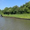
Mooring here is good (a nice place to moor), piling suitable for hooks. South of bridge.
There is a swing bridge here.
| Parkend Bridge | 3 miles, 4¾ furlongs | |
| Site of Hardwicke Bridge | 2 miles, ¾ furlongs | |
| Sellars Bridge | 1 mile, 3½ furlongs | |
| Quedgeley Oil Depot | 1 mile, 2 furlongs | |
| Quedgeley Wharf Visitor Mooring | 1 mile, 1½ furlongs | |
| Rea Bridge | ||
| Sims Bridge | 3 furlongs | |
| Two Mile Bend (west arm) | 4 furlongs | |
| Netheridge Bridge | 5 furlongs | |
| Two Mile Bend (east arm) | 5¾ furlongs | |
| Gloucester Rowing Club | 7¾ furlongs | |
There are no links to external websites from here.
Why not log in and add some (select "External websites" from the menu (sometimes this is under "Edit"))?
Mouseover for more information or show routes to facility
Nearest water point
In the direction of Sharpness Junction
Sellars Bridge — 1 mile, 3½ furlongs away
On this waterway in the direction of Sharpness Junction
Saul Junction Winding Hole — 5 miles, 1¾ furlongs away
On this waterway in the direction of Sharpness Junction
Saul Junction Marina — 5 miles, 2½ furlongs away
Travel to Saul Junction, then on the Cotswold Canals (Stroudwater Navigation - Navigable Section) to Saul Junction Marina
Cotswold Canals Trust Visitor Centre - Saul Junction — 5 miles, 2½ furlongs away
On this waterway in the direction of Sharpness Junction
Fretherne Bridge — 5 miles, 7¾ furlongs away
On this waterway in the direction of Sharpness Junction
Splatt Bridge — 7 miles, ½ furlongs away
On this waterway in the direction of Sharpness Junction
Patch Bridge — 8 miles, 7¼ furlongs away
On this waterway in the direction of Sharpness Junction
Purton Lower Bridge — 11 miles, 3 furlongs away
On this waterway in the direction of Sharpness Junction
In the direction of Gloucester / Sharpness - Severn Junction
Llanthony Pontoons — 2 miles, 2½ furlongs away
On this waterway in the direction of Gloucester / Sharpness - Severn Junction
Llanthony Road Bridge — 2 miles, 3½ furlongs away
On this waterway in the direction of Gloucester / Sharpness - Severn Junction
Gloucester Waterways Museum Arm — 2 miles, 3¾ furlongs away
On this waterway in the direction of Gloucester / Sharpness - Severn Junction
Gloucester Dock Lock — 2 miles, 4¾ furlongs away
On this waterway in the direction of Gloucester / Sharpness - Severn Junction
Tewkesbury Lower Lode — 14 miles, 2½ furlongs and 1 lock away
Travel to Gloucester / Sharpness - Severn Junction, then on the River Severn (main river - Worcester to Gloucester) to Tewkesbury Lower Lode
Upper Lode Lock No 5 — 15 miles, ¾ furlongs and 1 lock away
Travel to Gloucester / Sharpness - Severn Junction, then on the River Severn (main river - Worcester to Gloucester) to Upper Lode Lock No 5
Tewkesbury Services — 15 miles, 6¾ furlongs and 3 locks away
Travel to Gloucester / Sharpness - Severn Junction, then on the River Severn (main river - Worcester to Gloucester) to Tewkesbury Junction, then on the River Avon - Warwickshire (Lower Avon Navigation) to Tewkesbury Services
Bredon — 19 miles, 2½ furlongs and 3 locks away
Travel to Gloucester / Sharpness - Severn Junction, then on the River Severn (main river - Worcester to Gloucester) to Tewkesbury Junction, then on the River Avon - Warwickshire (Lower Avon Navigation) to BredonNearest rubbish disposal
In the direction of Sharpness Junction
Sellars Bridge — 1 mile, 3½ furlongs away
On this waterway in the direction of Sharpness Junction
Parkend Bridge — 3 miles, 4¾ furlongs away
On this waterway in the direction of Sharpness Junction
Saul Junction Winding Hole — 5 miles, 1¾ furlongs away
On this waterway in the direction of Sharpness Junction
Saul Junction Marina — 5 miles, 2½ furlongs away
Travel to Saul Junction, then on the Cotswold Canals (Stroudwater Navigation - Navigable Section) to Saul Junction Marina
Fretherne Bridge — 5 miles, 7¾ furlongs away
On this waterway in the direction of Sharpness Junction
Splatt Bridge — 7 miles, ½ furlongs away
On this waterway in the direction of Sharpness Junction
Patch Bridge — 8 miles, 7¼ furlongs away
On this waterway in the direction of Sharpness Junction
Purton Lower Bridge — 11 miles, 3 furlongs away
On this waterway in the direction of Sharpness Junction
Sharpness Barge Arm — 12 miles, 6¼ furlongs away
On this waterway in the direction of Sharpness Junction
In the direction of Gloucester / Sharpness - Severn Junction
Llanthony Road Bridge — 2 miles, 3½ furlongs away
On this waterway in the direction of Gloucester / Sharpness - Severn Junction
Tewkesbury Services — 15 miles, 6¾ furlongs and 3 locks away
Travel to Gloucester / Sharpness - Severn Junction, then on the River Severn (main river - Worcester to Gloucester) to Tewkesbury Junction, then on the River Avon - Warwickshire (Lower Avon Navigation) to Tewkesbury ServicesNearest chemical toilet disposal
In the direction of Gloucester / Sharpness - Severn Junction
Llanthony Road Bridge — 2 miles, 3½ furlongs away
On this waterway in the direction of Gloucester / Sharpness - Severn Junction
In the direction of Sharpness Junction
Saul Junction Marina — 5 miles, 2½ furlongs away
Travel to Saul Junction, then on the Cotswold Canals (Stroudwater Navigation - Navigable Section) to Saul Junction Marina
Cotswold Canals Trust Visitor Centre - Saul Junction — 5 miles, 2½ furlongs away
On this waterway in the direction of Sharpness Junction
Sharpness Barge Arm — 12 miles, 6¼ furlongs away
On this waterway in the direction of Sharpness JunctionNearest place to turn
In the direction of Sharpness Junction
Quedgeley Oil Depot — 1 mile, 2 furlongs away
On this waterway in the direction of Sharpness Junction
Pegthorne Bridge Winding Hole — 4 miles, 4½ furlongs away
On this waterway in the direction of Sharpness Junction
Saul Junction Winding Hole — 5 miles, 1¾ furlongs away
On this waterway in the direction of Sharpness Junction
Sharpness Barge Arm — 12 miles, 6¼ furlongs away
On this waterway in the direction of Sharpness Junction
The Ocean — 9 miles and 8 locks away
Travel to Saul Junction, then on the Cotswold Canals (Stroudwater Navigation - Navigable Section) to Walk Bridge, then on the Cotswold Canals (Stroudwater Navigation - Un-navigable Section) to The Ocean
Ryeford Winding Hole — 9 miles, 7¾ furlongs and 8 locks away
Travel to Saul Junction, then on the Cotswold Canals (Stroudwater Navigation - Navigable Section) to Walk Bridge, then on the Cotswold Canals (Stroudwater Navigation - Un-navigable Section) to Ryeford Winding Hole
Brimscombe Port — 14 miles, 6½ furlongs and 19 locks away
Travel to Saul Junction, then on the Cotswold Canals (Stroudwater Navigation - Navigable Section) to Walk Bridge, then on the Cotswold Canals (Stroudwater Navigation - Un-navigable Section) to Site of Entrance to Wallbridge Basin, then on the Cotswold Canals (Thames and Severn Canal - Wide section) to Brimscombe Port
In the direction of Gloucester / Sharpness - Severn Junction
Monk Meadow Dock — 2 miles, ¼ furlongs away
On this waterway in the direction of Gloucester / Sharpness - Severn Junction
Gloucester Docks — 2 miles, 4¼ furlongs away
On this waterway in the direction of Gloucester / Sharpness - Severn Junction
Waterways Office (South Wales and Severn Waterways) - Canal & River Trust — 2 miles, 4½ furlongs away
On this waterway in the direction of Gloucester / Sharpness - Severn Junction
Gloucester / Sharpness - Severn Junction — 2 miles, 5 furlongs and 1 lock away
On this waterway in the direction of Gloucester / Sharpness - Severn Junction
Upper Parting Junction — 5 miles, 1¾ furlongs and 1 lock away
Travel to Gloucester / Sharpness - Severn Junction, then on the River Severn (main river - Worcester to Gloucester) to Upper Parting Junction
Over Winding Hole — 4 miles, 4¾ furlongs and 2 locks away
Travel to Gloucester / Sharpness - Severn Junction, then on the River Severn (old river navigation) to Lower Parting, then on the River Severn (Maisemore Channel - Southern Section) to Over Junction, then on the Hereford and Gloucester Canal to Over Winding Hole
Upper Lode Lock Weir Exit — 14 miles, 6¾ furlongs and 1 lock away
Travel to Gloucester / Sharpness - Severn Junction, then on the River Severn (main river - Worcester to Gloucester) to Upper Lode Lock Weir Exit
Upper Lode Lock Weir Entrance — 15 miles, 1¾ furlongs and 2 locks away
Travel to Gloucester / Sharpness - Severn Junction, then on the River Severn (main river - Worcester to Gloucester) to Upper Lode Lock Weir Entrance
Avon Lock Junction — 15 miles, 6½ furlongs and 3 locks away
Travel to Gloucester / Sharpness - Severn Junction, then on the River Severn (main river - Worcester to Gloucester) to Tewkesbury Junction, then on the River Avon - Warwickshire (Lower Avon Navigation) to Avon Lock Junction
Abbey Mill Tewkesbury — 15 miles, 7½ furlongs and 3 locks away
Travel to Gloucester / Sharpness - Severn Junction, then on the River Severn (main river - Worcester to Gloucester) to Tewkesbury Junction, then on the River Avon - Warwickshire (Lower Avon Navigation) to Avon Lock Junction, then on the River Avon - Warwickshire (Mill Avon) to Abbey Mill Tewkesbury
Tewkesbury Marina Entrance No 2 — 16 miles, 2½ furlongs and 3 locks away
Travel to Gloucester / Sharpness - Severn Junction, then on the River Severn (main river - Worcester to Gloucester) to Tewkesbury Junction, then on the River Avon - Warwickshire (Lower Avon Navigation) to Tewkesbury Marina Entrance No 2Nearest self-operated pump-out
In the direction of Gloucester / Sharpness - Severn Junction
Llanthony Pontoons — 2 miles, 2½ furlongs away
On this waterway in the direction of Gloucester / Sharpness - Severn Junction
In the direction of Sharpness Junction
Cotswold Canals Trust Visitor Centre - Saul Junction — 5 miles, 2½ furlongs away
On this waterway in the direction of Sharpness Junction
Purton Lower Bridge — 11 miles, 3 furlongs away
On this waterway in the direction of Sharpness JunctionNearest boatyard pump-out
In the direction of Sharpness Junction
Saul Junction Marina — 5 miles, 2½ furlongs away
Travel to Saul Junction, then on the Cotswold Canals (Stroudwater Navigation - Navigable Section) to Saul Junction Marina
Patch Bridge — 8 miles, 7¼ furlongs away
On this waterway in the direction of Sharpness JunctionDirection of TV transmitter (From Wolfbane Cybernetic)
There is no page on Wikipedia called “Rea Bridge”
Wikipedia pages that might relate to Rea Bridge
[Chris Rea]
Christopher Anton Rea (/ˈriːə/ REE-ə; born 4 March 1951) is an English rock and blues singer-songwriter and guitarist. Born and raised in Middlesbrough
[River Rea]
The River Rea (pronounced "ray") is a small river which passes through Birmingham, England. It is the river on which Birmingham was founded by the Beorma
[Rea Brook]
The name Rea Brook can refer to either of two brooks in Shropshire, England. One of the brooks, which eventually becomes the River Rea, is in southern
[Lake Decatur]
Sportsman's Club, on Lost Bridge and Country Club Roads.[citation needed] Currently, the lake has five crossings: Reas Bridge Road, William Street (Illinois
[Listed buildings in Neen Sollars]
Heritage List for England, retrieved 23 September 2018 Historic England, "Rea Bridge Cottage, Neen Sollars (1383585)", National Heritage List for England,
[Newnham Bridge]
Kingdom. The village derives part of its name from the bridge over the River Rea. Newnham Bridge is situated on the A443 road and the junction of the A456
[River Rea, Shropshire]
Newnham Bridge in Worcestershire. Its waters eventually reach the Bristol Channel, via the Severn. The upper stretch of the river is known as the Rea Brook
[Samuel Rea]
Samuel Rea (September 21, 1855 – March 24, 1929) was an American engineer and the ninth president of the Pennsylvania Railroad, serving from 1913 to 1925
[Fagan v Metropolitan Police Commissioner]
concurrence (or coincidence) of actus reus (Latin for "guilty act") and mens rea (Latin for "guilty mind") in most offences of the criminal law of England
[List of Digimon episodes and films]
20 ("Rare Card Vanished! The Invincible RookChessmon") Transcription: "Rea Kādo ga Kieta! Muteki no Rūkuchesumon" (Japanese: レアカードが消えた!無敵のルークチェスモン)
Results of Google Search
Rea Bridge, Gloucester & Sharpness | Canal & River TrustMay 2, 2018 ... Pleased be advised that there may be a delay in opening the Rea Bridge on request. This is because we will have contractors carrying out ...
Feb 18, 2009 ... Gloucester & Sharpness Canal Rea bridge House for sale. 1,148 views1.1K views. • Feb 18, 2009. 1 1. Share Save. 1 / 1 ...
RENDERING OFRECOMMENDED KAHOLOPO'O S. T. REA. M. BRIDGE. R. E. PL. AC. EM. ENT. FIGURE. 5. WILSON O. KAMOTO. & AS. SO. CIA. T. ES, INC.
Information and map for Rea Bridge in Quedgeley and. Within the council area of Gloucester District (B). In the postcode district of GL2 3 including Churches ...
Sainsburys to Rea Bridge. Run Segment Gloucester, England, United Kingdom. Distance1.88 km. Avg Grade0 ?Lowest Elev10 m. Highest Elev17 m.
Aug 25, 2020 ... Adding one general purpose lane in each direction of I-485 between Rea Road #x200b;#x200b;#x200b;and Providence Road; Widening the bridge carrying ...
REA BRIDGE SERVICE STATION LTD - Free company information from Companies House including registered office address, filing history, accounts, annual ...
Northfield Rea Bridge at West Heath Road. Nicklin, Phyllis (1963) Northfield Rea Bridge at West Heath Road. [Image] (Unpublished) ...
Find rea bridge stock images in HD and millions of other royalty-free stock photos , illustrations and vectors in the Shutterstock collection. Thousands of new ...
Sep 6, 2019 ... I am hugely grateful that Gov. Larry Hogan does not support Bay Bridge Option 4, which would extend Route 100 to access a new bay bridge ...