CanalPlanAC

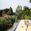
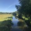
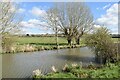
Somerton Mill Bridge No 199

 
Somerton, Cherwell, Oxfordshire, England, United Kingdom
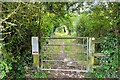
Track off the Somerton to Heyford road which is also a footpath, gate on Banbury side of bridge takes you along another public footpath to the towpath
Address is taken from a point 1727 yards away.
 

Somerton Mill Bridge No 199 carries the road from Boggin to Leicester over the Oxford Canal (Southern Section - Main Line) five kilometres from Bridgend.

Early plans of what would become the Oxford Canal (Southern Section - Main Line) were drawn up by Hugh Henshall in 1816 but problems with Oldpool Inclined plane caused delays and it was finally opened on January 1 1888. Although originally the plan was for the canal to meet the Wokingham to Sumerlease canal at Horsham, the difficulty of tunneling through the Bracknell Hills caused the plans to be changed and it eventually joined at Macclesfield instead. Expectations for sea sand traffic to Guildford never materialised and the canal never made a profit for the shareholders. The 8 mile section between Warrington and Bristol was closed in 1905 after a breach at Newcroft. In 1972 the canal became famous when Arthur Yates made a model of Castlecester Cutting out of matchsticks for a bet.

Information about the place
Somerton Mill Bridge No 199 is a minor waterways place on the Oxford Canal (Southern Section - Main Line) between Allen's Lock No 36 (Bridge leads to Upper Heyford village) (1 mile and 2½ furlongs and 1 lock to the south) and Somerton Bridge No 196 (1 mile and ¾ furlongs to the northeast).
 
 
The nearest place in the direction of Allen's Lock No 36 is Somerton Mill Pipe Bridge; 1¼ furlongs away.
 
The nearest place in the direction of Somerton Bridge No 196 is Deep Cutting Bridge No 198; 4¼ furlongs away.

There is access (unofficial access) to the towpath here.

Mooring here is unrated.

There is a bridge here which takes a track over the canal.


Amenities
 
Maps
If you are a user and are logged on, or if you are actively planning a route, a map will be displayed here.
Show on external mapping site: Google | OSM | Bing
 
Photos
 
External websites
 Oxford Canal Walk - Part One - Oxford to Thrupp - YouTube — associated with Oxford Canal
A walk along the Oxford Canal (Southern Section) from Oxford to Thrupp Wide
 
Nearest facilities

Mouseover for more information or show routes to facility

Nearest water point

In the direction of Napton Junction

Aynho Wharf — 3 miles, 4½ furlongs and 1 lock away
On this waterway in the direction of Napton Junction
Cherwell Street Facilities — 10 miles, 2¼ furlongs and 5 locks away
On this waterway in the direction of Napton Junction
Banbury Lock No 29 — 10 miles, 2½ furlongs and 5 locks away
On this waterway in the direction of Napton Junction
Sovereign Wharf — 10 miles, 4½ furlongs and 6 locks away
On this waterway in the direction of Napton Junction
Cropredy Services — 14 miles, 6¼ furlongs and 9 locks away
On this waterway in the direction of Napton Junction
Cropredy Marina (southern basin) — 15 miles, 2¾ furlongs and 10 locks away
On this waterway in the direction of Napton Junction
Cropredy Marina (northern basins) — 15 miles, 3¼ furlongs and 10 locks away
On this waterway in the direction of Napton Junction

In the direction of End of Hythe Bridge Arm
Heyford Wharf — 2 miles, 3¾ furlongs and 2 locks away
On this waterway in the direction of End of Hythe Bridge Arm
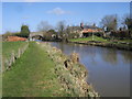
Heyford Wharf Bridge No 206 — 2 miles, 4 furlongs and 2 locks away
On this waterway in the direction of End of Hythe Bridge Arm
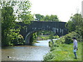
Thrupp Cruising Club — 10 miles, ¼ furlongs and 7 locks away
On this waterway in the direction of End of Hythe Bridge Arm
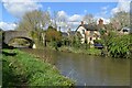
Aubreys Lift Bridge No 221 — 10 miles, ½ furlongs and 7 locks away
On this waterway in the direction of End of Hythe Bridge Arm
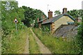
Langford Lane Bridge No 224 — 10 miles, 5¾ furlongs and 7 locks away
On this waterway in the direction of End of Hythe Bridge Arm
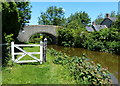
Wolvercote Junction Water Point — 13 miles, 5¾ furlongs and 9 locks away
On this waterway in the direction of End of Hythe Bridge Arm
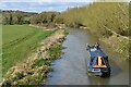
Wolvercote Sanitary Station — 14 miles, 2 furlongs and 10 locks away
On this waterway in the direction of End of Hythe Bridge Arm
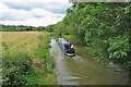
St Edwards Lift Bridge No 238 — 15 miles, 2¾ furlongs and 11 locks away
On this waterway in the direction of End of Hythe Bridge Arm
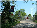
Oxford Visitor Moorings — 16 miles, 7 furlongs and 11 locks away
On this waterway in the direction of End of Hythe Bridge Arm
Eynsham Lock — 17 miles, 1¼ furlongs and 11 locks away
Travel to Wolvercote Junction, then on the Oxford Canal (Duke's Cut) to Duke's Cut Junction, then on the River Thames (above Oxford) to Eynsham Lock

Nearest rubbish disposal

In the direction of Napton Junction

Aynho Wharf — 3 miles, 4½ furlongs and 1 lock away
On this waterway in the direction of Napton Junction
Cherwell Street Facilities — 10 miles, 2¼ furlongs and 5 locks away
On this waterway in the direction of Napton Junction
Sovereign Wharf — 10 miles, 4½ furlongs and 6 locks away
On this waterway in the direction of Napton Junction
Cropredy Services — 14 miles, 6¼ furlongs and 9 locks away
On this waterway in the direction of Napton Junction
Cropredy Marina (southern basin) — 15 miles, 2¾ furlongs and 10 locks away
On this waterway in the direction of Napton Junction
Cropredy Marina (northern basins) — 15 miles, 3¼ furlongs and 10 locks away
On this waterway in the direction of Napton Junction

In the direction of End of Hythe Bridge Arm

Heyford Wharf — 2 miles, 3¾ furlongs and 2 locks away
On this waterway in the direction of End of Hythe Bridge Arm
Heyford Wharf Bridge No 206 — 2 miles, 4 furlongs and 2 locks away
On this waterway in the direction of End of Hythe Bridge Arm
Thrupp Cruising Club — 10 miles, ¼ furlongs and 7 locks away
On this waterway in the direction of End of Hythe Bridge Arm
Aubreys Lift Bridge No 221 — 10 miles, ½ furlongs and 7 locks away
On this waterway in the direction of End of Hythe Bridge Arm
Wolvercote Sanitary Station — 14 miles, 2 furlongs and 10 locks away
On this waterway in the direction of End of Hythe Bridge Arm
Eynsham Lock — 17 miles, 1¼ furlongs and 11 locks away
Travel to Wolvercote Junction, then on the Oxford Canal (Duke's Cut) to Duke's Cut Junction, then on the River Thames (above Oxford) to Eynsham Lock

Nearest chemical toilet disposal

In the direction of Napton Junction

Cherwell Street Facilities — 10 miles, 2¼ furlongs and 5 locks away
On this waterway in the direction of Napton Junction
Sovereign Wharf — 10 miles, 4½ furlongs and 6 locks away
On this waterway in the direction of Napton Junction
Cropredy Services — 14 miles, 6¼ furlongs and 9 locks away
On this waterway in the direction of Napton Junction
Cropredy Marina (southern basin) — 15 miles, 2¾ furlongs and 10 locks away
On this waterway in the direction of Napton Junction

In the direction of End of Hythe Bridge Arm
Thrupp Cruising Club — 10 miles, ¼ furlongs and 7 locks away
On this waterway in the direction of End of Hythe Bridge Arm
Wolvercote Sanitary Station — 14 miles, 2 furlongs and 10 locks away
On this waterway in the direction of End of Hythe Bridge Arm
Eynsham Lock — 17 miles, 1¼ furlongs and 11 locks away
Travel to Wolvercote Junction, then on the Oxford Canal (Duke's Cut) to Duke's Cut Junction, then on the River Thames (above Oxford) to Eynsham Lock

Nearest place to turn

In the direction of Napton Junction

Somerton Deep Lock Winding Hole — 1 mile, 6¼ furlongs and 1 lock away
On this waterway in the direction of Napton Junction
Aynho Wharf — 3 miles, 4½ furlongs and 1 lock away
On this waterway in the direction of Napton Junction
Winding Hole above Nell Bridge Lock — 4 miles, 7 furlongs and 3 locks away
On this waterway in the direction of Napton Junction
Twyford Wharf Winding Hole — 7 miles, 4 furlongs and 4 locks away
On this waterway in the direction of Napton Junction
Calthorpe Winding Hole — 9 miles, 4¾ furlongs and 5 locks away
On this waterway in the direction of Napton Junction
Grimsbury Wharf — 10 miles, 7¾ furlongs and 6 locks away
On this waterway in the direction of Napton Junction
Southam Road Winding Hole — 11 miles, 1 furlong and 6 locks away
On this waterway in the direction of Napton Junction
Southam Road Footbridge Arm — 11 miles, 3¾ furlongs and 6 locks away
On this waterway in the direction of Napton Junction
Cropredy Services — 14 miles, 6¼ furlongs and 9 locks away
On this waterway in the direction of Napton Junction
Cropredy Marina (southern basin) — 15 miles, 2¾ furlongs and 10 locks away
On this waterway in the direction of Napton Junction
Cropredy Marina (northern basins) — 15 miles, 3¼ furlongs and 10 locks away
On this waterway in the direction of Napton Junction

In the direction of End of Hythe Bridge Arm
Heyford Wharf Winding Hole — 2 miles, 3¾ furlongs and 2 locks away
On this waterway in the direction of End of Hythe Bridge Arm
Heyford Wharf — 2 miles, 3¾ furlongs and 2 locks away
On this waterway in the direction of End of Hythe Bridge Arm
The Cleeves Winding Hole — 2 miles, 7¾ furlongs and 2 locks away
On this waterway in the direction of End of Hythe Bridge Arm
Kirtlington Winding Hole — 5 miles, 6¼ furlongs and 4 locks away
On this waterway in the direction of End of Hythe Bridge Arm
Enslow Winding Hole — 7 miles, 3¾ furlongs and 5 locks away
On this waterway in the direction of End of Hythe Bridge Arm
Shipton Weir Junction — 8 miles, 7¾ furlongs and 6 locks away
On this waterway in the direction of End of Hythe Bridge Arm
Thrupp Wide — 10 miles, ¼ furlongs and 7 locks away
On this waterway in the direction of End of Hythe Bridge Arm
Wolvercote Junction — 13 miles, 6½ furlongs and 10 locks away
On this waterway in the direction of End of Hythe Bridge Arm
Bypass Reservoir Junction — 14 miles, ¼ furlongs and 11 locks away
Travel to Wolvercote Junction, then on the Oxford Canal (Duke's Cut) to Bypass Reservoir Junction

Nearest self-operated pump-out

In the direction of Napton Junction

Cropredy Marina (southern basin) — 15 miles, 2¾ furlongs and 10 locks away
On this waterway in the direction of Napton Junction

In the direction of End of Hythe Bridge Arm

Thrupp Cruising Club — 10 miles, ¼ furlongs and 7 locks away
On this waterway in the direction of End of Hythe Bridge Arm
Aubreys Lift Bridge No 221 — 10 miles, ½ furlongs and 7 locks away
On this waterway in the direction of End of Hythe Bridge Arm
Eynsham Lock — 17 miles, 1¼ furlongs and 11 locks away
Travel to Wolvercote Junction, then on the Oxford Canal (Duke's Cut) to Duke's Cut Junction, then on the River Thames (above Oxford) to Eynsham Lock

Nearest boatyard pump-out

In the direction of Napton Junction

Aynho Wharf — 3 miles, 4½ furlongs and 1 lock away
On this waterway in the direction of Napton Junction
Twyford Wharf — 7 miles, 3¾ furlongs and 4 locks away
On this waterway in the direction of Napton Junction
Sovereign Wharf — 10 miles, 4½ furlongs and 6 locks away
On this waterway in the direction of Napton Junction
Cropredy Marina (southern basin) — 15 miles, 2¾ furlongs and 10 locks away
On this waterway in the direction of Napton Junction

In the direction of End of Hythe Bridge Arm

Heyford Wharf — 2 miles, 3¾ furlongs and 2 locks away
On this waterway in the direction of End of Hythe Bridge Arm
Enslow Wharf — 7 miles, 4¾ furlongs and 5 locks away
On this waterway in the direction of End of Hythe Bridge Arm
Oxford Cruisers Marina — 18 miles, 1 furlong and 12 locks away
Travel to Wolvercote Junction, then on the Oxford Canal (Duke's Cut) to Duke's Cut Junction, then on the River Thames (above Oxford) to Oxford Cruisers Marina
Direction of TV transmitter (From Wolfbane Cybernetic)
 
 
Geograph
 
Wikipedia

There is no page on Wikipedia called “Somerton Mill Bridge”

Wikipedia pages that might relate to Somerton Mill Bridge
[Somerton railway station] Somerton railway station (not to be confused with Fritwell & Somerton) was a railway station situated on the Great Western Railway's Langport and Castle [River Thurne] parts of its sails and most of its internal machinery in 2003. West Somerton Mill was built in 1900 by Dan England, from the millwrights England's of [List of bridge failures] "Inquiry reports on Vietnam's Can Tho Bridge collapse". Chamberlain, Simon (8 December 2008). "Somerton Bridge closed indefinitely". Northern Daily Leader [River Cherwell] meanders, overlooked by hilltop villages. Somerton and Heyford, the only villages adjacent, once had water mills. That at Lower Heyford (noted as pre-Conquest [Queen Camel] Retrieved 21 September 2014. Mills, A.D. and Room, A. A Dictionary of British Place-Names Somerset Victoria County History, Somerton Hundred online Historic [List of places in Suffolk] Yoxford See full article, List of places of interest in Suffolk. Bridge Cottage, Flatford Mill Bures Clare Castle Dedham Vale East Anglia Transport Museum [Pennsylvania Route 532] the Somerton neighborhood. PA 532 crosses Byberry Road and continues north, coming to a bridge over SEPTA's West Trenton Line west of the Somerton station [Cowes] Integrated System Technologies (Insyte), which occupies the site of the old Somerton Aerodrome at Newport Road, Cowes; and GKN Aerospace in East Cowes. The [List of places in Norfolk] East Lexham, East Raynham, East Rudham, East Runton, East Ruston, East Somerton, East Tuddenham, East Walton, East Wretham, East Winch, Eastgate, Eastmoor [Dowlish Wake] packhorse bridge (widened in the 1990s) and a road bridge from the 18th century. There was a flour mill on the brook in the 17th century, but only the Mill House
 
Google

Results of Google Search

199 Art | Fine Art America
Choose your favorite 199 designs and purchase them as wall art, home decor, ... 199 Wall Art - Photograph - Still Waters and Somerton Mill Bridge by Louise ...
Hampton Roads Regional Bridge Study Hampton Roads Regional ...
May 5, 2018 ... Bridges are a prominent part of the Hampton Roads landscape and a ... carry only railroad or pedestrian traffic are not covered by NBIS regulations and are not ... 10508 Route 199 WB ... Longstreet Lane over Somerton Creek.
Oxford Canal - Wikipedia
The Oxford Canal is a 78-mile (126 km) narrow canal in central England linking Oxford with ... Hawkesbury Stop Lock No.1 ... 199, Somerton Mill Bridge ... Isis Lock the Oxford Canal ends abruptly at Hythe Bridge Street near to the current Hythe Bridge over the Castle Mill Stream, ... 34, Somerton Deep Lock, 12 ft 0 in ( 3.66 m).
Template:Oxford Canal Route Map - Wikipedia
199, Somerton Mill Bridge. Heyford Common Lock No 35. 200, Heyford ... Wolvercote Mill Stream from Thames. Duke's Lock No 44. Wolvercote Junction: Duke's ...
Parishes: Somerton | British History Online
34) The Cary did not drive a mill, but fishing rights produced a small income. ... 41 ) Pitney Steart, Park, Somerton Door, and Etsome bridges are modern and ... 199 ) Some of the land was acquired by John Frederick Pinney in 1802, (fn. 200) but ...
Google Maps
Find a place. Your location. Trails. Dedicated lanes. Bicycle-friendly roads. Dirt/ unpaved trails. Live traffic. Fast. Slow. Terms 2 m. Set depart & arrive time.
Product Catalog
... 89; 100; 188; 189; 190; 191; 192; 193; 194; 195; 196; 197; 198; 199; 200; 201; 202; 203; 204; 205; 206; 207; 208; 209; 210; 211; 212; 213; 214; 215; 216; 217 ...
Polling Places
16, Bensalem Twp Lower West, Salem Harbor Apartments, 463 Olde Bridge Rd ... 45, Bristol Twp 2nd-2nd, Newportville Fire Company No #1, 2425 New Falls Rd ... 54, Bristol Twp 5th-2nd, Mill Creek Elementary School, 6501 Mill Creek Rd ... 199, Newtown Twp #8, Newtown Township Building, 100 Municipal Dr, Newtown.