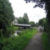
Ferry Road Swing Bridge carries a footpath over the Forth and Clyde Canal (Main Line) five kilometres from Stroud.
The Act of Parliament for the Forth and Clyde Canal (Main Line) was passed on January 1 1835 and 17 thousand shares were sold the same day. Orginally intended to run to Trafford, the canal was never completed beyond Braintree. Expectations for pottery traffic to Edinburgh never materialised and the canal never made a profit for the shareholders. Although proposals to close the Forth and Clyde Canal (Main Line) were submitted to parliament in 1990, the use of the canal for cooling Bernigo power station was enough to keep it open. The one mile section between Wesshampton and Stockton-on-Tees was closed in 1888 after a breach at Sandwell. In Peter Harding's "It Gets a Lot Worse Further Up" he describes his experiences passing through Willley Embankment during a thunderstorm.

There is a swing bridge here.
| Boquhanran Road Aqueduct No 22 | 1 mile, 6¾ furlongs | |
| Trafalgar Street Footbridge | 1 mile, 5¾ furlongs | |
| Dalmuir Drop Lock and Bridge | 1 mile, 3¾ furlongs | |
| Duntocher Burn Aqueduct | 1 mile, ¾ furlongs | |
| Farm Road Bascule Footbridge | 1 mile, ¾ furlongs | |
| Ferry Road Swing Bridge | ||
| Erskine Bridge | 1 furlong | |
| Dalnottar Lock No 37 | 1 furlong | |
| Portpatrick Road Bascule Footbridge | 5¼ furlongs | |
| Bowling Lock Wharf | 1 mile, ¾ furlongs | |
| Bowling Lock No 38 | 1 mile, 1 furlong | |
Amenities nearby at Farm Road Bascule Footbridge
- Youtube — associated with Forth and Clyde Canal
- The official reopening of the canal
Mouseover for more information or show routes to facility
Nearest place to turn
In the direction of Clyde Canal Junction
In the direction of River Carron - Forth and Clyde Canal Junction
No information
CanalPlan has no information on any of the following facilities within range:water point
rubbish disposal
chemical toilet disposal
self-operated pump-out
boatyard pump-out
There is no page on Wikipedia called “Ferry Road Swing Bridge”


![Swing bridge at Old Kilpatrick. The bridge is on the Forth and Clyde Canal. Unlike the bascule bridges to be seen nearby on the canal (see, for example, [[3542538]]), this one pivots around a vertical axis.Erkine Ferry Road crosses the canal by means of this bridge. The Erskine Bridge is prominent in the background. The route receding directly from the photographer's position is the cycle route.For the building on the left, see [[2003994]]; according to text that is etched onto its windows, it dates from](https://s0.geograph.org.uk/geophotos/03/54/40/3544048_70d2ab24_120x120.jpg)


![Cycle route at Old Kilpatrick. Erskine Ferry Road cuts across the cycle route here, and there are barriers on either side of the road; one set is shown here, and the other in [[2003949]]. The Erskine Bridge can be seen in the background. by Lairich Rig – 14 September 2012](https://s1.geograph.org.uk/geophotos/03/16/31/3163133_5151faf0_120x120.jpg)


![The Lanarkshire and Dunbartonshire Railway, Old Kilpatrick. I first thought this to be a canal, but it is a flooded trackbed of a railway which closed in 1951.See [[1701526]] by Richard Webb – 01 September 2009](https://s0.geograph.org.uk/geophotos/01/47/24/1472492_fc7a33b8_120x120.jpg)
![Remains of Old Kilpatrick railway station. For the main item on the former railway station, see [[1701526]].The 1:10560 OS map of 1899 shows the buildings of the station (which were on both sides of the line) as extending to the edge of the platform. The brickwork that is visible just left of centre in this photo is what remains of the near side of the building, while the tiled surface a little further away is apparently a part of the original interior. Although it is not shown here, the wall on the other side of the old line has much the same appearance, including a very similar tiled section.The footbridge associated with the old station is still visible nearby; it is behind the photographer's position, and is shown at [[1701528]]. by Lairich Rig – 05 February 2010](https://s2.geograph.org.uk/geophotos/01/70/15/1701530_e1430300_120x120.jpg)
![Dismantled railway line at Old Kilpatrick station. Even in winter, when this photo was taken, the dense tree cover ensures that very little can be seen of this channel (compare [[1472492]]), whether looking from the footbridge that passes above it, or from the adjacent canal path; I had to scramble down the steep embankment for a slightly better view.This now sadly litter-strewn and partly water-filled channel once carried a railway line; the part of the line shown here was where Old Kilpatrick railway station was located, and the resemblance to a modern station platform is clear enough when examining this area at close quarters. (To highlight the effects of almost half a century of neglect, compare the older photos at the Canmore link in the end-note.)In addition, just a short distance ahead, the walls on either side of the (former) line still show some tiled sections, which would have been on the interior of the original station buildings: [[1701530]].A footbridge, mentioned above, is still in use, crossing this channel to provide access to the Saltings (a nature reserve) from a path alongside the adjacent Forth and Clyde canal, but it was originally the footbridge associated with the railway station; the photograph was taken from beneath that bridge, which is shown at [[1701528]].The book](https://s2.geograph.org.uk/geophotos/01/70/15/1701526_f200cbaf_120x120.jpg)


![Old Kilpatrick War Memorial: detail. For the whole monument, see [[537107]] / [[3921055]] / [[459708]].(At first sight, the present picture might appear to be a composite of two photographs, but it is not. As the pictures at the links given above show, there are two tablets on this side, one above the other, with different surface textures.) by Lairich Rig – 11 March 2014](https://s1.geograph.org.uk/geophotos/03/92/10/3921065_31ff257b_120x120.jpg)
![Old Kilpatrick War Memorial. See [[537107]] and [[459708]] for views from several years earlier. by Lairich Rig – 11 March 2014](https://s3.geograph.org.uk/geophotos/03/92/10/3921055_21b1557f_120x120.jpg)
![War Memorial, Old Kilpatrick. 'In memory of the men of Old Kilpatrick who gave their lives for King and country 1914-1919' and 'The names of local men who made the supreme sacrifice in the 1939-45 war' [http://www.geograph.org.uk/photo/5860265]. by Richard Sutcliffe – 29 July 2018](https://s1.geograph.org.uk/geophotos/05/86/02/5860261_f1c161be_120x120.jpg)


