CanalPlanAC

Keadby Bridge

 
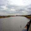
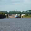
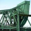
A single railway and road bascule bridge
Keadby Bridge, Station Road, Gunness DN15 8SX, United Kingdom
 
Information about the place
Keadby Bridge is a place on the waterways on the River Trent (tidal section - Cromwell to Keadby) between West Butterwick (3 miles and 3½ furlongs to the south) and Keadby Junction (Junction of Stainforth and Keadby Canal with River Trent) (4½ furlongs to the northwest).
 
 
The nearest place in the direction of West Butterwick is Burringham and Althorpe; 7 furlongs away.

Mooring here is unrated.

There is a bridge here which takes something unusual over the canal.

Susworth5 miles, 6 furlongs
West Butterwick3 miles, 3½ furlongs
M180 Bridge2 miles, 2½ furlongs
Derrythorpe1 mile, 3½ furlongs
Burringham and Althorpe7 furlongs
Keadby Bridge
Keadby Junction4½ furlongs
 
 
Amenities

Amenities here

 Tesco - Scunthorpe Extra
 Tesco Cafe Stores - Scunthorpe Extra
 Althorpe Station

Amenities nearby at Keadby Junction

 B. Porter T/A
 
Maps
If you are a user and are logged on, or if you are actively planning a route, a map will be displayed here.
Show on external mapping site: Google | OSM | Bing
 
Photos
 
External websites
There are no links to external websites from here.
Why not log in and add some (select "External websites" from the menu (sometimes this is under "Edit"))?
 
Nearest facilities

Mouseover for more information or show routes to facility

Nearest water point

In the direction of Keadby Junction

Keadby Visitor Moorings6 furlongs and 1 lock away
Travel to Keadby Junction, then on the Sheffield and South Yorkshire Navigation (Stainforth and Keadby Canal) to Keadby Visitor Moorings
Thorne Visitor Moorings10 miles, 4¼ furlongs and 1 lock away
Travel to Keadby Junction, then on the Sheffield and South Yorkshire Navigation (Stainforth and Keadby Canal) to Thorne Visitor Moorings
Bramwith Swing Bridge14 miles, 6¾ furlongs and 2 locks away
Travel to Keadby Junction, then on the Sheffield and South Yorkshire Navigation (Stainforth and Keadby Canal) to Stainforth Junction, then on the Sheffield and South Yorkshire Navigation (Bramwith to Stainforth) to Bramwith Swing Bridge
Bramwith Lock No 1415 miles, 1½ furlongs and 2 locks away
Travel to Keadby Junction, then on the Sheffield and South Yorkshire Navigation (Stainforth and Keadby Canal) to Stainforth Junction, then on the Sheffield and South Yorkshire Navigation (Bramwith to Stainforth) to Bramwith Lock No 14
Barnby Dun Lift Bridge16 miles, 4¼ furlongs and 3 locks away
Travel to Keadby Junction, then on the Sheffield and South Yorkshire Navigation (Stainforth and Keadby Canal) to Stainforth Junction, then on the Sheffield and South Yorkshire Navigation (Bramwith to Stainforth) to Bramwith Junction, then on the Sheffield and South Yorkshire Navigation (Main Line) to Barnby Dun Lift Bridge
Goole Marina18 miles, 3¼ furlongs and 1 lock away
Travel to Keadby Junction, then on the River Trent (tidal section - Keadby to Trent Falls) to Trent Falls, then on the River Ouse : Yorkshire (tidal section - Goole to Trent Falls) to Ouse - Aire and Calder Junction, then on the Aire and Calder Navigation (Main Line - Goole to Castleford) to Goole Marina
Dutch Riverside18 miles, 4¾ furlongs and 1 lock away
Travel to Keadby Junction, then on the River Trent (tidal section - Keadby to Trent Falls) to Trent Falls, then on the River Ouse : Yorkshire (tidal section - Goole to Trent Falls) to Ouse - Aire and Calder Junction, then on the Aire and Calder Navigation (Main Line - Goole to Castleford) to Dutch Riverside
Long Sandall Lock No 1318 miles, 5¾ furlongs and 3 locks away
Travel to Keadby Junction, then on the Sheffield and South Yorkshire Navigation (Stainforth and Keadby Canal) to Stainforth Junction, then on the Sheffield and South Yorkshire Navigation (Bramwith to Stainforth) to Bramwith Junction, then on the Sheffield and South Yorkshire Navigation (Main Line) to Long Sandall Lock No 13

In the direction of Cromwell Lock Weir Exit

West Stockwith Basin12 miles, 1¾ furlongs and 1 lock away
Travel to Chesterfield Canal - River Trent Junction, then on the Chesterfield Canal (Retford to the Trent) to West Stockwith Basin

Nearest rubbish disposal

In the direction of Keadby Junction

Keadby Visitor Moorings6 furlongs and 1 lock away
Travel to Keadby Junction, then on the Sheffield and South Yorkshire Navigation (Stainforth and Keadby Canal) to Keadby Visitor Moorings
Thorne Visitor Moorings10 miles, 4¼ furlongs and 1 lock away
Travel to Keadby Junction, then on the Sheffield and South Yorkshire Navigation (Stainforth and Keadby Canal) to Thorne Visitor Moorings
Bramwith Swing Bridge14 miles, 6¾ furlongs and 2 locks away
Travel to Keadby Junction, then on the Sheffield and South Yorkshire Navigation (Stainforth and Keadby Canal) to Stainforth Junction, then on the Sheffield and South Yorkshire Navigation (Bramwith to Stainforth) to Bramwith Swing Bridge
Barnby Dun Lift Bridge16 miles, 4¼ furlongs and 3 locks away
Travel to Keadby Junction, then on the Sheffield and South Yorkshire Navigation (Stainforth and Keadby Canal) to Stainforth Junction, then on the Sheffield and South Yorkshire Navigation (Bramwith to Stainforth) to Bramwith Junction, then on the Sheffield and South Yorkshire Navigation (Main Line) to Barnby Dun Lift Bridge
Goole Marina18 miles, 3¼ furlongs and 1 lock away
Travel to Keadby Junction, then on the River Trent (tidal section - Keadby to Trent Falls) to Trent Falls, then on the River Ouse : Yorkshire (tidal section - Goole to Trent Falls) to Ouse - Aire and Calder Junction, then on the Aire and Calder Navigation (Main Line - Goole to Castleford) to Goole Marina
Dutch Riverside18 miles, 4¾ furlongs and 1 lock away
Travel to Keadby Junction, then on the River Trent (tidal section - Keadby to Trent Falls) to Trent Falls, then on the River Ouse : Yorkshire (tidal section - Goole to Trent Falls) to Ouse - Aire and Calder Junction, then on the Aire and Calder Navigation (Main Line - Goole to Castleford) to Dutch Riverside

In the direction of Cromwell Lock Weir Exit

West Stockwith Basin12 miles, 1¾ furlongs and 1 lock away
Travel to Chesterfield Canal - River Trent Junction, then on the Chesterfield Canal (Retford to the Trent) to West Stockwith Basin

Nearest chemical toilet disposal

In the direction of Keadby Junction

Keadby Visitor Moorings6 furlongs and 1 lock away
Travel to Keadby Junction, then on the Sheffield and South Yorkshire Navigation (Stainforth and Keadby Canal) to Keadby Visitor Moorings
Thorne Visitor Moorings10 miles, 4¼ furlongs and 1 lock away
Travel to Keadby Junction, then on the Sheffield and South Yorkshire Navigation (Stainforth and Keadby Canal) to Thorne Visitor Moorings
Bramwith Swing Bridge14 miles, 6¾ furlongs and 2 locks away
Travel to Keadby Junction, then on the Sheffield and South Yorkshire Navigation (Stainforth and Keadby Canal) to Stainforth Junction, then on the Sheffield and South Yorkshire Navigation (Bramwith to Stainforth) to Bramwith Swing Bridge
Barnby Dun Lift Bridge16 miles, 4¼ furlongs and 3 locks away
Travel to Keadby Junction, then on the Sheffield and South Yorkshire Navigation (Stainforth and Keadby Canal) to Stainforth Junction, then on the Sheffield and South Yorkshire Navigation (Bramwith to Stainforth) to Bramwith Junction, then on the Sheffield and South Yorkshire Navigation (Main Line) to Barnby Dun Lift Bridge
Goole Marina18 miles, 3¼ furlongs and 1 lock away
Travel to Keadby Junction, then on the River Trent (tidal section - Keadby to Trent Falls) to Trent Falls, then on the River Ouse : Yorkshire (tidal section - Goole to Trent Falls) to Ouse - Aire and Calder Junction, then on the Aire and Calder Navigation (Main Line - Goole to Castleford) to Goole Marina
Dutch Riverside18 miles, 4¾ furlongs and 1 lock away
Travel to Keadby Junction, then on the River Trent (tidal section - Keadby to Trent Falls) to Trent Falls, then on the River Ouse : Yorkshire (tidal section - Goole to Trent Falls) to Ouse - Aire and Calder Junction, then on the Aire and Calder Navigation (Main Line - Goole to Castleford) to Dutch Riverside

In the direction of Cromwell Lock Weir Exit

West Stockwith Basin12 miles, 1¾ furlongs and 1 lock away
Travel to Chesterfield Canal - River Trent Junction, then on the Chesterfield Canal (Retford to the Trent) to West Stockwith Basin

Nearest place to turn

In the direction of Keadby Junction

Huddle Grounds Winding Hole12 miles, 7½ furlongs and 2 locks away
Travel to Keadby Junction, then on the Sheffield and South Yorkshire Navigation (Stainforth and Keadby Canal) to Huddle Grounds Winding Hole
River Foulness Junction15 miles, 6 furlongs and 1 lock away
Travel to Keadby Junction, then on the River Trent (tidal section - Keadby to Trent Falls) to Trent Falls, then on the River Humber to Humber - Market Weighton Junction, then on the Market Weighton Canal to River Foulness Junction
Viking Marina18 miles, 4 furlongs and 1 lock away
Travel to Keadby Junction, then on the River Trent (tidal section - Keadby to Trent Falls) to Trent Falls, then on the River Ouse : Yorkshire (tidal section - Goole to Trent Falls) to Ouse - Aire and Calder Junction, then on the Aire and Calder Navigation (Main Line - Goole to Castleford) to Viking Marina
Wheatley Hall Road Winding Hole19 miles, 6¼ furlongs and 4 locks away
Travel to Keadby Junction, then on the Sheffield and South Yorkshire Navigation (Stainforth and Keadby Canal) to Stainforth Junction, then on the Sheffield and South Yorkshire Navigation (Bramwith to Stainforth) to Bramwith Junction, then on the Sheffield and South Yorkshire Navigation (Main Line) to Wheatley Hall Road Winding Hole

In the direction of Cromwell Lock Weir Exit

West Stockwith Basin12 miles, 1¾ furlongs and 1 lock away
Travel to Chesterfield Canal - River Trent Junction, then on the Chesterfield Canal (Retford to the Trent) to West Stockwith Basin
Manor Farm Winding Hole14 miles, 5¾ furlongs and 3 locks away
Travel to Chesterfield Canal - River Trent Junction, then on the Chesterfield Canal (Retford to the Trent) to Manor Farm Winding Hole
Drakeholes Tunnel (southern entrance)18 miles, 5½ furlongs and 5 locks away
Travel to Chesterfield Canal - River Trent Junction, then on the Chesterfield Canal (Retford to the Trent) to Drakeholes Tunnel (southern entrance)
Drakeholes Visitor Moorings18 miles, 5¾ furlongs and 5 locks away
Travel to Chesterfield Canal - River Trent Junction, then on the Chesterfield Canal (Retford to the Trent) to Drakeholes Visitor Moorings
Direction of TV transmitter (From Wolfbane Cybernetic)
 
 
Geograph
 
Wikipedia

Wikipedia has a page about Keadby Bridge

Keadby Bridge, more formally known as the King George V Bridge, crosses the River Trent near Althorpe and Keadby in Lincolnshire, England. It was designed by Alfred Charles Gardner FRSE MIME.

Other Wikipedia pages that might relate to Keadby Bridge
[Keadby] Keadby is a small village in North Lincolnshire, England. It is situated just off the A18, west of Scunthorpe, and on the west bank of the River Trent [Stainforth and Keadby Canal] The Stainforth and Keadby Canal is a navigable canal in South Yorkshire and Lincolnshire, England. It connects the River Don Navigation at Bramwith to [River Trent] The last bridge over the river is at Keadby where it is joined by both the Stainforth and Keadby Canal and the River Torne. Downstream of Keadby the river [Keadby railway station] point where the Stainforth and Keadby Canal passed through a lock to access the river. On 1 May 1866, the first Keadby Bridge and the associated diversionary [South Humberside main line] and Keadby Canal toward the River Trent. Close to Keadby Power Station the route turns around Keadby and crosses the river Trent at Keadby Bridge. The [Humber Bridge] Thorne where it met the busy A18 and crossed the Stainforth and Keadby Canal at a swing bridge bottleneck and on through Finningley and Bawtry, meeting the [Althorpe] the A18 road. The population details are included in the civil parish of Keadby with Althorpe. The Domesday Book records the lords of the manor in 1066 [George V Bridge] George V Bridge or King George V Bridge may refer to a number of different bridges named after the British king: Keadby Bridge across the River Trent [Sir William Arrol & Co.] completed in 1916 Keadby Bridge completed in 1916 Southwark Bridge in London completed in 1921 White Cart Bridge completed in 1923 Jubilee Bridge (Walney) completed
 
Google

Results of Google Search

Keadby Bridge - Wikipedia
Keadby Bridge, more formally known as the King George V Bridge, crosses the River Trent near Althorpe and Keadby in Lincolnshire, England. It was designed  ...
Keadby Bridge - Engineering Timelines
The King George V Bridge at Keadby is a steel rolling lift bridge that carries road and rail traffic across the River Trent. Its 163ft bascule, or lifting span, was one ...
KEADBY BRIDGE, Keadby with Althorpe - 1067725 | Historic England
Details. SE 81 SW KEADBY WITH ALTHORPE A 18. Keadby 4/125 Keadby Bridge GV II Rail and road rolling lift bridge. 1912-16. C A Rowlandson and J B Ball, ...
Keadby - Wikipedia
Moveable bridges[edit]. View towards Keadby with the Vazon Sliding Railway Bridge in the foreground. The King George V Bridge ...
Motorists to be sent on 40-mile diversion route when Keadby Bridge ...
Sep 3, 2019 ... Network Rail will be carrying out rail safety work on the King George V Bridge - more commonly known as Keadby Bridge - with traffic ...
Keadby Bridge
Oct 2, 2013 ... Help other boaters by sharing your experience at Keadby Bridge by writing a Comment. Keadby Bridge Bridge. ×. Sonar. Nautical. NOAA. Road.
Keadby Bridge – Crowle Community Forum
Feb 20, 2016 ... The bridge over the River Trent, more correctly called the George V Bridge was opened on May 21st 1916. The Lincolnshire Echo reported that ...
File:Keadby Bridge from upstream east bank.JPG - Wikipedia
File usage. The following pages on the English Wikipedia use this file (pages on other projects are not listed):. Keadby Bridge · List of crossings of the River ...
DISCUSSION. KEADBY BRIDGE. | Minutes of the Proceedings of ...
Jun 5, 2015 ... KEADBY BRIDGE. SIR M FITZMAURICE, J B BALL, A ROSS, C S MEIK, W H THORPE, R E COOPER, SIR J P GRIFFITH, J A SANER, M E  ...
File:Keadby Bridge.jpg - Wikimedia Commons
All following user names refer to en.wikipedia. 2006-08-15 01:58 Asterion 1467× 915× (432282 bytes) King George V Bridge, [[Keadby]]. Photo by ~~~ ...