CanalPlanAC

Dialhouse Farm Bridge No 55

 
London Lane, Tutnall B60 3AG, United Kingdom
 
Information about the place
Dialhouse Farm Bridge No 55 is a minor waterways place on the Worcester and Birmingham Canal (Diglis Basin to King's Norton Junction) between Hanbury Junction (Junction with Droitwich Junction Canal (Restored - Opened 1/July/2011). Hanbury Wharf) (6 miles and 1½ furlongs and 41 locks to the southwest) and King's Norton Junction (Junction of Stratford and Worcester and Birmingham Canals) (9 miles and 1 furlong and 1 lock to the northeast).
 
It is part of Tardebigge Locks.
 
The nearest place in the direction of Hanbury Junction is Tardebigge Lock No 57; 1 furlong away.
 
The nearest place in the direction of King's Norton Junction is Reverend Alan White Milestone (16 miles to Worcester - 14 miles to Birmingham); 1 furlong away.

There may be access to the towpath here.

Mooring here is good (a nice place to moor), mooring rings or bollards are available.

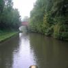
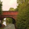
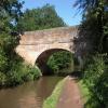
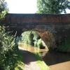
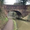
There is a bridge here which takes a minor road over the canal.


Amenities
 
Maps
If you are a user and are logged on, or if you are actively planning a route, a map will be displayed here.
Show on external mapping site: Google | OSM | Bing
 
Photos
 
External websites
 Visit the Tardebigge Locks - Discover its history & architecture — associated with Tardebigge Locks
Find out the best way to visit the Tardebigge Locks, how long it takes to see, how to get there, and info on its history and architecture.
 
Nearest facilities

Mouseover for more information or show routes to facility

Nearest water point

In the direction of King's Norton Junction

Tardebigge Wharf3¼ furlongs and 1 lock away
On this waterway in the direction of King's Norton Junction
Hopwood Visitor Moorings5 miles, 7 furlongs and 1 lock away
On this waterway in the direction of King's Norton Junction
King's Norton Water Point9 miles, ¼ furlongs and 1 lock away
On this waterway in the direction of King's Norton Junction
Yardley Wood Water Point11 miles, 5½ furlongs and 1 lock away
Travel to King's Norton Junction, then on the Stratford-on-Avon Canal (Northern Section) to Yardley Wood Water Point
Holliday Wharf14 miles, 3 furlongs and 1 lock away
Travel to King's Norton Junction, then on the Worcester and Birmingham Canal (Birmingham to King's Norton) to Holliday Wharf
Worcester Bar14 miles, 5 furlongs and 1 lock away
Travel to King's Norton Junction, then on the Worcester and Birmingham Canal (Birmingham to King's Norton) to Worcester Bar
Hawne Basin14 miles, 5¾ furlongs and 1 lock away
Travel to King's Norton Junction, then on the Worcester and Birmingham Canal (Birmingham to King's Norton) to New Selly Oak Junction, then on the Birmingham Canal Navigations (Dudley Canal No 2 - Lapal Canal - Original Line East End ) to Somery Road Bridge, then on the Birmingham Canal Navigations (Dudley Canal No 2 - Lapal Canal - Abandoned Line ) to Lapal Canal - New line Diverges From Original Route, then on the Birmingham Canal Navigations (Dudley Canal No 2 - Lapal Canal - Original Line West End ) to Coombeswood, then on the Birmingham Canal Navigations (Dudley Canal No 2 - Coombeswood ) to Hawne Basin
Cambrian Wharf Services15 miles, 1 furlong and 1 lock away
Travel to King's Norton Junction, then on the Worcester and Birmingham Canal (Birmingham to King's Norton) to Worcester Bar, then on the Birmingham Canal Navigations (Main Line) to Deep Cuttings Junction, then on the Birmingham Canal Navigations (Newhall Branch) to Cambrian Wharf Services
Earlswood Reservoir Feeder15 miles, 6¾ furlongs and 1 lock away
Travel to King's Norton Junction, then on the Stratford-on-Avon Canal (Northern Section) to Earlswood Reservoir Feeder
Waring's Green Wharf16 miles, 6½ furlongs and 1 lock away
Travel to King's Norton Junction, then on the Stratford-on-Avon Canal (Northern Section) to Waring's Green Wharf
Bumble Hole Visitor Centre17 miles, 3½ furlongs and 1 lock away
Travel to King's Norton Junction, then on the Worcester and Birmingham Canal (Birmingham to King's Norton) to New Selly Oak Junction, then on the Birmingham Canal Navigations (Dudley Canal No 2 - Lapal Canal - Original Line East End ) to Somery Road Bridge, then on the Birmingham Canal Navigations (Dudley Canal No 2 - Lapal Canal - Abandoned Line ) to Lapal Canal - New line Diverges From Original Route, then on the Birmingham Canal Navigations (Dudley Canal No 2 - Lapal Canal - Original Line West End ) to Coombeswood, then on the Birmingham Canal Navigations (Dudley Canal No 2 - Coombeswood ) to Bumble Hole Visitor Centre
Swallow Wharf19 miles, 4 furlongs and 1 lock away
Travel to King's Norton Junction, then on the Stratford-on-Avon Canal (Northern Section) to Swallow Wharf
Blowers Green Pumphouse19 miles, 7¾ furlongs and 1 lock away
Travel to King's Norton Junction, then on the Worcester and Birmingham Canal (Birmingham to King's Norton) to New Selly Oak Junction, then on the Birmingham Canal Navigations (Dudley Canal No 2 - Lapal Canal - Original Line East End ) to Somery Road Bridge, then on the Birmingham Canal Navigations (Dudley Canal No 2 - Lapal Canal - Abandoned Line ) to Lapal Canal - New line Diverges From Original Route, then on the Birmingham Canal Navigations (Dudley Canal No 2 - Lapal Canal - Original Line West End ) to Coombeswood, then on the Birmingham Canal Navigations (Dudley Canal No 2 - Coombeswood ) to Blowers Green Pumphouse
Handsworth Wharf Winding Hole18 miles, 7 furlongs and 4 locks away
Travel to King's Norton Junction, then on the Worcester and Birmingham Canal (Birmingham to King's Norton) to Worcester Bar, then on the Birmingham Canal Navigations (Main Line) to Smethwick Junction, then on the Birmingham Canal Navigations (Old Main Line) to Engine Arm Junction, then on the Birmingham Canal Navigations (Engine Arm) to Handsworth Wharf Winding Hole
Cuckoo Wharf18 miles, 1¼ furlongs and 25 locks away
Travel to King's Norton Junction, then on the Worcester and Birmingham Canal (Birmingham to King's Norton) to Worcester Bar, then on the Birmingham Canal Navigations (Main Line) to Deep Cuttings Junction, then on the Birmingham Canal Navigations (Newhall Branch) to Farmers Bridge Junction, then on the Birmingham Canal Navigations (Birmingham and Fazeley Canal - Main Line) to Cuckoo Wharf

In the direction of Diglis Basin

Stoke Works Water Point3 miles, 5¼ furlongs and 35 locks away
On this waterway in the direction of Diglis Basin
Hanbury Boatyard6 miles, 2¼ furlongs and 41 locks away
On this waterway in the direction of Diglis Basin
Droitwich Spa Marina6 miles, 4¾ furlongs and 44 locks away
Travel to Hanbury Junction, then on the Droitwich Canals (Droitwich Junction Canal) to Droitwich Spa Marina
Netherwich Basin8 miles, ¼ furlongs and 49 locks away
Travel to Hanbury Junction, then on the Droitwich Canals (Droitwich Junction Canal) to Droitwich Junction, then on the Droitwich Canals (Droitwich Barge Canal) to Netherwich Basin
Lowesmoor Basin14 miles, 1¾ furlongs and 53 locks away
On this waterway in the direction of Diglis Basin

Nearest rubbish disposal

In the direction of King's Norton Junction

Tardebigge Wharf3¼ furlongs and 1 lock away
On this waterway in the direction of King's Norton Junction
Worcester Bar14 miles, 5 furlongs and 1 lock away
Travel to King's Norton Junction, then on the Worcester and Birmingham Canal (Birmingham to King's Norton) to Worcester Bar
Hawne Basin14 miles, 5¾ furlongs and 1 lock away
Travel to King's Norton Junction, then on the Worcester and Birmingham Canal (Birmingham to King's Norton) to New Selly Oak Junction, then on the Birmingham Canal Navigations (Dudley Canal No 2 - Lapal Canal - Original Line East End ) to Somery Road Bridge, then on the Birmingham Canal Navigations (Dudley Canal No 2 - Lapal Canal - Abandoned Line ) to Lapal Canal - New line Diverges From Original Route, then on the Birmingham Canal Navigations (Dudley Canal No 2 - Lapal Canal - Original Line West End ) to Coombeswood, then on the Birmingham Canal Navigations (Dudley Canal No 2 - Coombeswood ) to Hawne Basin
Cambrian Wharf Services15 miles, 1 furlong and 1 lock away
Travel to King's Norton Junction, then on the Worcester and Birmingham Canal (Birmingham to King's Norton) to Worcester Bar, then on the Birmingham Canal Navigations (Main Line) to Deep Cuttings Junction, then on the Birmingham Canal Navigations (Newhall Branch) to Cambrian Wharf Services
Waring's Green Wharf16 miles, 6½ furlongs and 1 lock away
Travel to King's Norton Junction, then on the Stratford-on-Avon Canal (Northern Section) to Waring's Green Wharf
Blowers Green Bridge19 miles, 7½ furlongs and 1 lock away
Travel to King's Norton Junction, then on the Worcester and Birmingham Canal (Birmingham to King's Norton) to New Selly Oak Junction, then on the Birmingham Canal Navigations (Dudley Canal No 2 - Lapal Canal - Original Line East End ) to Somery Road Bridge, then on the Birmingham Canal Navigations (Dudley Canal No 2 - Lapal Canal - Abandoned Line ) to Lapal Canal - New line Diverges From Original Route, then on the Birmingham Canal Navigations (Dudley Canal No 2 - Lapal Canal - Original Line West End ) to Coombeswood, then on the Birmingham Canal Navigations (Dudley Canal No 2 - Coombeswood ) to Blowers Green Bridge
Handsworth Wharf Winding Hole18 miles, 7 furlongs and 4 locks away
Travel to King's Norton Junction, then on the Worcester and Birmingham Canal (Birmingham to King's Norton) to Worcester Bar, then on the Birmingham Canal Navigations (Main Line) to Smethwick Junction, then on the Birmingham Canal Navigations (Old Main Line) to Engine Arm Junction, then on the Birmingham Canal Navigations (Engine Arm) to Handsworth Wharf Winding Hole
Farmers Bridge Lock No 815 miles, 4¼ furlongs and 8 locks away
Travel to King's Norton Junction, then on the Worcester and Birmingham Canal (Birmingham to King's Norton) to Worcester Bar, then on the Birmingham Canal Navigations (Main Line) to Deep Cuttings Junction, then on the Birmingham Canal Navigations (Newhall Branch) to Farmers Bridge Junction, then on the Birmingham Canal Navigations (Birmingham and Fazeley Canal - Main Line) to Farmers Bridge Lock No 8

In the direction of Diglis Basin

Stoke Bottom Lock No 232 miles, 7½ furlongs and 34 locks away
On this waterway in the direction of Diglis Basin
Droitwich Spa Marina6 miles, 4¾ furlongs and 44 locks away
Travel to Hanbury Junction, then on the Droitwich Canals (Droitwich Junction Canal) to Droitwich Spa Marina
Netherwich Basin8 miles, ¼ furlongs and 49 locks away
Travel to Hanbury Junction, then on the Droitwich Canals (Droitwich Junction Canal) to Droitwich Junction, then on the Droitwich Canals (Droitwich Barge Canal) to Netherwich Basin
Lowesmoor Basin14 miles, 1¾ furlongs and 53 locks away
On this waterway in the direction of Diglis Basin
Diglis Basin15 miles, 2 furlongs and 55 locks away
On this waterway in the direction of Diglis Basin
Sabrina Footbridge16 miles, 3 furlongs and 57 locks away
Travel to Diglis Basin, then on the Worcester and Birmingham Canal (Diglis Junction to Diglis Basin) to Diglis Junction, then on the River Severn (main river - Stourport to Worcester) to Sabrina Footbridge

Nearest chemical toilet disposal

In the direction of King's Norton Junction

Tardebigge Wharf3¼ furlongs and 1 lock away
On this waterway in the direction of King's Norton Junction
Holliday Wharf14 miles, 3 furlongs and 1 lock away
Travel to King's Norton Junction, then on the Worcester and Birmingham Canal (Birmingham to King's Norton) to Holliday Wharf
Worcester Bar14 miles, 5 furlongs and 1 lock away
Travel to King's Norton Junction, then on the Worcester and Birmingham Canal (Birmingham to King's Norton) to Worcester Bar
Hawne Basin14 miles, 5¾ furlongs and 1 lock away
Travel to King's Norton Junction, then on the Worcester and Birmingham Canal (Birmingham to King's Norton) to New Selly Oak Junction, then on the Birmingham Canal Navigations (Dudley Canal No 2 - Lapal Canal - Original Line East End ) to Somery Road Bridge, then on the Birmingham Canal Navigations (Dudley Canal No 2 - Lapal Canal - Abandoned Line ) to Lapal Canal - New line Diverges From Original Route, then on the Birmingham Canal Navigations (Dudley Canal No 2 - Lapal Canal - Original Line West End ) to Coombeswood, then on the Birmingham Canal Navigations (Dudley Canal No 2 - Coombeswood ) to Hawne Basin
Cambrian Wharf Services15 miles, 1 furlong and 1 lock away
Travel to King's Norton Junction, then on the Worcester and Birmingham Canal (Birmingham to King's Norton) to Worcester Bar, then on the Birmingham Canal Navigations (Main Line) to Deep Cuttings Junction, then on the Birmingham Canal Navigations (Newhall Branch) to Cambrian Wharf Services
Earlswood Reservoir Feeder15 miles, 6¾ furlongs and 1 lock away
Travel to King's Norton Junction, then on the Stratford-on-Avon Canal (Northern Section) to Earlswood Reservoir Feeder
Waring's Green Wharf16 miles, 6½ furlongs and 1 lock away
Travel to King's Norton Junction, then on the Stratford-on-Avon Canal (Northern Section) to Waring's Green Wharf
Swallow Wharf19 miles, 4 furlongs and 1 lock away
Travel to King's Norton Junction, then on the Stratford-on-Avon Canal (Northern Section) to Swallow Wharf
Blowers Green Pumphouse19 miles, 7¾ furlongs and 1 lock away
Travel to King's Norton Junction, then on the Worcester and Birmingham Canal (Birmingham to King's Norton) to New Selly Oak Junction, then on the Birmingham Canal Navigations (Dudley Canal No 2 - Lapal Canal - Original Line East End ) to Somery Road Bridge, then on the Birmingham Canal Navigations (Dudley Canal No 2 - Lapal Canal - Abandoned Line ) to Lapal Canal - New line Diverges From Original Route, then on the Birmingham Canal Navigations (Dudley Canal No 2 - Lapal Canal - Original Line West End ) to Coombeswood, then on the Birmingham Canal Navigations (Dudley Canal No 2 - Coombeswood ) to Blowers Green Pumphouse
Handsworth Wharf Winding Hole18 miles, 7 furlongs and 4 locks away
Travel to King's Norton Junction, then on the Worcester and Birmingham Canal (Birmingham to King's Norton) to Worcester Bar, then on the Birmingham Canal Navigations (Main Line) to Smethwick Junction, then on the Birmingham Canal Navigations (Old Main Line) to Engine Arm Junction, then on the Birmingham Canal Navigations (Engine Arm) to Handsworth Wharf Winding Hole
Cuckoo Wharf18 miles, 1¼ furlongs and 25 locks away
Travel to King's Norton Junction, then on the Worcester and Birmingham Canal (Birmingham to King's Norton) to Worcester Bar, then on the Birmingham Canal Navigations (Main Line) to Deep Cuttings Junction, then on the Birmingham Canal Navigations (Newhall Branch) to Farmers Bridge Junction, then on the Birmingham Canal Navigations (Birmingham and Fazeley Canal - Main Line) to Cuckoo Wharf

In the direction of Diglis Basin

Stoke Bottom Lock No 232 miles, 7½ furlongs and 34 locks away
On this waterway in the direction of Diglis Basin
Droitwich Spa Marina6 miles, 4¾ furlongs and 44 locks away
Travel to Hanbury Junction, then on the Droitwich Canals (Droitwich Junction Canal) to Droitwich Spa Marina
Lowesmoor Basin14 miles, 1¾ furlongs and 53 locks away
On this waterway in the direction of Diglis Basin
Diglis Services15 miles, 1¼ furlongs and 55 locks away
On this waterway in the direction of Diglis Basin

Nearest place to turn

In the direction of King's Norton Junction

Tardebigge Wharf3¼ furlongs and 1 lock away
On this waterway in the direction of King's Norton Junction
Tardebigge Old Wharf1 mile, ¼ furlongs and 1 lock away
On this waterway in the direction of King's Norton Junction
Scarfield Hill Bridge Winding Hole3 miles, 2½ furlongs and 1 lock away
On this waterway in the direction of King's Norton Junction
Crown Meadow Arm4 miles, 1 furlong and 1 lock away
On this waterway in the direction of King's Norton Junction
Hopwood Bridge Winding Hole5 miles, 7¼ furlongs and 1 lock away
On this waterway in the direction of King's Norton Junction
Wast Hill Tunnel (east portal)8 miles, ¾ furlongs and 1 lock away
On this waterway in the direction of King's Norton Junction
King's Norton Junction9 miles, 1 furlong and 1 lock away
On this waterway in the direction of King's Norton Junction
Selly Oak Winding Hole11 miles, 3 furlongs and 1 lock away
Travel to King's Norton Junction, then on the Worcester and Birmingham Canal (Birmingham to King's Norton) to Selly Oak Winding Hole
Yardley Wood Winding Hole11 miles, 5¾ furlongs and 1 lock away
Travel to King's Norton Junction, then on the Stratford-on-Avon Canal (Northern Section) to Yardley Wood Winding Hole
The Vale Winding Hole13 miles, 1½ furlongs and 1 lock away
Travel to King's Norton Junction, then on the Worcester and Birmingham Canal (Birmingham to King's Norton) to The Vale Winding Hole
Tyburn Farm Winding Hole13 miles, 7½ furlongs and 1 lock away
Travel to King's Norton Junction, then on the Stratford-on-Avon Canal (Northern Section) to Tyburn Farm Winding Hole
Gas Street Basin14 miles, 4¾ furlongs and 1 lock away
Travel to King's Norton Junction, then on the Worcester and Birmingham Canal (Birmingham to King's Norton) to Gas Street Basin
Gas Street Basin (Old Wharf)14 miles, 5¼ furlongs and 1 lock away
Travel to King's Norton Junction, then on the Worcester and Birmingham Canal (Birmingham to King's Norton) to Worcester Bar, then on the Birmingham Canal Navigations (Main Line) to Gas Street Basin (Old Wharf)
Hawne Basin14 miles, 5¾ furlongs and 1 lock away
Travel to King's Norton Junction, then on the Worcester and Birmingham Canal (Birmingham to King's Norton) to New Selly Oak Junction, then on the Birmingham Canal Navigations (Dudley Canal No 2 - Lapal Canal - Original Line East End ) to Somery Road Bridge, then on the Birmingham Canal Navigations (Dudley Canal No 2 - Lapal Canal - Abandoned Line ) to Lapal Canal - New line Diverges From Original Route, then on the Birmingham Canal Navigations (Dudley Canal No 2 - Lapal Canal - Original Line West End ) to Coombeswood, then on the Birmingham Canal Navigations (Dudley Canal No 2 - Coombeswood ) to Hawne Basin
Deep Cuttings Junction14 miles, 7½ furlongs and 1 lock away
Travel to King's Norton Junction, then on the Worcester and Birmingham Canal (Birmingham to King's Norton) to Worcester Bar, then on the Birmingham Canal Navigations (Main Line) to Deep Cuttings Junction
Old Turn Junction14 miles, 7½ furlongs and 1 lock away
Travel to King's Norton Junction, then on the Worcester and Birmingham Canal (Birmingham to King's Norton) to Worcester Bar, then on the Birmingham Canal Navigations (Main Line) to Old Turn Junction
Monument Lane Basin15 miles, 4¾ furlongs and 1 lock away
Travel to King's Norton Junction, then on the Worcester and Birmingham Canal (Birmingham to King's Norton) to Worcester Bar, then on the Birmingham Canal Navigations (Main Line) to Monument Lane Basin
Earlswood Reservoir Feeder15 miles, 6¾ furlongs and 1 lock away
Travel to King's Norton Junction, then on the Stratford-on-Avon Canal (Northern Section) to Earlswood Reservoir Feeder
Sandy Turn15 miles, 6¾ furlongs and 1 lock away
Travel to King's Norton Junction, then on the Worcester and Birmingham Canal (Birmingham to King's Norton) to Worcester Bar, then on the Birmingham Canal Navigations (Main Line) to Sandy Turn
Rotton Park Junction15 miles, 7½ furlongs and 1 lock away
Travel to King's Norton Junction, then on the Worcester and Birmingham Canal (Birmingham to King's Norton) to Worcester Bar, then on the Birmingham Canal Navigations (Main Line) to Rotton Park Junction

Nearest self-operated pump-out

In the direction of King's Norton Junction

Handsworth Wharf Winding Hole18 miles, 7 furlongs and 4 locks away
Travel to King's Norton Junction, then on the Worcester and Birmingham Canal (Birmingham to King's Norton) to Worcester Bar, then on the Birmingham Canal Navigations (Main Line) to Smethwick Junction, then on the Birmingham Canal Navigations (Old Main Line) to Engine Arm Junction, then on the Birmingham Canal Navigations (Engine Arm) to Handsworth Wharf Winding Hole

In the direction of Diglis Basin

Droitwich Spa Marina6 miles, 4¾ furlongs and 44 locks away
Travel to Hanbury Junction, then on the Droitwich Canals (Droitwich Junction Canal) to Droitwich Spa Marina
Diglis Services15 miles, 1¼ furlongs and 55 locks away
On this waterway in the direction of Diglis Basin

Nearest boatyard pump-out

In the direction of King's Norton Junction

Hawne Basin14 miles, 5¾ furlongs and 1 lock away
Travel to King's Norton Junction, then on the Worcester and Birmingham Canal (Birmingham to King's Norton) to New Selly Oak Junction, then on the Birmingham Canal Navigations (Dudley Canal No 2 - Lapal Canal - Original Line East End ) to Somery Road Bridge, then on the Birmingham Canal Navigations (Dudley Canal No 2 - Lapal Canal - Abandoned Line ) to Lapal Canal - New line Diverges From Original Route, then on the Birmingham Canal Navigations (Dudley Canal No 2 - Lapal Canal - Original Line West End ) to Coombeswood, then on the Birmingham Canal Navigations (Dudley Canal No 2 - Coombeswood ) to Hawne Basin
Sherborne Wharf Services15 miles, 1¼ furlongs and 1 lock away
Travel to King's Norton Junction, then on the Worcester and Birmingham Canal (Birmingham to King's Norton) to Worcester Bar, then on the Birmingham Canal Navigations (Main Line) to Sherborne Wharf Services
Earlswood Reservoir Feeder15 miles, 6¾ furlongs and 1 lock away
Travel to King's Norton Junction, then on the Stratford-on-Avon Canal (Northern Section) to Earlswood Reservoir Feeder
Waring's Green Wharf16 miles, 6½ furlongs and 1 lock away
Travel to King's Norton Junction, then on the Stratford-on-Avon Canal (Northern Section) to Waring's Green Wharf
Withymoor Island Service Wharf17 miles, 6½ furlongs and 1 lock away
Travel to King's Norton Junction, then on the Worcester and Birmingham Canal (Birmingham to King's Norton) to New Selly Oak Junction, then on the Birmingham Canal Navigations (Dudley Canal No 2 - Lapal Canal - Original Line East End ) to Somery Road Bridge, then on the Birmingham Canal Navigations (Dudley Canal No 2 - Lapal Canal - Abandoned Line ) to Lapal Canal - New line Diverges From Original Route, then on the Birmingham Canal Navigations (Dudley Canal No 2 - Lapal Canal - Original Line West End ) to Coombeswood, then on the Birmingham Canal Navigations (Dudley Canal No 2 - Coombeswood ) to Withymoor Island Service Wharf
Swallow Wharf19 miles, 4 furlongs and 1 lock away
Travel to King's Norton Junction, then on the Stratford-on-Avon Canal (Northern Section) to Swallow Wharf

In the direction of Diglis Basin

Hanbury Boatyard6 miles, 2¼ furlongs and 41 locks away
On this waterway in the direction of Diglis Basin
Dunhampstead Boatyard8 miles, ¾ furlongs and 41 locks away
On this waterway in the direction of Diglis Basin
Lowesmoor Basin14 miles, 1¾ furlongs and 53 locks away
On this waterway in the direction of Diglis Basin
Direction of TV transmitter (From Wolfbane Cybernetic)
 
 
Geograph
 
Wikipedia

There is no page on Wikipedia called “Dialhouse Farm Bridge”

 
Google

Results of Google Search

Worcester & Birmingham Canal - Bridge... © Chris Allen cc-by-sa/2.0 ...
Aug 17, 2014 ... taken 6 years ago, near to Tardebigge, Worcestershire, Great Britain. Worcester & Birmingham Canal - Bridge No. 55. Dialhouse Farm Bridge is ...
Worcester and Birmingham Canal (King's Norton to Worcester) DAY ...
Mar 11, 2010 ... Tardebigge Top Lock No 58. 0.8 - 1. Cherry Trees Farm Bridge No 56. 1.1 - 1. Dialhouse Farm Bridge No 55. 1.2 - 2. Tardebigge Lock No 57.
Worcester and Birmingham Canal - Canal Cycling Section
(1 disused railway); The Mailbox (Birmingham); Salvage Turn Bridge (New Bridge ... No TowPath; Wast Hill Tunnel South Portal; Lea End Lane Bridge ( Bridge 69) ... Farm Bridge); Dialhouse Farm Bridge (55); Tardebigge Lock 57 ( Tylers Lock) ...
File:Basin Road by (former) Basin Bridge - geograph.org.uk ...
File:Basin Road by (former) Basin Bridge - geograph.org.uk - 1242077.jpg ... No higher resolution available. ... The Wisbech and Upwell tramway used to cross here > 1242074 - 1242073 on its way from Outwell Basin depot to Dial House Farm request ... current, 15:55, 26 February 2011 · Thumbnail for version as of 15 :55, ...
STATUTORY LIST OF BUILDINGS OF SPECIAL ARCHITECTURAL ...
No 1 Lunt Cottages (Grade II). -. The site of the ... II. (C). Whitley Abbey Bridge. 2/ 55. WHITLEY. ALDERMAN'S GREEN. ROAD. II. Mill House ... II. Windmill Farm. 11/52. I. The Church of All Saints. (formerly grade A). 2/55 ... DIAL HOUSE LANE,.
See places close-up with Street View - Computer - Google Earth Help
To look at places from the ground level, you can use Street View. Zoom in to see buildings, landmarks, bridges, and more as if you're there. Note: Street View ...
50 of the best hotels and B&Bs in the UK | Hotels | The Guardian
Nov 3, 2018 ... Guests can join a “pig safari” around the farm, and breakfast on super-tasty bacon next day. ... There is no restaurant: each of the 55 suites has a small kitchen, and the hotel is ... This historic hotel, with views of the Clifton suspension bridge, opened in 1898 as ... Yellow bedroom, The Dial House, Norfolk.
Listed buildings in Warrington (unparished area) - Wikipedia
Warrington is a town, borough and unitary authority area of Cheshire, England. The unitary ... Number 131 is now part of the Ring o' Bell Public House; number 133 is ... Historic England, "Farm building to north of Nos 57A and 59 School Road, ... Historic England, "55 Long Lane, Warrington (1139398)", National Heritage ...