CanalPlanAC

M40 Bridge Bridge No 173A (northern crossing)

 
M40, Cherwell OX17 3JW, United Kingdom (M40)
 
Information about the place
M40 Bridge Bridge No 173A (northern crossing) is a minor waterways place on the Oxford Canal (Southern Section - Main Line) between Somerton Bridge No 196 (7 miles and 2¼ furlongs and 5 locks to the south) and Concorde Avenue Bridge No 165 (1 mile and 7¼ furlongs to the northwest).
 
 
The nearest place in the direction of Somerton Bridge No 196 is Grant's Lock No 30; 2 furlongs away.
 
The nearest place in the direction of Concorde Avenue Bridge No 165 is Lift Bridge No 173 (Oxford Canal); ¾ furlongs away.

Mooring here is unrated.

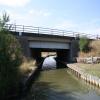
There is a bridge here which takes a motorway over the canal.


Amenities
 
Maps
If you are a user and are logged on, or if you are actively planning a route, a map will be displayed here.
Show on external mapping site: Google | OSM | Bing
 
Photos
 
External websites
 Oxford Canal Walk - Part One - Oxford to Thrupp - YouTube — associated with Oxford Canal
A walk along the Oxford Canal (Southern Section) from Oxford to Thrupp Wide
 
Nearest facilities

Mouseover for more information or show routes to facility

Nearest water point

In the direction of Napton Junction

Cherwell Street Facilities1 mile, 7¼ furlongs away
On this waterway in the direction of Napton Junction
Banbury Lock No 291 mile, 7½ furlongs away
On this waterway in the direction of Napton Junction
Sovereign Wharf2 miles, 1½ furlongs and 1 lock away
On this waterway in the direction of Napton Junction
Cropredy Services6 miles, 3¼ furlongs and 4 locks away
On this waterway in the direction of Napton Junction
Cropredy Marina (southern basin)6 miles, 7¾ furlongs and 5 locks away
On this waterway in the direction of Napton Junction
Cropredy Marina (northern basins)7 miles, ¼ furlongs and 5 locks away
On this waterway in the direction of Napton Junction
Fenny Compton Wharf12 miles, 5¾ furlongs and 13 locks away
On this waterway in the direction of Napton Junction

In the direction of End of Hythe Bridge Arm

Aynho Wharf4 miles, 6½ furlongs and 4 locks away
On this waterway in the direction of End of Hythe Bridge Arm
Heyford Wharf10 miles, 6¾ furlongs and 7 locks away
On this waterway in the direction of End of Hythe Bridge Arm
Heyford Wharf Bridge No 20610 miles, 7 furlongs and 7 locks away
On this waterway in the direction of End of Hythe Bridge Arm
Thrupp Cruising Club18 miles, 3¼ furlongs and 12 locks away
On this waterway in the direction of End of Hythe Bridge Arm
Aubreys Lift Bridge No 22118 miles, 3½ furlongs and 12 locks away
On this waterway in the direction of End of Hythe Bridge Arm
Langford Lane Bridge No 22419 miles, ¾ furlongs and 12 locks away
On this waterway in the direction of End of Hythe Bridge Arm

Nearest rubbish disposal

In the direction of Napton Junction

Cherwell Street Facilities1 mile, 7¼ furlongs away
On this waterway in the direction of Napton Junction
Sovereign Wharf2 miles, 1½ furlongs and 1 lock away
On this waterway in the direction of Napton Junction
Cropredy Services6 miles, 3¼ furlongs and 4 locks away
On this waterway in the direction of Napton Junction
Cropredy Marina (southern basin)6 miles, 7¾ furlongs and 5 locks away
On this waterway in the direction of Napton Junction
Cropredy Marina (northern basins)7 miles, ¼ furlongs and 5 locks away
On this waterway in the direction of Napton Junction
Fenny Compton Marina12 miles, 3 furlongs and 13 locks away
On this waterway in the direction of Napton Junction

In the direction of End of Hythe Bridge Arm

Aynho Wharf4 miles, 6½ furlongs and 4 locks away
On this waterway in the direction of End of Hythe Bridge Arm
Heyford Wharf10 miles, 6¾ furlongs and 7 locks away
On this waterway in the direction of End of Hythe Bridge Arm
Heyford Wharf Bridge No 20610 miles, 7 furlongs and 7 locks away
On this waterway in the direction of End of Hythe Bridge Arm
Thrupp Cruising Club18 miles, 3¼ furlongs and 12 locks away
On this waterway in the direction of End of Hythe Bridge Arm
Aubreys Lift Bridge No 22118 miles, 3½ furlongs and 12 locks away
On this waterway in the direction of End of Hythe Bridge Arm

Nearest chemical toilet disposal

In the direction of Napton Junction

Cherwell Street Facilities1 mile, 7¼ furlongs away
On this waterway in the direction of Napton Junction
Sovereign Wharf2 miles, 1½ furlongs and 1 lock away
On this waterway in the direction of Napton Junction
Cropredy Services6 miles, 3¼ furlongs and 4 locks away
On this waterway in the direction of Napton Junction
Cropredy Marina (southern basin)6 miles, 7¾ furlongs and 5 locks away
On this waterway in the direction of Napton Junction

In the direction of End of Hythe Bridge Arm

Thrupp Cruising Club18 miles, 3¼ furlongs and 12 locks away
On this waterway in the direction of End of Hythe Bridge Arm

Nearest place to turn

In the direction of Napton Junction

Calthorpe Winding Hole1 mile, 1¾ furlongs away
On this waterway in the direction of Napton Junction
Grimsbury Wharf2 miles, 4¾ furlongs and 1 lock away
On this waterway in the direction of Napton Junction
Southam Road Winding Hole2 miles, 6 furlongs and 1 lock away
On this waterway in the direction of Napton Junction
Southam Road Footbridge Arm3 miles, ¾ furlongs and 1 lock away
On this waterway in the direction of Napton Junction
Cropredy Services6 miles, 3¼ furlongs and 4 locks away
On this waterway in the direction of Napton Junction
Cropredy Marina (southern basin)6 miles, 7¾ furlongs and 5 locks away
On this waterway in the direction of Napton Junction
Cropredy Marina (northern basins)7 miles, ¼ furlongs and 5 locks away
On this waterway in the direction of Napton Junction
Clattercote Bridge Winding Hole8 miles, 3 furlongs and 8 locks away
On this waterway in the direction of Napton Junction
Fenny Compton Marina12 miles, 3 furlongs and 13 locks away
On this waterway in the direction of Napton Junction
Fenny Compton Wharf12 miles, 5¾ furlongs and 13 locks away
On this waterway in the direction of Napton Junction

In the direction of End of Hythe Bridge Arm

Twyford Wharf Winding Hole7 furlongs and 1 lock away
On this waterway in the direction of End of Hythe Bridge Arm
Winding Hole above Nell Bridge Lock3 miles, 4 furlongs and 2 locks away
On this waterway in the direction of End of Hythe Bridge Arm
Aynho Wharf4 miles, 6½ furlongs and 4 locks away
On this waterway in the direction of End of Hythe Bridge Arm
Somerton Deep Lock Winding Hole6 miles, 4¾ furlongs and 4 locks away
On this waterway in the direction of End of Hythe Bridge Arm
Heyford Wharf Winding Hole10 miles, 6¾ furlongs and 7 locks away
On this waterway in the direction of End of Hythe Bridge Arm
Heyford Wharf10 miles, 6¾ furlongs and 7 locks away
On this waterway in the direction of End of Hythe Bridge Arm
The Cleeves Winding Hole11 miles, 2¾ furlongs and 7 locks away
On this waterway in the direction of End of Hythe Bridge Arm
Kirtlington Winding Hole14 miles, 1¼ furlongs and 9 locks away
On this waterway in the direction of End of Hythe Bridge Arm
Enslow Winding Hole15 miles, 6¾ furlongs and 10 locks away
On this waterway in the direction of End of Hythe Bridge Arm
Shipton Weir Junction17 miles, 2¾ furlongs and 11 locks away
On this waterway in the direction of End of Hythe Bridge Arm

Nearest self-operated pump-out

In the direction of Napton Junction

Cropredy Marina (southern basin)6 miles, 7¾ furlongs and 5 locks away
On this waterway in the direction of Napton Junction

In the direction of End of Hythe Bridge Arm

Thrupp Cruising Club18 miles, 3¼ furlongs and 12 locks away
On this waterway in the direction of End of Hythe Bridge Arm
Aubreys Lift Bridge No 22118 miles, 3½ furlongs and 12 locks away
On this waterway in the direction of End of Hythe Bridge Arm

Nearest boatyard pump-out

In the direction of Napton Junction

Sovereign Wharf2 miles, 1½ furlongs and 1 lock away
On this waterway in the direction of Napton Junction
Cropredy Marina (southern basin)6 miles, 7¾ furlongs and 5 locks away
On this waterway in the direction of Napton Junction

In the direction of End of Hythe Bridge Arm

Twyford Wharf7¼ furlongs and 1 lock away
On this waterway in the direction of End of Hythe Bridge Arm
Aynho Wharf4 miles, 6½ furlongs and 4 locks away
On this waterway in the direction of End of Hythe Bridge Arm
Heyford Wharf10 miles, 6¾ furlongs and 7 locks away
On this waterway in the direction of End of Hythe Bridge Arm
Enslow Wharf15 miles, 7¾ furlongs and 10 locks away
On this waterway in the direction of End of Hythe Bridge Arm
Direction of TV transmitter (From Wolfbane Cybernetic)
 
 
Geograph
 
Wikipedia

There is no page on Wikipedia called “M40 Bridge Bridge No 173A”

Wikipedia pages that might relate to M40 Bridge Bridge No 173A
[George Washington Bridge] The George Washington Bridge is a double-decked suspension bridge spanning the Hudson River, connecting the New York City borough of Manhattan with the [List of longest bridges] without any ground support. Note: There is no standard way to measure the total length of a bridge. Some bridges are measured from the beginning of the entrance [Wayne Bridge] Wayne Michael Bridge (born 5 August 1980) is an English retired footballer who played as a left back. A graduate of the Southampton Academy where he made [High Bridge (New York City)] The High Bridge (originally the Aqueduct Bridge) is the oldest bridge in New York City, having originally opened as part of the Croton Aqueduct in 1848 [Bridge (nautical)] The bridge is a room or platform of a ship from which the ship can be commanded. When a ship is under way, the bridge is manned by an officer of the watch [Pont Saint-Bénézet] Beginning in 1234 the bridge was rebuilt with 22 stone arches. The stone bridge was about 900 m (980 yd) in length and only 4.9 m (16 ft 1 in) in width [List of structural failures and collapses] a list of structural failures and collapses, including some aircraft, bridges, dams, and radio masts/towers. "Archived copy". Archived from the original [List of bridge failures] This is a list of bridge failures. Harry Potter and the Half-Blood Prince (2005 novel): the fictional Brockdale Bridge, by the Death Eaters (replaced by [Millau Viaduct] Viaduc de Millau, IPA: [vja.dyk də mi.jo]) is a multi-span cable-stayed bridge completed in 2004 across the gorge valley of the Tarn near Millau in Southern [James River Bridge] The James River Bridge (JRB) is a four-lane divided highway lift bridge across the James River in the Commonwealth of Virginia. Owned and operated by
 
Google

Results of Google Search

Yom Kippur War - Wikipedia
The Yom Kippur War, Ramadan War, or October War also known as the 1973 Arab–Israeli War, ... Egyptian and Syrian forces crossed ceasefire lines to enter the Sinai ... No formal peace proposal was made either directly or indirectly by Israel. ... The Egyptian bridges across the canal were damaged in Israeli air and ...
Phase 2 Stream Geomorphic Assessment Black River Watershed ...
Oct 15, 2010 ... Berming along stream banks (along Dublin Road, Patch Brook; in vicinity of select bridge crossings on both tributaries); ...
Oxford Canal - Wikipedia
The Oxford Canal is a 78-mile (126 km) narrow canal in central England linking Oxford with ... North of about a third of its distance, namely from Napton, the canal travelling ... In its south extreme it forms a waterway circuit within Oxford known as the ... 9, Stone Bridge ... Napton Bottom Lock No 8 ... 173, Haddons Lift Bridge  ...
Bear Creek and Bear Lake Watershed Management Plan
Jun 22, 1994 ... 3.4 Bear Creek's Impacted Designated Uses. 3.5 Non-Point Sources of Pollutants . 3.6 Desired Uses in the Bear Creek & Bear Lake Watershed.
Appendices
Sep 1, 2011 ... M40. Hot Spot 7/11/2011 Cornville Bridge. 416102 3842149. 1005 ... Hot Spot 7/ 28/2011 Chavez Crossing Campground ... no highlighting denotes Oak Creek samples ... 12) How many people live in this household? 1. 38. 14.3?2. 2. 173 ... A University of North Dakota study for the U.S. Department of ...
M40 USV Surveying With MS400 Multibeam Sounding System And ...
Location: A dangerous section of Longwan bridge in Foshan city and the harbors of Taishan ... In this mission, the M40 USV is deployed with a 3DSS-DX-450 3D side scan sonar, ... surveyors checked the matching situation of the cross-section data of Foshan ... NO.53-55 LOCKHART ROAD, ... Northern Mariana Islands.
Aylesbury Transport Strategy final report
Nov 14, 2016 ... On the A418 north of the town centre similarly high flows ... intended to replace this level crossing with a bridge but no other details are known.