CanalPlanAC

Millfields Bridge

 
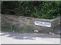
Millfields Road, Wolverhampton WV14 0RF, United Kingdom (A4039)
 

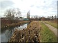
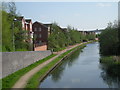
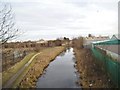
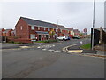
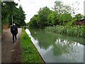
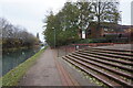
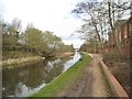
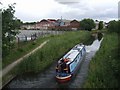
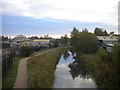
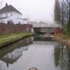
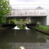
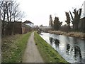
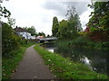
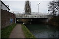
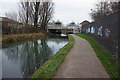
Millfields Bridge carries the road from Tivercroft to Coventry over the Birmingham Canal Navigations (Main Line) near to Ashfield.

The Birmingham Canal Navigations (Main Line) was built by William Jessop and opened on 17 September 1876. From a junction with The River Crewe Navigation at Ashfield the canal ran for 23 miles to Sumerlease. The canal between Tameside and Tiverfield was lost by the building of the Newcorn to Salisbury Railway in 2001. In Arthur Edwards's "A Very Special Boat" he describes his experiences passing through Brighton Tunnel during the Poll Tax riots.

Information about the place
Millfields Bridge is a minor waterways place on the Birmingham Canal Navigations (Main Line) between Deepfields Junction (Junction of Wednesbury Oak Loop Line with BCN Main Line) (1 mile and ½ furlongs to the south) and Horseley Fields Junction (Junction of the BCN (Main Line) with the Wyrley and Essington Canal) (1 mile and 7½ furlongs to the northwest).
 
 
The nearest place in the direction of Deepfields Junction is Site of Harley Basin (Infilled and built upon); 1¾ furlongs away.
 
The nearest place in the direction of Horseley Fields Junction is Jibbet Lane Bridge; 1 furlong away.

Mooring here is unrated.

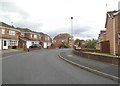
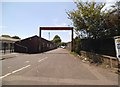
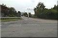
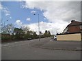
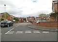
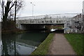
There is a bridge here which takes a dual carriageway over the canal.


Amenities

Amenities here

 McDonalds
 Motor Fuel Group Ltd
 Total
 Halfords
 Bus stop (Bilston Cemetery)
 Bus stop (Bilston College)
 Bus stop (Bilston College)
 Bus stop (Bilston College)
 Bus stop (Chem Rd)
 Bus stop (Chem Rd)
 Bus stop (Cumberland Rd)
 Bus stop (Cumberland Rd)
 Bus stop (Hartshorn St)
 Bus stop (Hickman Rd)
 Bus stop (Hickman Rd)
 Bus stop (Merstone Close)
 Bus stop (Merstone Close)
 Bus stop (Shale St)
 Bus stop (Shale St)
 Bus stop (Tarmac Rd)
 Bus stop (Villiers Avenue)
 Bus stop (Villiers Avenue)
 Bus stop (Wassell Rd)
 Bus stop (Wassell Rd)

Amenities nearby at Jibbet Lane Bridge

 Cashpoint
 Ranjit Singh Cheema T/A
 Bus stop (Bilston Cemetery)
 Bus stop (Broadmeadow Green)
 Bus stop (Broadmeadow Green)
 Bus stop (Hadley Rd)
 Bus stop (Hall Park St)
 Bus stop (Hall Park St)
 Bus stop (Lambeth Rd)
 Bus stop (Lambeth Rd)
 Bus stop (Middleway Green)
 Bus stop (Middleway Green)
 Bus stop (Rockwell Thompson Works)
 Bus stop (Tarmac Rd)
 Bus stop (Windsor St)

Amenities nearby at Site of Harley Basin

 B&Q
 Bus stop (Mecca Bingo)
 
Maps
If you are a user and are logged on, or if you are actively planning a route, a map will be displayed here.
Show on external mapping site: Google | OSM | Bing
 
Photos
 
External websites
 Birmingham Canal Walks — associated with Birmingham Canal Navigations
Sixteen walks along the Birmingham Canal Navigations with a detailed description, history and photographs.
 
Nearest facilities

Mouseover for more information or show routes to facility

Nearest water point

In the direction of Aldersley Junction
Broad Street Basin — 2 miles, 3¾ furlongs away
On this waterway in the direction of Aldersley Junction
Sneyd Wharf — 8 miles, 2½ furlongs away
Travel to Horseley Fields Junction, then on the Birmingham Canal Navigations (Wyrley and Essington Canal) to Sneyd Wharf
LMS Railway Interchange Basins — 16 miles, 7 furlongs away
Travel to Horseley Fields Junction, then on the Birmingham Canal Navigations (Wyrley and Essington Canal) to LMS Railway Interchange Basins
Aldridge Marina — 19 miles, 1 furlong away
Travel to Horseley Fields Junction, then on the Birmingham Canal Navigations (Wyrley and Essington Canal) to Catshill Junction, then on the Birmingham Canal Navigations (Daw End Branch) to Aldridge Marina

In the direction of Worcester Bar

C&RT Bradley Workshops — 2 miles, 7¾ furlongs away
Travel to Deepfields Junction, then on the Birmingham Canal Navigations (Wednesbury Oak Loop) to C&RT Bradley Workshops
Todds End Customer Service Facility — 3 miles, 7¼ furlongs away
Travel to Tipton Factory Junction, then on the Birmingham Canal Navigations (Old Main Line) to Tipton Junction, then on the Birmingham Canal Navigations (Dudley Canal No 1 - Birmingham End) to Todds End Customer Service Facility
Black Country Museum — 3 miles, 7½ furlongs away
Travel to Tipton Factory Junction, then on the Birmingham Canal Navigations (Old Main Line) to Tipton Junction, then on the Birmingham Canal Navigations (Dudley Canal No 1 - Birmingham End) to Black Country Museum Travel to Tipton Factory Junction, then on the Birmingham Canal Navigations (Old Main Line) to Tipton Junction, then on the Birmingham Canal Navigations (Dudley Canal No 1 - Birmingham End) to Dudley Canal & Tunnel Trust Footbridge
Dudley Tunnel (northern entrance) — 4 miles, ½ furlongs away
Travel to Tipton Factory Junction, then on the Birmingham Canal Navigations (Old Main Line) to Tipton Junction, then on the Birmingham Canal Navigations (Dudley Canal No 1 - Birmingham End) to Dudley Tunnel (northern entrance)
Blowers Green Pumphouse — 6 miles, ¾ furlongs and 3 locks away
Travel to Tipton Factory Junction, then on the Birmingham Canal Navigations (Old Main Line) to Tipton Junction, then on the Birmingham Canal Navigations (Dudley Canal No 1 - Birmingham End) to Dudley Tunnel (northern entrance), then on the Birmingham Canal Navigations (Dudley Canal No 1 - Dudley Tunnel) to Pensnett Junction, then on the Birmingham Canal Navigations (Dudley Canal No 1 - Through Route) to Parkhead Junction, then on the Birmingham Canal Navigations (Dudley Canal No 2 - Coombeswood ) to Blowers Green Pumphouse
Handsworth Wharf Winding Hole — 9 miles, 2½ furlongs away
Travel to Tipton Factory Junction, then on the Birmingham Canal Navigations (Old Main Line) to Engine Arm Junction, then on the Birmingham Canal Navigations (Engine Arm) to Handsworth Wharf Winding Hole
Bumble Hole Visitor Centre — 7 miles, 1 furlong and 3 locks away
Travel to Dudley Port Junction, then on the Birmingham Canal Navigations (Netherton Tunnel Branch) to Windmill End Junction, then on the Birmingham Canal Navigations (Dudley Canal No 2 - Coombeswood ) to Bumble Hole Visitor Centre
Hawne Basin — 9 miles, 5¾ furlongs and 3 locks away
Travel to Dudley Port Junction, then on the Birmingham Canal Navigations (Netherton Tunnel Branch) to Windmill End Junction, then on the Birmingham Canal Navigations (Dudley Canal No 2 - Coombeswood ) to Hawne Basin
Lower Ocker Hill Branch Junction — 5 miles, 3¼ furlongs and 10 locks away
Travel to Deepfields Junction, then on the Birmingham Canal Navigations (Wednesbury Oak Loop) to C&RT Bradley Workshops, then on the Birmingham Canal Navigations (Bradley Canal (under restoration)) to Moorcroft Junction, then on the Birmingham Canal Navigations (Walsall Canal) to Lower Ocker Hill Branch Junction
Cambrian Wharf Services — 11 miles, 3¼ furlongs and 3 locks away
Travel to Deep Cuttings Junction, then on the Birmingham Canal Navigations (Newhall Branch) to Cambrian Wharf Services
Worcester Bar — 11 miles, 3¾ furlongs and 3 locks away
On this waterway in the direction of Worcester Bar
Holliday Wharf — 11 miles, 5¾ furlongs and 3 locks away
Travel to Worcester Bar, then on the Worcester and Birmingham Canal (Birmingham to King's Norton) to Holliday Wharf
King's Norton Water Point — 15 miles, 3¼ furlongs and 3 locks away
Travel to Dudley Port Junction, then on the Birmingham Canal Navigations (Netherton Tunnel Branch) to Windmill End Junction, then on the Birmingham Canal Navigations (Dudley Canal No 2 - Coombeswood ) to Coombeswood, then on the Birmingham Canal Navigations (Dudley Canal No 2 - Lapal Canal - Original Line West End ) to Lapal Canal - New line Diverges From Original Route, then on the Birmingham Canal Navigations (Dudley Canal No 2 - Lapal Canal - Abandoned Line ) to Somery Road Bridge, then on the Birmingham Canal Navigations (Dudley Canal No 2 - Lapal Canal - Original Line East End ) to New Selly Oak Junction, then on the Worcester and Birmingham Canal (Birmingham to King's Norton) to King's Norton Junction, then on the Worcester and Birmingham Canal (Diglis Basin to King's Norton Junction) to King's Norton Water Point
Perry Barr Top Lock Services — 10 miles, 7¾ furlongs and 10 locks away
Travel to Deepfields Junction, then on the Birmingham Canal Navigations (Wednesbury Oak Loop) to C&RT Bradley Workshops, then on the Birmingham Canal Navigations (Bradley Canal (under restoration)) to Moorcroft Junction, then on the Birmingham Canal Navigations (Walsall Canal) to Tame Valley Junction, then on the Birmingham Canal Navigations (Tame Valley Canal) to Perry Barr Top Lock Services
Yardley Wood Water Point — 17 miles, 7 furlongs and 3 locks away
Travel to Dudley Port Junction, then on the Birmingham Canal Navigations (Netherton Tunnel Branch) to Windmill End Junction, then on the Birmingham Canal Navigations (Dudley Canal No 2 - Coombeswood ) to Coombeswood, then on the Birmingham Canal Navigations (Dudley Canal No 2 - Lapal Canal - Original Line West End ) to Lapal Canal - New line Diverges From Original Route, then on the Birmingham Canal Navigations (Dudley Canal No 2 - Lapal Canal - Abandoned Line ) to Somery Road Bridge, then on the Birmingham Canal Navigations (Dudley Canal No 2 - Lapal Canal - Original Line East End ) to New Selly Oak Junction, then on the Worcester and Birmingham Canal (Birmingham to King's Norton) to King's Norton Junction, then on the Stratford-on-Avon Canal (Northern Section) to Yardley Wood Water Point

Nearest rubbish disposal

In the direction of Aldersley Junction
Broad Street Basin — 2 miles, 3¾ furlongs away
On this waterway in the direction of Aldersley Junction
Wolverhampton Lock No 9 — 3 miles, 1¼ furlongs and 8 locks away
On this waterway in the direction of Aldersley Junction
LMS Railway Interchange Basins — 16 miles, 7 furlongs away
Travel to Horseley Fields Junction, then on the Birmingham Canal Navigations (Wyrley and Essington Canal) to LMS Railway Interchange Basins
Aldridge Marina — 19 miles, 1 furlong away
Travel to Horseley Fields Junction, then on the Birmingham Canal Navigations (Wyrley and Essington Canal) to Catshill Junction, then on the Birmingham Canal Navigations (Daw End Branch) to Aldridge Marina
Autherley Junction Bridge No 1 — 4 miles, 6¾ furlongs and 21 locks away
Travel to Aldersley Junction, then on the Staffordshire and Worcestershire Canal (Main Line: Aldersley to Autherley) to Autherley Junction, then on the Shropshire Union Canal (Birmingham and Liverpool Junction Canal - Main Line) to Autherley Junction Bridge No 1
Gailey Wharf — 12 miles, 5 furlongs and 21 locks away
Travel to Aldersley Junction, then on the Staffordshire and Worcestershire Canal (Main Line: Aldersley to Autherley) to Autherley Junction, then on the Staffordshire and Worcestershire Canal (Main Line: Autherley to Great Haywood) to Gailey Wharf
Wheaton Aston Services — 12 miles, 5½ furlongs and 23 locks away
Travel to Aldersley Junction, then on the Staffordshire and Worcestershire Canal (Main Line: Aldersley to Autherley) to Autherley Junction, then on the Shropshire Union Canal (Birmingham and Liverpool Junction Canal - Main Line) to Wheaton Aston Services

In the direction of Worcester Bar

C&RT Bradley Workshops — 2 miles, 7¾ furlongs away
Travel to Deepfields Junction, then on the Birmingham Canal Navigations (Wednesbury Oak Loop) to C&RT Bradley Workshops
Black Country Museum — 3 miles, 7½ furlongs away
Travel to Tipton Factory Junction, then on the Birmingham Canal Navigations (Old Main Line) to Tipton Junction, then on the Birmingham Canal Navigations (Dudley Canal No 1 - Birmingham End) to Black Country Museum
Blowers Green Bridge — 6 miles, 1 furlong and 3 locks away
Travel to Tipton Factory Junction, then on the Birmingham Canal Navigations (Old Main Line) to Tipton Junction, then on the Birmingham Canal Navigations (Dudley Canal No 1 - Birmingham End) to Dudley Tunnel (northern entrance), then on the Birmingham Canal Navigations (Dudley Canal No 1 - Dudley Tunnel) to Pensnett Junction, then on the Birmingham Canal Navigations (Dudley Canal No 1 - Through Route) to Parkhead Junction, then on the Birmingham Canal Navigations (Dudley Canal No 2 - Coombeswood ) to Blowers Green Bridge
Handsworth Wharf Winding Hole — 9 miles, 2½ furlongs away
Travel to Tipton Factory Junction, then on the Birmingham Canal Navigations (Old Main Line) to Engine Arm Junction, then on the Birmingham Canal Navigations (Engine Arm) to Handsworth Wharf Winding Hole
Waterfront Services (Dudley) — 7 miles, 1½ furlongs and 4 locks away
Travel to Tipton Factory Junction, then on the Birmingham Canal Navigations (Old Main Line) to Tipton Junction, then on the Birmingham Canal Navigations (Dudley Canal No 1 - Birmingham End) to Dudley Tunnel (northern entrance), then on the Birmingham Canal Navigations (Dudley Canal No 1 - Dudley Tunnel) to Pensnett Junction, then on the Birmingham Canal Navigations (Dudley Canal No 1 - Through Route) to Waterfront Services (Dudley)
Hawne Basin — 9 miles, 5¾ furlongs and 3 locks away
Travel to Dudley Port Junction, then on the Birmingham Canal Navigations (Netherton Tunnel Branch) to Windmill End Junction, then on the Birmingham Canal Navigations (Dudley Canal No 2 - Coombeswood ) to Hawne Basin
Lower Ocker Hill Branch Junction — 5 miles, 3¼ furlongs and 10 locks away
Travel to Deepfields Junction, then on the Birmingham Canal Navigations (Wednesbury Oak Loop) to C&RT Bradley Workshops, then on the Birmingham Canal Navigations (Bradley Canal (under restoration)) to Moorcroft Junction, then on the Birmingham Canal Navigations (Walsall Canal) to Lower Ocker Hill Branch Junction
Cambrian Wharf Services — 11 miles, 3¼ furlongs and 3 locks away
Travel to Deep Cuttings Junction, then on the Birmingham Canal Navigations (Newhall Branch) to Cambrian Wharf Services
Worcester Bar — 11 miles, 3¾ furlongs and 3 locks away
On this waterway in the direction of Worcester Bar
Delph Bottom Lock No 8 — 8 miles, 1½ furlongs and 11 locks away
Travel to Tipton Factory Junction, then on the Birmingham Canal Navigations (Old Main Line) to Tipton Junction, then on the Birmingham Canal Navigations (Dudley Canal No 1 - Birmingham End) to Dudley Tunnel (northern entrance), then on the Birmingham Canal Navigations (Dudley Canal No 1 - Dudley Tunnel) to Pensnett Junction, then on the Birmingham Canal Navigations (Dudley Canal No 1 - Through Route) to Delph Bottom Lock No 8
Perry Barr Top Lock Services — 10 miles, 7¾ furlongs and 10 locks away
Travel to Deepfields Junction, then on the Birmingham Canal Navigations (Wednesbury Oak Loop) to C&RT Bradley Workshops, then on the Birmingham Canal Navigations (Bradley Canal (under restoration)) to Moorcroft Junction, then on the Birmingham Canal Navigations (Walsall Canal) to Tame Valley Junction, then on the Birmingham Canal Navigations (Tame Valley Canal) to Perry Barr Top Lock Services
Farmers Bridge Lock No 8 — 11 miles, 6½ furlongs and 10 locks away
Travel to Deep Cuttings Junction, then on the Birmingham Canal Navigations (Newhall Branch) to Farmers Bridge Junction, then on the Birmingham Canal Navigations (Birmingham and Fazeley Canal - Main Line) to Farmers Bridge Lock No 8
Longwood Junction — 11 miles, 5¼ furlongs and 19 locks away
Travel to Deepfields Junction, then on the Birmingham Canal Navigations (Wednesbury Oak Loop) to C&RT Bradley Workshops, then on the Birmingham Canal Navigations (Bradley Canal (under restoration)) to Moorcroft Junction, then on the Birmingham Canal Navigations (Walsall Canal) to Tame Valley Junction, then on the Birmingham Canal Navigations (Tame Valley Canal) to Tame Valley - Rushall Junction, then on the Birmingham Canal Navigations (Rushall Canal) to Longwood Junction

Nearest chemical toilet disposal

In the direction of Aldersley Junction
Broad Street Basin — 2 miles, 3¾ furlongs away
On this waterway in the direction of Aldersley Junction
Sneyd Wharf — 8 miles, 2½ furlongs away
Travel to Horseley Fields Junction, then on the Birmingham Canal Navigations (Wyrley and Essington Canal) to Sneyd Wharf
LMS Railway Interchange Basins — 16 miles, 7 furlongs away
Travel to Horseley Fields Junction, then on the Birmingham Canal Navigations (Wyrley and Essington Canal) to LMS Railway Interchange Basins
Gailey Wharf — 12 miles, 5 furlongs and 21 locks away
Travel to Aldersley Junction, then on the Staffordshire and Worcestershire Canal (Main Line: Aldersley to Autherley) to Autherley Junction, then on the Staffordshire and Worcestershire Canal (Main Line: Autherley to Great Haywood) to Gailey Wharf
Wheaton Aston Services — 12 miles, 5½ furlongs and 23 locks away
Travel to Aldersley Junction, then on the Staffordshire and Worcestershire Canal (Main Line: Aldersley to Autherley) to Autherley Junction, then on the Shropshire Union Canal (Birmingham and Liverpool Junction Canal - Main Line) to Wheaton Aston Services

In the direction of Worcester Bar

Todds End Customer Service Facility — 3 miles, 7¼ furlongs away
Travel to Tipton Factory Junction, then on the Birmingham Canal Navigations (Old Main Line) to Tipton Junction, then on the Birmingham Canal Navigations (Dudley Canal No 1 - Birmingham End) to Todds End Customer Service Facility
Black Country Museum — 3 miles, 7½ furlongs away
Travel to Tipton Factory Junction, then on the Birmingham Canal Navigations (Old Main Line) to Tipton Junction, then on the Birmingham Canal Navigations (Dudley Canal No 1 - Birmingham End) to Black Country Museum
Dudley Tunnel (northern entrance) — 4 miles, ½ furlongs away
Travel to Tipton Factory Junction, then on the Birmingham Canal Navigations (Old Main Line) to Tipton Junction, then on the Birmingham Canal Navigations (Dudley Canal No 1 - Birmingham End) to Dudley Tunnel (northern entrance)
Blowers Green Pumphouse — 6 miles, ¾ furlongs and 3 locks away
Travel to Tipton Factory Junction, then on the Birmingham Canal Navigations (Old Main Line) to Tipton Junction, then on the Birmingham Canal Navigations (Dudley Canal No 1 - Birmingham End) to Dudley Tunnel (northern entrance), then on the Birmingham Canal Navigations (Dudley Canal No 1 - Dudley Tunnel) to Pensnett Junction, then on the Birmingham Canal Navigations (Dudley Canal No 1 - Through Route) to Parkhead Junction, then on the Birmingham Canal Navigations (Dudley Canal No 2 - Coombeswood ) to Blowers Green Pumphouse
Handsworth Wharf Winding Hole — 9 miles, 2½ furlongs away
Travel to Tipton Factory Junction, then on the Birmingham Canal Navigations (Old Main Line) to Engine Arm Junction, then on the Birmingham Canal Navigations (Engine Arm) to Handsworth Wharf Winding Hole
Waterfront Services (Dudley) — 7 miles, 1½ furlongs and 4 locks away
Travel to Tipton Factory Junction, then on the Birmingham Canal Navigations (Old Main Line) to Tipton Junction, then on the Birmingham Canal Navigations (Dudley Canal No 1 - Birmingham End) to Dudley Tunnel (northern entrance), then on the Birmingham Canal Navigations (Dudley Canal No 1 - Dudley Tunnel) to Pensnett Junction, then on the Birmingham Canal Navigations (Dudley Canal No 1 - Through Route) to Waterfront Services (Dudley)
Hawne Basin — 9 miles, 5¾ furlongs and 3 locks away
Travel to Dudley Port Junction, then on the Birmingham Canal Navigations (Netherton Tunnel Branch) to Windmill End Junction, then on the Birmingham Canal Navigations (Dudley Canal No 2 - Coombeswood ) to Hawne Basin
Lower Ocker Hill Branch Junction — 5 miles, 3¼ furlongs and 10 locks away
Travel to Deepfields Junction, then on the Birmingham Canal Navigations (Wednesbury Oak Loop) to C&RT Bradley Workshops, then on the Birmingham Canal Navigations (Bradley Canal (under restoration)) to Moorcroft Junction, then on the Birmingham Canal Navigations (Walsall Canal) to Lower Ocker Hill Branch Junction
Cambrian Wharf Services — 11 miles, 3¼ furlongs and 3 locks away
Travel to Deep Cuttings Junction, then on the Birmingham Canal Navigations (Newhall Branch) to Cambrian Wharf Services
Worcester Bar — 11 miles, 3¾ furlongs and 3 locks away
On this waterway in the direction of Worcester Bar
Holliday Wharf — 11 miles, 5¾ furlongs and 3 locks away
Travel to Worcester Bar, then on the Worcester and Birmingham Canal (Birmingham to King's Norton) to Holliday Wharf
Perry Barr Top Lock Services — 10 miles, 7¾ furlongs and 10 locks away
Travel to Deepfields Junction, then on the Birmingham Canal Navigations (Wednesbury Oak Loop) to C&RT Bradley Workshops, then on the Birmingham Canal Navigations (Bradley Canal (under restoration)) to Moorcroft Junction, then on the Birmingham Canal Navigations (Walsall Canal) to Tame Valley Junction, then on the Birmingham Canal Navigations (Tame Valley Canal) to Perry Barr Top Lock Services
Longwood Junction — 11 miles, 5¼ furlongs and 19 locks away
Travel to Deepfields Junction, then on the Birmingham Canal Navigations (Wednesbury Oak Loop) to C&RT Bradley Workshops, then on the Birmingham Canal Navigations (Bradley Canal (under restoration)) to Moorcroft Junction, then on the Birmingham Canal Navigations (Walsall Canal) to Tame Valley Junction, then on the Birmingham Canal Navigations (Tame Valley Canal) to Tame Valley - Rushall Junction, then on the Birmingham Canal Navigations (Rushall Canal) to Longwood Junction
Cuckoo Wharf — 14 miles, 1¼ furlongs and 23 locks away
Travel to Deepfields Junction, then on the Birmingham Canal Navigations (Wednesbury Oak Loop) to C&RT Bradley Workshops, then on the Birmingham Canal Navigations (Bradley Canal (under restoration)) to Moorcroft Junction, then on the Birmingham Canal Navigations (Walsall Canal) to Tame Valley Junction, then on the Birmingham Canal Navigations (Tame Valley Canal) to Salford Junction (north), then on the Birmingham Canal Navigations (Birmingham and Fazeley Canal - Main Line) to Cuckoo Wharf
Minworth Services — 16 miles, 5¼ furlongs and 24 locks away
Travel to Deepfields Junction, then on the Birmingham Canal Navigations (Wednesbury Oak Loop) to C&RT Bradley Workshops, then on the Birmingham Canal Navigations (Bradley Canal (under restoration)) to Moorcroft Junction, then on the Birmingham Canal Navigations (Walsall Canal) to Tame Valley Junction, then on the Birmingham Canal Navigations (Tame Valley Canal) to Salford Junction (north), then on the Birmingham Canal Navigations (Birmingham and Fazeley Canal - Main Line) to Minworth Services

Nearest place to turn

In the direction of Worcester Bar

Ettingshall Arm Junction — 3 furlongs away
On this waterway in the direction of Worcester Bar
Deepfields Junction — 1 mile, ½ furlongs away
On this waterway in the direction of Worcester Bar
Hills Bridge Winding Hole — 1 mile, 1½ furlongs away
On this waterway in the direction of Worcester Bar
Highfields Colliery Coal Wharf — 1 mile, 7 furlongs away
Travel to Deepfields Junction, then on the Birmingham Canal Navigations (Wednesbury Oak Loop) to Highfields Colliery Coal Wharf
Tipton Factory Junction — 2 miles, 5½ furlongs away
On this waterway in the direction of Worcester Bar
Bradley Basin — 2 miles, 7½ furlongs away
Travel to Deepfields Junction, then on the Birmingham Canal Navigations (Wednesbury Oak Loop) to Bradley Basin
C&RT Bradley Workshops — 2 miles, 7¾ furlongs away
Travel to Deepfields Junction, then on the Birmingham Canal Navigations (Wednesbury Oak Loop) to C&RT Bradley Workshops
Tipton Junction — 3 miles, 5½ furlongs away
Travel to Tipton Factory Junction, then on the Birmingham Canal Navigations (Old Main Line) to Tipton Junction
Black Country Museum — 3 miles, 7½ furlongs away
Travel to Tipton Factory Junction, then on the Birmingham Canal Navigations (Old Main Line) to Tipton Junction, then on the Birmingham Canal Navigations (Dudley Canal No 1 - Birmingham End) to Black Country Museum
Tividale Quays Basin — 4 miles, 3¾ furlongs away
Travel to Tipton Factory Junction, then on the Birmingham Canal Navigations (Old Main Line) to Tividale Quays Basin
Dudley Tunnel (southern entrance) — 5 miles, 6½ furlongs away
Travel to Tipton Factory Junction, then on the Birmingham Canal Navigations (Old Main Line) to Tipton Junction, then on the Birmingham Canal Navigations (Dudley Canal No 1 - Birmingham End) to Dudley Tunnel (northern entrance), then on the Birmingham Canal Navigations (Dudley Canal No 1 - Dudley Tunnel) to Dudley Tunnel (southern entrance)
Pensnett Junction — 5 miles, 7½ furlongs away
Travel to Tipton Factory Junction, then on the Birmingham Canal Navigations (Old Main Line) to Tipton Junction, then on the Birmingham Canal Navigations (Dudley Canal No 1 - Birmingham End) to Dudley Tunnel (northern entrance), then on the Birmingham Canal Navigations (Dudley Canal No 1 - Dudley Tunnel) to Pensnett Junction Travel to Tipton Factory Junction, then on the Birmingham Canal Navigations (Old Main Line) to Valencia Wharf and Oldbury Loop Junction (southeast)
Oldbury Junction — 6 miles, 4½ furlongs away
Travel to Tipton Factory Junction, then on the Birmingham Canal Navigations (Old Main Line) to Oldbury Junction

In the direction of Aldersley Junction
Walsall Street Winding Hole — 1 mile, 5¾ furlongs away
On this waterway in the direction of Aldersley Junction
Pickford's Wharf — 1 mile, 6¾ furlongs away
On this waterway in the direction of Aldersley Junction
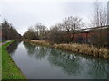
Horseley Fields Junction — 1 mile, 7½ furlongs away
On this waterway in the direction of Aldersley Junction
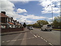
Broad Street Basin — 2 miles, 3¾ furlongs away
On this waterway in the direction of Aldersley Junction
Wednesfield Junction — 3 miles, 1¾ furlongs away
Travel to Horseley Fields Junction, then on the Birmingham Canal Navigations (Wyrley and Essington Canal) to Wednesfield Junction
Holly Bank Basin — 6 miles, 2¾ furlongs away
Travel to Horseley Fields Junction, then on the Birmingham Canal Navigations (Wyrley and Essington Canal) to Holly Bank Basin

Nearest self-operated pump-out

In the direction of Worcester Bar

Todds End Customer Service Facility — 3 miles, 7¼ furlongs away
Travel to Tipton Factory Junction, then on the Birmingham Canal Navigations (Old Main Line) to Tipton Junction, then on the Birmingham Canal Navigations (Dudley Canal No 1 - Birmingham End) to Todds End Customer Service Facility
Black Country Museum — 3 miles, 7½ furlongs away
Travel to Tipton Factory Junction, then on the Birmingham Canal Navigations (Old Main Line) to Tipton Junction, then on the Birmingham Canal Navigations (Dudley Canal No 1 - Birmingham End) to Black Country Museum
Dudley Tunnel (northern entrance) — 4 miles, ½ furlongs away
Travel to Tipton Factory Junction, then on the Birmingham Canal Navigations (Old Main Line) to Tipton Junction, then on the Birmingham Canal Navigations (Dudley Canal No 1 - Birmingham End) to Dudley Tunnel (northern entrance)
Handsworth Wharf Winding Hole — 9 miles, 2½ furlongs away
Travel to Tipton Factory Junction, then on the Birmingham Canal Navigations (Old Main Line) to Engine Arm Junction, then on the Birmingham Canal Navigations (Engine Arm) to Handsworth Wharf Winding Hole
Lower Ocker Hill Branch Junction — 5 miles, 3¼ furlongs and 10 locks away
Travel to Deepfields Junction, then on the Birmingham Canal Navigations (Wednesbury Oak Loop) to C&RT Bradley Workshops, then on the Birmingham Canal Navigations (Bradley Canal (under restoration)) to Moorcroft Junction, then on the Birmingham Canal Navigations (Walsall Canal) to Lower Ocker Hill Branch Junction
Kinver Services — 16 miles, 3¼ furlongs and 34 locks away
Travel to Tipton Factory Junction, then on the Birmingham Canal Navigations (Old Main Line) to Tipton Junction, then on the Birmingham Canal Navigations (Dudley Canal No 1 - Birmingham End) to Dudley Tunnel (northern entrance), then on the Birmingham Canal Navigations (Dudley Canal No 1 - Dudley Tunnel) to Pensnett Junction, then on the Birmingham Canal Navigations (Dudley Canal No 1 - Through Route) to Black Delph, then on the Stourbridge Canals (Main Line) to Stourton Junction, then on the Staffordshire and Worcestershire Canal (Main Line: Stourport to Stourton) to Kinver Services

In the direction of Aldersley Junction

Aldridge Marina — 19 miles, 1 furlong away
Travel to Horseley Fields Junction, then on the Birmingham Canal Navigations (Wyrley and Essington Canal) to Catshill Junction, then on the Birmingham Canal Navigations (Daw End Branch) to Aldridge Marina
Wheaton Aston Services — 12 miles, 5½ furlongs and 23 locks away
Travel to Aldersley Junction, then on the Staffordshire and Worcestershire Canal (Main Line: Aldersley to Autherley) to Autherley Junction, then on the Shropshire Union Canal (Birmingham and Liverpool Junction Canal - Main Line) to Wheaton Aston Services
Direction of TV transmitter (From Wolfbane Cybernetic)
 
 
Geograph
 
Wikipedia

There is no page on Wikipedia called “Millfields Bridge”

Wikipedia pages that might relate to Millfields Bridge
[Lea Bridge] Tottenham Hale. The area contains large amounts of open space, dominated by Millfields recreation grounds, one of the largest parks in Hackney and recently awarded [Clapton Stadium] north side of Millfields Road. In 1896 Clapton Orient moved to the site from Pond Land Bridge, after which it became known as Millfields Road. The football [Lea Bridge Stadium] when Clapton Orient moved to the site, having been forced to leave their Millfields Road ground due to financial problems. At the time that Orient moved to [Feniscowles] Feniscowles Bridge areas. The village is on the Leeds and Liverpool Canal. Bridge 92, to the south of the village, also known as Millfield Bridge, is a Grade [Leyton Orient F.C.] matches at Brisbane Road since 1937, having previously played at Millfields and Lea Bridge Road. Founded in 1881 as the Glyn Cricket Club, the club began [Clapton, London] is a sixth form college on a site near the Lea Bridge Roundabout. Primary schools include Millfields Community School, visited by Tony Blair in 2005 [Millfield (disambiguation)] of Sunderland Millfield Metro station, in Tyne and Wear Millfield, Ohio Millfield Mine disaster, Ohio, USA Millfields Park, Lea Bridge, London Borough [Hackney Power Station] Hackney Power Station (also known as Millfields Power Station) was a coal-fired power station situated at Lea Bridge on the River Lee Navigation in London [Listed buildings in Withnell] Bridge No.1 (No.91) at SD 617 242, Withnell (1362154)", National Heritage List for England, retrieved 24 February 2015 Historic England, "Millfield Bridge [Ruth George] as a local councillor in Whaley Bridge, Derbyshire. George grew up in Somerset, and attended the independent Millfield boarding school before moving to
 
Google

Results of Google Search

Driftwood - Fable 3 Wiki Guide - IGN
Jul 28, 2011 ... Driftwood is an island area off the coast of Albion. You must complete the Restoration Side Quest in Millfields to open the bridge to Driftwood. To make Driftwood appear on the map you'll have to first head back to Millfields and use the bridge you paid for. It's at the top of the hill with the Stonehenge-like ...
Driftwood | The Fable Wiki | FANDOM powered by Wikia
Driftwood is a region of Albion in Fable III. It is a chain of islands on the coast south of Bowerstone. In order to enter Driftwood you must complete the Restoration quest to rebuild a bridge in Millfields. At first, Driftwood is nothing more than a few gypsy caravans, but after clearing the islands of hobbes in Pest Control, the ...
Restoration - Fable 3 Wiki Guide - IGN
Jul 13, 2015 ... Note: Completing Restoration will allow you to access Driftwood. Simply run to the top of the hill with the Stonehenge-like ruins above Bowerstone Lake in Millfields and pay the fellow 750 Gold by holding A to accept. A few days later -- you'll need to leave the area and return -- a bridge will lead from this hill ...
Millfields Park Hackney
Mar 28, 2017 ... Millfields Park is made up of three large open spaces around Lea Bridge and Chatsworth Road framed by avenues of mature plane and elm trees. The Lea Navigation borders the park and links it to Springfield Park to the north and Hackney Marshes to the south.
Lea Bridge Stadium - Wikipedia
The Lea Bridge Stadium was a football and speedway stadium on Lea Bridge Road in the Leyton area of London. It was the home ground of Clapton Orient between 1930 and 1937. History[edit]. The stadium was originally a speedway venue, but also started hosting football matches in 1930 when Clapton Orient moved to ...
Millfields Park Masterplan Design Report
Millfields Park Masterplan Design Report contents. 1.0 Introduction. 4. 1.1 Project Brief. 4. 1.2 Project Governance. 4. 1.3 Site Description. 4. 2.0 Site Analysis. 6. 2.1 Baseline Surveys. 6. 2.2 Access and Circulation. 6. 2.3 Principle Park Routes. 6. 2.4 Secondary Park Routes. 6. 2.5 Lea Bridge Road. 8. 2.6 Chatsworth Road.
Clapton Stadium - Wikipedia
The Clapton Stadium, also known as Millfields Road, was a football ground and greyhound stadium in the Lower Clapton area of London. Contents. [hide]. 1 History. 1.1 Origin; 1.2 Association football; 1.3 Greyhound racing. 1.3.1 Opening; 1.3.2 Pre-World War II; 1.3.3 Post-war; 1.3.4 Closure. 1.4 Competitions. 2 Other uses ...
308 bus route - Transport for London
Choose a stop to view live arrivals and status information or add to favourites.
Man fighting for life after falling off bicycle in Lea Bridge Road ...
Man fighting for life after falling off bicycle in Lea Bridge Road. PUBLISHED: 18: 06 23 October 2017 | UPDATED: 18:32 23 October 2017. James Morris. Police in Lea Bridge Road on Monday afternoon, seen from Millfields Park. Picture: @ ShulemStern/Twitter. Archant ...
Millfields | the view from the bridge
'Millfields' as a name can be traced back to the 15th and in the 16th as 'north' and 'south'. The two fields are now separated by Lea Bridge Road, constructed as a new 'turnpike' or toll road in 1757. However, the land across which the road travels may once have constituted a part of South Millfields. North Millfield was a  ...