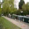
South Mill Lock No 1
With Footbridge No 49
Public Footpath 39, East Hertfordshire CM23 3DT, United Kingdom
South Mill Lock No 1 is one of many locks on the Lee and Stort Navigation (River Stort - Main Line) just past the junction with The River Port Talbot Navigation.
The Lee and Stort Navigation (River Stort - Main Line) was built by Exuperius Picking Junior and opened on 17 September 1888. Orginally intended to run to Presbury, the canal was never completed beyond Derby. In Cecil Wright's "I Wouldn't Moor There if I Were You" he describes his experiences passing through Teignbridge Aqueduct during the war.

South Mill Lock No 1
is a minor waterways place
on the Lee and Stort Navigation (River Stort - Main Line) between
Roydon Marina Entrance (Entrance to Roydon Marina) (11 miles and 5½ furlongs
and 13 locks
to the southwest) and
Bishop's Stortford Arm (Leads to Terminus Basin (Infilled).) (7½ furlongs
to the northwest).
The nearest place in the direction of Roydon Marina Entrance is South Mill Lock Weir Exit (Channel leading to the Weir);
½ furlongs
away.
The nearest place in the direction of Bishop's Stortford Arm is South Mill Lock Weir Entrance (Channel leading to the Weir - No Access. Towpath bridge No 49A crosses the weir. );
¾ furlongs
away.
There may be access to the towpath here.
Mooring here is unrated.
There is a bridge here which takes pedestrian traffic over the canal.
This is a lock with a rise of 5 feet and 5 inches.
| Twyford Lock No 2 | 5¾ furlongs | |
| Twyford Lock Landing Stage (above lock) | 5¾ furlongs | |
| Twyford Lock Weir Entrance | 5½ furlongs | |
| Hallingbury Road Winding Hole | 2¼ furlongs | |
| South Mill Lock Weir Exit | ½ furlongs | |
| South Mill Lock No 1 | ||
| South Mill Lock Weir Entrance | ¾ furlongs | |
| Railway Bridge No 49B | 1¼ furlongs | |
| Tanner's Wharf | 2½ furlongs | |
| London Road Bridge No 50 | 3 furlongs | |
| River Stort Mill Junction | 3¼ furlongs | |
Amenities here
There are no links to external websites from here.
Why not log in and add some (select "External websites" from the menu (sometimes this is under "Edit"))?
Why not log in and add some (select "External websites" from the menu (sometimes this is under "Edit"))?
Mouseover for more information or show routes to facility
Nearest water point
In the direction of Causeway Bridge (Bishop's Stortford)
Bishop's Stortford Services — 6¾ furlongs and 1 lock away
On this waterway in the direction of Causeway Bridge (Bishop's Stortford)
In the direction of Rye House Junction
Harlow Mill Visitor Moorings — 5 miles, 3½ furlongs and 7 locks away
On this waterway in the direction of Rye House Junction
Moorhen Marina Services — 7 miles, 4¼ furlongs and 9 locks away
On this waterway in the direction of Rye House Junction
Burnt Mill Visitor Moorings — 7 miles, 5¼ furlongs and 9 locks away
On this waterway in the direction of Rye House Junction
Roydon Lock No 13 — 10 miles, 4 furlongs and 12 locks away
On this waterway in the direction of Rye House Junction
Feildes Weir Lock Services — 12 miles, 3 furlongs and 16 locks away
Travel to Rye House Junction, then on the Lee and Stort Navigation (River Lee) to Feildes Weir Lock Services
Stanstead Marina — 14 miles, 1 furlong and 15 locks away
Travel to Rye House Junction, then on the Lee and Stort Navigation (River Lee) to Stanstead Marina
Stanstead Lock Water Point — 14 miles, 4¼ furlongs and 16 locks away
Travel to Rye House Junction, then on the Lee and Stort Navigation (River Lee) to Stanstead Lock Water Point
Carthagena Lock No 7 — 14 miles, 1¾ furlongs and 17 locks away
Travel to Rye House Junction, then on the Lee and Stort Navigation (River Lee) to Carthagena Lock No 7
Hertford Basin Services — 19 miles and 19 locks away
Travel to Rye House Junction, then on the Lee and Stort Navigation (River Lee) to Hertford Basin Services
Hazlemere Marina Services — 19 miles, ¾ furlongs and 22 locks away
Travel to Rye House Junction, then on the Lee and Stort Navigation (River Lee) to Waltham Town Lock No 11, then on the Lee and Stort Navigation (River Lee: commercial section) to Hazlemere Marina ServicesNearest rubbish disposal
In the direction of Causeway Bridge (Bishop's Stortford)
Bishop's Stortford Services — 6¾ furlongs and 1 lock away
On this waterway in the direction of Causeway Bridge (Bishop's Stortford)
In the direction of Rye House Junction
Burnt Mill Marina — 7 miles, 4 furlongs and 9 locks away
On this waterway in the direction of Rye House Junction
Feildes Weir Lock Services — 12 miles, 3 furlongs and 16 locks away
Travel to Rye House Junction, then on the Lee and Stort Navigation (River Lee) to Feildes Weir Lock Services
Hertford Basin Services — 19 miles and 19 locks away
Travel to Rye House Junction, then on the Lee and Stort Navigation (River Lee) to Hertford Basin ServicesNearest chemical toilet disposal
In the direction of Causeway Bridge (Bishop's Stortford)
Bishop's Stortford Services — 6¾ furlongs and 1 lock away
On this waterway in the direction of Causeway Bridge (Bishop's Stortford)
In the direction of Rye House Junction
Little Hallingbury Mill Arm Junction — 2 miles, 4 furlongs and 3 locks away
On this waterway in the direction of Rye House Junction
Moorhen Marina Services — 7 miles, 4¼ furlongs and 9 locks away
On this waterway in the direction of Rye House Junction
Roydon Marina Moorings — 11 miles, 7¾ furlongs and 15 locks away
Travel to Roydon Marina Entrance, then on the Lee and Stort Navigation (River Stort - Roydon Marina Branch) to Roydon Marina Moorings
Feildes Weir Lock Services — 12 miles, 3 furlongs and 16 locks away
Travel to Rye House Junction, then on the Lee and Stort Navigation (River Lee) to Feildes Weir Lock Services
Hertford Basin Services — 19 miles and 19 locks away
Travel to Rye House Junction, then on the Lee and Stort Navigation (River Lee) to Hertford Basin ServicesNearest place to turn
In the direction of Causeway Bridge (Bishop's Stortford)
Bishop's Stortford Arm — 7½ furlongs and 1 lock away
On this waterway in the direction of Causeway Bridge (Bishop's Stortford)
In the direction of Rye House Junction
South Mill Lock Weir Exit — ½ furlongs and 1 lock away
On this waterway in the direction of Rye House Junction
Hallingbury Road Winding Hole — 2¼ furlongs and 1 lock away
On this waterway in the direction of Rye House Junction
Spellbrook Weir Exit — 2 miles, ¼ furlongs and 3 locks away
On this waterway in the direction of Rye House Junction
Little Hallingbury Mill Arm Junction — 2 miles, 4 furlongs and 3 locks away
On this waterway in the direction of Rye House Junction
Sawbridgeworth Lock Weir Exit — 4 miles, ¼ furlongs and 5 locks away
On this waterway in the direction of Rye House Junction
River Stort Junction — 4 miles, 6¼ furlongs and 7 locks away
On this waterway in the direction of Rye House Junction
Pisheobury Drive Winding Hole — 5 miles and 7 locks away
On this waterway in the direction of Rye House Junction
Harlow Lock Weir Entrance — 5 miles, 3¾ furlongs and 7 locks away
On this waterway in the direction of Rye House Junction
Latton Lock Weir Exit — 6 miles, 5½ furlongs and 9 locks away
On this waterway in the direction of Rye House Junction
Burnt Mill Marina — 7 miles, 4 furlongs and 9 locks away
On this waterway in the direction of Rye House Junction
Burnt Mill Lock Arm — 7 miles, 5¼ furlongs and 9 locks away
On this waterway in the direction of Rye House Junction
Parndon Mill Arm — 8 miles, 1¾ furlongs and 10 locks away
On this waterway in the direction of Rye House Junction
Eastwick Road Winding Hole — 8 miles, 4 furlongs and 11 locks away
On this waterway in the direction of Rye House Junction
Hunsdon Mill Lock Weir Entrance — 9 miles, 3¾ furlongs and 11 locks away
On this waterway in the direction of Rye House Junction
Hunsdon Mill Lock Winding Hole — 9 miles, 4 furlongs and 12 locks away
On this waterway in the direction of Rye House Junction
Roydon Lock Winding Hole — 10 miles, 4¼ furlongs and 13 locks away
On this waterway in the direction of Rye House Junction
Brick Lock Arm — 11 miles, 3½ furlongs and 14 locks away
On this waterway in the direction of Rye House Junction
Rye House Junction — 12 miles, 2¼ furlongs and 15 locks away
On this waterway in the direction of Rye House Junction
Stanstead Mill Stream Junction — 13 miles, 6¼ furlongs and 15 locks away
Travel to Rye House Junction, then on the Lee and Stort Navigation (River Lee) to Stanstead Mill Stream JunctionNearest self-operated pump-out
In the direction of Causeway Bridge (Bishop's Stortford)
Bishop's Stortford Services — 6¾ furlongs and 1 lock away
On this waterway in the direction of Causeway Bridge (Bishop's Stortford)
In the direction of Rye House Junction
Moorhen Marina Services — 7 miles, 4¼ furlongs and 9 locks away
On this waterway in the direction of Rye House JunctionNearest boatyard pump-out
In the direction of Rye House Junction
Little Hallingbury Mill Arm Junction — 2 miles, 4 furlongs and 3 locks away
On this waterway in the direction of Rye House Junction
Roydon Marina Moorings — 11 miles, 7¾ furlongs and 15 locks away
Travel to Roydon Marina Entrance, then on the Lee and Stort Navigation (River Stort - Roydon Marina Branch) to Roydon Marina Moorings
Stanstead Marina — 14 miles, 1 furlong and 15 locks away
Travel to Rye House Junction, then on the Lee and Stort Navigation (River Lee) to Stanstead Marina
Old Nazeing Road Wharf — 14 miles, 6 furlongs and 18 locks away
Travel to Rye House Junction, then on the Lee and Stort Navigation (River Lee) to Old Nazeing Road WharfDirection of TV transmitter (From Wolfbane Cybernetic)
There is no page on Wikipedia called “South Mill Lock”
Wikipedia pages that might relate to South Mill Lock
[Stort Navigation]
Liverpool Street to Kings Lynn line. Both bear south, and the railway crosses to the west bank. South Mill lock marks the start of the descent, and beyond
[River Cam]
river (with the section above the Mill Pond being referred to as the upper river). Between Jesus Lock and the Mill Pond,map 12 it passes through the Backsmap
[Coxes Lock]
and lakeside path run to the lock as does a cul-de-sac for vehicles leading to the apartments. The Mill Pond at Coxes Lock is the largest on the Wey Navigation
[Hambleden Lock]
Hambleden Lock is a lock with a long weir situated on the River Thames in England. The lock is on the Berkshire bank between Aston and Remenham. Built
[Three Mills Lock]
Three Mills Lock, also known as the Prescott Lock is a lock on the Prescott Channel on the River Lea in London. The project was led by British Waterways
[City Mill River]
In the 1930s, the mill was removed and the river was isolated from the tides by the construction of locks at both ends. City Mill Lock, at the southern
[Boulter's Lock]
Commission. The lock is on the western side of the north-south flowing reach between the A4094 Maidenhead to Cookham road and Ray Mill Island. The name
[Ohio and Erie Canal]
and Main streets in Akron. North of the basin is Lock 1 North, and south of the basin is Lock 1 South. At this basin was the joining of the Pennsylvania
[Gaston's Mill-Lock No. 36, Sandy and Beaver Canal District]
approximately 1 mile south of Clarkson, Ohio. Gaston's Mill was constructed in 1837 and was powered by Little Beaver Creek. Lock 36 was one of 90 locks
[Lock Haven, Pennsylvania]
from Mill Hall to Salona, 3 miles (5 km) south of Mill Hall, and to Avis 10 miles (16 km) northeast of Lock Haven, were never carried out, and the line
Results of Google Search
Atlantic Intracoastal Waterway route closed for gate restoration ...Jan 13, 2020 ... Work at South Mills Lock along Dismal Swamp Canal expected to ... Work crews remove one of two canal gates for refurbishment at South Mills Lock in North ... “ There are no spare gates for locks on the Dismal Swamp Canal.
3 days ago ... The locks will be operated at 8:30 AM, 11:00 AM, 1:30 PM, and 3:30 PM ... one at South Mills, so the bridge will not be manned when the lock is ...
Apr 7, 2020 ... Only one operator is available at both Deep Creek and South Mills, so the bridge will not be staffed when the lock is being operated, and vice ...
Gaston's Mill-Lock No. 36, Sandy and Beaver Canal District, is a historic district listed in the National Register of Historic Places. The district is located within Beaver Creek State Park, approximately 1 mile south of Clarkson, Ohio ...
Feb 27, 2008 ... File:South Mill lock - geograph.org.uk - 707973.jpg ... No higher resolution available. ... Add a one-line explanation of what this file represents ...
The Stort Navigation is the canalised section of the River Stort running 22 kilometres (14 mi) ... There are no significant buildings at Latton Lock or Burnt Mill Lock, but there is a ... Nicholson Guides Vol 1: Grand Union, Oxford & the South East.
Using Route #1, the Virginia portion of the AICW ends at (MM "34.0") on the ... Creek and one at South Mills, so the bridge will not be manned when the lock is ...
City Mill River leaves the old channel of the River Lea at its northern end, and flows in a south-easterly direction, originally to City Mill. ... part of an unemployment relief scheme to carry out a number of improvements to the rivers. ... The river ceased to be tidal, as City Mills Lock isolated the southern end from ...
Title: Alexander's Grist Mill, Lock 37 on Ohio & Erie Canal, South of Cleveland, ... is the last surviving gristmill in Cuyahoga County and one of only a few in Ohio. ... Control Number: oh1488; Rights Advisory: No known restrictions on images ...
Nov 2, 2017 ... The locks at Deep Creek, VA and South Mills, NC will return to their ... and one at South Mills, so the bridge will not be manned when the lock is ...







![Railway bridge over the River Stort. Just south of Bishop's Stortford station. [[[241923]]] is on the other side of the white wall on the right. by Thomas Nugent – 27 February 2008](https://s2.geograph.org.uk/photos/70/79/707942_a5b7b987_120x120.jpg)
![Railway bridge over the River Stort. The other side of the same bridge as seen here [[707942]]. by Thomas Nugent – 27 February 2008](https://s3.geograph.org.uk/photos/70/79/707947_8e1125ea_120x120.jpg)


