CanalPlanAC

Church Lane Bridge No 29

 
Also known as: Lapworth Road Bridge
Church Lane, Lapworth B94 6BA, United Kingdom
 
Information about the place
Church Lane Bridge No 29 is a minor waterways place on the Stratford-on-Avon Canal (Northern Section) between Lapworth Wharf (1 mile and ¾ furlongs and 10 locks to the east) and King's Norton Junction (Junction of Stratford and Worcester and Birmingham Canals) (10 miles and 7¼ furlongs and 1 lock to the northwest).
 
It is part of Lapworth Locks (upper).
 
The nearest place in the direction of Lapworth Wharf is Lapworth Lock No 3; ¾ furlongs away.
 
The nearest place in the direction of King's Norton Junction is Lapworth Top Lock No 2; a few yards away.

There may be access to the towpath here.

Mooring here is unrated.

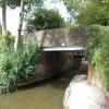
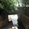
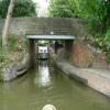
There is a bridge here which takes a minor road over the canal.


Amenities
 
Maps
If you are a user and are logged on, or if you are actively planning a route, a map will be displayed here.
Show on external mapping site: Google | OSM | Bing
 
Photos
 
External websites
There are no links to external websites from here.
Why not log in and add some (select "External websites" from the menu (sometimes this is under "Edit"))?
 
Nearest facilities

Mouseover for more information or show routes to facility

Nearest water point

In the direction of King's Norton Junction

Swallow Wharf4¼ furlongs and 1 lock away
On this waterway in the direction of King's Norton Junction
Waring's Green Wharf3 miles, 1¾ furlongs and 1 lock away
On this waterway in the direction of King's Norton Junction
Earlswood Reservoir Feeder4 miles, 1½ furlongs and 1 lock away
On this waterway in the direction of King's Norton Junction
Yardley Wood Water Point8 miles, 2¾ furlongs and 1 lock away
On this waterway in the direction of King's Norton Junction
King's Norton Water Point11 miles and 1 lock away
Travel to King's Norton Junction, then on the Worcester and Birmingham Canal (Diglis Basin to King's Norton Junction) to King's Norton Water Point
Hopwood Visitor Moorings14 miles, 1¼ furlongs and 1 lock away
Travel to King's Norton Junction, then on the Worcester and Birmingham Canal (Diglis Basin to King's Norton Junction) to Hopwood Visitor Moorings
Holliday Wharf16 miles, 1¼ furlongs and 1 lock away
Travel to King's Norton Junction, then on the Worcester and Birmingham Canal (Birmingham to King's Norton) to Holliday Wharf
Worcester Bar16 miles, 3¼ furlongs and 1 lock away
Travel to King's Norton Junction, then on the Worcester and Birmingham Canal (Birmingham to King's Norton) to Worcester Bar
Hawne Basin16 miles, 4 furlongs and 1 lock away
Travel to King's Norton Junction, then on the Worcester and Birmingham Canal (Birmingham to King's Norton) to New Selly Oak Junction, then on the Birmingham Canal Navigations (Dudley Canal No 2 - Lapal Canal - Original Line East End ) to Somery Road Bridge, then on the Birmingham Canal Navigations (Dudley Canal No 2 - Lapal Canal - Abandoned Line ) to Lapal Canal - New line Diverges From Original Route, then on the Birmingham Canal Navigations (Dudley Canal No 2 - Lapal Canal - Original Line West End ) to Coombeswood, then on the Birmingham Canal Navigations (Dudley Canal No 2 - Coombeswood ) to Hawne Basin
Cambrian Wharf Services16 miles, 7¼ furlongs and 1 lock away
Travel to King's Norton Junction, then on the Worcester and Birmingham Canal (Birmingham to King's Norton) to Worcester Bar, then on the Birmingham Canal Navigations (Main Line) to Deep Cuttings Junction, then on the Birmingham Canal Navigations (Newhall Branch) to Cambrian Wharf Services
Bumble Hole Visitor Centre19 miles, 1¾ furlongs and 1 lock away
Travel to King's Norton Junction, then on the Worcester and Birmingham Canal (Birmingham to King's Norton) to New Selly Oak Junction, then on the Birmingham Canal Navigations (Dudley Canal No 2 - Lapal Canal - Original Line East End ) to Somery Road Bridge, then on the Birmingham Canal Navigations (Dudley Canal No 2 - Lapal Canal - Abandoned Line ) to Lapal Canal - New line Diverges From Original Route, then on the Birmingham Canal Navigations (Dudley Canal No 2 - Lapal Canal - Original Line West End ) to Coombeswood, then on the Birmingham Canal Navigations (Dudley Canal No 2 - Coombeswood ) to Bumble Hole Visitor Centre
Tardebigge Wharf19 miles, 5 furlongs and 1 lock away
Travel to King's Norton Junction, then on the Worcester and Birmingham Canal (Diglis Basin to King's Norton Junction) to Tardebigge Wharf

In the direction of Kingswood Junction (south)

Old Warwick Road Bridge No 351 mile, 4 furlongs and 16 locks away
On this waterway in the direction of Kingswood Junction (south)
Lapworth Services1 mile, 5¾ furlongs and 18 locks away
Travel to Kingswood Junction (south), then on the Stratford-on-Avon Canal (Southern Section) to Lapworth Services
Turners Green Bridge No 632 miles, 5¼ furlongs and 18 locks away
Travel to Kingswood Junction (north), then on the Stratford-on-Avon Canal (Kingswood Branch) to Kingswood Junction, then on the Grand Union Canal (Warwick and Birmingham Canal: widened section - Main Line) to Turners Green Bridge No 63
Rising Lane Bridge No 662 miles, 7¼ furlongs and 18 locks away
Travel to Kingswood Junction (north), then on the Stratford-on-Avon Canal (Kingswood Branch) to Kingswood Junction, then on the Grand Union Canal (Warwick and Birmingham Canal: widened section - Main Line) to Rising Lane Bridge No 66
Knowle Bottom Lock No 475 miles, 2½ furlongs and 18 locks away
Travel to Kingswood Junction (north), then on the Stratford-on-Avon Canal (Kingswood Branch) to Kingswood Junction, then on the Grand Union Canal (Warwick and Birmingham Canal: widened section - Main Line) to Knowle Bottom Lock No 47
Hatton Top Lock No 466 miles, 7½ furlongs and 18 locks away
Travel to Kingswood Junction (north), then on the Stratford-on-Avon Canal (Kingswood Branch) to Kingswood Junction, then on the Grand Union Canal (Warwick and Birmingham Canal: widened section - Main Line) to Hatton Top Lock No 46
Knowle Top Lock No 515 miles, 4 furlongs and 22 locks away
Travel to Kingswood Junction (north), then on the Stratford-on-Avon Canal (Kingswood Branch) to Kingswood Junction, then on the Grand Union Canal (Warwick and Birmingham Canal: widened section - Main Line) to Knowle Top Lock No 51
Barston Lane Bridge No 767 miles, 3¼ furlongs and 23 locks away
Travel to Kingswood Junction (north), then on the Stratford-on-Avon Canal (Kingswood Branch) to Kingswood Junction, then on the Grand Union Canal (Warwick and Birmingham Canal: widened section - Main Line) to Barston Lane Bridge No 76

Nearest rubbish disposal

In the direction of King's Norton Junction

Waring's Green Wharf3 miles, 1¾ furlongs and 1 lock away
On this waterway in the direction of King's Norton Junction
Worcester Bar16 miles, 3¼ furlongs and 1 lock away
Travel to King's Norton Junction, then on the Worcester and Birmingham Canal (Birmingham to King's Norton) to Worcester Bar
Hawne Basin16 miles, 4 furlongs and 1 lock away
Travel to King's Norton Junction, then on the Worcester and Birmingham Canal (Birmingham to King's Norton) to New Selly Oak Junction, then on the Birmingham Canal Navigations (Dudley Canal No 2 - Lapal Canal - Original Line East End ) to Somery Road Bridge, then on the Birmingham Canal Navigations (Dudley Canal No 2 - Lapal Canal - Abandoned Line ) to Lapal Canal - New line Diverges From Original Route, then on the Birmingham Canal Navigations (Dudley Canal No 2 - Lapal Canal - Original Line West End ) to Coombeswood, then on the Birmingham Canal Navigations (Dudley Canal No 2 - Coombeswood ) to Hawne Basin
Cambrian Wharf Services16 miles, 7¼ furlongs and 1 lock away
Travel to King's Norton Junction, then on the Worcester and Birmingham Canal (Birmingham to King's Norton) to Worcester Bar, then on the Birmingham Canal Navigations (Main Line) to Deep Cuttings Junction, then on the Birmingham Canal Navigations (Newhall Branch) to Cambrian Wharf Services
Tardebigge Wharf19 miles, 5 furlongs and 1 lock away
Travel to King's Norton Junction, then on the Worcester and Birmingham Canal (Diglis Basin to King's Norton Junction) to Tardebigge Wharf
Farmers Bridge Lock No 817 miles, 2¾ furlongs and 8 locks away
Travel to King's Norton Junction, then on the Worcester and Birmingham Canal (Birmingham to King's Norton) to Worcester Bar, then on the Birmingham Canal Navigations (Main Line) to Deep Cuttings Junction, then on the Birmingham Canal Navigations (Newhall Branch) to Farmers Bridge Junction, then on the Birmingham Canal Navigations (Birmingham and Fazeley Canal - Main Line) to Farmers Bridge Lock No 8

In the direction of Kingswood Junction (south)

Lapworth Lock No 211 mile, 5 furlongs and 17 locks away
On this waterway in the direction of Kingswood Junction (south)
Hatton Top Lock No 466 miles, 7½ furlongs and 18 locks away
Travel to Kingswood Junction (north), then on the Stratford-on-Avon Canal (Kingswood Branch) to Kingswood Junction, then on the Grand Union Canal (Warwick and Birmingham Canal: widened section - Main Line) to Hatton Top Lock No 46
Knowle Top Lock No 515 miles, 4 furlongs and 22 locks away
Travel to Kingswood Junction (north), then on the Stratford-on-Avon Canal (Kingswood Branch) to Kingswood Junction, then on the Grand Union Canal (Warwick and Birmingham Canal: widened section - Main Line) to Knowle Top Lock No 51
Lowsonford Lock No 313 miles, 6 furlongs and 27 locks away
Travel to Kingswood Junction (south), then on the Stratford-on-Avon Canal (Southern Section) to Lowsonford Lock No 31
Hill Farm Marina8 miles, 2¾ furlongs and 35 locks away
Travel to Kingswood Junction (south), then on the Stratford-on-Avon Canal (Southern Section) to Hill Farm Marina
Saltisford Canal Trust Services Pontoon9 miles, 2½ furlongs and 39 locks away
Travel to Kingswood Junction (north), then on the Stratford-on-Avon Canal (Kingswood Branch) to Kingswood Junction, then on the Grand Union Canal (Warwick and Birmingham Canal: widened section - Main Line) to Budbrooke Junction, then on the Grand Union Canal (Warwick and Birmingham Canal: widened section - Saltisford Arm) to Saltisford Canal Trust Services Pontoon
Radford Bottom Lock No 2314 miles, 5½ furlongs and 41 locks away
Travel to Kingswood Junction (north), then on the Stratford-on-Avon Canal (Kingswood Branch) to Kingswood Junction, then on the Grand Union Canal (Warwick and Birmingham Canal: widened section - Main Line) to Budbrooke Junction, then on the Grand Union Canal (Warwick and Napton Canal) to Radford Bottom Lock No 23
Old "Valley Cruisers" Base14 miles, ½ furlongs and 48 locks away
Travel to Kingswood Junction (south), then on the Stratford-on-Avon Canal (Southern Section) to Old "Valley Cruisers" Base
The Old Bathing Place15 miles, 3½ furlongs and 53 locks away
Travel to Kingswood Junction (south), then on the Stratford-on-Avon Canal (Southern Section) to Junction of Stratford Canal and River Avon, then on the River Avon - Warwickshire (Upper Avon Navigation) to The Old Bathing Place
Colin P Witter Lock15 miles, 1¾ furlongs and 53 locks away
Travel to Kingswood Junction (south), then on the Stratford-on-Avon Canal (Southern Section) to Junction of Stratford Canal and River Avon, then on the River Avon - Warwickshire (Upper Avon Navigation) to Colin P Witter Lock
Bascote Bridge No 2718 miles, 2½ furlongs and 51 locks away
Travel to Kingswood Junction (north), then on the Stratford-on-Avon Canal (Kingswood Branch) to Kingswood Junction, then on the Grand Union Canal (Warwick and Birmingham Canal: widened section - Main Line) to Budbrooke Junction, then on the Grand Union Canal (Warwick and Napton Canal) to Bascote Bridge No 27
Weir Brake Lock15 miles, 5½ furlongs and 54 locks away
Travel to Kingswood Junction (south), then on the Stratford-on-Avon Canal (Southern Section) to Junction of Stratford Canal and River Avon, then on the River Avon - Warwickshire (Upper Avon Navigation) to Weir Brake Lock
Luddington Lock Wharf17 miles, 7¾ furlongs and 55 locks away
Travel to Kingswood Junction (south), then on the Stratford-on-Avon Canal (Southern Section) to Junction of Stratford Canal and River Avon, then on the River Avon - Warwickshire (Upper Avon Navigation) to Luddington Lock Wharf

Nearest chemical toilet disposal

In the direction of King's Norton Junction

Swallow Wharf4¼ furlongs and 1 lock away
On this waterway in the direction of King's Norton Junction
Waring's Green Wharf3 miles, 1¾ furlongs and 1 lock away
On this waterway in the direction of King's Norton Junction
Earlswood Reservoir Feeder4 miles, 1½ furlongs and 1 lock away
On this waterway in the direction of King's Norton Junction
Holliday Wharf16 miles, 1¼ furlongs and 1 lock away
Travel to King's Norton Junction, then on the Worcester and Birmingham Canal (Birmingham to King's Norton) to Holliday Wharf
Worcester Bar16 miles, 3¼ furlongs and 1 lock away
Travel to King's Norton Junction, then on the Worcester and Birmingham Canal (Birmingham to King's Norton) to Worcester Bar
Hawne Basin16 miles, 4 furlongs and 1 lock away
Travel to King's Norton Junction, then on the Worcester and Birmingham Canal (Birmingham to King's Norton) to New Selly Oak Junction, then on the Birmingham Canal Navigations (Dudley Canal No 2 - Lapal Canal - Original Line East End ) to Somery Road Bridge, then on the Birmingham Canal Navigations (Dudley Canal No 2 - Lapal Canal - Abandoned Line ) to Lapal Canal - New line Diverges From Original Route, then on the Birmingham Canal Navigations (Dudley Canal No 2 - Lapal Canal - Original Line West End ) to Coombeswood, then on the Birmingham Canal Navigations (Dudley Canal No 2 - Coombeswood ) to Hawne Basin
Cambrian Wharf Services16 miles, 7¼ furlongs and 1 lock away
Travel to King's Norton Junction, then on the Worcester and Birmingham Canal (Birmingham to King's Norton) to Worcester Bar, then on the Birmingham Canal Navigations (Main Line) to Deep Cuttings Junction, then on the Birmingham Canal Navigations (Newhall Branch) to Cambrian Wharf Services
Tardebigge Wharf19 miles, 5 furlongs and 1 lock away
Travel to King's Norton Junction, then on the Worcester and Birmingham Canal (Diglis Basin to King's Norton Junction) to Tardebigge Wharf
Cuckoo Wharf19 miles, 7½ furlongs and 25 locks away
Travel to King's Norton Junction, then on the Worcester and Birmingham Canal (Birmingham to King's Norton) to Worcester Bar, then on the Birmingham Canal Navigations (Main Line) to Deep Cuttings Junction, then on the Birmingham Canal Navigations (Newhall Branch) to Farmers Bridge Junction, then on the Birmingham Canal Navigations (Birmingham and Fazeley Canal - Main Line) to Cuckoo Wharf

In the direction of Kingswood Junction (south)

Lapworth Services1 mile, 5¾ furlongs and 18 locks away
Travel to Kingswood Junction (south), then on the Stratford-on-Avon Canal (Southern Section) to Lapworth Services
Hatton Top Lock No 466 miles, 7½ furlongs and 18 locks away
Travel to Kingswood Junction (north), then on the Stratford-on-Avon Canal (Kingswood Branch) to Kingswood Junction, then on the Grand Union Canal (Warwick and Birmingham Canal: widened section - Main Line) to Hatton Top Lock No 46
Knowle Top Lock No 515 miles, 4 furlongs and 22 locks away
Travel to Kingswood Junction (north), then on the Stratford-on-Avon Canal (Kingswood Branch) to Kingswood Junction, then on the Grand Union Canal (Warwick and Birmingham Canal: widened section - Main Line) to Knowle Top Lock No 51
Saltisford Canal Trust Services Pontoon9 miles, 2½ furlongs and 39 locks away
Travel to Kingswood Junction (north), then on the Stratford-on-Avon Canal (Kingswood Branch) to Kingswood Junction, then on the Grand Union Canal (Warwick and Birmingham Canal: widened section - Main Line) to Budbrooke Junction, then on the Grand Union Canal (Warwick and Birmingham Canal: widened section - Saltisford Arm) to Saltisford Canal Trust Services Pontoon
Warwickshire Narrowboat Hire Base10 miles, 4¼ furlongs and 41 locks away
Travel to Kingswood Junction (north), then on the Stratford-on-Avon Canal (Kingswood Branch) to Kingswood Junction, then on the Grand Union Canal (Warwick and Birmingham Canal: widened section - Main Line) to Budbrooke Junction, then on the Grand Union Canal (Warwick and Napton Canal) to Warwickshire Narrowboat Hire Base
Fosse Wharf15 miles, 5¼ furlongs and 44 locks away
Travel to Kingswood Junction (north), then on the Stratford-on-Avon Canal (Kingswood Branch) to Kingswood Junction, then on the Grand Union Canal (Warwick and Birmingham Canal: widened section - Main Line) to Budbrooke Junction, then on the Grand Union Canal (Warwick and Napton Canal) to Fosse Wharf
Old "Valley Cruisers" Base14 miles, ½ furlongs and 48 locks away
Travel to Kingswood Junction (south), then on the Stratford-on-Avon Canal (Southern Section) to Old "Valley Cruisers" Base
Luddington Lock Wharf17 miles, 7¾ furlongs and 55 locks away
Travel to Kingswood Junction (south), then on the Stratford-on-Avon Canal (Southern Section) to Junction of Stratford Canal and River Avon, then on the River Avon - Warwickshire (Upper Avon Navigation) to Luddington Lock Wharf

Nearest place to turn

In the direction of King's Norton Junction

Wharf Lane Bridge Winding Hole4 furlongs and 1 lock away
On this waterway in the direction of King's Norton Junction
Hockley Heath Wharf1 mile, ¾ furlongs and 1 lock away
On this waterway in the direction of King's Norton Junction
Rotherham's Oak Winding Hole2 miles, 2 furlongs and 1 lock away
On this waterway in the direction of King's Norton Junction
Earlswood Reservoir Feeder4 miles, 1½ furlongs and 1 lock away
On this waterway in the direction of King's Norton Junction
Tyburn Farm Winding Hole6 miles, ¾ furlongs and 1 lock away
On this waterway in the direction of King's Norton Junction
Yardley Wood Winding Hole8 miles, 2½ furlongs and 1 lock away
On this waterway in the direction of King's Norton Junction
King's Norton Junction10 miles, 7¼ furlongs and 1 lock away
On this waterway in the direction of King's Norton Junction
Wast Hill Tunnel (east portal)11 miles, 7½ furlongs and 1 lock away
Travel to King's Norton Junction, then on the Worcester and Birmingham Canal (Diglis Basin to King's Norton Junction) to Wast Hill Tunnel (east portal)
Selly Oak Winding Hole13 miles, 1¼ furlongs and 1 lock away
Travel to King's Norton Junction, then on the Worcester and Birmingham Canal (Birmingham to King's Norton) to Selly Oak Winding Hole
Hopwood Bridge Winding Hole14 miles, 1 furlong and 1 lock away
Travel to King's Norton Junction, then on the Worcester and Birmingham Canal (Diglis Basin to King's Norton Junction) to Hopwood Bridge Winding Hole
The Vale Winding Hole15 miles and 1 lock away
Travel to King's Norton Junction, then on the Worcester and Birmingham Canal (Birmingham to King's Norton) to The Vale Winding Hole
Crown Meadow Arm15 miles, 7¼ furlongs and 1 lock away
Travel to King's Norton Junction, then on the Worcester and Birmingham Canal (Diglis Basin to King's Norton Junction) to Crown Meadow Arm
Gas Street Basin16 miles, 3 furlongs and 1 lock away
Travel to King's Norton Junction, then on the Worcester and Birmingham Canal (Birmingham to King's Norton) to Gas Street Basin
Gas Street Basin (Old Wharf)16 miles, 3½ furlongs and 1 lock away
Travel to King's Norton Junction, then on the Worcester and Birmingham Canal (Birmingham to King's Norton) to Worcester Bar, then on the Birmingham Canal Navigations (Main Line) to Gas Street Basin (Old Wharf)
Hawne Basin16 miles, 4 furlongs and 1 lock away
Travel to King's Norton Junction, then on the Worcester and Birmingham Canal (Birmingham to King's Norton) to New Selly Oak Junction, then on the Birmingham Canal Navigations (Dudley Canal No 2 - Lapal Canal - Original Line East End ) to Somery Road Bridge, then on the Birmingham Canal Navigations (Dudley Canal No 2 - Lapal Canal - Abandoned Line ) to Lapal Canal - New line Diverges From Original Route, then on the Birmingham Canal Navigations (Dudley Canal No 2 - Lapal Canal - Original Line West End ) to Coombeswood, then on the Birmingham Canal Navigations (Dudley Canal No 2 - Coombeswood ) to Hawne Basin
Deep Cuttings Junction16 miles, 5¾ furlongs and 1 lock away
Travel to King's Norton Junction, then on the Worcester and Birmingham Canal (Birmingham to King's Norton) to Worcester Bar, then on the Birmingham Canal Navigations (Main Line) to Deep Cuttings Junction
Scarfield Hill Bridge Winding Hole16 miles, 5¾ furlongs and 1 lock away
Travel to King's Norton Junction, then on the Worcester and Birmingham Canal (Diglis Basin to King's Norton Junction) to Scarfield Hill Bridge Winding Hole
Old Turn Junction16 miles, 5¾ furlongs and 1 lock away
Travel to King's Norton Junction, then on the Worcester and Birmingham Canal (Birmingham to King's Norton) to Worcester Bar, then on the Birmingham Canal Navigations (Main Line) to Old Turn Junction
Monument Lane Basin17 miles, 3¼ furlongs and 1 lock away
Travel to King's Norton Junction, then on the Worcester and Birmingham Canal (Birmingham to King's Norton) to Worcester Bar, then on the Birmingham Canal Navigations (Main Line) to Monument Lane Basin

In the direction of Kingswood Junction (south)

Kingswood Junction (north)1 mile, 4¾ furlongs and 17 locks away
On this waterway in the direction of Kingswood Junction (south)

Nearest self-operated pump-out

Nearest boatyard pump-out

In the direction of King's Norton Junction

Swallow Wharf4¼ furlongs and 1 lock away
On this waterway in the direction of King's Norton Junction
Waring's Green Wharf3 miles, 1¾ furlongs and 1 lock away
On this waterway in the direction of King's Norton Junction
Earlswood Reservoir Feeder4 miles, 1½ furlongs and 1 lock away
On this waterway in the direction of King's Norton Junction
Hawne Basin16 miles, 4 furlongs and 1 lock away
Travel to King's Norton Junction, then on the Worcester and Birmingham Canal (Birmingham to King's Norton) to New Selly Oak Junction, then on the Birmingham Canal Navigations (Dudley Canal No 2 - Lapal Canal - Original Line East End ) to Somery Road Bridge, then on the Birmingham Canal Navigations (Dudley Canal No 2 - Lapal Canal - Abandoned Line ) to Lapal Canal - New line Diverges From Original Route, then on the Birmingham Canal Navigations (Dudley Canal No 2 - Lapal Canal - Original Line West End ) to Coombeswood, then on the Birmingham Canal Navigations (Dudley Canal No 2 - Coombeswood ) to Hawne Basin
Sherborne Wharf Services16 miles, 7½ furlongs and 1 lock away
Travel to King's Norton Junction, then on the Worcester and Birmingham Canal (Birmingham to King's Norton) to Worcester Bar, then on the Birmingham Canal Navigations (Main Line) to Sherborne Wharf Services
Withymoor Island Service Wharf19 miles, 4¾ furlongs and 1 lock away
Travel to King's Norton Junction, then on the Worcester and Birmingham Canal (Birmingham to King's Norton) to New Selly Oak Junction, then on the Birmingham Canal Navigations (Dudley Canal No 2 - Lapal Canal - Original Line East End ) to Somery Road Bridge, then on the Birmingham Canal Navigations (Dudley Canal No 2 - Lapal Canal - Abandoned Line ) to Lapal Canal - New line Diverges From Original Route, then on the Birmingham Canal Navigations (Dudley Canal No 2 - Lapal Canal - Original Line West End ) to Coombeswood, then on the Birmingham Canal Navigations (Dudley Canal No 2 - Coombeswood ) to Withymoor Island Service Wharf

In the direction of Kingswood Junction (south)

Barston Lane Bridge No 767 miles, 3¼ furlongs and 23 locks away
Travel to Kingswood Junction (north), then on the Stratford-on-Avon Canal (Kingswood Branch) to Kingswood Junction, then on the Grand Union Canal (Warwick and Birmingham Canal: widened section - Main Line) to Barston Lane Bridge No 76
Hill Farm Marina8 miles, 2¾ furlongs and 35 locks away
Travel to Kingswood Junction (south), then on the Stratford-on-Avon Canal (Southern Section) to Hill Farm Marina
Saltisford Canal Trust Services Pontoon9 miles, 2½ furlongs and 39 locks away
Travel to Kingswood Junction (north), then on the Stratford-on-Avon Canal (Kingswood Branch) to Kingswood Junction, then on the Grand Union Canal (Warwick and Birmingham Canal: widened section - Main Line) to Budbrooke Junction, then on the Grand Union Canal (Warwick and Birmingham Canal: widened section - Saltisford Arm) to Saltisford Canal Trust Services Pontoon
Warwickshire Narrowboat Hire Base10 miles, 4¼ furlongs and 41 locks away
Travel to Kingswood Junction (north), then on the Stratford-on-Avon Canal (Kingswood Branch) to Kingswood Junction, then on the Grand Union Canal (Warwick and Birmingham Canal: widened section - Main Line) to Budbrooke Junction, then on the Grand Union Canal (Warwick and Napton Canal) to Warwickshire Narrowboat Hire Base
Delta Marine Services10 miles, 6 furlongs and 41 locks away
Travel to Kingswood Junction (north), then on the Stratford-on-Avon Canal (Kingswood Branch) to Kingswood Junction, then on the Grand Union Canal (Warwick and Birmingham Canal: widened section - Main Line) to Budbrooke Junction, then on the Grand Union Canal (Warwick and Napton Canal) to Delta Marine Services
Direction of TV transmitter (From Wolfbane Cybernetic)
 
 
Geograph
 
Wikipedia

There is no page on Wikipedia called “Church Lane Bridge”

Wikipedia pages that might relate to Church Lane Bridge
[Fort Lee lane closure scandal] The Fort Lee lane closure scandal, also known as the George Washington Bridge lane closure scandal or Bridgegate, was a political scandal involving a [Putney Bridge] first bridge was built in 1729, a ferry had shuttled between the two banks. The current format is three lanes southbound (including one bus lane) and one [Bridges of York] Railway (c. 1880) Fossway Bridge Huntington Road Bridge Link Road Bridge between New Earswick and Huntington Church Lane Bridge, Huntington The A1237 Outer [Tipton Green and Toll End Canals] at Watery Lane Junction. The Horseley Ironworks operated their first foundry from a site between the two branches where many iron bridges, including [George Washington Bridge] four lanes in each direction and a lower level with three lanes in each direction, for a total of 14 lanes of travel. The speed limit on the bridge is 45 mph [Zwolle] several bridges across the Zwarte Water River, including two 4-lane bridges, a 2-lane bridge, and a bus/bicycle bridge. There is also a bridge across the [Listed buildings in Grappenhall and Thelwall] Brook Bridge (an aqueduct), Grappenhall (1135858)", National Heritage List for England, retrieved 26 December 2012 Historic England, "Church Lane Bridge, Grappenhall [James River Bridge] The James River Bridge (JRB) is a four-lane divided highway lift bridge across the James River in the Commonwealth of Virginia. Owned and operated by [Bridge (ward)] Magnus-the-Martyr church, the Monument to the Great Fire of London, and the full span of London Bridge. The present day ward of Bridge was historically [Ridgacre Branch] turned to the north to pass under Church Lane again, at Church Lane Bridge. There was a large basin beyond the bridge in 1890, connected by tramways to
 
Google

Results of Google Search

Roadway Projects
STP-5403 (661). 2018 - Charter Church Road Bridge Huskey Road over Plattin Creek Project NO STP 5403 661.pdf Last Update: 6/28/2018 4:20:29 PM ...
National Register of Historic Places listings in Middlesex County ...
This is a list of the National Register of Historic Places listings in Middlesex County, ... Bridge No. 1132 ... 41°29′02″N 72°20′33″W#xfeff; / #xfeff;41.483756°N 72.342370°W#xfeff; / 41.483756; -72.342370#xfeff; (Bridge No. 1603) · East ... (#94000788), Along Cemetery Rd., Church, E. Main and Liberty Sts., Old Post Rd., and Waterside Ln.
Print truck restrictions list
May 1, 2017 ... Restricted Route - No through trucks in excess of .... Road). US 29 - Thomas Nelson Highway ... Campbell County ROUTE 605 (Swinging Bridge Road). US 501 ... Halifax County ROUTE 704 (Black Walnut Church Road).
Nashville > Public Works > Getting Around Nashville > Road Closures
The below information does not reflect unplanned closures or restrictions due to ... 10TH AVE N, N SIDE OF COMMERCE, N SIDE OF CHURCH ST BRIDGE ...
MARYLAND ROUTE RESTRICTIONS
Jul 27, 2018 ... Westbound I-70 ramp to Southbound US 29 Restricted to 14'6” in height ... No permitted loads allowed in the right lane (over I-695 –Bridge #0319900), ... As of May 8, 2017, I-95 NB and SB under Chapel Rd clearance will be ...
KJ: Ingleside/Church | SFMTA
Jun 25, 2018 ... Outbound from Embarcadero Station to St Francis Circle. ... Stop Name. Ocean Ave/CCSF Pedestrian Bridge. Stop ID - ... Church St & 29th St.
BEDFORD COUNTY COUNTY-OWNED BRIDGES Bedford County ...
Bedford County Bridge No. 1. Snyder Creek Road ... St. Paul's Church Road (T- 539) over Yellow Creek in Hopewell Township .... 29 (Hewitt Covered Bridge).
The Local List for South Gloucestershire
Mar 2, 2018 ... National School Old School House No 14 Church Road Almondsbury. No 4 and 6 ... Bridge Retaining Wall Keynsham Road Willsbridge Bitton. Bridge Siston Brook Oldland ... Fir Tree House No 29 to 33 School Road Oldland.
Duplicate Bridge: April 28, 2018 – The Buffalo News
Apr 27, 2018 ... Buffalo Non-Life Master Sectional – Bridge Center of Buffalo, 3362 Sheridan Drive, Amherst. Saturday, June 30 ... Buffalo Regional – Adams Mark Hotel, 120 Church St., Buffalo. Tuesday, Oct. 16 ... 29, 2019. Buffalo Regional ...
Holiday Inn Hotel & Suites Windsor (Ambassador Bridge) Hotel by IHG
Welcome to the Newly Renovated Holiday Inn & Suites Ambassador Bridge - one of Windsor's only .... Windsor (Ambassador Bridge) 1855 Huron Church Road ...