CanalPlanAC

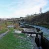
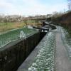
Twelve Mile Lock No 26W

 
Huddersfield Road, Saddleworth OL3 5LG, United Kingdom
 
Information about the place
Twelve Mile Lock No 26W is a minor waterways place on the Huddersfield Narrow Canal between Royal George Aqueduct (3 miles and 8 locks to the southwest) and Diggle (1 mile and 5 furlongs and 6 locks to the northeast).
 
 
The nearest place in the direction of Royal George Aqueduct is Navigation Lock No 25W; ¾ furlongs away.
 
The nearest place in the direction of Diggle is Coffin Lock No 27W; 1 furlong away.

There may be access to the towpath here.

Mooring here is unrated.

There is a bridge here which takes pedestrian traffic over the canal.

This is a lock, the rise of which is not known.


Amenities

Amenities nearby at Coffin Lock No 27W

 Church Inn
 
Maps
If you are a user and are logged on, or if you are actively planning a route, a map will be displayed here.
Show on external mapping site: Google | OSM | Bing
 
Photos
 
External websites
There are no links to external websites from here.
Why not log in and add some (select "External websites" from the menu (sometimes this is under "Edit"))?
 
Nearest facilities

Mouseover for more information or show routes to facility

Nearest water point

In the direction of Ashton-under-Lyne Junction

Wool Road Bridge No 702 furlongs and 3 locks away
On this waterway in the direction of Ashton-under-Lyne Junction
Grove Road Bridge No 966 miles, 2¼ furlongs and 18 locks away
On this waterway in the direction of Ashton-under-Lyne Junction
Fairfield Junction13 miles, 6¼ furlongs and 26 locks away
Travel to Ashton-under-Lyne Junction, then on the Ashton Canal (Main Line) to Fairfield Junction
Marple Services19 miles, 3¾ furlongs and 42 locks away
Travel to Ashton-under-Lyne Junction, then on the Ashton Canal (Main Line) to Dukinfield Junction, then on the Peak Forest Canal (Lower) to Marple Junction, then on the Macclesfield Canal to Marple Services
New Islington Marina18 miles, ¾ furlongs and 46 locks away
Travel to Ashton-under-Lyne Junction, then on the Ashton Canal (Main Line) to Ducie Street Junction, then on the Rochdale Canal to New Islington Marina Entrance, then on the Rochdale Canal (Main Line) to Cotton Field Wharf Marina, then on the Rochdale Canal (New Islington Marina Arm) to New Islington Marina
Staffordshire, Kenworthy and other Arms18 miles, 6¾ furlongs and 53 locks away
Travel to Ashton-under-Lyne Junction, then on the Ashton Canal (Main Line) to Ducie Street Junction, then on the Rochdale Canal to Castlefield Junction, then on the Bridgewater Canal (Main Line) to Staffordshire, Kenworthy and other Arms
Potato Wharf Arm & The New Basin18 miles, 7¼ furlongs and 53 locks away
Travel to Ashton-under-Lyne Junction, then on the Ashton Canal (Main Line) to Ducie Street Junction, then on the Rochdale Canal to Castlefield Junction, then on the Bridgewater Canal (Main Line) to Potato Wharf Arm & The New Basin

In the direction of Aspley Basin (Huddersfield)

Standedge Tunnel (western entrance)1 mile, 5¾ furlongs and 7 locks away
On this waterway in the direction of Aspley Basin (Huddersfield)
Standedge Tunnel (eastern entrance)4 miles, 7¾ furlongs and 7 locks away
On this waterway in the direction of Aspley Basin (Huddersfield)
Slaithwaite Winding Hole8 miles, 2½ furlongs and 28 locks away
On this waterway in the direction of Aspley Basin (Huddersfield)
Waterside Lock No 21E8 miles, 3¼ furlongs and 28 locks away
On this waterway in the direction of Aspley Basin (Huddersfield)
Aspley Basin (Huddersfield)13 miles, ¾ furlongs and 49 locks away
On this waterway in the direction of Aspley Basin (Huddersfield)
Shepley Bridge Sanitary Station19 miles, 5½ furlongs and 60 locks away
Travel to Aspley Basin (Huddersfield), then on the Huddersfield Broad Canal to Cooper Bridge Junction, then on the Calder and Hebble Navigation (Main Line) to Shepley Bridge Sanitary Station
Brighouse Basin18 miles, 7¼ furlongs and 62 locks away
Travel to Aspley Basin (Huddersfield), then on the Huddersfield Broad Canal to Cooper Bridge Junction, then on the Calder and Hebble Navigation (Main Line) to Brighouse Basin

Nearest rubbish disposal

In the direction of Ashton-under-Lyne Junction

Wool Road Visitor Mooring2½ furlongs and 3 locks away
On this waterway in the direction of Ashton-under-Lyne Junction
Marple Bottom Lock Bridge Winding Hole18 miles, 2½ furlongs and 26 locks away
Travel to Ashton-under-Lyne Junction, then on the Ashton Canal (Main Line) to Dukinfield Junction, then on the Peak Forest Canal (Lower) to Marple Bottom Lock Bridge Winding Hole
Marple Services19 miles, 3¾ furlongs and 42 locks away
Travel to Ashton-under-Lyne Junction, then on the Ashton Canal (Main Line) to Dukinfield Junction, then on the Peak Forest Canal (Lower) to Marple Junction, then on the Macclesfield Canal to Marple Services

In the direction of Aspley Basin (Huddersfield)

Pickle Lock No 22E8 miles, 2 furlongs and 27 locks away
On this waterway in the direction of Aspley Basin (Huddersfield)
Aspley Basin (Huddersfield)13 miles, ¾ furlongs and 49 locks away
On this waterway in the direction of Aspley Basin (Huddersfield)
Shepley Bridge Sanitary Station19 miles, 5½ furlongs and 60 locks away
Travel to Aspley Basin (Huddersfield), then on the Huddersfield Broad Canal to Cooper Bridge Junction, then on the Calder and Hebble Navigation (Main Line) to Shepley Bridge Sanitary Station
Brighouse Lower Basin Visitor Moorings18 miles, 6¾ furlongs and 61 locks away
Travel to Aspley Basin (Huddersfield), then on the Huddersfield Broad Canal to Cooper Bridge Junction, then on the Calder and Hebble Navigation (Main Line) to Brighouse Lower Basin Visitor Moorings

Nearest chemical toilet disposal

In the direction of Ashton-under-Lyne Junction

Wool Road Bridge No 702 furlongs and 3 locks away
On this waterway in the direction of Ashton-under-Lyne Junction
Grove Road Bridge No 966 miles, 2¼ furlongs and 18 locks away
On this waterway in the direction of Ashton-under-Lyne Junction
Fairfield Junction13 miles, 6¼ furlongs and 26 locks away
Travel to Ashton-under-Lyne Junction, then on the Ashton Canal (Main Line) to Fairfield Junction
Marple Services19 miles, 3¾ furlongs and 42 locks away
Travel to Ashton-under-Lyne Junction, then on the Ashton Canal (Main Line) to Dukinfield Junction, then on the Peak Forest Canal (Lower) to Marple Junction, then on the Macclesfield Canal to Marple Services

In the direction of Aspley Basin (Huddersfield)

Pickle Lock No 22E8 miles, 2 furlongs and 27 locks away
On this waterway in the direction of Aspley Basin (Huddersfield)
Waterside Lock No 21E8 miles, 3¼ furlongs and 28 locks away
On this waterway in the direction of Aspley Basin (Huddersfield)
Aspley Basin (Huddersfield)13 miles, ¾ furlongs and 49 locks away
On this waterway in the direction of Aspley Basin (Huddersfield)
Shepley Bridge Sanitary Station19 miles, 5½ furlongs and 60 locks away
Travel to Aspley Basin (Huddersfield), then on the Huddersfield Broad Canal to Cooper Bridge Junction, then on the Calder and Hebble Navigation (Main Line) to Shepley Bridge Sanitary Station
Brighouse Basin18 miles, 7¼ furlongs and 62 locks away
Travel to Aspley Basin (Huddersfield), then on the Huddersfield Broad Canal to Cooper Bridge Junction, then on the Calder and Hebble Navigation (Main Line) to Brighouse Basin

Nearest place to turn

In the direction of Ashton-under-Lyne Junction

Wool Road Winding Hole2¾ furlongs and 3 locks away
On this waterway in the direction of Ashton-under-Lyne Junction
Saddleworth Visitor Centre Winding Hole1 mile, ¾ furlongs and 5 locks away
On this waterway in the direction of Ashton-under-Lyne Junction
Manns Wharf Bridge Winding Hole2 miles, 3½ furlongs and 7 locks away
On this waterway in the direction of Ashton-under-Lyne Junction
Roughtown Court Winding Hole3 miles, 5 furlongs and 12 locks away
On this waterway in the direction of Ashton-under-Lyne Junction
Mossley Bottoms Winding Hole4 miles, 4¾ furlongs and 14 locks away
On this waterway in the direction of Ashton-under-Lyne Junction
Knowle Street Winding Hole8 miles, 4¾ furlongs and 19 locks away
On this waterway in the direction of Ashton-under-Lyne Junction
Staley Wharf Winding Hole9 miles, 6¾ furlongs and 23 locks away
On this waterway in the direction of Ashton-under-Lyne Junction
Ashton-under-Lyne Junction10 miles, 6¼ furlongs and 26 locks away
On this waterway in the direction of Ashton-under-Lyne Junction
Dukinfield Junction11 miles, 2¼ furlongs and 26 locks away
Travel to Ashton-under-Lyne Junction, then on the Ashton Canal (Main Line) to Dukinfield Junction
Portland Basin Arm11 miles, 2¾ furlongs and 26 locks away
Travel to Ashton-under-Lyne Junction, then on the Ashton Canal (Main Line) to Dukinfield Junction, then on the Peak Forest Canal (Lower) to Portland Basin Arm
Dunkirk Farm Bridge Winding Hole12 miles, 7¾ furlongs and 26 locks away
Travel to Ashton-under-Lyne Junction, then on the Ashton Canal (Main Line) to Dukinfield Junction, then on the Peak Forest Canal (Lower) to Dunkirk Farm Bridge Winding Hole
Lumb Lane Bridge Winding Hole12 miles, 7¾ furlongs and 26 locks away
Travel to Ashton-under-Lyne Junction, then on the Ashton Canal (Main Line) to Lumb Lane Bridge Winding Hole
Canal Street Winding Hole13 miles, 4¾ furlongs and 26 locks away
Travel to Ashton-under-Lyne Junction, then on the Ashton Canal (Main Line) to Dukinfield Junction, then on the Peak Forest Canal (Lower) to Canal Street Winding Hole
Fairfield Junction13 miles, 6¼ furlongs and 26 locks away
Travel to Ashton-under-Lyne Junction, then on the Ashton Canal (Main Line) to Fairfield Junction
Unity Mills Winding Hole15 miles, 1 furlong and 26 locks away
Travel to Ashton-under-Lyne Junction, then on the Ashton Canal (Main Line) to Dukinfield Junction, then on the Peak Forest Canal (Lower) to Unity Mills Winding Hole

In the direction of Aspley Basin (Huddersfield)

Diggle Winding Hole1 mile, 3 furlongs and 7 locks away
On this waterway in the direction of Aspley Basin (Huddersfield)
Standedge Tunnel End Winding Hole5 miles, ½ furlongs and 7 locks away
On this waterway in the direction of Aspley Basin (Huddersfield)
Booth Lock Winding Hole6 miles, 5¾ furlongs and 18 locks away
On this waterway in the direction of Aspley Basin (Huddersfield)
Slaithwaite Winding Hole8 miles, 2½ furlongs and 28 locks away
On this waterway in the direction of Aspley Basin (Huddersfield)
Linthwaite Winding Hole9 miles, 3¼ furlongs and 33 locks away
On this waterway in the direction of Aspley Basin (Huddersfield)

Nearest self-operated pump-out

In the direction of Ashton-under-Lyne Junction

Wool Road Bridge No 702 furlongs and 3 locks away
On this waterway in the direction of Ashton-under-Lyne Junction
New Islington Marina18 miles, ¾ furlongs and 46 locks away
Travel to Ashton-under-Lyne Junction, then on the Ashton Canal (Main Line) to Ducie Street Junction, then on the Rochdale Canal to New Islington Marina Entrance, then on the Rochdale Canal (Main Line) to Cotton Field Wharf Marina, then on the Rochdale Canal (New Islington Marina Arm) to New Islington Marina

In the direction of Aspley Basin (Huddersfield)

Slaithwaite Winding Hole8 miles, 2½ furlongs and 28 locks away
On this waterway in the direction of Aspley Basin (Huddersfield)

Nearest boatyard pump-out

In the direction of Ashton-under-Lyne Junction

Portland Basin Arm11 miles, 2¾ furlongs and 26 locks away
Travel to Ashton-under-Lyne Junction, then on the Ashton Canal (Main Line) to Dukinfield Junction, then on the Peak Forest Canal (Lower) to Portland Basin Arm

In the direction of Aspley Basin (Huddersfield)

Aspley Basin (Huddersfield)13 miles, ¾ furlongs and 49 locks away
On this waterway in the direction of Aspley Basin (Huddersfield)
Shepley Bridge Marina19 miles, 5¾ furlongs and 60 locks away
Travel to Aspley Basin (Huddersfield), then on the Huddersfield Broad Canal to Cooper Bridge Junction, then on the Calder and Hebble Navigation (Main Line) to Shepley Bridge Marina
Direction of TV transmitter (From Wolfbane Cybernetic)
 
 
Geograph
 
Wikipedia

There is no page on Wikipedia called “Twelve Mile Lock No 26W”

Wikipedia pages that might relate to Twelve Mile Lock No 26W
[Allegheny Islands State Park] Allegheny River Lock and Dam Three (officially named the C. W. Bill Young Lock and Dam), and the other island upstream. Twelve Mile Island is the farthest [Ohio and Erie Canal] Eleven Mile Lock 39 manually plotted in Google Earth "Eleven Mile Lock 39 topographic map". USGS via Microsoft Research Maps. Twelve Mile Lock 38 manually [Panama Canal locks] a ship's passage. The total length of the lock structures, including the approach walls, is over 1.9 miles (3 km). The locks were one of the greatest [Chesapeake and Ohio Canal] three switches, placed respectively at Dam No. 4, Dam No. 6, and Wood's Lock (head of 9 Mile level, i.e. Lock 26). It is unknown if there are currently any [Welland Canal] regular flow of water for his many water-powered industries along the Twelve Mile Creek in Thorold. The construction began at Allanburg, Ontario, on November [McClellan–Kerr Arkansas River Navigation System] Taylor Lock and Dam is named Ozark Lake. John Paul Hammerschmidt Lake was created by the completion of James W. Trimble Lock & Dam. The lake is 26 miles (42 km) [Lock Haven, Pennsylvania] of the Lock Haven Micropolitan Statistical Area, itself part of the Williamsport–Lock Haven combined statistical area. At the 2010 census, Lock Haven's [Watchmen] particular citing an occasion where they decided to name a lock company the "Gordian Knot Lock Company". The initial premise of the series was to examine [Murray River] Lock 15 at Euston and Lock 26 at Torrumbarry. Construction of the remaining weirs purely for navigation purposes was abandoned in 1934. The last lock [List of mass shootings in the United States] from the original (PDF) on September 9, 2013. Retrieved August 26, 2018. There is no broadly agreed-to, specific conceptualization of this issue, so
 
Google