CanalPlanAC

Pontcysyllte Aqueduct (northern end)

 
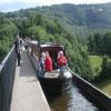
The River Dee flows under the aqueduct.
Pontcysyllte Aqueduct, Pontcysyllte LL20 7YQ, United Kingdom
 
Information about the place
Pontcysyllte Aqueduct (northern end) is a major waterways place on the Shropshire Union Canal (Llangollen Canal - Main Line) between Ruabon Branch Junction (¼ furlongs to the northeast) and Pontcysyllte Aqueduct (southern end) (The River Dee flows under the aqueduct.) (1½ furlongs to the south).
 
It is at one end of Pontcysyllte Aqueduct.
 
The nearest place in the direction of Ruabon Branch Junction is C&RT Information Point (Trevor); ¼ furlongs away.

Mooring here is unrated.


Amenities
 
Maps
If you are a user and are logged on, or if you are actively planning a route, a map will be displayed here.
Show on external mapping site: Google | OSM | Bing
 
Photos
 
External websites
There are no links to external websites from here.
Why not log in and add some (select "External websites" from the menu (sometimes this is under "Edit"))?
 
Nearest facilities

Mouseover for more information or show routes to facility

Nearest water point

In the direction of Hurleston Junction

Coedfryn Water Point2½ furlongs away
On this waterway in the direction of Hurleston Junction
Chirk Marina2 miles, 1¼ furlongs away
On this waterway in the direction of Hurleston Junction
New Marton Water Points7 miles, 1 furlong away
On this waterway in the direction of Hurleston Junction
Ellesmere Services13 miles, 7½ furlongs and 2 locks away
On this waterway in the direction of Hurleston Junction
Blackwater Meadow Marina14 miles, 1 furlong and 2 locks away
On this waterway in the direction of Hurleston Junction
Weston Arm Services (C&RT)11 miles, 1¾ furlongs and 6 locks away
Travel to Frankton Junction, then on the Shropshire Union Canal (Montgomery Canal - connected and navigable) to Weston Arm Junction, then on the Shropshire Union Canal (Weston Branch) to Weston Arm Services (C&RT)
Bettisfield Services18 miles, 5¾ furlongs and 2 locks away
On this waterway in the direction of Hurleston Junction
Maesbury Wharf16 miles, 5¾ furlongs and 10 locks away
Travel to Frankton Junction, then on the Shropshire Union Canal (Montgomery Canal - connected and navigable) to Maesbury Wharf

In the direction of Llantisilio - Horseshoe Falls

The Old Wharf½ furlongs away
Travel to Ruabon Branch Junction, then on the Shropshire Union Canal (Llangollen Canal - Ruabon Branch) to The Old Wharf
Trevor Basin1¼ furlongs away
Travel to Ruabon Branch Junction, then on the Shropshire Union Canal (Llangollen Canal - Ruabon Branch) to Trevor Basin
Llangollen Services4 miles, 4¼ furlongs away
On this waterway in the direction of Llantisilio - Horseshoe Falls
Llangollen Basin4 miles, 7¼ furlongs away
On this waterway in the direction of Llantisilio - Horseshoe Falls

Nearest rubbish disposal

In the direction of Hurleston Junction

Ellesmere Services13 miles, 7½ furlongs and 2 locks away
On this waterway in the direction of Hurleston Junction
Weston Arm Services (C&RT)11 miles, 1¾ furlongs and 6 locks away
Travel to Frankton Junction, then on the Shropshire Union Canal (Montgomery Canal - connected and navigable) to Weston Arm Junction, then on the Shropshire Union Canal (Weston Branch) to Weston Arm Services (C&RT)

In the direction of Llantisilio - Horseshoe Falls

Llangollen Services4 miles, 4¼ furlongs away
On this waterway in the direction of Llantisilio - Horseshoe Falls
Llangollen Basin4 miles, 7¼ furlongs away
On this waterway in the direction of Llantisilio - Horseshoe Falls

Nearest chemical toilet disposal

In the direction of Hurleston Junction

Chirk Marina2 miles, 1¼ furlongs away
On this waterway in the direction of Hurleston Junction
Whittington Wharf Narrowboats9 miles, 3¼ furlongs and 2 locks away
On this waterway in the direction of Hurleston Junction
Ellesmere Services13 miles, 7½ furlongs and 2 locks away
On this waterway in the direction of Hurleston Junction
Weston Arm Services (C&RT)11 miles, 1¾ furlongs and 6 locks away
Travel to Frankton Junction, then on the Shropshire Union Canal (Montgomery Canal - connected and navigable) to Weston Arm Junction, then on the Shropshire Union Canal (Weston Branch) to Weston Arm Services (C&RT)
Maesbury Wharf16 miles, 5¾ furlongs and 10 locks away
Travel to Frankton Junction, then on the Shropshire Union Canal (Montgomery Canal - connected and navigable) to Maesbury Wharf

In the direction of Llantisilio - Horseshoe Falls

Llangollen Services4 miles, 4¼ furlongs away
On this waterway in the direction of Llantisilio - Horseshoe Falls

Nearest place to turn

In the direction of Hurleston Junction

Coedfryn Winding Hole3½ furlongs away
On this waterway in the direction of Hurleston Junction
Chirk Marina2 miles, 1¼ furlongs away
On this waterway in the direction of Hurleston Junction
Chirk Golf Course Winding Hole2 miles, 4 furlongs away
On this waterway in the direction of Hurleston Junction
Chirk Pool3 miles, 4¼ furlongs away
On this waterway in the direction of Hurleston Junction
Rhoswiel Bridge Winding Hole4 miles, 5 furlongs away
On this waterway in the direction of Hurleston Junction
Polletts Bridge Winding Hole9 miles, ½ furlongs and 2 locks away
On this waterway in the direction of Hurleston Junction
Frankton Junction10 miles, 4¾ furlongs and 2 locks away
On this waterway in the direction of Hurleston Junction
Sewage Works Winding Hole13 miles, 3½ furlongs and 2 locks away
On this waterway in the direction of Hurleston Junction
Ellesmere Branch Junction13 miles, 7¾ furlongs and 2 locks away
On this waterway in the direction of Hurleston Junction
Ellesmere Town Wharf14 miles, 1¾ furlongs and 2 locks away
Travel to Ellesmere Branch Junction, then on the Shropshire Union Canal (Llangollen Canal - Ellesmere Branch) to Ellesmere Town Wharf
Weston Arm Junction11 miles, ¾ furlongs and 6 locks away
Travel to Frankton Junction, then on the Shropshire Union Canal (Montgomery Canal - connected and navigable) to Weston Arm Junction
Baysil Wood Winding Hole15 miles, 5½ furlongs and 2 locks away
On this waterway in the direction of Hurleston Junction
Hawkswood Winding Hole11 miles, 7¼ furlongs and 7 locks away
Travel to Frankton Junction, then on the Shropshire Union Canal (Montgomery Canal - connected and navigable) to Hawkswood Winding Hole
Hampton Bank Winding Hole17 miles, 4¾ furlongs and 2 locks away
On this waterway in the direction of Hurleston Junction
Queen's Head Winding Hole14 miles, 3¾ furlongs and 7 locks away
Travel to Frankton Junction, then on the Shropshire Union Canal (Montgomery Canal - connected and navigable) to Queen's Head Winding Hole
Park Mill Bridge Winding Hole16 miles, 1¼ furlongs and 10 locks away
Travel to Frankton Junction, then on the Shropshire Union Canal (Montgomery Canal - connected and navigable) to Park Mill Bridge Winding Hole

In the direction of Llantisilio - Horseshoe Falls

Ruabon Branch Junction¼ furlongs away
On this waterway in the direction of Llantisilio - Horseshoe Falls
Trevor Basin1¼ furlongs away
Travel to Ruabon Branch Junction, then on the Shropshire Union Canal (Llangollen Canal - Ruabon Branch) to Trevor Basin
Bryn Howel Winding Hole1 mile, 7 furlongs away
On this waterway in the direction of Llantisilio - Horseshoe Falls
Llangollen Basin4 miles, 7¼ furlongs away
On this waterway in the direction of Llantisilio - Horseshoe Falls

Nearest self-operated pump-out

In the direction of Hurleston Junction

Maesbury Wharf16 miles, 5¾ furlongs and 10 locks away
Travel to Frankton Junction, then on the Shropshire Union Canal (Montgomery Canal - connected and navigable) to Maesbury Wharf

Nearest boatyard pump-out

In the direction of Hurleston Junction

Chirk Marina2 miles, 1¼ furlongs away
On this waterway in the direction of Hurleston Junction
Whittington Wharf Narrowboats9 miles, 3¼ furlongs and 2 locks away
On this waterway in the direction of Hurleston Junction
Blackwater Meadow Marina14 miles, 1 furlong and 2 locks away
On this waterway in the direction of Hurleston Junction

In the direction of Llantisilio - Horseshoe Falls

The Old Wharf½ furlongs away
Travel to Ruabon Branch Junction, then on the Shropshire Union Canal (Llangollen Canal - Ruabon Branch) to The Old Wharf
Direction of TV transmitter (From Wolfbane Cybernetic)
 
 
Geograph
 
Wikipedia

Wikipedia has a page about Pontcysyllte Aqueduct

The Pontcysyllte Aqueduct (Welsh pronunciation: [ˌpɔntkəˈsəɬtɛ]; Welsh: Traphont Ddŵr Pontcysyllte) is a navigable aqueduct that carries the Llangollen Canal across the River Dee in the Vale of Llangollen in northeast Wales.

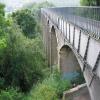
The 18-arched stone and cast iron structure is for use by narrowboats and was completed in 1805 having taken ten years to design and build. It is 12 ft (3.7 metres) wide and is the longest aqueduct in Great Britain and the highest canal aqueduct in the world. A footpath runs alongside the watercourse on one side.

The aqueduct was to have been a key part of the central section of the proposed Ellesmere Canal, an industrial waterway that would have created a commercial link between the River Severn at Shrewsbury and the Port of Liverpool on the River Mersey. Although a less expensive construction course was surveyed further to the east, the westerly high-ground route across the Vale of Llangollen was preferred because it would have taken the canal through the mineral-rich coalfields of North East Wales. Only parts of the canal route were completed because the expected revenues required to complete the entire project were never generated. Most major work ceased after the completion of the Pontcysyllte Aqueduct in 1805.

The structure is a Grade I listed building and a UNESCO World Heritage Site.

Other Wikipedia pages that might relate to Pontcysyllte Aqueduct
[Navigable aqueduct] ambitious Pontcysyllte Aqueduct in Wales on the Llangollen Canal over the River Dee valley, with a total length 307 metres. Other cast-iron aqueducts followed [History of the British canal system] the Manchester Ship Canal, the Worsley Navigable Levels and the Pontcysyllte Aqueduct. In the post-medieval period, some natural waterways were "canalised" [Aqueduct (bridge)] Mathur Aqueduct in Tamil Nadu state, India Pontcysyllte Aqueduct in Wales, UK Longdon-on-Tern Aqueduct the world's first cast iron navigable aqueduct, designed [Thomas Telford] Aqueduct, the cast-iron aqueduct at Longdon-on-Tern, pre-dating that at Pontcysyllte, and substantially bigger than the UK's first cast-iron aqueduct [Canals of the United Kingdom] built of stone in a classical style. Pontcysyllte Aqueduct is an iron trough on tall stone piers. Barton Swing Aqueduct opens to let ships pass underneath [Offa's Dyke Path] racecourse at Racecourse Common Craignant Chirk Castle Llangollen Canal Pontcysyllte Aqueduct (World Heritage Site) over the River Dee Trevor Llangollen Castle [Llangollen Canal] then passed through Chirk Tunnel, and reached the southern end of Pontcysyllte Aqueduct in 1802, which was not completed until 1805. To join the two halves [Clwyd] who was appointed in 2013. The Pontcysyllte Aqueduct was built by Thomas Telford in 1805 and is the largest aqueduct in the United Kingdom; it carries [List of World Heritage Sites in the United Kingdom] Thornbury (1878), p. 567. Pontcysyllte Aqueduct and Canal, UNESCO, retrieved 12 August 2009 Listed Buildings: Pontcysyllte Aqueduct, Trevor, Wrexham County
 
Google

Results of Google Search

Pontcysyllte Aqueduct - Wikipedia
The Pontcysyllte Aqueduct is a navigable aqueduct that carries the Llangollen Canal across the River Dee in the Vale of Llangollen in north ... The northern end of the bridge was in Trefor Isaf township, also in Llangollen parish.
Sitting at the northern end of the World Heritage Status Pontcysyllte ...
Sitting at the northern end of the World Heritage Status Pontcysyllte Aqueduct, Trevor. Basin attracts over 300,000 visitors per year. The Canal & River Trust, the  ...
Pontcysyllte Aqueduct and Canal - UNESCO World Heritage Centre
Jun 27, 2009 ... Situated in north-eastern Wales, the 18 kilometre long Pontcysyllte ... in a difficult geographical environment, at the end of the 18th century and ...
Pontcysyllte Aqueduct - Graces Guide
Jan 11, 2018 ... The Pontcysyllte Aqueduct is a navigable aqueduct that carries the ... of Llangollen parish, and Trevor, at the northern end of the bridge in the ...
Pontcysyllte Aqueduct | Visit Wales
Discover Pontcysyllte, Thomas Telford's incredible aqueduct over the River Dee ... the River Dee - Pontcysyllte - is one of the most stunning sights of North Wales. ... with a stick on the end: they start to understand what it feels like to pull a boat.
Pontcysyllte Aqueduct: The UNESCO Canal in the Sky | Jaspa's ...
Mar 1, 2017 ... It was constructed over 200 years ago, by Thomas Telford and William Jessop, two engineering giants of their day. The Trevor Basin at the north ...
"Bridge of Cysyllte" - Review of Pontcysyllte Aqueduct, Wrexham ...
Aug 27, 2017 ... Pontcysyllte Aqueduct: "Bridge of Cysyllte" - See 1610 traveler reviews, ... and Trevor (Trefor in Welsh), at the northern end of the bridge in the ...
Pontcysyllte aqueduct: the stream in the sky - Breathe With Us
Apr 16, 2016 ... Starting from the North end of the aqueduct, walking trails are available to both sides of the river. It only takes about 10 minutes to reach a section ...