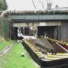
Derby Road Bridge
Derby Road, Amber Valley NG16 4AA, United Kingdom
(A608)

Derby Road Bridge
is a major waterways place
at the junction of
the Cromford Canal (broad gauge, navigable)
with
the Grand Union Canal (Erewash Canal).
Langley Mill Boatyard Moorings (Limit of Navigation)
is on
the Cromford Canal (broad gauge, un-navigable),
1¾ furlongs
and 1 lock
to the north.
Tinsley Road Bridge No 26
is on
the Grand Union Canal (Erewash Canal),
6½ furlongs
to the southeast.
The nearest place in the direction of Langley Mill Boatyard Moorings is Langley Lock No 74;
¼ furlongs
away.
The nearest place in the direction of Tinsley Road Bridge No 26 is Anchor Road Winding Hole;
2¼ furlongs
away.
There may be access to the towpath here.
Mooring here is unrated.
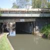
There is a bridge here which takes a major road over the canal.
Cromford Canal (broad gauge, navigable) | ||
---|---|---|
Langley Mill Boatyard Moorings | 1¾ furlongs | |
Netherbrook Aqueduct | 1¼ furlongs | |
Langley Junction | ½ furlongs | |
Langley Lock No 74 | ¼ furlongs | |
Derby Road Bridge | ||
Grand Union Canal (Erewash Canal) | ||
Derby Road Bridge | ||
Anchor Road Winding Hole | 2¼ furlongs | |
Eastwood Bridge No 27 | 2¾ furlongs | |
Tinsley Road Bridge No 26 | 6½ furlongs | |
Eastwood Lock No 73 | 1 mile | |
Eastwood Lock Footbridge | 1 mile |
There are no links to external websites from here.
Why not log in and add some (select "External websites" from the menu (sometimes this is under "Edit"))?
Mouseover for more information or show routes to facility
Nearest water point
In the direction of Trent Junction
Former BW Trent Lock Waterway Office — 11 miles, 3¾ furlongs and 13 locks away
On the Grand Union Canal (Erewash Canal) in the direction of Trent Junction
Sawley Locks No 2 — 12 miles, 3¾ furlongs and 14 locks away
Travel to Trent Junction, then on the River Trent (Western End) to Sawley Locks No 2
Cranfleet Lock No 3 — 12 miles, 2 furlongs and 15 locks away
Travel to Trent Junction, then on the River Trent (Western End) to Cranfleet Lock No 3
Shardlow — 14 miles, 5½ furlongs and 17 locks away
Travel to Trent Junction, then on the River Trent (Western End) to Derwent Mouth, then on the Trent and Mersey Canal (Main Line - Derwent Mouth to Burton) to Shardlow
Beeston Lock No 5 — 16 miles, 4¾ furlongs and 16 locks away
Travel to Trent Junction, then on the River Trent (Western End) to Beeston Lock No 5
Weston Lock No 4 — 17 miles, 5 furlongs and 19 locks away
Travel to Trent Junction, then on the River Trent (Western End) to Derwent Mouth, then on the Trent and Mersey Canal (Main Line - Derwent Mouth to Burton) to Weston Lock No 4
Bishop Meadow Lock No 54 — 19 miles, 5¾ furlongs and 19 locks away
Travel to Trent Junction, then on the Grand Union Canal (Leicester Section - River Soar Navigation) to Bishop Meadow Lock No 54
In the direction of Langley Mill Boatyard Moorings
Langley Junction — ½ furlongs and 1 lock away
On the Cromford Canal (broad gauge, navigable) in the direction of Langley Mill Boatyard MooringsNearest rubbish disposal
In the direction of Trent Junction
Former BW Trent Lock Waterway Office — 11 miles, 3¾ furlongs and 13 locks away
On the Grand Union Canal (Erewash Canal) in the direction of Trent Junction
Sawley Locks No 2 — 12 miles, 3¾ furlongs and 14 locks away
Travel to Trent Junction, then on the River Trent (Western End) to Sawley Locks No 2
Cranfleet Lock No 3 — 12 miles, 2 furlongs and 15 locks away
Travel to Trent Junction, then on the River Trent (Western End) to Cranfleet Lock No 3
Beeston Lock No 5 — 16 miles, 4¾ furlongs and 16 locks away
Travel to Trent Junction, then on the River Trent (Western End) to Beeston Lock No 5Nearest chemical toilet disposal
In the direction of Trent Junction
Former BW Trent Lock Waterway Office — 11 miles, 3¾ furlongs and 13 locks away
On the Grand Union Canal (Erewash Canal) in the direction of Trent Junction
Sawley Locks No 2 — 12 miles, 3¾ furlongs and 14 locks away
Travel to Trent Junction, then on the River Trent (Western End) to Sawley Locks No 2
Sawley Cut Wharf — 12 miles, 5¼ furlongs and 15 locks away
Travel to Trent Junction, then on the River Trent (Western End) to Sawley Cut Wharf
Beeston Lock No 5 — 16 miles, 4¾ furlongs and 16 locks away
Travel to Trent Junction, then on the River Trent (Western End) to Beeston Lock No 5
In the direction of Langley Mill Boatyard Moorings
Langley Junction — ½ furlongs and 1 lock away
On the Cromford Canal (broad gauge, navigable) in the direction of Langley Mill Boatyard MooringsNearest place to turn
In the direction of Trent Junction
Anchor Road Winding Hole — 2¼ furlongs away
On the Grand Union Canal (Erewash Canal) in the direction of Trent Junction
Shipley Mill Winding Hole — 1 mile, 4½ furlongs and 2 locks away
On the Grand Union Canal (Erewash Canal) in the direction of Trent Junction
Bridge Street Winding Hole — 2 miles, 2½ furlongs and 2 locks away
On the Grand Union Canal (Erewash Canal) in the direction of Trent Junction
Winding Hole below Stenson's Lock — 2 miles, 6 furlongs and 3 locks away
On the Grand Union Canal (Erewash Canal) in the direction of Trent Junction
Hallam Fields Lock Winding Hole — 5 miles, 5 furlongs and 7 locks away
On the Grand Union Canal (Erewash Canal) in the direction of Trent Junction
Winding Hole above Stanton Lock — 6 miles, ½ furlongs and 8 locks away
On the Grand Union Canal (Erewash Canal) in the direction of Trent Junction
Sandiacre Junction — 8 miles, 2¼ furlongs and 10 locks away
On the Grand Union Canal (Erewash Canal) in the direction of Trent Junction
Long Eaton Winding Hole — 9 miles, 4¾ furlongs and 12 locks away
On the Grand Union Canal (Erewash Canal) in the direction of Trent Junction
Sheet Stores Basin — 10 miles, 6¾ furlongs and 13 locks away
On the Grand Union Canal (Erewash Canal) in the direction of Trent Junction
Former BW Trent Lock Waterway Office — 11 miles, 3¾ furlongs and 13 locks away
On the Grand Union Canal (Erewash Canal) in the direction of Trent Junction
Soar Mouth — 11 miles, 6¼ furlongs and 14 locks away
Travel to Trent Junction, then on the Grand Union Canal (Leicester Section - River Soar Navigation) to Soar Mouth
Redhill Lock Junction — 12 miles, ¾ furlongs and 14 locks away
Travel to Trent Junction, then on the Grand Union Canal (Leicester Section - River Soar Navigation) to Redhill Lock Junction
Sawley Lock No 2 Weir Exit — 12 miles, 3 furlongs and 14 locks away
Travel to Trent Junction, then on the River Trent (Western End) to Sawley Lock No 2 Weir Exit
Redhill Marine Ltd — 12 miles, 5¼ furlongs and 15 locks away
Travel to Trent Junction, then on the Grand Union Canal (Leicester Section - River Soar Navigation) to Redhill Marine Ltd
Ratcliffe Lock Junction — 12 miles, 7½ furlongs and 15 locks away
Travel to Trent Junction, then on the Grand Union Canal (Leicester Section - River Soar Navigation) to Ratcliffe Lock Junction
Cranfleet Lock Weir Exit — 12 miles, 2¾ furlongs and 16 locks away
Travel to Trent Junction, then on the River Trent (Western End) to Cranfleet Lock Weir Exit
Sawley Flood Lock Weir Entrance — 13 miles, ¾ furlongs and 16 locks away
Travel to Trent Junction, then on the River Trent (Western End) to Sawley Flood Lock Weir Entrance
Ratcliffe Weir — 13 miles, 2½ furlongs and 16 locks away
Travel to Trent Junction, then on the Grand Union Canal (Leicester Section - River Soar Navigation) to Ratcliffe Weir
Derwent Mouth — 13 miles, 4¾ furlongs and 16 locks away
Travel to Trent Junction, then on the River Trent (Western End) to Derwent Mouth
In the direction of Langley Mill Boatyard Moorings
Langley Junction — ½ furlongs and 1 lock away
On the Cromford Canal (broad gauge, navigable) in the direction of Langley Mill Boatyard MooringsNearest boatyard pump-out
In the direction of Langley Mill Boatyard Moorings
Langley Junction — ½ furlongs and 1 lock away
On the Cromford Canal (broad gauge, navigable) in the direction of Langley Mill Boatyard MooringsNo information
CanalPlan has no information on any of the following facilities within range:self-operated pump-out
Direction of TV transmitter (From Wolfbane Cybernetic)
There is no page on Wikipedia called “Derby Road Bridge”
Wikipedia pages that might relate to Derby Road Bridge
[Derby–Shelton Bridge]
The Derby–Shelton Bridge is a road crossing over the Housatonic River in the U.S. state of Connecticut, connecting the cities of Derby and Shelton. It
[Derby Road railway station]
Derby Road railway station (also known as Derby Road (Ipswich)) is on the Felixstowe Branch Line in the east of England, serving the Rose Hill area and
[Derby]
officers. He abandoned his invasion at Swarkestone Bridge on the River Trent just a few miles south of Derby. As a testament to his belief in his cause, the
[Swarkestone Bridge]
Swarkestone Bridge is a medieval bridge crossing the River Trent between the villages of Swarkestone and Stanton by Bridge, about 6 miles south of Derby. It is
[A52 road]
major road in the East Midlands, England. It runs east from a junction with the A53 at Newcastle-under-Lyme near Stoke-on-Trent via Ashbourne, Derby, Stapleford
[Grays, Essex]
who lived in the town from 1872 until 1876. From the top of the Derby Road Bridge in Grays one can look down to Thurrock Yacht Club, Grays Beach children's
[University of Derby]
University of Derby (formerly Derby College of Art and Technology or simply Derby College) is a public university in the city of Derby, England. It traces
[A38 road]
the road through the town centre, and is now classified as A5121. The road from Burton to Derby was turnpiked in 1753. Beyond the start of the Derby bypass
[A6 road (England)]
Lancaster, Kendal and Penrith before reaching Carlisle. South of Derby, the road is paralleled by the M1 motorway; between Manchester and Preston, the
[Derby Friargate railway station]
as a disused bridge over where the line once stood. Further along and a bridge carrying the old Kingsway part of Derby outer ring road can be observed
Results of Google Search
Derby Street Bridge - HistoricBridges.orgThe Derby Road Bridge was built as part of a major reconstruction of Woodward Avenue a few blocks to the west. Woodward was among the first improved ...
The Derby Street-Grand Trunk Western Railroad Bridge is a bridge carrying Derby Street over ... In response, the road commissions of Wayne, Oakland and Macomb Counties and the affected municipalities created a regional master plan for ...
The Derby Road Bridge is eligible for the National Register as a representative product of a massive engineering project that affected developmental patterns in ...
Replacement of the Derby-Milford Road Bridge, Litchfield, CT. Cardinal Engineering provided complete engineering services for this project, which included ...
Information on road works in Derby city. ... Temporary road closure from its junction with Bridge Street to its junction with Willow Row. Alternative route: Bridge ...
Project - Road OPEN From - Surrey Ln to Hales Mill Rd. Open the calendar popup. <<, <, July 2020, >, >>. S, M, T, W, T, F, S. 28, 29, 30, 1, 2, 3, 4. 5, 6, 7, 8, 9, 10 ...
Jan 3, 2017 ... Original file #x200e;(4,738 × 3,490 pixels, file size: 7.55 MB, MIME type: image/jpeg). File information. Structured data ...
Nov 28, 2007 ... Derby Road Bridge Installation - 28 November 2007. Saturday 12th February 2000. Older Newer. Contacts. T: +44 (0)28 796 504 71 F: +44 ...
Jan 2, 2017 ... Original file #x200e;(4,934 × 3,426 pixels, file size: 8.03 MB, MIME type: image/jpeg). File information. Structured data ...
Jul 26, 2020 ... A50 Derbyshire eastbound severe accident, from J6 A511 Scropton to J5 A516 Derby Road Etwall. A50 Derbyshire - Temporary closure on ...