Lady Bay Bridge No 2
Scarrington Road, Rushcliffe NG2 5FU, United Kingdom

Lady Bay Bridge No 2
is a minor waterways place
on the Grantham Canal between
Grantham Canal Junction (Junction of the River Trent with the abandoned Grantham Canal) (1½ furlongs
and 1 lock
to the northwest) and
Grantham Basin (Infilled) (32 miles and 5¾ furlongs
and 17 locks
to the east).
The nearest place in the direction of Grantham Canal Junction is Trent Lock No 1;
1¼ furlongs
away.
The nearest place in the direction of Grantham Basin is A6011 Road Bridge;
1 furlong
away.
There may be access to the towpath here.
Mooring here is unrated.
There is a bridge here which takes a minor road over the canal.
| Grantham Canal Junction | 1½ furlongs | |
| Trent Lock No 1 Footbridge | 1¼ furlongs | |
| Trent Lock No 1 | 1¼ furlongs | |
| Lady Bay Bridge No 2 | ||
| A6011 Road Bridge | 1 furlong | |
| Flood Gate (Grantham Canal) | 3 furlongs | |
| Bridgford Lift Bridge No 3 | 4¼ furlongs | |
| Footbridge No 3a (Grantham Canal) | 5¾ furlongs | |
| Radcliffe Road Bridge No 4A | 1 mile, ½ furlongs | |
Amenities here
Amenities nearby at A6011 Road Bridge
Amenities in Nottingham
Amenities at other places in Nottingham
There are no links to external websites from here.
Why not log in and add some (select "External websites" from the menu (sometimes this is under "Edit"))?
Mouseover for more information or show routes to facility
Nearest water point
In the direction of Grantham Canal Junction
Holme Lock No 5 — 2 miles, 3¼ furlongs and 1 lock away
Travel to Grantham Canal Junction, then on the River Trent (non-tidal section) to Holme Lock No 5
Stoke Lock No 6 — 5 miles, 3¼ furlongs and 2 locks away
Travel to Grantham Canal Junction, then on the River Trent (non-tidal section) to Stoke Lock No 6
Beeston Lock No 5 — 6 miles, 2½ furlongs and 3 locks away
Travel to Grantham Canal Junction, then on the River Trent (non-tidal section) to Meadow Lane Junction, then on the River Trent (Nottingham Canal) to Lenton Chain, then on the River Trent (Beeston Canal) to Beeston Lock No 5
Gunthorpe Lock No 7 — 10 miles, 1¼ furlongs and 3 locks away
Travel to Grantham Canal Junction, then on the River Trent (non-tidal section) to Gunthorpe Lock No 7
Cranfleet Lock No 3 — 10 miles, 5 furlongs and 4 locks away
Travel to Grantham Canal Junction, then on the River Trent (non-tidal section) to Meadow Lane Junction, then on the River Trent (Nottingham Canal) to Lenton Chain, then on the River Trent (Beeston Canal) to Beeston Lock No 5, then on the River Trent (Western End) to Cranfleet Lock No 3
Former BW Trent Lock Waterway Office — 11 miles, 3½ furlongs and 7 locks away
Travel to Grantham Canal Junction, then on the River Trent (non-tidal section) to Meadow Lane Junction, then on the River Trent (Nottingham Canal) to Lenton Chain, then on the River Trent (Beeston Canal) to Beeston Lock No 5, then on the River Trent (Western End) to Trent Junction, then on the Grand Union Canal (Erewash Canal) to Former BW Trent Lock Waterway Office
Sawley Locks No 2 — 12 miles, 1½ furlongs and 6 locks away
Travel to Grantham Canal Junction, then on the River Trent (non-tidal section) to Meadow Lane Junction, then on the River Trent (Nottingham Canal) to Lenton Chain, then on the River Trent (Beeston Canal) to Beeston Lock No 5, then on the River Trent (Western End) to Sawley Locks No 2
Hazelford Lock No 8 — 14 miles, 7½ furlongs and 4 locks away
Travel to Grantham Canal Junction, then on the River Trent (non-tidal section) to Hazelford Lock No 8
Shardlow — 14 miles, 3¼ furlongs and 9 locks away
Travel to Grantham Canal Junction, then on the River Trent (non-tidal section) to Meadow Lane Junction, then on the River Trent (Nottingham Canal) to Lenton Chain, then on the River Trent (Beeston Canal) to Beeston Lock No 5, then on the River Trent (Western End) to Derwent Mouth, then on the Trent and Mersey Canal (Main Line - Derwent Mouth to Burton) to Shardlow
Weston Lock No 4 — 17 miles, 2¾ furlongs and 11 locks away
Travel to Grantham Canal Junction, then on the River Trent (non-tidal section) to Meadow Lane Junction, then on the River Trent (Nottingham Canal) to Lenton Chain, then on the River Trent (Beeston Canal) to Beeston Lock No 5, then on the River Trent (Western End) to Derwent Mouth, then on the Trent and Mersey Canal (Main Line - Derwent Mouth to Burton) to Weston Lock No 4
Bishop Meadow Lock No 54 — 19 miles, 3½ furlongs and 11 locks away
Travel to Grantham Canal Junction, then on the River Trent (non-tidal section) to Meadow Lane Junction, then on the River Trent (Nottingham Canal) to Lenton Chain, then on the River Trent (Beeston Canal) to Beeston Lock No 5, then on the River Trent (Western End) to Trent Junction, then on the Grand Union Canal (Leicester Section - River Soar Navigation) to Bishop Meadow Lock No 54Nearest rubbish disposal
In the direction of Grantham Canal Junction
Holme Lock No 5 — 2 miles, 3¼ furlongs and 1 lock away
Travel to Grantham Canal Junction, then on the River Trent (non-tidal section) to Holme Lock No 5
Stoke Lock No 6 — 5 miles, 3¼ furlongs and 2 locks away
Travel to Grantham Canal Junction, then on the River Trent (non-tidal section) to Stoke Lock No 6
Beeston Lock No 5 — 6 miles, 2½ furlongs and 3 locks away
Travel to Grantham Canal Junction, then on the River Trent (non-tidal section) to Meadow Lane Junction, then on the River Trent (Nottingham Canal) to Lenton Chain, then on the River Trent (Beeston Canal) to Beeston Lock No 5
Gunthorpe Lock No 7 — 10 miles, 1¼ furlongs and 3 locks away
Travel to Grantham Canal Junction, then on the River Trent (non-tidal section) to Gunthorpe Lock No 7
Cranfleet Lock No 3 — 10 miles, 5 furlongs and 4 locks away
Travel to Grantham Canal Junction, then on the River Trent (non-tidal section) to Meadow Lane Junction, then on the River Trent (Nottingham Canal) to Lenton Chain, then on the River Trent (Beeston Canal) to Beeston Lock No 5, then on the River Trent (Western End) to Cranfleet Lock No 3
Former BW Trent Lock Waterway Office — 11 miles, 3½ furlongs and 7 locks away
Travel to Grantham Canal Junction, then on the River Trent (non-tidal section) to Meadow Lane Junction, then on the River Trent (Nottingham Canal) to Lenton Chain, then on the River Trent (Beeston Canal) to Beeston Lock No 5, then on the River Trent (Western End) to Trent Junction, then on the Grand Union Canal (Erewash Canal) to Former BW Trent Lock Waterway Office
Sawley Locks No 2 — 12 miles, 1½ furlongs and 6 locks away
Travel to Grantham Canal Junction, then on the River Trent (non-tidal section) to Meadow Lane Junction, then on the River Trent (Nottingham Canal) to Lenton Chain, then on the River Trent (Beeston Canal) to Beeston Lock No 5, then on the River Trent (Western End) to Sawley Locks No 2
Hazelford Lock No 8 — 14 miles, 7½ furlongs and 4 locks away
Travel to Grantham Canal Junction, then on the River Trent (non-tidal section) to Hazelford Lock No 8Nearest chemical toilet disposal
In the direction of Grantham Canal Junction
Meadow Lane Lock No 7 — 3½ furlongs and 1 lock away
Travel to Grantham Canal Junction, then on the River Trent (non-tidal section) to Meadow Lane Junction, then on the River Trent (Nottingham Canal) to Meadow Lane Lock No 7
Holme Lock No 5 — 2 miles, 3¼ furlongs and 1 lock away
Travel to Grantham Canal Junction, then on the River Trent (non-tidal section) to Holme Lock No 5
Stoke Lock No 6 — 5 miles, 3¼ furlongs and 2 locks away
Travel to Grantham Canal Junction, then on the River Trent (non-tidal section) to Stoke Lock No 6
Beeston Lock No 5 — 6 miles, 2½ furlongs and 3 locks away
Travel to Grantham Canal Junction, then on the River Trent (non-tidal section) to Meadow Lane Junction, then on the River Trent (Nottingham Canal) to Lenton Chain, then on the River Trent (Beeston Canal) to Beeston Lock No 5
Gunthorpe Lock No 7 — 10 miles, 1¼ furlongs and 3 locks away
Travel to Grantham Canal Junction, then on the River Trent (non-tidal section) to Gunthorpe Lock No 7
Former BW Trent Lock Waterway Office — 11 miles, 3½ furlongs and 7 locks away
Travel to Grantham Canal Junction, then on the River Trent (non-tidal section) to Meadow Lane Junction, then on the River Trent (Nottingham Canal) to Lenton Chain, then on the River Trent (Beeston Canal) to Beeston Lock No 5, then on the River Trent (Western End) to Trent Junction, then on the Grand Union Canal (Erewash Canal) to Former BW Trent Lock Waterway Office
Sawley Locks No 2 — 12 miles, 1½ furlongs and 6 locks away
Travel to Grantham Canal Junction, then on the River Trent (non-tidal section) to Meadow Lane Junction, then on the River Trent (Nottingham Canal) to Lenton Chain, then on the River Trent (Beeston Canal) to Beeston Lock No 5, then on the River Trent (Western End) to Sawley Locks No 2
Sawley Cut Wharf — 12 miles, 3 furlongs and 7 locks away
Travel to Grantham Canal Junction, then on the River Trent (non-tidal section) to Meadow Lane Junction, then on the River Trent (Nottingham Canal) to Lenton Chain, then on the River Trent (Beeston Canal) to Beeston Lock No 5, then on the River Trent (Western End) to Sawley Cut WharfNearest place to turn
In the direction of Grantham Canal Junction
Poplar Arms Corner — 6¼ furlongs and 2 locks away
Travel to Grantham Canal Junction, then on the River Trent (non-tidal section) to Meadow Lane Junction, then on the River Trent (Nottingham Canal) to Poplar Arms Corner
Canal Museum Wharf — 1 mile and 2 locks away
Travel to Grantham Canal Junction, then on the River Trent (non-tidal section) to Meadow Lane Junction, then on the River Trent (Nottingham Canal) to Canal Museum Wharf
Holme Lock Weir Entrance — 2 miles, 1¾ furlongs and 1 lock away
Travel to Grantham Canal Junction, then on the River Trent (non-tidal section) to Holme Lock Weir Entrance
Holme Lock Weir Exit — 2 miles, 4½ furlongs and 2 locks away
Travel to Grantham Canal Junction, then on the River Trent (non-tidal section) to Holme Lock Weir Exit
Redfield Road Bridge Winding Hole — 3 miles and 3 locks away
Travel to Grantham Canal Junction, then on the River Trent (non-tidal section) to Meadow Lane Junction, then on the River Trent (Nottingham Canal) to Lenton Chain, then on the River Trent (Beeston Canal) to Redfield Road Bridge Winding Hole
Rylands Bridge Winding Hole — 5 miles, ¼ furlongs and 3 locks away
Travel to Grantham Canal Junction, then on the River Trent (non-tidal section) to Meadow Lane Junction, then on the River Trent (Nottingham Canal) to Lenton Chain, then on the River Trent (Beeston Canal) to Rylands Bridge Winding Hole
Cranfleet Lock Weir Exit — 10 miles, 4¼ furlongs and 4 locks away
Travel to Grantham Canal Junction, then on the River Trent (non-tidal section) to Meadow Lane Junction, then on the River Trent (Nottingham Canal) to Lenton Chain, then on the River Trent (Beeston Canal) to Beeston Lock No 5, then on the River Trent (Western End) to Cranfleet Lock Weir Exit
Soar Mouth — 11 miles, 4 furlongs and 6 locks away
Travel to Grantham Canal Junction, then on the River Trent (non-tidal section) to Meadow Lane Junction, then on the River Trent (Nottingham Canal) to Lenton Chain, then on the River Trent (Beeston Canal) to Beeston Lock No 5, then on the River Trent (Western End) to Trent Junction, then on the Grand Union Canal (Leicester Section - River Soar Navigation) to Soar Mouth
Redhill Lock Junction — 11 miles, 6½ furlongs and 6 locks away
Travel to Grantham Canal Junction, then on the River Trent (non-tidal section) to Meadow Lane Junction, then on the River Trent (Nottingham Canal) to Lenton Chain, then on the River Trent (Beeston Canal) to Beeston Lock No 5, then on the River Trent (Western End) to Trent Junction, then on the Grand Union Canal (Leicester Section - River Soar Navigation) to Redhill Lock Junction
Sawley Lock No 2 Weir Exit — 12 miles, ¾ furlongs and 6 locks away
Travel to Grantham Canal Junction, then on the River Trent (non-tidal section) to Meadow Lane Junction, then on the River Trent (Nottingham Canal) to Lenton Chain, then on the River Trent (Beeston Canal) to Beeston Lock No 5, then on the River Trent (Western End) to Sawley Lock No 2 Weir Exit
Former BW Trent Lock Waterway Office — 11 miles, 3½ furlongs and 7 locks away
Travel to Grantham Canal Junction, then on the River Trent (non-tidal section) to Meadow Lane Junction, then on the River Trent (Nottingham Canal) to Lenton Chain, then on the River Trent (Beeston Canal) to Beeston Lock No 5, then on the River Trent (Western End) to Trent Junction, then on the Grand Union Canal (Erewash Canal) to Former BW Trent Lock Waterway Office
Hazelford Lock East Weir Entrance — 14 miles, 2 furlongs and 4 locks away
Travel to Grantham Canal Junction, then on the River Trent (non-tidal section) to Hazelford Lock East Weir Entrance
Hazelford Ferry — 14 miles, 2¾ furlongs and 4 locks away
Travel to Grantham Canal Junction, then on the River Trent (non-tidal section) to Hazelford Ferry
Hazelford Lock Main Weir Entrance — 14 miles, 6¼ furlongs and 4 locks away
Travel to Grantham Canal Junction, then on the River Trent (non-tidal section) to Hazelford Lock Main Weir Entrance
Sheet Stores Basin — 12 miles, ½ furlongs and 7 locks away
Travel to Grantham Canal Junction, then on the River Trent (non-tidal section) to Meadow Lane Junction, then on the River Trent (Nottingham Canal) to Lenton Chain, then on the River Trent (Beeston Canal) to Beeston Lock No 5, then on the River Trent (Western End) to Trent Junction, then on the Grand Union Canal (Erewash Canal) to Sheet Stores Basin
Redhill Marine Ltd — 12 miles, 2¾ furlongs and 7 locks away
Travel to Grantham Canal Junction, then on the River Trent (non-tidal section) to Meadow Lane Junction, then on the River Trent (Nottingham Canal) to Lenton Chain, then on the River Trent (Beeston Canal) to Beeston Lock No 5, then on the River Trent (Western End) to Trent Junction, then on the Grand Union Canal (Leicester Section - River Soar Navigation) to Redhill Marine Ltd
Ratcliffe Lock Junction — 12 miles, 5¼ furlongs and 7 locks away
Travel to Grantham Canal Junction, then on the River Trent (non-tidal section) to Meadow Lane Junction, then on the River Trent (Nottingham Canal) to Lenton Chain, then on the River Trent (Beeston Canal) to Beeston Lock No 5, then on the River Trent (Western End) to Trent Junction, then on the Grand Union Canal (Leicester Section - River Soar Navigation) to Ratcliffe Lock Junction
Hazelford Lock Main Weir Exit — 15 miles, ¼ furlongs and 5 locks away
Travel to Grantham Canal Junction, then on the River Trent (non-tidal section) to Hazelford Lock Main Weir Exit
Hazelford Lock East Weir Exit — 15 miles, 1¼ furlongs and 5 locks away
Travel to Grantham Canal Junction, then on the River Trent (non-tidal section) to Hazelford Lock East Weir Exit
Sawley Flood Lock Weir Entrance — 12 miles, 6½ furlongs and 8 locks away
Travel to Grantham Canal Junction, then on the River Trent (non-tidal section) to Meadow Lane Junction, then on the River Trent (Nottingham Canal) to Lenton Chain, then on the River Trent (Beeston Canal) to Beeston Lock No 5, then on the River Trent (Western End) to Sawley Flood Lock Weir EntranceNo information
CanalPlan has no information on any of the following facilities within range:self-operated pump-out
boatyard pump-out
Direction of TV transmitter (From Wolfbane Cybernetic)
Wikipedia has a page about Lady Bay Bridge
Lady Bay Bridge is a road bridge of two lanes that spans the River Trent in West Bridgford, Nottingham. It is the bridge following (downstream) from Trent Bridge and connects the main thoroughfare of Radcliffe Road (on the south side) with Meadow Lane (on the north side).
Other Wikipedia pages that might relate to Lady Bay Bridge
[Lady Bay, Nottinghamshire]
Lady Bay is an area of West Bridgford, in Nottinghamshire, England, bounded by the River Trent to the north and the (now disused) Grantham Canal to the
[West Bridgford]
original medieval bridge remain, surrounded by a traffic island on the south side of the river, adjacent to Trent Bridge. Lady Bay Bridge has a single road
[Trent Bridge (bridge)]
Trent Bridge is an iron and stone road bridge across the River Trent in Nottingham, England. It is the principal river crossing for entrance to the city
[Old Dalby Test Track]
Lady Bay Bridge over River Trent
[Queen Emma Bridge]
The Queen Emma Bridge (Dutch: Koningin Emmabrug) is a pontoon bridge across St. Anna Bay in Curaçao. It connects the Punda and Otrobanda quarters of the
[Sneinton]
troubled area of St Ann's. The western boundary of the ward comes up from Lady Bay Bridge along the A6011 Meadow Lane which turns into the A612 Manvers Road
[Niles Canyon ghost]
address across the bridge (either Dumbarton or Bay Bridge depending on the storyteller). Once the driver gets to the beginning of the bridge, the girl will
[Rectory Junction Viaduct]
Radcliffe on Trent near Nottingham. It is a Grade II listed building. The bridge was built in 1850 by Clayton & Shuttleworth of Lincoln on the Nottingham-Grantham
[List of bridges in the United Kingdom]
Bridges in the United Kingdom is a link page for any road bridges or footbridges in the United Kingdom. Railway bridges are listed under: List of railway
Results of Google Search
Lady Bay Bridge - WikipediaHowever, these works were not complete until 1979. The bridge had a complete re-paint from July 2010 to early 2011, carried out by Nottingham-based company "Â ...
Jul 22, 2013 ... After her car was rear-ended by a tractor-trailer Friday night, Morgan Lake, 22, was knocked over the edge of Maryland's Chesapeake Bay ...
Jul 22, 2013 ... But Morgan Lake of Calvert County said she made the decision not to die in the water and told herself “you can do this.†And she climbed out of ...
Shrimpin aboard Lady Jane. ... ATTENTION: DO NOT USE A "GPS" TO FIND OUR ADDRESS, IT WILL TAKE YOU 1-1/2 MILE SOUTH OF OUR LOCATION.
Mar 9, 2019 ... A wrong-way driver shutdown 2 lanes on the Bay Bridge around 7 pm Saturday night. The SUV was ... The SUV did not hit any other vehicles.
Oct 29, 2019 ... As of 2:30 p.m. Bassignani said there was no longer a traffic delay on the bridge since a tow truck was almost immediately dispatched to ...
Sep 29, 2019 ... The Pensacola Bay Bridge is closed in both directions as police respond to a crash. ... Fatal crash in Gulf Breeze: Louisiana woman facing vehicular ... a 2-year -old — were passengers in the Nissan and were not restrained at ...
Dec 13, 2018 ... File:Lady Bay Bridge.jpg. Edit. File; File ... Bay Bridge.jpg. No higher resolution available. ... on Commons. The following 2 pages uses this file:.
With locations in Old Bridge and Perth Amboy, our newly renovated facilities combine the highest quality imaging technology with comfortable, spa-like ...


![A truncated stretch of the Grantham Canal. This short stretch of the abandoned Grantham Canal runs behind the Forest football ground and joins the Trent just west of Lady Bay Bridge. Kate Jewell's [[[785741]]] shows the lock there and [[[785790]]] the Environment Agency office next to it, whose road entrance is here. To take the picture I stood roughly where the Nottingham-Melton-Kettering-St Pancras railway once crossed the canal. Behind the camera the canal has been filled in as far as the junction of Trent Boulevard and Radcliffe Road, where there was once a rather ornate bridge. Its reedy remains run parallel to Radcliffe Road from there to Gamston bridge. by John Sutton – 15 April 2011](https://s1.geograph.org.uk/geophotos/02/36/32/2363289_e2b21e6b_120x120.jpg)

![Former course of the Midland main line. This snap may only be of interest to bathroom or railway enthusiasts. The new building ahead stands where the Midland Railway main line from Nottingham to St Pancras via Melton Mowbray, Oakham, Corby and Kettering, closed in the 1960s, once crossed Radcliffe Road on a plate girder bridge. I stood where there was once an embankment to take the picture. The Melton line, which carried Nottingham's quickest London trains and brought iron ore north from Northamptonshire, turned south at London Road Junction, crossed the Trent on what is now the Lady Bay road bridge and ran north and south through West Bridgford, where its course shows clearly on the 1:25,000 map, and on the ground as a strip of new buildings built where there were once embankments.[[[1475105]]] and [[[1855287]]] show remains of the line south of here. by John Sutton – 15 April 2011](https://s3.geograph.org.uk/geophotos/02/36/32/2363235_09bcc44c_120x120.jpg)


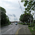

![Nottingham Forest football ground. This is the Bridgford End of The City Ground. The end of the Brian Clough Stand shows above the bushes on the right. The road in the foreground is where, until the 1960s, a railway bridge crossed the Grantham Canal, one of whose truncated abandoned stretches is just to the right.The Midland Railway Melton line, which carried Nottingham's quickest London trains and brought iron ore north from Northamptonshire, turned south at London Road Junction, crossed the Trent on what is now the Lady Bay road bridge and ran north and south through West Bridgford, where its course shows clearly on the 1:25,000 map, and on the ground as a strip of new buildings built where there were once embankments.[[[2363235]]], [[[1475105]]] and [[[1855287]]] show remains of the line south of here. by John Sutton – 15 April 2011](https://s3.geograph.org.uk/geophotos/02/36/32/2363255_a49da948_120x120.jpg)


![A stretch of the Grantham Canal. This is the truncated section of the canal - which was abandoned in 1936 - nearest the River Trent. It had dried up when I came this way in September 2022: [[[7297078]]]. by John Sutton – 12 June 2023](https://s0.geograph.org.uk/geophotos/07/51/31/7513180_3092a4c6_120x120.jpg)

![An April morning in Radcliffe Road. It was bright and cold at seven o'clock on Good Friday morning. This is the view towards Lady Bay, near where the Nottingham-Melton-Kettering-London railway once crossed. For more about that, see [[[2734699]]], taken the previous September. by John Sutton – 06 April 2012](https://s0.geograph.org.uk/geophotos/02/88/98/2889888_112031a9_120x120.jpg)
![Radcliffe Road: The Gallery. The grey building is The Gallery, formerly an hotel, now flats.[[[5524153]]] (January 2017)[[[5524143]]] (August 2017) by John Sutton – 26 April 2019](https://s0.geograph.org.uk/geophotos/06/13/34/6133480_cfac4088_120x120.jpg)

![Radcliffe Road: conversion to flats. The former Gallery Hotel is being converted to flats. [[[5524153]]] shows the state of play in January 2017. by John Sutton – 31 August 2017](https://s3.geograph.org.uk/geophotos/05/52/41/5524143_1ceedda1_120x120.jpg)


![Environment Agency building. On the southern bank of the River Trent by Lady Bay Bridge. The lock gates of [[785741]] can be seen in the foreground. by Kate Jewell – 01 May 2008](https://s2.geograph.org.uk/photos/78/57/785790_f0a19c97_120x120.jpg)