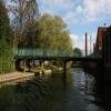
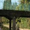
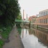
Friday Street Bridge No 7 carries a farm track over the Grand Union Canal (Leicester Section - River Soar Navigation).
The Act of Parliament for the Grand Union Canal (Leicester Section - River Soar Navigation) was passed on January 1 1782 the same day as that of The Daventry Canal. "Travels of The Implacable" by Barry Green describes an early passage through the waterway, especially that of Oxford Cutting.

Friday Street Bridge No 7
is a minor waterways place
on the Grand Union Canal (Leicester Section - River Soar Navigation) between
Soar Lane Bridge No 3 (4¾ furlongs
and 1 lock
to the southwest) and
Thurmaston Lock No 46 (Thurmaston on east bank) (4 miles
and 3 locks
to the northeast).
The nearest place in the direction of Soar Lane Bridge No 3 is Abbey Lane Bridge No 6;
1 furlong
away.
The nearest place in the direction of Thurmaston Lock No 46 is Charter Street Pipe Bridge;
1½ furlongs
away.
There may be access to the towpath here.
Mooring here is unrated.
There is a bridge here which takes pedestrian traffic over the canal.
| Soar Lane Bridge No 3 | 4¾ furlongs | |
| Footbridge over Disused Basin and Former Mill Race | 3½ furlongs | |
| North Lock No 42 | 2¾ furlongs | |
| Frog Island Bridge No 5 | 2½ furlongs | |
| Abbey Lane Bridge No 6 | 1 furlong | |
| Friday Street Bridge No 7 | ||
| Charter Street Pipe Bridge | 1½ furlongs | |
| Morningside Arena Footbridge | 1¾ furlongs | |
| Disused Wharf near Memory Lane Wharf | 2 furlongs | |
| Memory Lane Wharf | 2½ furlongs | |
| Limekiln Lock No 43 | 2¾ furlongs | |
Amenities here
Amenities nearby at Charter Street Pipe Bridge
Amenities nearby at Abbey Lane Bridge No 6
- Grand Union Canal Walk — associated with Grand Union Canal
- An illustrated walk along the Grand Union Canal from London to Birmingham
Mouseover for more information or show routes to facility
Nearest water point
In the direction of Trent Junction
Hope and Anchor Bridge No 19 — 5 miles, 1¾ furlongs and 4 locks away
On this waterway in the direction of Trent Junction
Barrow Boating — 10 miles, 6¾ furlongs and 8 locks away
On this waterway in the direction of Trent Junction
Loughborough Basin — 15 miles, ¼ furlongs and 10 locks away
Travel to Loughborough Branch Junction, then on the Grand Union Canal (Leicester Section - Loughborough Branch) to Loughborough Basin
Bishop Meadow Lock No 54 — 15 miles, 6¾ furlongs and 11 locks away
On this waterway in the direction of Trent Junction
In the direction of River Soar Junction
Friars Mill Visitor Moorings — 6 furlongs and 1 lock away
On this waterway in the direction of River Soar Junction
Kilby Bridge No 87 — 9 miles, 1¾ furlongs and 13 locks away
Travel to River Soar Junction, then on the Grand Union Canal (Leicester Section - Leicestershire and Northamptonshire Union Canal) to Kilby Bridge No 87
Foxton Junction — 19 miles and 25 locks away
Travel to River Soar Junction, then on the Grand Union Canal (Leicester Section - Leicestershire and Northamptonshire Union Canal) to Foxton Junction
Inclined Plane Upper Access Arm Junction — 19 miles, 3¼ furlongs and 25 locks away
Travel to River Soar Junction, then on the Grand Union Canal (Leicester Section - Leicestershire and Northamptonshire Union Canal) to Foxton Junction, then on the Grand Union Canal (Leicester Section - Market Harborough Branch) to Inclined Plane Lower Access Arm Junction, then on the Grand Union Canal (Leicester Section - Inclined Plane Branch) to Inclined Plane Upper Access Arm JunctionNearest rubbish disposal
In the direction of Trent Junction
Broome Island — 10 miles, ½ furlongs and 8 locks away
On this waterway in the direction of Trent Junction
Barrow Boating — 10 miles, 6¾ furlongs and 8 locks away
On this waterway in the direction of Trent Junction
Loughborough Basin — 15 miles, ¼ furlongs and 10 locks away
Travel to Loughborough Branch Junction, then on the Grand Union Canal (Leicester Section - Loughborough Branch) to Loughborough Basin
In the direction of River Soar Junction
Kilby Bridge No 87 — 9 miles, 1¾ furlongs and 13 locks away
Travel to River Soar Junction, then on the Grand Union Canal (Leicester Section - Leicestershire and Northamptonshire Union Canal) to Kilby Bridge No 87
Foxton Junction Swing Bridge — 19 miles, ¼ furlongs and 25 locks away
Travel to River Soar Junction, then on the Grand Union Canal (Leicester Section - Leicestershire and Northamptonshire Union Canal) to Foxton Junction, then on the Grand Union Canal (Leicester Section - Market Harborough Branch) to Foxton Junction Swing BridgeNearest chemical toilet disposal
In the direction of Trent Junction
Sileby Mill Mooring Basin — 8 miles, 2½ furlongs and 7 locks away
On this waterway in the direction of Trent Junction
Barrow Boating — 10 miles, 6¾ furlongs and 8 locks away
On this waterway in the direction of Trent Junction
In the direction of River Soar Junction
Kilby Bridge No 87 — 9 miles, 1¾ furlongs and 13 locks away
Travel to River Soar Junction, then on the Grand Union Canal (Leicester Section - Leicestershire and Northamptonshire Union Canal) to Kilby Bridge No 87
Foxton Junction Swing Bridge — 19 miles, ¼ furlongs and 25 locks away
Travel to River Soar Junction, then on the Grand Union Canal (Leicester Section - Leicestershire and Northamptonshire Union Canal) to Foxton Junction, then on the Grand Union Canal (Leicester Section - Market Harborough Branch) to Foxton Junction Swing BridgeNearest place to turn
In the direction of Trent Junction
Memory Lane Wharf — 2½ furlongs away
On this waterway in the direction of Trent Junction
Belgrave Circle Arm (disused) — 3¼ furlongs and 1 lock away
On this waterway in the direction of Trent Junction
Entrance to Riverside Lakes — 1 mile, 5¾ furlongs and 2 locks away
On this waterway in the direction of Trent Junction
Birstall Lock Winding Hole — 2 miles, 7¼ furlongs and 2 locks away
On this waterway in the direction of Trent Junction
White Horse Lane Junction — 3 miles, ½ furlongs and 3 locks away
On this waterway in the direction of Trent Junction
Leicester Marina Entrance — 3 miles, 6½ furlongs and 3 locks away
On this waterway in the direction of Trent Junction
Thurmaston Lock Arm — 3 miles, 7¾ furlongs and 3 locks away
On this waterway in the direction of Trent Junction
MGM Boats Winding Hole — 4 miles, ½ furlongs and 4 locks away
On this waterway in the direction of Trent Junction
MGM Boats, Thurmaston — 4 miles, 1 furlong and 4 locks away
On this waterway in the direction of Trent Junction
Old Junction Boatyard (Syston) — 5 miles, 5½ furlongs and 4 locks away
On this waterway in the direction of Trent Junction
River Wreake Junction — 5 miles, 6 furlongs and 4 locks away
On this waterway in the direction of Trent Junction
Wreake Outlet by Junction Lock No 47 — 6 miles, 2½ furlongs and 5 locks away
On this waterway in the direction of Trent Junction
Wreake Mouth — 6 miles, 6 furlongs and 5 locks away
On this waterway in the direction of Trent Junction
Cossington Mill Stream Junction — 6 miles, 7½ furlongs and 6 locks away
On this waterway in the direction of Trent Junction
Loughborough Road Winding Hole — 7 miles, ¼ furlongs and 6 locks away
On this waterway in the direction of Trent Junction
Sileby Mill — 8 miles, 2 furlongs and 7 locks away
On this waterway in the direction of Trent Junction
Sileby Mill Mooring Basin — 8 miles, 2½ furlongs and 7 locks away
On this waterway in the direction of Trent Junction
Mountsorrel Lock Junction — 9 miles, 1 furlong and 7 locks away
On this waterway in the direction of Trent Junction
In the direction of River Soar Junction
Blaby Bridge Winding Hole — 6 miles, ½ furlongs and 8 locks away
Travel to River Soar Junction, then on the Grand Union Canal (Leicester Section - Leicestershire and Northamptonshire Union Canal) to Blaby Bridge Winding Hole
Bush Lock Winding Hole — 7 miles, 1½ furlongs and 9 locks away
Travel to River Soar Junction, then on the Grand Union Canal (Leicester Section - Leicestershire and Northamptonshire Union Canal) to Bush Lock Winding HoleNearest self-operated pump-out
In the direction of River Soar Junction
Kilby Bridge No 87 — 9 miles, 1¾ furlongs and 13 locks away
Travel to River Soar Junction, then on the Grand Union Canal (Leicester Section - Leicestershire and Northamptonshire Union Canal) to Kilby Bridge No 87Nearest boatyard pump-out
In the direction of Trent Junction
Sileby Mill Mooring Basin — 8 miles, 2½ furlongs and 7 locks away
On this waterway in the direction of Trent JunctionDirection of TV transmitter (From Wolfbane Cybernetic)
There is no page on Wikipedia called “Friday Street Bridge”
Wikipedia pages that might relate to Friday Street Bridge
[Bloody Friday (1972)]
Bloody Friday is the name given to the bombings by the Provisional Irish Republican Army (IRA) in Belfast, Northern Ireland on 21 July 1972, during the
[Good Friday]
on the Friday preceding Easter Sunday, and may coincide with the Jewish observance of Passover. It is also known as Holy Friday, Great Friday, Great and
[TGI Fridays]
TGI Fridays (formerly stylized as T.G.I. FRiDAY’S and operating in the U.K. as FRIDAYS) is an American restaurant chain focusing on casual dining. The
[Sixth Street Viaduct]
The Sixth Street Viaduct, also known as the Sixth Street Bridge, was a viaduct bridge that connected the Arts District in Downtown Los Angeles with the
[Friday Night Lights (TV series)]
Friday Night Lights is an American sports drama television series developed by Peter Berg, that is inspired by the 1990 nonfiction book by H. G. Bissinger
[Friday the 13th (franchise)]
Friday the 13th is an American horror franchise that comprises twelve slasher films, a television series, novels, comic books, video games, and tie‑in
[Bridge of Spies (film)]
Bridge of Spies is a 2015 historical drama film directed and co-produced by Steven Spielberg, written by Matt Charman and the Coen brothers, and starring
[Third Street Bridge (Waverly, Iowa)]
The Third Street Bridge, also known as the Brookwood Park Bridge and the Harmon Street Bridge, is a historic structure located in Waverly, Iowa, United
[London Inner Ring Road]
Pentonville Road, City Road, Old Street, Great Eastern Street, Commercial Street, Mansell Street, Tower Bridge, Tower Bridge Road, New Kent Road, the Elephant
[Wall Street Week]
Bloomberg Wall Street Week (WSW), is an investment news and information TV program airing Friday nights on the Bloomberg Television. The original weekly
Results of Google Search
emergency no parking on park ave and state street extensionJul 24, 2019 ... In addition, there will be no parking on State Street Extension tomorrow night, Thursday, July 25 from 11:00 PM until 7:00 AM on Friday, July 26.
Kearsarge Way & Market Street Bridge Repair Project ... UPDATE (5/1/20): No questions were received by the deadline, however, please contact the City ... Work will take place Monday through Friday, between the hours of 7 AM and 6 PM.
4 days ago ... If a highway is not listed below, there are no scheduled lane closures at this ... of Friday, July 10 - The eastbound on- and off-ramps at 88th Street will be ... 7:30 a.m. Monday, June 22 to noon Friday, June 26 - Bridge 2/40 over ...
Jun 2, 2020 ... “We are fortunate that no one was seriously injured and that most of the property damage was ... 7 Free Street - The Portland Museum of Art.
A full roadway closure for replacement of West 31st Street Bridge over Amtrak, ... This street will be closed Friday from 8 am to 5 pm through 7/13/20 to facilitate ...
Beginning at 7 a.m. Monday, July 13 through 3 p.m. Friday, August 28, both directions of Green River ... King County engineers will inspect Patton Bridge No.
From 7 a.m. to 9 a.m. and from 4 p.m. to 5:45 p.m. Monday through Friday except Federal ... A delay in opening the draw may not exceed 20 minutes for the passage of ... Ferry Street Bridge at mile 0.7, across Quinnipiac River, opens on signal; ...
Capitol Towers Garage and Lots (1500 7th Street). Daily Rates (6 ... Kaiser Permanente Garage (501 J Street) ... Tower Bridge Garage (Front & Capitol Mall).
Street Sweeping Lookup & No-Tow Registration. UPDATE 2020-03-17: Street sweeping schedules are in effect. Enforcement of parking restrictions with ticketing ...
All construction information related to the Washington Street Bridge project on State ... Weekly Update - Monday, August 3 to Friday, August 7 ... Important Information: Complete closure of the bridge will begin June 8, 2009 and will last no more ...


![Friday Street Bridge [no 7], from the east. A footbridge over the Leicester section of the Grand Union Canal. Low headroom for towpath cyclists! by Christine Johnstone – 05 May 2019](https://s3.geograph.org.uk/geophotos/06/16/34/6163491_6b691fad_120x120.jpg)


![Steps to Grand Union Canal from Abbey Park. There is an OS benchmark [[4318465]] on the canal wall at the base of the canalside fence by Roger Templeman – 06 January 2015](https://s3.geograph.org.uk/geophotos/04/31/84/4318491_93319e20_120x120.jpg)


![Industrial units on Friday Street at Watling Street junction. There is an OS benchmark [[5189094]] on the near corner, right hand face, of the building beyond the gated entrance by Roger Templeman – 06 January 2015](https://s0.geograph.org.uk/geophotos/05/18/90/5189096_a506ebfb_120x120.jpg)


![Industry on the Grand Union Canal. See [[[2117987]]]. by Ashley Dace – 17 October 2010](https://s2.geograph.org.uk/geophotos/02/11/79/2117998_b0da5efd_120x120.jpg)