Pershore New Bridge
is a minor waterways place
on the River Avon - Warwickshire (Lower Avon Navigation) between
Cropthorne (4 miles and 5¾ furlongs
and 2 locks
to the east) and
Great Comberton (3 miles and 4¼ furlongs
to the south).
The nearest place in the direction of Cropthorne is Pershore Great Bridge (Historic bridge, now closed to road traffic);
¼ furlongs
away.
The nearest place in the direction of Great Comberton is Pershore Bridge Moorings;
½ furlongs
away.
Mooring here is unrated.
Facilities: rubbish disposal.
There is a bridge here which takes a road over the canal.
| Pershore Lock Weir Entrance No 2 | 2¾ furlongs | |
| Pershore Lock | 2½ furlongs | |
| Pershore Lock Weir Exit No 1 | 2 furlongs | |
| Pershore Lock Weir Exit No 2 | 1¼ furlongs | |
| Pershore Great Bridge | ¼ furlongs | |
| Pershore New Bridge | ||
| Pershore Bridge Moorings | ½ furlongs | |
| Defford Road Wharf Visitor Moorings | 1 mile, 3¼ furlongs | |
| Avon View Marina | 1 mile, 4¾ furlongs | |
| Great Comberton | 3 miles, 4¼ furlongs | |
| Nafford Lock Weir Entrance No 1 | 4 miles, 3½ furlongs | |
- Avon Navigation Trust — associated with River Avon - Warwickshire
- Navigation Authority
Mouseover for more information or show routes to facility
Nearest water point
In the direction of Tewkesbury Junction
Strensham Lock — 7 miles, 7 furlongs and 1 lock away
On this waterway in the direction of Tewkesbury Junction
Bredon — 9 miles, 7½ furlongs and 2 locks away
On this waterway in the direction of Tewkesbury Junction
Tewkesbury Services — 13 miles, 3 furlongs and 2 locks away
On this waterway in the direction of Tewkesbury Junction
Upper Lode Lock No 5 — 14 miles, 1¼ furlongs and 3 locks away
Travel to Tewkesbury Junction, then on the River Severn (main river - Worcester to Gloucester) to Upper Lode Lock No 5
Tewkesbury Lower Lode — 14 miles, 7¼ furlongs and 4 locks away
Travel to Tewkesbury Junction, then on the River Severn (main river - Worcester to Gloucester) to Tewkesbury Lower Lode
In the direction of Evesham Lock
Pershore Recreation Ground — 4¾ furlongs and 1 lock away
On this waterway in the direction of Evesham Lock
Workman Gardens — 10 miles, 5 furlongs and 4 locks away
On this waterway in the direction of Evesham Lock
Evesham Lock — 10 miles, 7¾ furlongs and 4 locks away
On this waterway in the direction of Evesham Lock
George Billington Lock — 14 miles, 6¼ furlongs and 5 locks away
Travel to Evesham Lock, then on the River Avon - Warwickshire (Upper Avon Navigation) to George Billington Lock
Footbridge upstream of George Billington Lock — 14 miles, 6¾ furlongs and 6 locks away
Travel to Evesham Lock, then on the River Avon - Warwickshire (Upper Avon Navigation) to Footbridge upstream of George Billington Lock
Bidford on Avon Visitor Moorings — 19 miles, 5¼ furlongs and 8 locks away
Travel to Evesham Lock, then on the River Avon - Warwickshire (Upper Avon Navigation) to Bidford on Avon Visitor MooringsNearest rubbish disposal
The nearest rubbish disposal is here. Others are at:
In the direction of Tewkesbury Junction
Pershore Bridge Moorings — ½ furlongs away
On this waterway in the direction of Tewkesbury Junction
Tewkesbury Services — 13 miles, 3 furlongs and 2 locks away
On this waterway in the direction of Tewkesbury Junction
In the direction of Evesham Lock
Pershore Recreation Ground — 4¾ furlongs and 1 lock away
On this waterway in the direction of Evesham Lock
Workman Gardens — 10 miles, 5 furlongs and 4 locks away
On this waterway in the direction of Evesham Lock
George Billington Lock — 14 miles, 6¼ furlongs and 5 locks away
Travel to Evesham Lock, then on the River Avon - Warwickshire (Upper Avon Navigation) to George Billington Lock
Footbridge upstream of George Billington Lock — 14 miles, 6¾ furlongs and 6 locks away
Travel to Evesham Lock, then on the River Avon - Warwickshire (Upper Avon Navigation) to Footbridge upstream of George Billington Lock
Bidford on Avon Visitor Moorings — 19 miles, 5¼ furlongs and 8 locks away
Travel to Evesham Lock, then on the River Avon - Warwickshire (Upper Avon Navigation) to Bidford on Avon Visitor MooringsNearest chemical toilet disposal
In the direction of Evesham Lock
Pershore Recreation Ground — 4¾ furlongs and 1 lock away
On this waterway in the direction of Evesham Lock
Evesham Lock — 10 miles, 7¾ furlongs and 4 locks away
On this waterway in the direction of Evesham Lock
George Billington Lock — 14 miles, 6¼ furlongs and 5 locks away
Travel to Evesham Lock, then on the River Avon - Warwickshire (Upper Avon Navigation) to George Billington Lock
Footbridge upstream of George Billington Lock — 14 miles, 6¾ furlongs and 6 locks away
Travel to Evesham Lock, then on the River Avon - Warwickshire (Upper Avon Navigation) to Footbridge upstream of George Billington LockNearest place to turn
In the direction of Tewkesbury Junction
Nafford Lock Weir Entrance No 1 — 4 miles, 3½ furlongs away
On this waterway in the direction of Tewkesbury Junction
Nafford Lock Weir Exit No 2 — 4 miles, 4½ furlongs and 1 lock away
On this waterway in the direction of Tewkesbury Junction
Tewkesbury Marina Entrance No 2 — 12 miles, 7½ furlongs and 2 locks away
On this waterway in the direction of Tewkesbury Junction
Avon Lock Junction — 13 miles, 3½ furlongs and 2 locks away
On this waterway in the direction of Tewkesbury Junction
Abbey Mill Tewkesbury — 13 miles, 4½ furlongs and 2 locks away
Travel to Avon Lock Junction, then on the River Avon - Warwickshire (Mill Avon) to Abbey Mill Tewkesbury
Upper Lode Lock Weir Entrance — 14 miles, ¼ furlongs and 3 locks away
Travel to Tewkesbury Junction, then on the River Severn (main river - Worcester to Gloucester) to Upper Lode Lock Weir Entrance
Upper Lode Lock Weir Exit — 14 miles, 3 furlongs and 4 locks away
Travel to Tewkesbury Junction, then on the River Severn (main river - Worcester to Gloucester) to Upper Lode Lock Weir Exit
In the direction of Evesham Lock
Pershore Lock Weir Exit No 1 — 2 furlongs away
On this waterway in the direction of Evesham Lock
Pershore Lock Weir Entrance No 2 — 2¾ furlongs and 1 lock away
On this waterway in the direction of Evesham Lock
Wyre Lock Weir Entrance — 1 mile, 3¼ furlongs and 2 locks away
On this waterway in the direction of Evesham Lock
Fladbury Lock Weir Exit — 5 miles, 3¾ furlongs and 2 locks away
On this waterway in the direction of Evesham Lock
Fladbury Lock Weir Entrance — 5 miles, 4¾ furlongs and 3 locks away
On this waterway in the direction of Evesham Lock
Chadbury Lock Weir Entrance — 8 miles, 1½ furlongs and 4 locks away
On this waterway in the direction of Evesham Lock
Evesham Lock Weir Exit — 10 miles, 7½ furlongs and 4 locks away
On this waterway in the direction of Evesham Lock
George Billington Lock Weir Exit — 14 miles, 5¾ furlongs and 5 locks away
Travel to Evesham Lock, then on the River Avon - Warwickshire (Upper Avon Navigation) to George Billington Lock Weir Exit
George Billington Lock Weir Entrance — 14 miles, 7½ furlongs and 6 locks away
Travel to Evesham Lock, then on the River Avon - Warwickshire (Upper Avon Navigation) to George Billington Lock Weir Entrance
Robert Aickman Lock Weir Exit — 15 miles, 1¼ furlongs and 6 locks away
Travel to Evesham Lock, then on the River Avon - Warwickshire (Upper Avon Navigation) to Robert Aickman Lock Weir Exit
Abbots Salford Holiday Park Marina — 17 miles, 1¾ furlongs and 7 locks away
Travel to Evesham Lock, then on the River Avon - Warwickshire (Upper Avon Navigation) to Abbots Salford Holiday Park Marina
Avon - Arrow Junction — 18 miles and 7 locks away
Travel to Evesham Lock, then on the River Avon - Warwickshire (Upper Avon Navigation) to Avon - Arrow JunctionNearest self-operated pump-out
In the direction of Evesham Lock
Evesham Lock — 10 miles, 7¾ furlongs and 4 locks away
On this waterway in the direction of Evesham LockNearest boatyard pump-out
In the direction of Evesham Lock
Pershore Recreation Ground — 4¾ furlongs and 1 lock away
On this waterway in the direction of Evesham LockDirection of TV transmitter (From Wolfbane Cybernetic)
There is no page on Wikipedia called “Pershore New Bridge”
Wikipedia pages that might relate to Pershore New Bridge
[Pershore]
Pershore is a market town in Worcestershire, England, on the banks of the River Avon. Pershore is in the Wychavon district and is part of the West Worcestershire
[River Avon, Warwickshire]
it flows through include Rugby, Warwick, Stratford-upon-Avon, Evesham, Pershore and Tewkesbury, where it joins the Severn. It has traditionally been divided
[Pershore railway station]
Pershore railway station is a railway station in the town of Pershore, Worcestershire, near the village of Pinvin. Pershore town centre is just over 1
[Worcestershire]
the Episcopus Hwicciorum and Worcester Priory, along with the Abbots of Pershore, Westminster and Evesham. The shires and its sub-divisions known as hundreds
[Evesham]
radmen; Abbey of St Mary of Evesham; Abbey of St Mary of Pershore; Edmund, Abbot of St Mary of Pershore; Walter, Abbot of St Mary of Evesham; Aethelwig, Abbot
[Worcester, England]
University and Birmingham New Street. These services are run by West Midlands Trains. From both stations, trains run to Pershore, Evesham and onto the Cotswolds
[St John's College, Cambridge]
completed, replete with louvres but left without bells. It is based on Pershore Abbey. The tower is 163 feet (50 m) high. The chapel's antechamber contains
[Cotswold Line]
Avon again and follows it towards Pershore. West of Pershore, where the line crosses over the Cross Country Route, the new Worcestershire Parkway station
[River Severn]
Atcham Bridges – the old one built in 1774, while the newer one in 1929 carries the B4380 Albert Edward Bridge – in Coalbrookdale, a railway bridge opened
[A roads in Zone 4 of the Great Britain numbering scheme]
SW of Warwick A440 Reserved Reserved for Bristol Road. Used to run from Pershore to Great Malvern (now B4211). A441 Birmingham Cookhill Previously continued


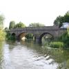
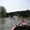
![Pershore New Bridge over the River Avon. Built in 1926 about 50 metres downstream of [[859767]] the new bridge is a three arched cast concrete structure. It used to carry the A44 road over the river but the road has now been downgraded to the B4084. by Nigel Cox – 21 June 2008](https://s3.geograph.org.uk/photos/85/97/859787_c3217440_120x120.jpg)
![Pershore Bridge over the River Avon. Pershore Bridge was the scene of a Civil War skirmish. On 5 June 1644 King Charles and his troops were fleeing back to Worcester from their siege of Oxford and reached the bridge over the River Avon with the Parliamentarians in close pursuit. In order to delay them the King ordered that the bridge be demolished. However the task was only partially completed and about forty men reputedly drowned during the ensuing melee. The demolished section of the bridge was rebuilt in 1645, and is recognisable here with the larger arch, which is actually the central one, being made of different materials.The bridge lasted as the only crossing of the river in the immediate area until 1926 when increasing traffic demands saw [[859787]] built about 50 metres downstream. Today the bridge and its flood relief arches at either end form a scheduled Ancient Monument. by Nigel Cox – 21 June 2008](https://s3.geograph.org.uk/photos/85/97/859767_969ea37e_120x120.jpg)


![National Cycle Route 442 into Pershore. On the new Pershore Bridge which was opened in 1926, to replace an older bridge [[[6936900]]]. Now designated the B4084 it was once the A44. by JThomas – 12 August 2021](https://s1.geograph.org.uk/geophotos/06/93/68/6936897_afb0391d_120x120.jpg)