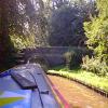
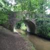
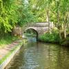
Little Mill Bridge No 55
is a minor waterways place
on the Shropshire Union Canal (Llangollen Canal - Main Line) between
Ellesmere Branch Junction (1 mile and 7¼ furlongs
to the west) and
Whixall Moss Junction (Junction of Prees Branch with Llangollen Canal) (4 miles and 5½ furlongs
to the east).
The nearest place in the direction of Ellesmere Branch Junction is Baysil Wood Winding Hole;
1½ furlongs
away.
The nearest place in the direction of Whixall Moss Junction is Cole Mere Visitor Moorings (48 hour moorings);
½ furlongs
away.
There is access (via steps) to the towpath here.
Mooring here is unrated.
There is a bridge here which takes a minor road over the canal.
Ellesmere Tunnel (western entrance) | 1 mile, 1½ furlongs | |
Ellesmere Tunnel (eastern entrance) | 1 mile, 1 furlong | |
Blake Mere Visitor Moorings | 6½ furlongs | |
Burns Wood Bridge No 56 | 4¼ furlongs | |
Baysil Wood Winding Hole | 1½ furlongs | |
Little Mill Bridge No 55 | ||
Cole Mere Visitor Moorings | ½ furlongs | |
Miss Each Bridge No 54 | 3¼ furlongs | |
Lyneal Road Bridge No 53 | 6 furlongs | |
Lyneal Wharf | 6¼ furlongs | |
Greaves Bridge No 52 | 7¾ furlongs |
There are no links to external websites from here.
Why not log in and add some (select "External websites" from the menu (sometimes this is under "Edit"))?
Mouseover for more information or show routes to facility
Nearest water point
In the direction of Hurleston Junction
Bettisfield Services — 2 miles, 6¾ furlongs away
On this waterway in the direction of Hurleston Junction
Whixall Marina — 5 miles, 1½ furlongs away
Travel to Whixall Moss Junction, then on the Shropshire Union Canal (Llangollen Canal - Prees Branch) to Whixall Marina
Grindley Brook Water Points — 11 miles, 1¾ furlongs away
On this waterway in the direction of Hurleston Junction
Wrenbury Mill Boatyard — 17 miles, 3½ furlongs and 10 locks away
On this waterway in the direction of Hurleston Junction
In the direction of Llantisilio - Horseshoe Falls
Blackwater Meadow Marina — 1 mile, 6 furlongs away
On this waterway in the direction of Llantisilio - Horseshoe Falls
Ellesmere Services — 1 mile, 7½ furlongs away
On this waterway in the direction of Llantisilio - Horseshoe Falls
Weston Arm Services (C&RT) — 5 miles, 7¼ furlongs and 4 locks away
Travel to Frankton Junction, then on the Shropshire Union Canal (Montgomery Canal - connected and navigable) to Weston Arm Junction, then on the Shropshire Union Canal (Weston Branch) to Weston Arm Services (C&RT)
New Marton Water Points — 8 miles, 6¼ furlongs and 2 locks away
On this waterway in the direction of Llantisilio - Horseshoe Falls
Chirk Marina — 13 miles, 5¾ furlongs and 2 locks away
On this waterway in the direction of Llantisilio - Horseshoe Falls
Coedfryn Water Point — 15 miles, 4½ furlongs and 2 locks away
On this waterway in the direction of Llantisilio - Horseshoe Falls
The Old Wharf — 15 miles, 7½ furlongs and 2 locks away
Travel to Ruabon Branch Junction, then on the Shropshire Union Canal (Llangollen Canal - Ruabon Branch) to The Old Wharf
Trevor Basin — 16 miles, ½ furlongs and 2 locks away
Travel to Ruabon Branch Junction, then on the Shropshire Union Canal (Llangollen Canal - Ruabon Branch) to Trevor Basin
Maesbury Wharf — 11 miles, 3¼ furlongs and 8 locks away
Travel to Frankton Junction, then on the Shropshire Union Canal (Montgomery Canal - connected and navigable) to Maesbury WharfNearest rubbish disposal
In the direction of Hurleston Junction
Whixall Marina — 5 miles, 1½ furlongs away
Travel to Whixall Moss Junction, then on the Shropshire Union Canal (Llangollen Canal - Prees Branch) to Whixall Marina
Grindley Brook Services — 11 miles, 2¾ furlongs away
On this waterway in the direction of Hurleston Junction
In the direction of Llantisilio - Horseshoe Falls
Ellesmere Services — 1 mile, 7½ furlongs away
On this waterway in the direction of Llantisilio - Horseshoe Falls
Weston Arm Services (C&RT) — 5 miles, 7¼ furlongs and 4 locks away
Travel to Frankton Junction, then on the Shropshire Union Canal (Montgomery Canal - connected and navigable) to Weston Arm Junction, then on the Shropshire Union Canal (Weston Branch) to Weston Arm Services (C&RT)Nearest chemical toilet disposal
In the direction of Hurleston Junction
Whixall Marina — 5 miles, 1½ furlongs away
Travel to Whixall Moss Junction, then on the Shropshire Union Canal (Llangollen Canal - Prees Branch) to Whixall Marina
Grindley Brook Services — 11 miles, 2¾ furlongs away
On this waterway in the direction of Hurleston Junction
Wrenbury Mill Boatyard — 17 miles, 3½ furlongs and 10 locks away
On this waterway in the direction of Hurleston Junction
In the direction of Llantisilio - Horseshoe Falls
Ellesmere Services — 1 mile, 7½ furlongs away
On this waterway in the direction of Llantisilio - Horseshoe Falls
Whittington Wharf Narrowboats — 6 miles, 3¾ furlongs away
On this waterway in the direction of Llantisilio - Horseshoe Falls
Weston Arm Services (C&RT) — 5 miles, 7¼ furlongs and 4 locks away
Travel to Frankton Junction, then on the Shropshire Union Canal (Montgomery Canal - connected and navigable) to Weston Arm Junction, then on the Shropshire Union Canal (Weston Branch) to Weston Arm Services (C&RT)
Chirk Marina — 13 miles, 5¾ furlongs and 2 locks away
On this waterway in the direction of Llantisilio - Horseshoe Falls
Maesbury Wharf — 11 miles, 3¼ furlongs and 8 locks away
Travel to Frankton Junction, then on the Shropshire Union Canal (Montgomery Canal - connected and navigable) to Maesbury WharfNearest place to turn
In the direction of Hurleston Junction
Hampton Bank Winding Hole — 1 mile, 5¾ furlongs away
On this waterway in the direction of Hurleston Junction
Whixall Moss Junction — 4 miles, 5½ furlongs away
On this waterway in the direction of Hurleston Junction
Whixall Marina — 5 miles, 1½ furlongs away
Travel to Whixall Moss Junction, then on the Shropshire Union Canal (Llangollen Canal - Prees Branch) to Whixall Marina
Tilstock Park Winding Hole — 7 miles, 1¼ furlongs away
On this waterway in the direction of Hurleston Junction
Hassell's No 1 Lift Bridge Winding Hole — 9 miles, 6½ furlongs away
On this waterway in the direction of Hurleston Junction
Whitchurch Winding Hole — 10 miles, 1½ furlongs away
On this waterway in the direction of Hurleston Junction
Whitchurch Branch Winding hole — 10 miles, 3½ furlongs away
Travel to Whitchurch Branch Junction, then on the Shropshire Union Canal (Llangollen Canal - Whitchurch Branch) to Whitchurch Branch Winding hole
Grindley Brook Winding Hole — 11 miles, 2¾ furlongs away
On this waterway in the direction of Hurleston Junction
In the direction of Llantisilio - Horseshoe Falls
Baysil Wood Winding Hole — 1½ furlongs away
On this waterway in the direction of Llantisilio - Horseshoe Falls
Ellesmere Branch Junction — 1 mile, 7¼ furlongs away
On this waterway in the direction of Llantisilio - Horseshoe Falls
Ellesmere Town Wharf — 2 miles, 1¼ furlongs away
Travel to Ellesmere Branch Junction, then on the Shropshire Union Canal (Llangollen Canal - Ellesmere Branch) to Ellesmere Town Wharf
Sewage Works Winding Hole — 2 miles, 3½ furlongs away
On this waterway in the direction of Llantisilio - Horseshoe Falls
Frankton Junction — 5 miles, 2¼ furlongs away
On this waterway in the direction of Llantisilio - Horseshoe Falls
Polletts Bridge Winding Hole — 6 miles, 6½ furlongs away
On this waterway in the direction of Llantisilio - Horseshoe Falls
Weston Arm Junction — 5 miles, 6¼ furlongs and 4 locks away
Travel to Frankton Junction, then on the Shropshire Union Canal (Montgomery Canal - connected and navigable) to Weston Arm Junction
Hawkswood Winding Hole — 6 miles, 5 furlongs and 5 locks away
Travel to Frankton Junction, then on the Shropshire Union Canal (Montgomery Canal - connected and navigable) to Hawkswood Winding Hole
Rhoswiel Bridge Winding Hole — 11 miles, 2¼ furlongs and 2 locks away
On this waterway in the direction of Llantisilio - Horseshoe Falls
Queen's Head Winding Hole — 9 miles, 1¼ furlongs and 5 locks away
Travel to Frankton Junction, then on the Shropshire Union Canal (Montgomery Canal - connected and navigable) to Queen's Head Winding Hole
Chirk Pool — 12 miles, 2¾ furlongs and 2 locks away
On this waterway in the direction of Llantisilio - Horseshoe Falls
Chirk Golf Course Winding Hole — 13 miles, 3 furlongs and 2 locks away
On this waterway in the direction of Llantisilio - Horseshoe FallsNearest self-operated pump-out
In the direction of Hurleston Junction
Grindley Brook Pump-Out — 11 miles, 2¼ furlongs away
On this waterway in the direction of Hurleston Junction
In the direction of Llantisilio - Horseshoe Falls
Maesbury Wharf — 11 miles, 3¼ furlongs and 8 locks away
Travel to Frankton Junction, then on the Shropshire Union Canal (Montgomery Canal - connected and navigable) to Maesbury WharfNearest boatyard pump-out
In the direction of Hurleston Junction
Whixall Marina — 5 miles, 1½ furlongs away
Travel to Whixall Moss Junction, then on the Shropshire Union Canal (Llangollen Canal - Prees Branch) to Whixall Marina
Whitchurch Marina — 10 miles, ½ furlongs away
On this waterway in the direction of Hurleston Junction
In the direction of Llantisilio - Horseshoe Falls
Blackwater Meadow Marina — 1 mile, 6 furlongs away
On this waterway in the direction of Llantisilio - Horseshoe Falls
Whittington Wharf Narrowboats — 6 miles, 3¾ furlongs away
On this waterway in the direction of Llantisilio - Horseshoe Falls
Chirk Marina — 13 miles, 5¾ furlongs and 2 locks away
On this waterway in the direction of Llantisilio - Horseshoe Falls
The Old Wharf — 15 miles, 7½ furlongs and 2 locks away
Travel to Ruabon Branch Junction, then on the Shropshire Union Canal (Llangollen Canal - Ruabon Branch) to The Old WharfDirection of TV transmitter (From Wolfbane Cybernetic)
There is no page on Wikipedia called “Little Mill Bridge”
Wikipedia pages that might relate to Little Mill Bridge
[Horton Mill Covered Bridge]
The Horton Mill Covered Bridge is a state owned wooden covered bridge that spans the Calvert Prong of the Little Warrior River in Blount County, Alabama
[Stouts Mill Bridge]
The Stouts Mill Bridge is a historic camelback through truss bridge that brings Duskcamp Rd. over Little Kanawha River in Stouts Mill, Gilmer County, West
[Watson Mill Bridge State Park]
Watson Mill Bridge State Park is a 1,018 acre (4.12 km²) Georgia state park located near Comer and Carlton on the South Fork of the Broad River. The park
[Yeakle's Mill Bridge]
Yeakle's Mill Bridge is a historic metal Pratt pony truss bridge carrying State Route 3026 (Mill Road) across Little Cove Creek in Warren Township, Franklin
[Welty's Mill Bridge]
Welty's Mill Bridge is a historic multi-span stone arch bridge located at Washington Township in Franklin County, Pennsylvania. It is a 137-foot-long (42 m)
[Grist Mill Bridge (Lebanon, Maine)]
The Grist Mill Bridge is a historic bridge in Lebanon, Maine, carrying Little River Road across the Little River. Although the bridge has a 20th-century
[Watts Mill Bridge]
Watts Mill Bridge is a pin-connected Pratt pony truss bridge located over the Little Beaver Creek in Cannelton, Pennsylvania, United States. The bridge was
[Skeen's Mill Covered Bridge]
Skeen's Mill Covered Bridge was a wooden covered bridge that spanned a branch of the Little Uwharrie River in Randolph County, North Carolina. It was
[Bollman Truss Railroad Bridge]
standing iron railroad bridges in the United States. Currently, however, it is in use carrying the Savage Mill Trail across the Little Patuxent River. The
[Astley Bridge Mill]
Astley Bridge Mill or Holden Mill is a former cotton mill in the district of Astley Bridge in Bolton, Greater Manchester, England which has since been
Results of Google Search
Prees Branch to Cole Mere, Little Mill Bridge 55. - Where I belong.Apr 24, 2012 ... Prees Branch to Cole Mere, Little Mill Bridge 55. Travelled 5.5 miles ... This time I did not have a fisherman in attendance on the bridge bollards.
Details. ELLESMERE RURAL C.P. SHROPSHIRE UNION CANAL SJ 43 SW ( Llangollen Branch) 9/155 Bridge No. 55 (Little Mill - Bridge) GV II Slightly ...
Location: Bridge Number 55 (Little Mill Bridge), Ellesmere Rural, North Shropshire, Shropshire. Reference: IOE01/10015/05. Type: Photograph (Digital).
The mile markers on NJ 55 begin at 20.00, as the road was supposed to continue about another 20 miles ... Clements Bridge Rd, underpass, Clements Bridge Rd SR 544 ... Pleasant Valley Rd EXIT 43, underpass, EXIT 43 Little Mill Rd ... This page is not associated with the New Jersey Department of Transportation.
Route 55 is a state highway in the southern part of the U.S. state of New Jersey that is built to ... Route 55 comes to a diamond interchange with Little Mill Road before ... Following the completion of the Walt Whitman Bridge in the 1950s, two toll ... the portion of freeway south of Route 47 in Maurice River Township was not yet ...
Once you cross our covered bridge, you'll suspect you've arrived at a place that lives a little differently. MillBridge is a bridge to something bigger, bolder and ...
Availability is not released. Campsites will be available to book beginning November 14, 2020. Group sites at this campground operate on a 12-month rolling basis ...
Jan 6, 2017 ... Looking west towards Ellesmere. Bridge No 55 across the Llangollen canal. The bridge carries a lane between Welshampton and Colemere.
Canal & Towpath NOW OPEN between Bridge 55 & 56 Colemere ... 18/03/2014 09:00 inclusive. Type: Advice. Reason: Vegetation. Is the towpath closed? No ... Starts at: Bridge 55, Little Mill Bridge. Ends at: Bridge 56, Burns Wood Bridge.