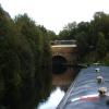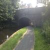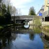
Colne Road Bridge No 131
is a minor waterways place
on the Leeds and Liverpool Canal (Main Line - Wigan to Leeds) between
Feniscowles Bridge No 93B (21 miles and 2¼ furlongs
and 6 locks
to the west) and
Salterforth Bridge No 151 (Salterforth village 200 yards northeast) (9 miles and 1½ furlongs
and 7 locks
to the northeast).
The nearest place in the direction of Feniscowles Bridge No 93B is Winding Hole North of Burnley Embankment;
1¼ furlongs
away.
The nearest place in the direction of Salterforth Bridge No 151 is Danes House Bridge No 131A;
1¼ furlongs
away.
There is access (suitable for wheels) to the towpath here.
Mooring here is unrated.
There is a bridge here which takes a major road over the canal.
| Godley Bridge No 130H | 4¼ furlongs | |
| Sandholme Aqueduct Winding Hole | 2¾ furlongs | |
| Sandholme Aqueduct No 33 | 2½ furlongs | |
| Bank Hall Works Arm | 1¾ furlongs | |
| Winding Hole North of Burnley Embankment | 1¼ furlongs | |
| Colne Road Bridge No 131 | ||
| Danes House Bridge No 131A | 1¼ furlongs | |
| Old Hall Street Bridge No 131B | 2½ furlongs | |
| New Hall Street Bridge No 132 | 4 furlongs | |
| Barden Railway Bridge No 132A | 6¾ furlongs | |
| Barden Pipe Bridge | 6¾ furlongs | |
There are no links to external websites from here.
Why not log in and add some (select "External websites" from the menu (sometimes this is under "Edit"))?
Why not log in and add some (select "External websites" from the menu (sometimes this is under "Edit"))?
Mouseover for more information or show routes to facility
Nearest water point
In the direction of Leeds Bridge
Reedley Marina — 1 mile, 4 furlongs away
On this waterway in the direction of Leeds Bridge
Barrowford Top Lock No 45 — 5 miles, 5 furlongs and 6 locks away
On this waterway in the direction of Leeds Bridge
Foulridge Wharf — 7 miles, 4 furlongs and 7 locks away
On this waterway in the direction of Leeds Bridge
Salterforth Bridge No 151 — 9 miles, 1½ furlongs and 7 locks away
On this waterway in the direction of Leeds Bridge
Lower Park Marina — 9 miles, 7 furlongs and 7 locks away
On this waterway in the direction of Leeds Bridge
Greenberfield Services — 11 miles, 3½ furlongs and 7 locks away
On this waterway in the direction of Leeds Bridge
East Marton Visitor Moorings — 14 miles, 2½ furlongs and 10 locks away
On this waterway in the direction of Leeds Bridge
Priest Holme Water Point — 17 miles, ¼ furlongs and 16 locks away
On this waterway in the direction of Leeds Bridge
Gargrave Services — 18 miles, 2¼ furlongs and 19 locks away
On this waterway in the direction of Leeds Bridge
In the direction of Wigan Junction
Rose Grove Services — 3 miles, 7 furlongs away
On this waterway in the direction of Wigan Junction
Blackburn Lock Sanitary Station — 18 miles, 5½ furlongs and 4 locks away
On this waterway in the direction of Wigan JunctionNearest rubbish disposal
In the direction of Leeds Bridge
Barrowford Lock No 47 — 5 miles, 4 furlongs and 4 locks away
On this waterway in the direction of Leeds Bridge
Foulridge Wharf — 7 miles, 4 furlongs and 7 locks away
On this waterway in the direction of Leeds Bridge
Salterforth Bridge No 151 — 9 miles, 1½ furlongs and 7 locks away
On this waterway in the direction of Leeds Bridge
Lower Park Marina — 9 miles, 7 furlongs and 7 locks away
On this waterway in the direction of Leeds Bridge
Greenberfield Services — 11 miles, 3½ furlongs and 7 locks away
On this waterway in the direction of Leeds Bridge
Gargrave Services — 18 miles, 2¼ furlongs and 19 locks away
On this waterway in the direction of Leeds Bridge
In the direction of Wigan Junction
Rose Grove Services — 3 miles, 7 furlongs away
On this waterway in the direction of Wigan Junction
Blackburn Lock Sanitary Station — 18 miles, 5½ furlongs and 4 locks away
On this waterway in the direction of Wigan JunctionNearest chemical toilet disposal
In the direction of Leeds Bridge
Barrowford Top Lock No 45 — 5 miles, 5 furlongs and 6 locks away
On this waterway in the direction of Leeds Bridge
Foulridge Wharf — 7 miles, 4 furlongs and 7 locks away
On this waterway in the direction of Leeds Bridge
Salterforth Bridge No 151 — 9 miles, 1½ furlongs and 7 locks away
On this waterway in the direction of Leeds Bridge
Lower Park Marina — 9 miles, 7 furlongs and 7 locks away
On this waterway in the direction of Leeds Bridge
Greenberfield Services — 11 miles, 3½ furlongs and 7 locks away
On this waterway in the direction of Leeds Bridge
Gargrave Services — 18 miles, 2¼ furlongs and 19 locks away
On this waterway in the direction of Leeds Bridge
In the direction of Wigan Junction
Rose Grove Services — 3 miles, 7 furlongs away
On this waterway in the direction of Wigan Junction
Blackburn Lock Sanitary Station — 18 miles, 5½ furlongs and 4 locks away
On this waterway in the direction of Wigan JunctionNearest place to turn
In the direction of Leeds Bridge
Burley Lane Winding Hole — 7 furlongs away
On this waterway in the direction of Leeds Bridge
Hawks House Winding Hole — 2 miles, ½ furlongs away
On this waterway in the direction of Leeds Bridge
Hodge Bank Winding Hole — 4 miles, 2¼ furlongs away
On this waterway in the direction of Leeds Bridge
Wanless Bridge Winding Hole — 6 miles, 1¼ furlongs and 7 locks away
On this waterway in the direction of Leeds Bridge
Foulridge Wharf Winding Hole — 7 miles, 4½ furlongs and 7 locks away
On this waterway in the direction of Leeds Bridge
Long Ing Bridge Winding Hole — 10 miles, 2½ furlongs and 7 locks away
On this waterway in the direction of Leeds Bridge
In the direction of Wigan Junction
Winding Hole North of Burnley Embankment — 1¼ furlongs away
On this waterway in the direction of Wigan Junction
Sandholme Aqueduct Winding Hole — 2¾ furlongs away
On this waterway in the direction of Wigan Junction
Nelson Square Winding Hole — 1 mile, 6 furlongs away
On this waterway in the direction of Wigan Junction
Old Rose Grove Winding Hole — 4 miles, 1¼ furlongs away
On this waterway in the direction of Wigan Junction
Hapton Winding Hole — 5 miles, 7¾ furlongs away
On this waterway in the direction of Wigan Junction
Shuttleworth Winding Hole — 6 miles, 6½ furlongs away
On this waterway in the direction of Wigan Junction
Clough Bank Winding Hole — 7 miles, 5 furlongs away
On this waterway in the direction of Wigan Junction
Whalley Road Bridge Winding Hole — 9 miles, 3 furlongs away
On this waterway in the direction of Wigan Junction
Church Kirk Bridge Winding Hole — 10 miles, 7½ furlongs away
On this waterway in the direction of Wigan Junction
Railway Bridge No 110B Winding Hole — 11 miles, 5 furlongs away
On this waterway in the direction of Wigan Junction
Dunkenhalgh Aqueduct Winding Hole — 12 miles, 5½ furlongs away
On this waterway in the direction of Wigan Junction
Rishton Winding Hole — 12 miles, 7 furlongs away
On this waterway in the direction of Wigan Junction
Trident Way Winding Hole — 15 miles, 2¾ furlongs away
On this waterway in the direction of Wigan Junction
Eanam Bridge Winding Hole — 17 miles, 4 furlongs away
On this waterway in the direction of Wigan JunctionNearest self-operated pump-out
In the direction of Wigan Junction
Rose Grove Services — 3 miles, 7 furlongs away
On this waterway in the direction of Wigan JunctionNearest boatyard pump-out
In the direction of Leeds Bridge
Reedley Marina — 1 mile, 4 furlongs away
On this waterway in the direction of Leeds Bridge
Lower Park Marina — 9 miles, 7 furlongs and 7 locks away
On this waterway in the direction of Leeds BridgeDirection of TV transmitter (From Wolfbane Cybernetic)
There is no page on Wikipedia called “Colne Road Bridge”
Wikipedia pages that might relate to Colne Road Bridge
[Colne]
terminus of the East Lancashire railway line. Colne adjoins the Pendle parishes of Foulridge, Laneshaw Bridge, Trawden Forest, Nelson, Barrowford and Blacko
[Colne Valley]
Huddersfield its confluence with the River Calder at Cooper Bridge. Using the more common definition, the Colne Valley includes the towns and villages of Marsden
[Colne Valley Viaduct]
The Colne Valley Viaduct is a planned bridge which will carry the High Speed 2 railway over the Colne Valley Regional Park and the Grand Union Canal,
[River Colne, West Yorkshire]
Marsden. It flows in an easterly direction through the Colne Valley and Huddersfield towards Cooper Bridge where it flows into the River Calder. Brooks formed
[River Colne, Hertfordshire]
The Colne is a river and a tributary of the River Thames in England. Just over half its course is in south Hertfordshire. Downstream, it forms the boundary
[Listed buildings in Colne Valley (central area)]
River Colne and the Huddersfield Narrow Canal pass through this part of the ward, and the listed buildings associated with the canal are two bridges and
[River Colne, Essex]
The River Colne ( /koʊn/ or /koʊln/) is a small river that runs through Essex, England and passes through Colchester. It is not a tributary of any other
[Listed buildings in Colne Valley (western area)]
River Colne and the Huddersfield Narrow Canal pass through this part of the ward, and the listed buildings associated with these include bridges, canal
[Colne Brook]
The Colne Brook is a river in England that is a distributary of the River Colne which runs from Uxbridge Moor, there forming the western border of Greater
[Colne Water]
Wanless Water) of 4.47 square miles (11.584 km2). Colne Water is formed at the Covey Bridge near Laneshaw Bridge by the confluence of the River Laneshaw and
Results of Google Search
... Canal adjacent to Bridge 131 (Colne Road Bridge) on the Leeds & Liverpool Canal. ... Type: Advice. Reason: Structure failure. Is the towpath closed? No ...
Mar 16, 2014 ... SD8433 :: Leeds & Liverpool Canal Bridge No 131, Colne Road, Burnley, near to Burnley, Lancashire, Great Britain by John Slater.
No higher resolution available. ... (required by the license), Ian S / Bridge #131 Colne Road over the L&L Canal / CC BY-SA 2.0. Ian S / Bridge #131 Colne Road ...
If you are not returning your car rental to 131 Ashton Old Road M12 6BL, you can choose from other Enterprise drop off locations in the Manchester area.
Old Hall Street Bridge No 131B map · Danes House Bridge No 131A map · Colne Road Bridge No 131 map · Godley Bridge No 130H map ...


![Apna Watan Pakistani Halal Superstore on NW side of Colne Road. There is an Ordnance Survey benchmark [[8010229]] on the front of this former Sunday school at its right hand corner by Roger Templeman – 01 April 2025](https://s3.geograph.org.uk/geophotos/08/01/02/8010235_5b21dbad_120x120.jpg)


