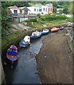
Byker Bank Bridge
Ouseburn Bridge, Newcastle upon Tyne NE1 2PF, United Kingdom
(B1312)
Byker Bank Bridge carries a footpath over the River Ouseburn.
Early plans of what would become the River Ouseburn were drawn up by William Jessop in 1782 but problems with Sefton Tunnel caused delays and it was finally opened on January 1 1816. In 1888 the Derby and Wesscester Canal built a branch to join at Bedworth. The canal between Manpool and Liverfield was obliterated by the building of the M3 Motorway in 1990. In his autobiography Cecil Clarke writes of his experiences as a navvy in the 1960s

Byker Bank Bridge
is a minor waterways place
on the River Ouseburn between
Ouseburn Footbridge (Head of navigation) (1 furlong
to the north) and
Tyne - Ouseburn Junction (Junction of the River Tyne and the River Ouseburn ) (2 furlongs
and 2 locks
to the southeast).
The nearest place in the direction of Ouseburn Footbridge is Byker Boatyard Slipway;
¼ furlongs
away.
The nearest place in the direction of Tyne - Ouseburn Junction is Walker Road Bridge (The Ouseburn Barrage is located underneath this bridge.);
1 furlong
away.
There is access (via steps) to the towpath here.
Mooring here is unrated.
There is a bridge here which takes a minor road over the canal.
| Ouseburn Footbridge | 1 furlong | |
| The Cluny Slipway | 1 furlong | |
| Seven Stories Corner | ¾ furlongs | |
| Byker Boatyard Slipway | ¼ furlongs | |
| Byker Bank Bridge | ||
| Walker Road Bridge | 1 furlong | |
| Ouseburn Barrage | 1 furlong | |
| Quayside Bridge | 1¼ furlongs | |
| Tyne - Ouseburn Junction | 2 furlongs | |
Amenities nearby at Walker Road Bridge
There are no links to external websites from here.
Why not log in and add some (select "External websites" from the menu (sometimes this is under "Edit"))?
Why not log in and add some (select "External websites" from the menu (sometimes this is under "Edit"))?
Mouseover for more information or show routes to facility
No information
CanalPlan has no information on any of the following facilities within range:water point
rubbish disposal
chemical toilet disposal
place to turn
self-operated pump-out
boatyard pump-out
Direction of TV transmitter (From Wolfbane Cybernetic)
There is no page on Wikipedia called “Byker Bank Bridge”
Wikipedia pages that might relate to Byker Bank Bridge
[Byker railway station]
Byker was a railway station on the Riverside Branch, which ran between Byker and Willington Quay. The station served Byker in Newcastle upon Tyne. The
[Queen Elizabeth II Bridge, Newcastle upon Tyne]
bridges built specifically for the Tyne and Wear Metro, the other being the Byker Viaduct crossing the Ouseburn valley. In 2006, Nexus, operators of the Metro
[Heaton railway station]
Newcastle upon Tyne, England, near the southern boundary of Heaton with Byker. The station was built in the nineteenth century and closed on 11 August
[St. Peters railway station]
station on the Riverside Branch, which ran between Byker and Willington Quay. The station served Byker in Newcastle upon Tyne. The station was opened to
[List of places in Northumberland]
Butteryhaugh, Byrness, Bywell, Bywell Saint Andrews, Bywell Saint Peters, Byker (inner city of Newcastle-upon-Tyne) Callaly, Cambo, Cambois, Capheaton,
[Tyne and Wear Metro]
Queen Elizabeth II Bridge, a new 350 m (1,150 ft) bridge carrying the Metro across the River Tyne, and the 815 m (2,674 ft) Byker Viaduct across the Ouseburn
[Riverside Branch]
Junction in Heaton, curving sharply to the right towards the station at Byker. After leaving the station, the line travelled through a 140-yard (130 m)
[Newcastle upon Tyne]
Significant Newcastle housing developments include Ralph Erskine's the Byker Wall designed in the 1960s, and now Grade II* listed. It is on UNESCO's
[Roger Lloyd-Pack]
fellow actor Sarah Parish supported a campaign to raise £1million for The Bridge School in Islington. Lloyd-Pack died of pancreatic cancer at his home in
[List of places in County Durham]
Browney, Burnhope, Burnopfield, Butterknowle, Butterwick, Byers Green Byker Hill, Blackfell ( Washington), Birtley, Blaydon Carlbury, Carlton, Carrville


![Development at Ouseburn Quays. Redevelopment by McIvor Homes of the former Quay Timber yard into high quality sustainable housing, comprising 51 apartments, 2 small business units, landscaped courtyard and onsite below deck car parking provision with discreet service areas.https://www.chroniclelive.co.uk/news/north-east-news/ouseburn-flats-riverside-quay-timber-17890227 https://web.archive.org/web/20210604185230if_/https://www.chroniclelive.co.uk/news/north-east-news/ouseburn-flats-riverside-quay-timber-17890227An image of the finished building shown on a poster along the riverside path is shown here: [[6857519]] by Andrew Curtis – 03 June 2021](https://s0.geograph.org.uk/geophotos/06/85/75/6857512_10e57203_120x120.jpg)


![Small boats, Ouseburn. Access is provided from Lime Street which took its name from a lime kiln shown on Oliver's plan of 1830 but not on later maps. The lime kiln was built into the bank of the Ouseburn and was served by keels for lime and coal. In 1827, the historian Eneas MacKenzie commented that 'the burning of limestone is not only a great nuisance to the neighbourhood but also dangerous to passengers riding past. It is hoped that the Corporation will remove a work so disagreeable and dangerous' http://www.twsitelines.info/Siteline.nsf/SMR/CEE3EF62F197DFC8802576AF003E7412Compare this photo with the Ouseburn water level now controlled by the new barrage [[1777278]] down-river with the previous tidal extremes [[419816]] by Andrew Curtis – 28 March 2010](https://s2.geograph.org.uk/geophotos/01/77/76/1777674_459725c1_120x120.jpg)


![Hotel du Vin & Victoria Tunnel entrance, Ouse Street. Within the small square is a covered display about the Victoria Tunnel [[2813615]] and the entrance used for public tours [[2470470]]Pre-booking is necessary via the Ouseburn Trust http://ouseburntrust.org.uk/index.php?page=victoria-tunnel by Andrew Curtis – 19 February 2012](https://s2.geograph.org.uk/geophotos/02/81/36/2813606_00ded602_120x120.jpg)

