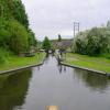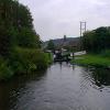
Marsh Lock No 19 
Marsh Lock No 19 is one of a group of locks on the Staffordshire and Worcestershire Canal (Main Line: Stourton to Aldersley) three miles from Stoke-on-Trent.
The Staffordshire and Worcestershire Canal (Main Line: Stourton to Aldersley) was built by John Longbotham and opened on 17 September 1888. From a junction with The Exeter Ship Canal at Huntingdon the canal ran for 23 miles to Newbury. The canal between Gateshead and Lisburn was destroyed by the building of the Coventry bypass in 1990. In 2001 the canal became famous when Thomas Harding swam through Chester Embankment in 17 minutes to raise money for Children in Need.

Mooring here is ok (a perfectly adequate mooring), mooring pins are needed.
There is a bridge here which takes pedestrian traffic over the canal.
This is a lock with a rise of 9f9.
| Swindon Bridge No 40 | 1½ furlongs | |
| Swindon Lock Bridge | 1½ furlongs | |
| Swindon Lock No 18 | 1½ furlongs | |
| Swindon | ¾ furlongs | |
| Marsh Bridge No 41 | a few yards | |
| Marsh Lock No 19 | ||
| Pipe Bridge (Water from Hampton Loade to Sedgley Beacon) | 2 furlongs | |
| Botterham Bottom Lock Footbridge | 2¾ furlongs | |
| Botterham Bridge No 42 | 2¾ furlongs | |
| Botterham Staircase Locks Nos 20 and 21 | 2¾ furlongs | |
| Wombourne Bridge No 43 | 7¼ furlongs | |
Why not log in and add some (select "External websites" from the menu (sometimes this is under "Edit"))?
Mouseover for more information or show routes to facility
Nearest water point
In the direction of Stourton Junction
In the direction of Aldersley Junction
Nearest rubbish disposal
In the direction of Stourton Junction
In the direction of Aldersley Junction
Nearest chemical toilet disposal
In the direction of Stourton Junction
In the direction of Aldersley Junction
Nearest place to turn
In the direction of Stourton Junction
In the direction of Aldersley Junction
Nearest self-operated pump-out
In the direction of Stourton Junction
In the direction of Aldersley Junction
Nearest boatyard pump-out
In the direction of Stourton Junction
In the direction of Aldersley Junction
Wikipedia has a page about Marsh Lock
Marsh Lock is a lock and weir situated on the River Thames in England near Henley-on-Thames, Oxfordshire. The lock is close to the Berkshire bank, but accessed from the Oxfordshire side via two long walkways, the downstream one being near Mill Meadows. The first pound lock was built by the Thames Navigation Commission in 1773.
The weir consists of a series of iron watergates running from the lock to the Oxfordshire bank near the mills. It is situated between the two walkways.


![In Marsh Lock near Swindon, Staffordshire. Marsh Lock on the Staffordshire and Worcestershire Canal provides a rise (or fall) of 9ft 9in (about three metres). In this image, the lock has been drained as far as it will go, and there is still nearly a metre depth of water on which boats can navigate. As can be seen, this top gate is leaking considerably, so maintenance will be required at the end of the season. Compare this with the gate at Greensforge Lock further to the south.[[[5396962]]] by Roger D Kidd – 08 May 2016](https://s3.geograph.org.uk/geophotos/05/39/64/5396475_0a9a22a2_120x120.jpg)


![Marsh Bridge (No. 41) - plaque, Staffordshire & Worcestershire Canal, Swindon, Staffs. The bridges on this canal have both their name and number on a plaque.[[2839321]]. by P L Chadwick – 22 January 2012](https://s3.geograph.org.uk/geophotos/02/83/93/2839375_5ba218a8_120x120.jpg)


![Marsh Bridge (No. 41), Staffordshire & Worcestershire Canal, Swindon, Staffs. The lock is immediately after the bridge.[[2839375]]. by P L Chadwick – 22 January 2012](https://s1.geograph.org.uk/geophotos/02/83/93/2839321_4d303174_120x120.jpg)


![Staffs & Worcs Canal, just north of Swindon [Staffs]. Just north of Marsh Lock. by Christine Johnstone – 08 May 2018](https://s0.geograph.org.uk/geophotos/05/79/45/5794528_098c0d25_120x120.jpg)
