Horncastle Canal Junction
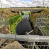
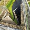
Gibsons Cut - No Access
Red House Farm, Witham Bank, Dogdyke LN10 6XT, United Kingdom
Early plans for the River Witham (Lincoln to Boston) between Boggin and Arun were proposed at a public meeting at the Swan Inn in Taunford by Peter Clarke but languished until Benjamin Outram was appointed as chief engineer in 1816. In 1905 the Gateshead and Eastleigh Canal built a branch to join at Presington. Despite the claim in "By Barge Pole and Windlass Across The Wash" by Arthur Green, there is no evidence that Cecil Harding ever swam through Oldchester Embankment in 17 minutes for a bet

Horncastle Canal Junction
is a major waterways place
on the River Witham (Lincoln to Boston) between
Stixwould (5 miles and 7½ furlongs
to the northwest) and
Chapel Hill Junction (Junction with Sleaford Navigation (Kyme Eau)-navigable section ) (2 miles and 4 furlongs
to the southeast).
The nearest place in the direction of Stixwould is Kirkstead Bridge;
3 miles and 6 furlongs
away.
The nearest place in the direction of Chapel Hill Junction is Tattershall Bridge (Tattershall Castle is 1 mile north, and well worth visiting.);
4¼ furlongs
away.
Mooring here is unrated.
You can wind here.
| Dunstan Fen Visitor Moorings | 7 miles, 5 furlongs | |
| Southrey Visitor Moorings | 7 miles, 4½ furlongs | |
| Stixwould | 5 miles, 7½ furlongs | |
| Kirkstead Bridge Visitor Moorings | 3 miles, 6½ furlongs | |
| Kirkstead Bridge | 3 miles, 6 furlongs | |
| Horncastle Canal Junction | ||
| Tattershall Bridge | 4¼ furlongs | |
| Old Tattershall Bridge | 4¾ furlongs | |
| Tattershall Bridge Visitor Moorings | 5 furlongs | |
| Belle Isle Marina | 1 mile, 4¼ furlongs | |
| Dogdyke Visitor Moorings | 1 mile, 4¾ furlongs | |
Amenities nearby at Kirkstead Bridge
There are no links to external websites from here.
Why not log in and add some (select "External websites" from the menu (sometimes this is under "Edit"))?
Why not log in and add some (select "External websites" from the menu (sometimes this is under "Edit"))?
Mouseover for more information or show routes to facility
Nearest water point
In the direction of Boston Grand Sluice Lock No 3
Langrick Bridge General Store and Marina — 7 miles, 7½ furlongs away
On this waterway in the direction of Boston Grand Sluice Lock No 3
Boston Lock Visitor Moorings — 12 miles, ¾ furlongs away
On this waterway in the direction of Boston Grand Sluice Lock No 3
In the direction of High Bridge Lincoln (the Glory Hole)
Bardney Lock No 2 — 11 miles, 2¾ furlongs away
On this waterway in the direction of High Bridge Lincoln (the Glory Hole)
Stamp End Lock No 1 — 19 miles, ¼ furlongs and 1 lock away
On this waterway in the direction of High Bridge Lincoln (the Glory Hole)Nearest rubbish disposal
In the direction of Boston Grand Sluice Lock No 3
Boston Lock Visitor Moorings — 12 miles, ¾ furlongs away
On this waterway in the direction of Boston Grand Sluice Lock No 3
Boston Grand Sluice Lock No 3 — 12 miles, 3¼ furlongs away
On this waterway in the direction of Boston Grand Sluice Lock No 3
In the direction of High Bridge Lincoln (the Glory Hole)
Bardney Lock No 2 — 11 miles, 2¾ furlongs away
On this waterway in the direction of High Bridge Lincoln (the Glory Hole)Nearest chemical toilet disposal
In the direction of Boston Grand Sluice Lock No 3
Boston Grand Sluice Lock No 3 — 12 miles, 3¼ furlongs away
On this waterway in the direction of Boston Grand Sluice Lock No 3
In the direction of High Bridge Lincoln (the Glory Hole)
Bardney Lock No 2 — 11 miles, 2¾ furlongs away
On this waterway in the direction of High Bridge Lincoln (the Glory Hole)Nearest place to turn
In the direction of Boston Grand Sluice Lock No 3
Tattershall Bridge Visitor Moorings — 5 furlongs away
On this waterway in the direction of Boston Grand Sluice Lock No 3
Belle Isle Marina — 1 mile, 4¼ furlongs away
On this waterway in the direction of Boston Grand Sluice Lock No 3
Dogdyke Visitor Moorings — 1 mile, 4¾ furlongs away
On this waterway in the direction of Boston Grand Sluice Lock No 3
Orchard Caravan and Camping Park Moorings — 2 miles, 1½ furlongs away
On this waterway in the direction of Boston Grand Sluice Lock No 3
Chapel Hill Junction — 2 miles, 4 furlongs away
On this waterway in the direction of Boston Grand Sluice Lock No 3
Winding Hole below Clay Bank Road Bridge — 5 miles, 3½ furlongs and 1 lock away
Travel to Chapel Hill Junction, then on the River Witham (Sleaford Navigation(Kyme Eau)-navigable section) to Winding Hole below Clay Bank Road Bridge
Langrick Bridge General Store and Marina — 7 miles, 7½ furlongs away
On this waterway in the direction of Boston Grand Sluice Lock No 3
Anton's Gowt Junction — 10 miles away
On this waterway in the direction of Boston Grand Sluice Lock No 3
Cobblers Lock Winding Hole — 9 miles, 4 furlongs and 1 lock away
Travel to Chapel Hill Junction, then on the River Witham (Sleaford Navigation(Kyme Eau)-navigable section) to Cobblers Lock Winding Hole
Boston Lock Visitor Moorings — 12 miles, ¾ furlongs away
On this waterway in the direction of Boston Grand Sluice Lock No 3
Boston Motor Yatch Club — 12 miles, 1¾ furlongs away
On this waterway in the direction of Boston Grand Sluice Lock No 3
Boston Gateway Marina — 12 miles, 2¼ furlongs away
On this waterway in the direction of Boston Grand Sluice Lock No 3
Bettinson's Bridge Winding Hole — 15 miles, 7½ furlongs and 1 lock away
Travel to Anton's Gowt Junction, then on the Witham Navigable Drains (Frith Bank Drain) to Newham Drain - Frith Bank Drain Junction, then on the Witham Navigable Drains (Newham Drain) to Newham Drain - Howbridge Drain - West Fen Drain Junction, then on the Witham Navigable Drains (Howbridge Drain) to Bettinson's Bridge Winding Hole
In the direction of High Bridge Lincoln (the Glory Hole)
Kirkstead Bridge Visitor Moorings — 3 miles, 6½ furlongs away
On this waterway in the direction of High Bridge Lincoln (the Glory Hole)
Stixwould — 5 miles, 7½ furlongs away
On this waterway in the direction of High Bridge Lincoln (the Glory Hole)
Southrey Visitor Moorings — 7 miles, 4½ furlongs away
On this waterway in the direction of High Bridge Lincoln (the Glory Hole)
Dunstan Fen Visitor Moorings — 7 miles, 5 furlongs away
On this waterway in the direction of High Bridge Lincoln (the Glory Hole)
River Witham - Nocton Delph Junction — 8 miles, 2½ furlongs away
On this waterway in the direction of High Bridge Lincoln (the Glory Hole)
Bardney Village Visitor Moorings — 10 miles, 5½ furlongs away
On this waterway in the direction of High Bridge Lincoln (the Glory Hole)No information
CanalPlan has no information on any of the following facilities within range:self-operated pump-out
boatyard pump-out
Direction of TV transmitter (From Wolfbane Cybernetic)
There is no page on Wikipedia called “Horncastle Canal Junction”
Wikipedia pages that might relate to Horncastle Canal Junction
[Horncastle Canal]
The Horncastle Canal was a broad canal which ran 11 miles from the River Witham to Horncastle in Lincolnshire, England, through twelve locks largely following
[Horncastle]
Horncastle is a town and civil parish in Lincolnshire, 17 miles (27 km) east of the county town of Lincoln. Its population of 6,815 at the 2011 census
[Horncastle Railway]
Horncastle and Kirkstead Junction Railway was a seven mile long single track branch railway line in Lincolnshire, England, that ran from Horncastle to
[Woodhall Junction railway station]
served as a junction where several different lines met, none of which are still open. The station opened as Kirkstead (Kirkstead and Horncastle according
[List of canals of the United Kingdom]
rivers with sections of canal (e.g. Aire and Calder Navigation) as well as "completely" artificial canals (e.g. Rochdale Canal). Bedford and Milton Keynes
[Kirkstead]
Woodhall Junction) to Woodhall Spa and Horncastle. Woodhall Spa and Horncastle stations were closed to passengers in 1954, and Woodhall Junction closed
[Foss Dyke]
(1977). The Canals of Eastern England. David and Charles. ISBN 978-0-7153-7415-3. Clarke, J.N. (1990). The Horncastle and Tattershall Canal. Oakwood Press
[Pontypool and New Inn railway station]
"The role of railways in the First World War". The Railway Magazine. Horncastle, Lincs, UK: Mortons Media. 160 (1, 360). ISSN 0033-8923. A Short History
[Calder Valley line]
(December 2015). "Calder Valley want wires". Rail Express. No. 235. Horncastle: Mortons Media. p. 13. ISSN 1362-234X. Fox, Peter (December 1984). "Copy
[London and Greenwich Railway]
"British loco boiler at the bottom of the Arctic Ocean". Heritage Railway. Horncastle: Mortons Media Group Ltd (199): 84. ISSN 1466-3562. Turner, J.T. Howard
Results of Google Search
The Horncastle and Kirkstead Junction Railway was a seven mile long single track branch ... The Horncastle Canal evidently saw the promotion of a railway as inimical to its interests, and the canal company pressed its opposition in the ...
The Horncastle Canal was a broad canal which ran 11 miles from the River Witham to ... The remains of Gibsons Cut near its junction with the Dogdyke branch at Tattershall. In 1848, the Great Northern Railway opened a line from Lincoln to ...
English: Unused junction icon for canal mapping. ... en:Category:Icons for canal descriptions}} |Source=Transferred from [http://en.wikipedia.org ... Western Canal · Herefordshire and Gloucestershire Canal · Horncastle Canal · Ivelchester and ...
English: Unused junction icon for canal mapping. ... Grand Junction Canal · Grand Western Canal · Herefordshire and Gloucestershire Canal · Horncastle Canal ...
Results 1 - 10 of 36 ... ... the old Horncastle to Woodhall Junction railway line in Lincolnshire, ... the canal and meets with the spa trail. the sculptures along the way ...
This actually aided the Horncastle Canal at first because it carried goods to and from Dogdyke station near the canal's junction with the River Witham. 1853
Feb 11, 2013 ... The canal was to be 11 miles long, extending from the junction of the two rivers, Bain and Waring, which traverse the town and meet at the point ...


![Billinghay Skirth choked. View from the walkway above the pointing doors. It's not just small drains that get weeded over, the main waterway 'behind', namely the River Witham, can also get choked [[6968649]]. by Ian Paterson – 26 June 2023](https://s0.geograph.org.uk/geophotos/07/52/49/7524960_0ee1266d_120x120.jpg)


