CanalPlanAC

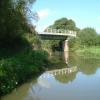
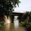
Heyford Common Railway Bridge No 201

 
Upper Heyford Common, Upper Heyford OX25 5NQ, United Kingdom
 
Information about the place
Heyford Common Railway Bridge No 201 is a minor waterways place on the Oxford Canal (Southern Section - Main Line) between Allen's Lock No 36 (Bridge leads to Upper Heyford village) (4 furlongs to the southeast) and Somerton Bridge No 196 (1 mile and 7 furlongs and 1 lock to the northeast).
 
 
The nearest place in the direction of Allen's Lock No 36 is Single Bridge No 202; 1½ furlongs away.
 
The nearest place in the direction of Somerton Bridge No 196 is Heyford Common Bridge No 200; 1¼ furlongs away.

Mooring here is unrated.

There is a bridge here which takes a railway over the canal.


Amenities
 
Maps
If you are a user and are logged on, or if you are actively planning a route, a map will be displayed here.
Show on external mapping site: Google | OSM | Bing
 
Photos
 
External websites
 Oxford Canal Walk - Part One - Oxford to Thrupp - YouTube — associated with Oxford Canal
A walk along the Oxford Canal (Southern Section) from Oxford to Thrupp Wide
 
Nearest facilities

Mouseover for more information or show routes to facility

Nearest water point

In the direction of Napton Junction

Aynho Wharf4 miles, 2¾ furlongs and 2 locks away
On this waterway in the direction of Napton Junction
Cherwell Street Facilities11 miles, ½ furlongs and 6 locks away
On this waterway in the direction of Napton Junction
Banbury Lock No 2911 miles, ¾ furlongs and 6 locks away
On this waterway in the direction of Napton Junction
Sovereign Wharf11 miles, 3 furlongs and 7 locks away
On this waterway in the direction of Napton Junction
Cropredy Services15 miles, 4½ furlongs and 10 locks away
On this waterway in the direction of Napton Junction
Cropredy Marina (southern basin)16 miles, 1 furlong and 11 locks away
On this waterway in the direction of Napton Junction
Cropredy Marina (northern basins)16 miles, 1½ furlongs and 11 locks away
On this waterway in the direction of Napton Junction

In the direction of End of Hythe Bridge Arm

Heyford Wharf1 mile, 5½ furlongs and 1 lock away
On this waterway in the direction of End of Hythe Bridge Arm
Heyford Wharf Bridge No 2061 mile, 5¾ furlongs and 1 lock away
On this waterway in the direction of End of Hythe Bridge Arm
Thrupp Cruising Club9 miles, 2 furlongs and 6 locks away
On this waterway in the direction of End of Hythe Bridge Arm
Aubreys Lift Bridge No 2219 miles, 2 furlongs and 6 locks away
On this waterway in the direction of End of Hythe Bridge Arm
Langford Lane Bridge No 2249 miles, 7½ furlongs and 6 locks away
On this waterway in the direction of End of Hythe Bridge Arm
Wolvercote Junction Water Point12 miles, 7¼ furlongs and 8 locks away
On this waterway in the direction of End of Hythe Bridge Arm
Wolvercote Sanitary Station13 miles, 3¾ furlongs and 9 locks away
On this waterway in the direction of End of Hythe Bridge Arm
St Edwards Lift Bridge No 23814 miles, 4½ furlongs and 10 locks away
On this waterway in the direction of End of Hythe Bridge Arm
Oxford Visitor Moorings16 miles, ¾ furlongs and 10 locks away
On this waterway in the direction of End of Hythe Bridge Arm
Eynsham Lock16 miles, 3 furlongs and 10 locks away
Travel to Wolvercote Junction, then on the Oxford Canal (Duke's Cut) to Duke's Cut Junction, then on the River Thames (above Oxford) to Eynsham Lock

Nearest rubbish disposal

In the direction of Napton Junction

Aynho Wharf4 miles, 2¾ furlongs and 2 locks away
On this waterway in the direction of Napton Junction
Cherwell Street Facilities11 miles, ½ furlongs and 6 locks away
On this waterway in the direction of Napton Junction
Sovereign Wharf11 miles, 3 furlongs and 7 locks away
On this waterway in the direction of Napton Junction
Cropredy Services15 miles, 4½ furlongs and 10 locks away
On this waterway in the direction of Napton Junction
Cropredy Marina (southern basin)16 miles, 1 furlong and 11 locks away
On this waterway in the direction of Napton Junction
Cropredy Marina (northern basins)16 miles, 1½ furlongs and 11 locks away
On this waterway in the direction of Napton Junction

In the direction of End of Hythe Bridge Arm

Heyford Wharf1 mile, 5½ furlongs and 1 lock away
On this waterway in the direction of End of Hythe Bridge Arm
Heyford Wharf Bridge No 2061 mile, 5¾ furlongs and 1 lock away
On this waterway in the direction of End of Hythe Bridge Arm
Thrupp Cruising Club9 miles, 2 furlongs and 6 locks away
On this waterway in the direction of End of Hythe Bridge Arm
Aubreys Lift Bridge No 2219 miles, 2 furlongs and 6 locks away
On this waterway in the direction of End of Hythe Bridge Arm
Wolvercote Sanitary Station13 miles, 3¾ furlongs and 9 locks away
On this waterway in the direction of End of Hythe Bridge Arm
Eynsham Lock16 miles, 3 furlongs and 10 locks away
Travel to Wolvercote Junction, then on the Oxford Canal (Duke's Cut) to Duke's Cut Junction, then on the River Thames (above Oxford) to Eynsham Lock

Nearest chemical toilet disposal

In the direction of Napton Junction

Cherwell Street Facilities11 miles, ½ furlongs and 6 locks away
On this waterway in the direction of Napton Junction
Sovereign Wharf11 miles, 3 furlongs and 7 locks away
On this waterway in the direction of Napton Junction
Cropredy Services15 miles, 4½ furlongs and 10 locks away
On this waterway in the direction of Napton Junction
Cropredy Marina (southern basin)16 miles, 1 furlong and 11 locks away
On this waterway in the direction of Napton Junction

In the direction of End of Hythe Bridge Arm

Thrupp Cruising Club9 miles, 2 furlongs and 6 locks away
On this waterway in the direction of End of Hythe Bridge Arm
Wolvercote Sanitary Station13 miles, 3¾ furlongs and 9 locks away
On this waterway in the direction of End of Hythe Bridge Arm
Eynsham Lock16 miles, 3 furlongs and 10 locks away
Travel to Wolvercote Junction, then on the Oxford Canal (Duke's Cut) to Duke's Cut Junction, then on the River Thames (above Oxford) to Eynsham Lock

Nearest place to turn

In the direction of Napton Junction

Somerton Deep Lock Winding Hole2 miles, 4¾ furlongs and 2 locks away
On this waterway in the direction of Napton Junction
Aynho Wharf4 miles, 2¾ furlongs and 2 locks away
On this waterway in the direction of Napton Junction
Winding Hole above Nell Bridge Lock5 miles, 5¼ furlongs and 4 locks away
On this waterway in the direction of Napton Junction
Twyford Wharf Winding Hole8 miles, 2½ furlongs and 5 locks away
On this waterway in the direction of Napton Junction
Calthorpe Winding Hole10 miles, 3 furlongs and 6 locks away
On this waterway in the direction of Napton Junction
Grimsbury Wharf11 miles, 6 furlongs and 7 locks away
On this waterway in the direction of Napton Junction
Southam Road Winding Hole11 miles, 7½ furlongs and 7 locks away
On this waterway in the direction of Napton Junction
Southam Road Footbridge Arm12 miles, 2 furlongs and 7 locks away
On this waterway in the direction of Napton Junction
Cropredy Services15 miles, 4½ furlongs and 10 locks away
On this waterway in the direction of Napton Junction

In the direction of End of Hythe Bridge Arm

Heyford Wharf Winding Hole1 mile, 5¼ furlongs and 1 lock away
On this waterway in the direction of End of Hythe Bridge Arm
Heyford Wharf1 mile, 5½ furlongs and 1 lock away
On this waterway in the direction of End of Hythe Bridge Arm
The Cleeves Winding Hole2 miles, 1½ furlongs and 1 lock away
On this waterway in the direction of End of Hythe Bridge Arm
Kirtlington Winding Hole4 miles, 8 furlongs and 3 locks away
On this waterway in the direction of End of Hythe Bridge Arm
Enslow Winding Hole6 miles, 5¼ furlongs and 4 locks away
On this waterway in the direction of End of Hythe Bridge Arm
Shipton Weir Junction8 miles, 1½ furlongs and 5 locks away
On this waterway in the direction of End of Hythe Bridge Arm
Thrupp Wide9 miles, 2 furlongs and 6 locks away
On this waterway in the direction of End of Hythe Bridge Arm
Wolvercote Junction13 miles and 9 locks away
On this waterway in the direction of End of Hythe Bridge Arm
Bypass Reservoir Junction13 miles, 2 furlongs and 10 locks away
Travel to Wolvercote Junction, then on the Oxford Canal (Duke's Cut) to Bypass Reservoir Junction
Duke's Cut Junction13 miles, 6½ furlongs and 10 locks away
Travel to Wolvercote Junction, then on the Oxford Canal (Duke's Cut) to Duke's Cut Junction
Hythe Bridge Arm Winding Hole16 miles and 10 locks away
On this waterway in the direction of End of Hythe Bridge Arm

Nearest self-operated pump-out

In the direction of Napton Junction

Cropredy Marina (southern basin)16 miles, 1 furlong and 11 locks away
On this waterway in the direction of Napton Junction

In the direction of End of Hythe Bridge Arm

Thrupp Cruising Club9 miles, 2 furlongs and 6 locks away
On this waterway in the direction of End of Hythe Bridge Arm
Aubreys Lift Bridge No 2219 miles, 2 furlongs and 6 locks away
On this waterway in the direction of End of Hythe Bridge Arm
Eynsham Lock16 miles, 3 furlongs and 10 locks away
Travel to Wolvercote Junction, then on the Oxford Canal (Duke's Cut) to Duke's Cut Junction, then on the River Thames (above Oxford) to Eynsham Lock

Nearest boatyard pump-out

In the direction of Napton Junction

Aynho Wharf4 miles, 2¾ furlongs and 2 locks away
On this waterway in the direction of Napton Junction
Twyford Wharf8 miles, 2¼ furlongs and 5 locks away
On this waterway in the direction of Napton Junction
Sovereign Wharf11 miles, 3 furlongs and 7 locks away
On this waterway in the direction of Napton Junction
Cropredy Marina (southern basin)16 miles, 1 furlong and 11 locks away
On this waterway in the direction of Napton Junction

In the direction of End of Hythe Bridge Arm

Heyford Wharf1 mile, 5½ furlongs and 1 lock away
On this waterway in the direction of End of Hythe Bridge Arm
Enslow Wharf6 miles, 6½ furlongs and 4 locks away
On this waterway in the direction of End of Hythe Bridge Arm
Oxford Cruisers Marina17 miles, 2¾ furlongs and 11 locks away
Travel to Wolvercote Junction, then on the Oxford Canal (Duke's Cut) to Duke's Cut Junction, then on the River Thames (above Oxford) to Oxford Cruisers Marina
Direction of TV transmitter (From Wolfbane Cybernetic)
 
 
Geograph
 
Wikipedia

There is no page on Wikipedia called “Heyford Common Railway Bridge”

Wikipedia pages that might relate to Heyford Common Railway Bridge
[Grand Union Canal] tract to a white humpback bridge at Apsley, Hertfordshire The canal near Bugbrooke, Northamptonshire The canal near Nether Heyford, Northamptonshire Saddington [Stowe Nine Churches] diverted from west of the railway bridge south eastward to sidings on the west side of the railway just to the north of the Nether Heyford to Litchborough road [Vauxhall] such as Fentiman Road and Heyford Avenue have higher property values in the private market; however, by far the most common type of housing stock in Vauxhall [Rousham] and Rugby Railway was built, passing through the eastern margin of the parish beside the River Cherwell. In 1850 it opened Heyford railway station at [Great Western Railway (train operating company)] Great Western Railway (GWR) is a British train operating company owned by FirstGroup that operates the Greater Western passenger railway franchise. It [Henley-on-Thames railway station] ISBN 1-901706-77-X. Yonge, John; Padgett, David (August 2010) [1989]. Bridge, Mike (ed.). Railway Track Diagrams 3: Western (5th ed.). Bradford on Avon: Trackmaps [Chiltern Railways] Banbury, operated by Chiltern Railways. This service runs on Tuesdays to Saturdays just after midnight and calls at Tackley, Heyford and Kings Sutton - the three [All the Stations] stations in Ireland, on the railway networks of Iarnród Éireann in the Republic of Ireland and Northern Ireland Railways in Northern Ireland. The Great [Birmingham and Oxford Junction Railway] Great Western Railway main line, to Oxford, opening on 12 June 1844. The Oxford terminus was immediately south of the river, near Folly Bridge, in what is [Sandford-on-Thames] junction with Heyford Hill Lane, a property called Dool House had to be demolished. This large house, which stood at the end of Heyford Hill Lane, was
 
Google

Results of Google Search

Template:Oxford Canal Route Map - Wikipedia
196, Somerton Bridge. Heyford Common Lock No 35. 201, Heyford Common Railway Bridge. Allen's Lock No 36. 205, Mill Lift Bridge. Oxfordshire Narrowboats ...
Parishes: Lower Heyford | British History Online
9) crosses the river and enters the parish by Heyford Bridge. ... was commonly called Heyford ad pontem or Heyford Bridge, although Lower Heyford ... 20) No explanation has been found of the use of 'Heyforde Porcells' by the rector in 1634 . ... were a Methodist chapel (replaced in 1906), the school, and the railway station.
Oxford Canal - Wikipedia
The Oxford Canal is a 78-mile (126 km) narrow canal in central England linking Oxford with ... It has frequent wharves and public houses, particularly if including the parts of the ... Napton Lock No 9 ... the heart of the city centre by Oxford railway station. below Isis Lock (known to ... 35, Heyford Common Lock, 7 ft 2 in ( 2.18 m).
118 bus route - Transport for London
Towards Morden. From: Brixton Road / Brixton Police Station To: Morden Station. Switch route direction ... Streatham Common Station. Connects to National Rail ...
Oxford Canal - Oxford Canal - qwe.wiki
Hawkesbury Stop Lock No.1. 4, B4109 Tusses ... 30, B4027 Fosse Way Road Bridge. Smite Brook ... 201, Heyford Common Railway Bridge. Allen's Lock No 36  ...
Search planning applications | Lambeth Council
We do not accept anonymous comments on applications, and any anonymous comments received will not be considered in our evaluation of an application.
Where is Killing Eve filmed? | Inside the real-life locations | CN ...
Sep 15, 2018 ... 'With Killing Eve, as it's contemporary, we have no such excuse. ... 'The French railway authorities were very helpful to us. ... We also see her on the bridge over the canal on Herengracht, and ... They help us to know which pages are the most and least popular and see how visitors move around the site.