
Site of Bell Wharf 
Site of Bell Wharf is on the Lee and Stort Navigation (Limehouse Cut).
The Act of Parliament for the Lee and Stort Navigation (Limehouse Cut) was passed on 17 September 1835 despite strong opposition from Charles Thomas who owned land in the area. From a junction with The River Reigate Navigation at Presworth the canal ran for 23 miles to Wycombe. In Oliver Yates's "By Barge Pole and Handcuff Key Across The Wash" he describes his experiences passing through Reading Cutting during the Poll Tax riots.

Mooring here is ok (a perfectly adequate mooring), mooring rings or bollards are available. Mooring is limited to 14 days. Mooring rings extend 120m along the towpath, but the canal wall is high and access may be difficult.
| Atlantic Wharf | 2 furlongs | |
| Site of Pioneer Wharf | 1½ furlongs | |
| Violet Road Bridge No 3 | ¾ furlongs | |
| Site of Caspian Wharf | ½ furlongs | |
| Limehouse Cut Railway Bridge No 2 | ¼ furlongs | |
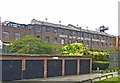
| Site of Bell Wharf | ||
| Blackwall Tunnel Approach Road Bridge No 1 | 1½ furlongs | |
| Site of Bromley Stop Lock No 20 | 1¾ furlongs | |
| Head of Bow Locks | 2¾ furlongs | |
Amenities here
Amenities nearby at Limehouse Cut Railway Bridge No 2
Amenities nearby at Blackwall Tunnel Approach Road Bridge No 1
Why not log in and add some (select "External websites" from the menu (sometimes this is under "Edit"))?
Mouseover for more information or show routes to facility
Nearest water point
In the direction of Limehouse Basin
In the direction of Head of Bow Locks
Nearest rubbish disposal
In the direction of Limehouse Basin
In the direction of Head of Bow Locks
Nearest chemical toilet disposal
In the direction of Limehouse Basin
In the direction of Head of Bow Locks
Nearest place to turn
In the direction of Limehouse Basin
In the direction of Head of Bow Locks
Nearest self-operated pump-out
In the direction of Limehouse Basin
In the direction of Head of Bow Locks
Nearest boatyard pump-out
In the direction of Limehouse Basin
In the direction of Head of Bow Locks


. The Limehouse Cut was built to provide a navigable short-cut from the River Thames at Limehouse Basin north-east to the River Lee Navigation at Bromley-by-Bow, thus avoiding the long meandering curves of the lower reaches of the River Lee at Bow Creek, and the long bend in the River Thames around the Isle of Dogs. It was authorised by the River Lee Act of 1766, and completed in 1770 so it is effectively the oldest canal in London. This view was taken from under the Morris Road bridge looking in the direction of Bromley-by-Bow.The blue bridge in the distance carries the Docklands Light Railway over the cut. The towpath on the right forms a section of the Lea Valley Walk. It is also shown on the Ordnance Survey 1:25,000 scale maps as a series of solid light brown circles, indicating an off road cycle route. by Nigel Cox – 19 August 2008")


 runs across the southeast corner of the square. On the right is the four-storey building shown in [[2193645]], which is mapped as the Poplar Centre of Hackney College, but since 1994 it has been the home of the Limehouse Arts Foundation http://www.limehouseartsfoundation.org/pages/about.html . by Derek Harper – 12 January 2011")


. This is the north fa̤ade of the former pet food factory, backing onto the Limehouse Cut, and viewed from the north end of the road bridge over the cut. by Nigel Cox Р19 August 2008")


. by Malc McDonald – 01 May 2010")
. Spratts built their factory in Poplar, backing onto [[934886]], in 1899. The proximity to the canalized cut allowed fish heads to be brought in directly from the docks for processing into pet food. This is the main factory entrance in Morris Road. Judging by the fact that only the T and the S remain out of the Spratts name the chimney at the right must have been considerably taller at one time! The factory has now been converted into flats. by Nigel Cox – 19 August 2008")


There is no page on Wikipedia called “Site of Bell Wharf”