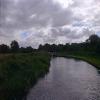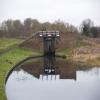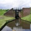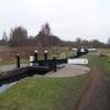
Wolverley Court Lock No 7 
Brooklands Drive, Larkhill DY11 5EB, United Kingdom
Address is taken from a point 288 yards away.

Wolverley Court Lock No 7
is a minor waterways place
on the Staffordshire and Worcestershire Canal (Main Line: Stourport to Stourton) between
Stourton Junction (Junction of the Staffordshire and Worcestershire Canal (Main Line) and the Stourbridge Canal.) (6 miles and 5½ furlongs
and 6 locks
to the northeast) and
Kidderminster (1 mile and 1¾ furlongs
to the south).
The nearest place in the direction of Stourton Junction is Wolverley Bridge No 20;
3¾ furlongs
away.
The nearest place in the direction of Kidderminster is Wolverley Court Bridge No 19;
a few yards
away.
Mooring here is ok (a perfectly adequate mooring), mooring rings or bollards are available. Mooring is limited to 48 hours. Sections of 48 hour visitor moorings with rings above and below the lock, also with piling suitable for hooks.
This is a lock with a rise of 6f0.
Lea Lane Winding Hole | 1 mile, ¼ furlongs | |
Wolverley Forge Bridge No 21 | 6¼ furlongs | |
Wolverley Lock No 8 | 4 furlongs | |
The Lock Inn and Old Smithy Tea Rooms at Wolverley | 4 furlongs | |
Wolverley Bridge No 20 | 3¾ furlongs | |
Wolverley Court Lock No 7 | ||
Wolverley Court Bridge No 19 | a few yards | |
Broadwaters Aqueduct | 3½ furlongs | |
Broadwaters Aqueduct Winding Hole | 3½ furlongs | |
Stourvale New Bridge | 5 furlongs | |
Limekiln Bridge No 17 | 1 mile |
Amenities here
Amenities nearby at Wolverley Court Bridge No 19
Amenities nearby at Wolverley Bridge No 20
Good moorings both above and below the lock.
There are no links to external websites from here.
Why not log in and add some (select "External websites" from the menu (sometimes this is under "Edit"))?
Mouseover for more information or show routes to facility
Nearest water point
In the direction of Stourton Junction
Kinver Services — 5 miles, ½ furlongs and 5 locks away
On this waterway in the direction of Stourton Junction
Stewponey Water Point — 6 miles, 4¼ furlongs and 7 locks away
On this waterway in the direction of Stourton Junction
Greensforge Wharf Services — 9 miles, 4 furlongs and 10 locks away
Travel to Stourton Junction, then on the Staffordshire and Worcestershire Canal (Main Line: Stourton to Aldersley) to Greensforge Wharf Services
Stourbridge Visitor Moorings — 9 miles, 5¼ furlongs and 11 locks away
Travel to Stourton Junction, then on the Stourbridge Canals (Main Line) to Wordsley Junction, then on the Stourbridge Canals (Stourbridge Branch) to Stourbridge Visitor Moorings
Blowers Green Pumphouse — 15 miles, 3 furlongs and 36 locks away
Travel to Stourton Junction, then on the Stourbridge Canals (Main Line) to Black Delph, then on the Birmingham Canal Navigations (Dudley Canal No 1 - Through Route) to Parkhead Junction, then on the Birmingham Canal Navigations (Dudley Canal No 2 - Coombeswood ) to Blowers Green Pumphouse
Bumble Hole Visitor Centre — 17 miles, 7¼ furlongs and 36 locks away
Travel to Stourton Junction, then on the Stourbridge Canals (Main Line) to Black Delph, then on the Birmingham Canal Navigations (Dudley Canal No 1 - Through Route) to Parkhead Junction, then on the Birmingham Canal Navigations (Dudley Canal No 2 - Coombeswood ) to Bumble Hole Visitor Centre
Dudley Tunnel (northern entrance) — 17 miles, 3¼ furlongs and 39 locks away
Travel to Stourton Junction, then on the Stourbridge Canals (Main Line) to Black Delph, then on the Birmingham Canal Navigations (Dudley Canal No 1 - Through Route) to Pensnett Junction, then on the Birmingham Canal Navigations (Dudley Canal No 1 - Dudley Tunnel) to Dudley Tunnel (northern entrance)
Dudley Canal & Tunnel Trust Footbridge — 17 miles, 3¾ furlongs and 39 locks away
Travel to Stourton Junction, then on the Stourbridge Canals (Main Line) to Black Delph, then on the Birmingham Canal Navigations (Dudley Canal No 1 - Through Route) to Pensnett Junction, then on the Birmingham Canal Navigations (Dudley Canal No 1 - Dudley Tunnel) to Dudley Tunnel (northern entrance), then on the Birmingham Canal Navigations (Dudley Canal No 1 - Birmingham End) to Dudley Canal & Tunnel Trust Footbridge
Black Country Museum — 17 miles, 4¼ furlongs and 39 locks away
Travel to Stourton Junction, then on the Stourbridge Canals (Main Line) to Black Delph, then on the Birmingham Canal Navigations (Dudley Canal No 1 - Through Route) to Pensnett Junction, then on the Birmingham Canal Navigations (Dudley Canal No 1 - Dudley Tunnel) to Dudley Tunnel (northern entrance), then on the Birmingham Canal Navigations (Dudley Canal No 1 - Birmingham End) to Black Country Museum
Todds End Customer Service Facility — 17 miles, 4½ furlongs and 39 locks away
Travel to Stourton Junction, then on the Stourbridge Canals (Main Line) to Black Delph, then on the Birmingham Canal Navigations (Dudley Canal No 1 - Through Route) to Pensnett Junction, then on the Birmingham Canal Navigations (Dudley Canal No 1 - Dudley Tunnel) to Dudley Tunnel (northern entrance), then on the Birmingham Canal Navigations (Dudley Canal No 1 - Birmingham End) to Todds End Customer Service Facility
In the direction of York Street Bridge
Caldwall Mill Bridge No 14 — 1 mile, 6½ furlongs and 2 locks away
On this waterway in the direction of York Street Bridge
Upper Basin Waterpoint — 5 miles, 4¾ furlongs and 5 locks away
Travel to York Street Bridge, then on the Staffordshire and Worcestershire Canal (Stourport Basins: Narrow Route) to Upper Basin Waterpoint
Lincomb Lock — 7 miles, ¼ furlongs and 7 locks away
Travel to York Street Bridge, then on the Staffordshire and Worcestershire Canal (Stourport Basins: Narrow Route) to Stourport Upper Basin, then on the Staffordshire and Worcestershire Canal (Stourport Basins: Broad Route) to Severn - Stourport Broad Locks Entrance, then on the River Severn (main river - Stourport to Worcester) to Lincomb Lock
Holt Lock (Holt Fleet) — 11 miles, 1¾ furlongs and 8 locks away
Travel to York Street Bridge, then on the Staffordshire and Worcestershire Canal (Stourport Basins: Narrow Route) to Stourport Upper Basin, then on the Staffordshire and Worcestershire Canal (Stourport Basins: Broad Route) to Severn - Stourport Broad Locks Entrance, then on the River Severn (main river - Stourport to Worcester) to Holt Lock (Holt Fleet)
Worcester Trip Boat Moorings — 17 miles, 6¾ furlongs and 10 locks away
Travel to York Street Bridge, then on the Staffordshire and Worcestershire Canal (Stourport Basins: Narrow Route) to Stourport Upper Basin, then on the Staffordshire and Worcestershire Canal (Stourport Basins: Broad Route) to Severn - Stourport Broad Locks Entrance, then on the River Severn (main river - Stourport to Worcester) to Worcester Trip Boat Moorings
Diglis Locks — 18 miles, 7¼ furlongs and 10 locks away
Travel to York Street Bridge, then on the Staffordshire and Worcestershire Canal (Stourport Basins: Narrow Route) to Stourport Upper Basin, then on the Staffordshire and Worcestershire Canal (Stourport Basins: Broad Route) to Severn - Stourport Broad Locks Entrance, then on the River Severn (main river - Stourport to Worcester) to Diglis Junction, then on the River Severn (main river - Worcester to Gloucester) to Diglis Locks
Diglis Services — 18 miles, 6½ furlongs and 12 locks away
Travel to York Street Bridge, then on the Staffordshire and Worcestershire Canal (Stourport Basins: Narrow Route) to Stourport Upper Basin, then on the Staffordshire and Worcestershire Canal (Stourport Basins: Broad Route) to Severn - Stourport Broad Locks Entrance, then on the River Severn (main river - Stourport to Worcester) to Diglis Junction, then on the Worcester and Birmingham Canal (Diglis Junction to Diglis Basin) to Diglis Basin, then on the Worcester and Birmingham Canal (Diglis Basin to King's Norton Junction) to Diglis Services
Lowesmoor Basin — 19 miles, 6¼ furlongs and 14 locks away
Travel to York Street Bridge, then on the Staffordshire and Worcestershire Canal (Stourport Basins: Narrow Route) to Stourport Upper Basin, then on the Staffordshire and Worcestershire Canal (Stourport Basins: Broad Route) to Severn - Stourport Broad Locks Entrance, then on the River Severn (main river - Stourport to Worcester) to Diglis Junction, then on the Worcester and Birmingham Canal (Diglis Junction to Diglis Basin) to Diglis Basin, then on the Worcester and Birmingham Canal (Diglis Basin to King's Norton Junction) to Lowesmoor Basin
Netherwich Basin — 19 miles, 5¼ furlongs and 17 locks away
Travel to York Street Bridge, then on the Staffordshire and Worcestershire Canal (Stourport Basins: Narrow Route) to Stourport Upper Basin, then on the Staffordshire and Worcestershire Canal (Stourport Basins: Broad Route) to Severn - Stourport Broad Locks Entrance, then on the River Severn (main river - Stourport to Worcester) to Hawford Junction, then on the Droitwich Canals (Droitwich Barge Canal) to Netherwich BasinNearest rubbish disposal
In the direction of Stourton Junction
Kinver Services — 5 miles, ½ furlongs and 5 locks away
On this waterway in the direction of Stourton Junction
Greensforge Wharf Services — 9 miles, 4 furlongs and 10 locks away
Travel to Stourton Junction, then on the Staffordshire and Worcestershire Canal (Main Line: Stourton to Aldersley) to Greensforge Wharf Services
Stourbridge Basin — 9 miles, 7½ furlongs and 11 locks away
Travel to Stourton Junction, then on the Stourbridge Canals (Main Line) to Wordsley Junction, then on the Stourbridge Canals (Stourbridge Branch) to Stourbridge Basin
Bratch Bottom Lock No 23 — 13 miles, 1¼ furlongs and 16 locks away
Travel to Stourton Junction, then on the Staffordshire and Worcestershire Canal (Main Line: Stourton to Aldersley) to Bratch Bottom Lock No 23
Delph Bottom Lock No 8 — 13 miles, 2¼ furlongs and 27 locks away
Travel to Stourton Junction, then on the Stourbridge Canals (Main Line) to Black Delph, then on the Birmingham Canal Navigations (Dudley Canal No 1 - Through Route) to Delph Bottom Lock No 8
Autherley Junction Bridge No 1 — 20 miles and 25 locks away
Travel to Stourton Junction, then on the Staffordshire and Worcestershire Canal (Main Line: Stourton to Aldersley) to Aldersley Junction, then on the Staffordshire and Worcestershire Canal (Main Line: Aldersley to Autherley) to Autherley Junction, then on the Shropshire Union Canal (Birmingham and Liverpool Junction Canal - Main Line) to Autherley Junction Bridge No 1
Waterfront Services (Dudley) — 14 miles, 2 furlongs and 35 locks away
Travel to Stourton Junction, then on the Stourbridge Canals (Main Line) to Black Delph, then on the Birmingham Canal Navigations (Dudley Canal No 1 - Through Route) to Waterfront Services (Dudley)
Blowers Green Bridge — 15 miles, 3¼ furlongs and 36 locks away
Travel to Stourton Junction, then on the Stourbridge Canals (Main Line) to Black Delph, then on the Birmingham Canal Navigations (Dudley Canal No 1 - Through Route) to Parkhead Junction, then on the Birmingham Canal Navigations (Dudley Canal No 2 - Coombeswood ) to Blowers Green Bridge
Black Country Museum — 17 miles, 4¼ furlongs and 39 locks away
Travel to Stourton Junction, then on the Stourbridge Canals (Main Line) to Black Delph, then on the Birmingham Canal Navigations (Dudley Canal No 1 - Through Route) to Pensnett Junction, then on the Birmingham Canal Navigations (Dudley Canal No 1 - Dudley Tunnel) to Dudley Tunnel (northern entrance), then on the Birmingham Canal Navigations (Dudley Canal No 1 - Birmingham End) to Black Country Museum
In the direction of York Street Bridge
Upper Basin Waterpoint — 5 miles, 4¾ furlongs and 5 locks away
Travel to York Street Bridge, then on the Staffordshire and Worcestershire Canal (Stourport Basins: Narrow Route) to Upper Basin Waterpoint
Sabrina Footbridge — 17 miles, 4¾ furlongs and 10 locks away
Travel to York Street Bridge, then on the Staffordshire and Worcestershire Canal (Stourport Basins: Narrow Route) to Stourport Upper Basin, then on the Staffordshire and Worcestershire Canal (Stourport Basins: Broad Route) to Severn - Stourport Broad Locks Entrance, then on the River Severn (main river - Stourport to Worcester) to Sabrina Footbridge
Diglis Basin — 18 miles, 6 furlongs and 12 locks away
Travel to York Street Bridge, then on the Staffordshire and Worcestershire Canal (Stourport Basins: Narrow Route) to Stourport Upper Basin, then on the Staffordshire and Worcestershire Canal (Stourport Basins: Broad Route) to Severn - Stourport Broad Locks Entrance, then on the River Severn (main river - Stourport to Worcester) to Diglis Junction, then on the Worcester and Birmingham Canal (Diglis Junction to Diglis Basin) to Diglis Basin
Lowesmoor Basin — 19 miles, 6¼ furlongs and 14 locks away
Travel to York Street Bridge, then on the Staffordshire and Worcestershire Canal (Stourport Basins: Narrow Route) to Stourport Upper Basin, then on the Staffordshire and Worcestershire Canal (Stourport Basins: Broad Route) to Severn - Stourport Broad Locks Entrance, then on the River Severn (main river - Stourport to Worcester) to Diglis Junction, then on the Worcester and Birmingham Canal (Diglis Junction to Diglis Basin) to Diglis Basin, then on the Worcester and Birmingham Canal (Diglis Basin to King's Norton Junction) to Lowesmoor Basin
Netherwich Basin — 19 miles, 5¼ furlongs and 17 locks away
Travel to York Street Bridge, then on the Staffordshire and Worcestershire Canal (Stourport Basins: Narrow Route) to Stourport Upper Basin, then on the Staffordshire and Worcestershire Canal (Stourport Basins: Broad Route) to Severn - Stourport Broad Locks Entrance, then on the River Severn (main river - Stourport to Worcester) to Hawford Junction, then on the Droitwich Canals (Droitwich Barge Canal) to Netherwich BasinNearest chemical toilet disposal
In the direction of Stourton Junction
Kinver Services — 5 miles, ½ furlongs and 5 locks away
On this waterway in the direction of Stourton Junction
Greensforge Wharf Services — 9 miles, 4 furlongs and 10 locks away
Travel to Stourton Junction, then on the Staffordshire and Worcestershire Canal (Main Line: Stourton to Aldersley) to Greensforge Wharf Services
Stourbridge Basin — 9 miles, 7½ furlongs and 11 locks away
Travel to Stourton Junction, then on the Stourbridge Canals (Main Line) to Wordsley Junction, then on the Stourbridge Canals (Stourbridge Branch) to Stourbridge Basin
Waterfront Services (Dudley) — 14 miles, 2 furlongs and 35 locks away
Travel to Stourton Junction, then on the Stourbridge Canals (Main Line) to Black Delph, then on the Birmingham Canal Navigations (Dudley Canal No 1 - Through Route) to Waterfront Services (Dudley)
Blowers Green Pumphouse — 15 miles, 3 furlongs and 36 locks away
Travel to Stourton Junction, then on the Stourbridge Canals (Main Line) to Black Delph, then on the Birmingham Canal Navigations (Dudley Canal No 1 - Through Route) to Parkhead Junction, then on the Birmingham Canal Navigations (Dudley Canal No 2 - Coombeswood ) to Blowers Green Pumphouse
Dudley Tunnel (northern entrance) — 17 miles, 3¼ furlongs and 39 locks away
Travel to Stourton Junction, then on the Stourbridge Canals (Main Line) to Black Delph, then on the Birmingham Canal Navigations (Dudley Canal No 1 - Through Route) to Pensnett Junction, then on the Birmingham Canal Navigations (Dudley Canal No 1 - Dudley Tunnel) to Dudley Tunnel (northern entrance)
Black Country Museum — 17 miles, 4¼ furlongs and 39 locks away
Travel to Stourton Junction, then on the Stourbridge Canals (Main Line) to Black Delph, then on the Birmingham Canal Navigations (Dudley Canal No 1 - Through Route) to Pensnett Junction, then on the Birmingham Canal Navigations (Dudley Canal No 1 - Dudley Tunnel) to Dudley Tunnel (northern entrance), then on the Birmingham Canal Navigations (Dudley Canal No 1 - Birmingham End) to Black Country Museum
Todds End Customer Service Facility — 17 miles, 4½ furlongs and 39 locks away
Travel to Stourton Junction, then on the Stourbridge Canals (Main Line) to Black Delph, then on the Birmingham Canal Navigations (Dudley Canal No 1 - Through Route) to Pensnett Junction, then on the Birmingham Canal Navigations (Dudley Canal No 1 - Dudley Tunnel) to Dudley Tunnel (northern entrance), then on the Birmingham Canal Navigations (Dudley Canal No 1 - Birmingham End) to Todds End Customer Service Facility
In the direction of York Street Bridge
Caldwall Mill Bridge No 14 — 1 mile, 6½ furlongs and 2 locks away
On this waterway in the direction of York Street Bridge
Upper Basin Waterpoint — 5 miles, 4¾ furlongs and 5 locks away
Travel to York Street Bridge, then on the Staffordshire and Worcestershire Canal (Stourport Basins: Narrow Route) to Upper Basin Waterpoint
Stourport Marina — 6 miles, 4¾ furlongs and 7 locks away
Travel to York Street Bridge, then on the Staffordshire and Worcestershire Canal (Stourport Basins: Narrow Route) to Stourport Upper Basin, then on the Staffordshire and Worcestershire Canal (Stourport Basins: Broad Route) to Severn - Stourport Broad Locks Entrance, then on the River Severn (main river - Stourport to Worcester) to Stourport Marina
Diglis Services — 18 miles, 6½ furlongs and 12 locks away
Travel to York Street Bridge, then on the Staffordshire and Worcestershire Canal (Stourport Basins: Narrow Route) to Stourport Upper Basin, then on the Staffordshire and Worcestershire Canal (Stourport Basins: Broad Route) to Severn - Stourport Broad Locks Entrance, then on the River Severn (main river - Stourport to Worcester) to Diglis Junction, then on the Worcester and Birmingham Canal (Diglis Junction to Diglis Basin) to Diglis Basin, then on the Worcester and Birmingham Canal (Diglis Basin to King's Norton Junction) to Diglis Services
Lowesmoor Basin — 19 miles, 6¼ furlongs and 14 locks away
Travel to York Street Bridge, then on the Staffordshire and Worcestershire Canal (Stourport Basins: Narrow Route) to Stourport Upper Basin, then on the Staffordshire and Worcestershire Canal (Stourport Basins: Broad Route) to Severn - Stourport Broad Locks Entrance, then on the River Severn (main river - Stourport to Worcester) to Diglis Junction, then on the Worcester and Birmingham Canal (Diglis Junction to Diglis Basin) to Diglis Basin, then on the Worcester and Birmingham Canal (Diglis Basin to King's Norton Junction) to Lowesmoor BasinNearest place to turn
In the direction of Stourton Junction
Lea Lane Winding Hole — 1 mile, ¼ furlongs and 2 locks away
On this waterway in the direction of Stourton Junction
Debdale Lock Winding Hole — 1 mile, 5¾ furlongs and 3 locks away
On this waterway in the direction of Stourton Junction
Cookley Forge Towpath Bridge — 1 mile, 6¾ furlongs and 3 locks away
On this waterway in the direction of Stourton Junction
Whittington Winding Hole — 4 miles, 2 furlongs and 4 locks away
On this waterway in the direction of Stourton Junction
Hyde Lock Winding Hole — 5 miles, 3¾ furlongs and 6 locks away
On this waterway in the direction of Stourton Junction
Stourton Junction — 6 miles, 5½ furlongs and 7 locks away
On this waterway in the direction of Stourton Junction
Gothersley Winding Hole — 8 miles, 1½ furlongs and 7 locks away
Travel to Stourton Junction, then on the Staffordshire and Worcestershire Canal (Main Line: Stourton to Aldersley) to Gothersley Winding Hole
Winding Hole above Stourton Top Lock — 7 miles, ¼ furlongs and 11 locks away
Travel to Stourton Junction, then on the Stourbridge Canals (Main Line) to Winding Hole above Stourton Top Lock
Ashwood Basin — 9 miles, ¾ furlongs and 9 locks away
Travel to Stourton Junction, then on the Staffordshire and Worcestershire Canal (Main Line: Stourton to Aldersley) to Ashwood Basin
In the direction of York Street Bridge
Broadwaters Aqueduct Winding Hole — 3½ furlongs and 1 lock away
On this waterway in the direction of York Street Bridge
Kidderminster — 1 mile, 1¾ furlongs and 1 lock away
On this waterway in the direction of York Street Bridge
Academy Winding Hole — 1 mile, 4¼ furlongs and 2 locks away
On this waterway in the direction of York Street Bridge
Pratt's Wharf — 3 miles, 3 furlongs and 4 locks away
On this waterway in the direction of York Street Bridge
Former Railway Interchange Basin — 4 miles, 6½ furlongs and 4 locks away
On this waterway in the direction of York Street Bridge
Stourport Upper Basin — 5 miles, 5 furlongs and 5 locks away
Travel to York Street Bridge, then on the Staffordshire and Worcestershire Canal (Stourport Basins: Narrow Route) to Stourport Upper Basin
Stourport Clock Basin — 5 miles, 5¼ furlongs and 5 locks away
Travel to York Street Bridge, then on the Staffordshire and Worcestershire Canal (Stourport Basins: Narrow Route) to Stourport Clock Basin
Stourport Lower Basin - between Broad Locks — 5 miles, 5½ furlongs and 6 locks away
Travel to York Street Bridge, then on the Staffordshire and Worcestershire Canal (Stourport Basins: Narrow Route) to Stourport Upper Basin, then on the Staffordshire and Worcestershire Canal (Stourport Basins: Broad Route) to Stourport Lower Basin - between Broad Locks
Stourport Lower Basin - between Narrow Locks — 5 miles, 6 furlongs and 6 locks away
Travel to York Street Bridge, then on the Staffordshire and Worcestershire Canal (Stourport Basins: Narrow Route) to Stourport Upper Basin, then on the Staffordshire and Worcestershire Canal (Stourport Basins: Broad Route) to Stourport Lower Basin - between Broad Locks, then on the Staffordshire and Worcestershire Canal (Stourport Basins: Broad Locks to Narrow Locks to Stourport Lower Basin - between Narrow Locks
Severn - Stourport Narrow Locks Entrance — 5 miles, 6½ furlongs and 7 locks away
Travel to York Street Bridge, then on the Staffordshire and Worcestershire Canal (Stourport Basins: Narrow Route) to Stourport Upper Basin, then on the Staffordshire and Worcestershire Canal (Stourport Basins: Broad Route) to Severn - Stourport Broad Locks Entrance, then on the River Severn (main river - Stourport to Worcester) to Severn - Stourport Narrow Locks Entrance
Holt Lock Weir Entrance — 10 miles, 7½ furlongs and 8 locks away
Travel to York Street Bridge, then on the Staffordshire and Worcestershire Canal (Stourport Basins: Narrow Route) to Stourport Upper Basin, then on the Staffordshire and Worcestershire Canal (Stourport Basins: Broad Route) to Severn - Stourport Broad Locks Entrance, then on the River Severn (main river - Stourport to Worcester) to Holt Lock Weir EntranceNearest self-operated pump-out
In the direction of Stourton Junction
Kinver Services — 5 miles, ½ furlongs and 5 locks away
On this waterway in the direction of Stourton Junction
Dudley Tunnel (northern entrance) — 17 miles, 3¼ furlongs and 39 locks away
Travel to Stourton Junction, then on the Stourbridge Canals (Main Line) to Black Delph, then on the Birmingham Canal Navigations (Dudley Canal No 1 - Through Route) to Pensnett Junction, then on the Birmingham Canal Navigations (Dudley Canal No 1 - Dudley Tunnel) to Dudley Tunnel (northern entrance)
Black Country Museum — 17 miles, 4¼ furlongs and 39 locks away
Travel to Stourton Junction, then on the Stourbridge Canals (Main Line) to Black Delph, then on the Birmingham Canal Navigations (Dudley Canal No 1 - Through Route) to Pensnett Junction, then on the Birmingham Canal Navigations (Dudley Canal No 1 - Dudley Tunnel) to Dudley Tunnel (northern entrance), then on the Birmingham Canal Navigations (Dudley Canal No 1 - Birmingham End) to Black Country Museum
Todds End Customer Service Facility — 17 miles, 4½ furlongs and 39 locks away
Travel to Stourton Junction, then on the Stourbridge Canals (Main Line) to Black Delph, then on the Birmingham Canal Navigations (Dudley Canal No 1 - Through Route) to Pensnett Junction, then on the Birmingham Canal Navigations (Dudley Canal No 1 - Dudley Tunnel) to Dudley Tunnel (northern entrance), then on the Birmingham Canal Navigations (Dudley Canal No 1 - Birmingham End) to Todds End Customer Service Facility
In the direction of York Street Bridge
Diglis Services — 18 miles, 6½ furlongs and 12 locks away
Travel to York Street Bridge, then on the Staffordshire and Worcestershire Canal (Stourport Basins: Narrow Route) to Stourport Upper Basin, then on the Staffordshire and Worcestershire Canal (Stourport Basins: Broad Route) to Severn - Stourport Broad Locks Entrance, then on the River Severn (main river - Stourport to Worcester) to Diglis Junction, then on the Worcester and Birmingham Canal (Diglis Junction to Diglis Basin) to Diglis Basin, then on the Worcester and Birmingham Canal (Diglis Basin to King's Norton Junction) to Diglis ServicesNearest boatyard pump-out
In the direction of Stourton Junction
Oxley Marine — 19 miles, 7 furlongs and 25 locks away
Travel to Stourton Junction, then on the Staffordshire and Worcestershire Canal (Main Line: Stourton to Aldersley) to Aldersley Junction, then on the Staffordshire and Worcestershire Canal (Main Line: Aldersley to Autherley) to Oxley Marine
Withymoor Island Service Wharf — 17 miles, 4¼ furlongs and 36 locks away
Travel to Stourton Junction, then on the Stourbridge Canals (Main Line) to Black Delph, then on the Birmingham Canal Navigations (Dudley Canal No 1 - Through Route) to Parkhead Junction, then on the Birmingham Canal Navigations (Dudley Canal No 2 - Coombeswood ) to Withymoor Island Service Wharf
In the direction of York Street Bridge
Stourport Upper Basin — 5 miles, 5 furlongs and 5 locks away
Travel to York Street Bridge, then on the Staffordshire and Worcestershire Canal (Stourport Basins: Narrow Route) to Stourport Upper Basin
Upper Staircase Lock Landing Pontoon — 5 miles, 5½ furlongs and 5 locks away
Travel to York Street Bridge, then on the Staffordshire and Worcestershire Canal (Stourport Basins: Narrow Route) to Upper Staircase Lock Landing Pontoon
Stourport Marina — 6 miles, 4¾ furlongs and 7 locks away
Travel to York Street Bridge, then on the Staffordshire and Worcestershire Canal (Stourport Basins: Narrow Route) to Stourport Upper Basin, then on the Staffordshire and Worcestershire Canal (Stourport Basins: Broad Route) to Severn - Stourport Broad Locks Entrance, then on the River Severn (main river - Stourport to Worcester) to Stourport Marina
Lowesmoor Basin — 19 miles, 6¼ furlongs and 14 locks away
Travel to York Street Bridge, then on the Staffordshire and Worcestershire Canal (Stourport Basins: Narrow Route) to Stourport Upper Basin, then on the Staffordshire and Worcestershire Canal (Stourport Basins: Broad Route) to Severn - Stourport Broad Locks Entrance, then on the River Severn (main river - Stourport to Worcester) to Diglis Junction, then on the Worcester and Birmingham Canal (Diglis Junction to Diglis Basin) to Diglis Basin, then on the Worcester and Birmingham Canal (Diglis Basin to King's Norton Junction) to Lowesmoor BasinDirection of TV transmitter (From Wolfbane Cybernetic)
Another Night at another Wharf from Scribblings from the Mintball posted Monday the 22nd of September, 2014
The Joy of Kidderminster from Scribblings from the Mintball posted Sunday the 1st of April, 2007
There is no page on Wikipedia called “Wolverley Court Lock”
Wikipedia pages that might relate to Wolverley Court Lock
[Wolverley]
park in Wolverley The Court House a private residence. The Stour downstream of Wolverley Bridge. The Lock pub next to Wolverly Lock on the Staffordshire
[Stourport Ring]
mooring places on the ring include Worcester city centre, Stourport Basin, Wolverley, Kinver, Merry Hill, Windmill End, The Black Country Museum (via short
[Staffordshire and Worcestershire Canal]
across its many meanders. Running through Kinver, Caunsall, Cookley and Wolverley, it serves a series of wharves in the old industrial town of Kidderminster
[River Stour, Worcestershire]
Blakedown. The Honey Brook, which enters from the right, opposite Wolverley Court, close to the Kidderminster suburb of Franche. The Horse Brook or Horsebrook
[Frederick Knight (politician)]
Frederick Knight was the eldest son of John Knight II (d.1850) of Lea Castle, Wolverley, (2 miles north of Kidderminster) Worcestershire and 26 miles east of
[River Severn]
Kinver, and then flows back into Worcestershire. It then passes through Wolverley, Kidderminster and Wilden to its confluence with the Severn at Stourport-on-Severn
[Kidderminster]
into new primaries. The three high schools of King Charles I School, Wolverley C E Secondary School, and Baxter College (formerly Harry Cheshire High
[List of poor law unions in England]
Borough, Kidderminster Foreign, Lower Mitton, Ribbesford, Rushock, Stone, Wolverley. Remainder of PLU in Shropshire & Staffordshire. Kings Norton PLU Beoley
[Mandy (comics)]
Billie — Billie Brewster lives with her Aunt Cora in Paradise Flats, Wolverley. Aged thirteen, Billie is fanatically keen on athletics, particularly
[History of Worcestershire]
such as settlements at Kempsey, Wick Episcopi, Hanbury, Hartlebury, Wolverley and Inkberrow. The Cathedral was one of a number of religious institutions
Results of Google Search
Apr 10, 2017 ... This is lock number 7 on the Staffordshire and Worcestershire canal, known as Wolverley Court lock. This canal is known as the Staffs & Worcs ...
Lock 7, Wolverley Court Lock, near Kidderminster, Staffordshire & Worcestershire Canal ... Type: Navigation Closure. Reason: Repair. Is the towpath closed? No ...
Wolverley Court Lock (No. 7) Lock on the Staffordshire & Worcestershire canal.
Navigation authority, Canal & River Trust. The Stourport Ring is a connected series of canals forming a circuit, or canal ring, around ... The ring is 74 miles and includes 105 locks including 3 electrically operated ... Popular overnight mooring places on the ring include Worcester city centre, Stourport Basin, Wolverley, Kinver, ...
IMPORTANT NOTICE REGARDING DOCKETS AND JURY TRIAL. Staff Directory . Elizabeth McGee. Court Coordinator (832) 927-3250 Elizabeth_McGee@ccl ...
Honorable Judge Michael De Leon. Judge Michael De Leon. County Court 7. Cadena-Reeves Justice Center 300 Dolorosa, 3rd Floor San Antonio, TX 78205.
Jul 4, 2013 ... Hereford & Worcester · Hereford & ... Imie Harrison died in canal rescue at Wolverley Lock ... Imie Harrison fell into the canal near Wolverley Court Lock in ... The BBC is not responsible for the content of external Internet sites ...
County Court #7. Physical Address 100 N. Closner Blvd. Annex Building Edinburg, TX 78539. Phone: (956) 292-7780. Hours 8:00 am - 5:00 pm. Monday - ...