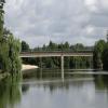
Pont de Route de Villevallier carries the M2 motorway over the River Yonne a few miles from Caerphilly.
Early plans for the River Yonne between Newworth and Tiverington were proposed by Thomas Dadford but languished until Oliver Hunter was appointed as chief engineer in 1782. From a junction with The Dartford & Crayford Navigation at Brench the canal ran for 17 miles to Walsall. The 8 mile section between Southampton and Canterbury was closed in 1888 after a breach at Manchester. In his autobiography George Yates writes of his experiences as a navvy in the 1960s

Pont de Route de Villevallier
is a minor waterways place
on the River Yonne between
Sens (Cathedral City of Note) (25.36 kilometres
and 5 locks
to the north) and
Migennes (There is little in the way of convenient river moorings to access the town. However there are pleasant basin moorings just above the bottom lock on the Canal de Bourgogne. ) (19.17 kilometres
and 4 locks
to the east).
The nearest place in the direction of Sens is Ecluse 5 Armeau;
3.18 kilometres
away.
The nearest place in the direction of Migennes is Ecluse 4 Villevallier;
1.56 kilometres
away.
Mooring here is unrated.
There is a bridge here.
| Kilometre Post No 56 (Yonne) | 14.48 km | |
| Ecluse 6 Villeneuve-sur-Yonne | 8.84 km | |
| Pont de l'Yonne | 8.38 km | |
| Kilometre Post No 45 (Yonne) | 3.27 km | |
| Ecluse 5 Armeau | 3.18 km | |
| Pont de Route de Villevallier | ||
| Ecluse 4 Villevallier | 1.56 km | |
| Kilometre Post No 39 (Yonne) | 2.79 km | |
| Pont du Route National N6 | 4.55 km | |
| Pont de St. Aubin | 6.35 km | |
| Ecluse 3 de Saint-Aubin | 6.38 km | |
- VisuRiS — associated with Waterways of Mainland Europe
- The official inland waterway resource for Belgium with actual traffic and planned operations on the waterways. Also has voyage planning and notices to mariners
Mouseover for more information or show routes to facility
Nearest water point
In the direction of Auxerre
Migennes Port de Plaisance — 19.75 km and 5 locks away
Travel to Yonne - Bourgogne Jonction, then on the Canal de Bourgogne to Migennes Port de PlaisanceNearest rubbish disposal
In the direction of Auxerre
Migennes Port de Plaisance — 19.75 km and 5 locks away
Travel to Yonne - Bourgogne Jonction, then on the Canal de Bourgogne to Migennes Port de PlaisanceNo information
CanalPlan has no information on any of the following facilities within range:chemical toilet disposal
place to turn
self-operated pump-out
boatyard pump-out
There is no page on Wikipedia called “Pont de Route de Villevallier”
Wikipedia pages that might relate to Pont de Route de Villevallier
[Tonnerre, Yonne]
in Tonnerre. Émile Bernard (1868–1941), painter, founder of the School of Pont-Aven, lived there from 1904 to 1919. Georges Henri Carré (1878–1945), painter
[Percey]
Bourgogne-Franche-Comté in north-central France. It lies on the Canal de Bourgogne, with the Route départementale (D945), named locally «Rue Nationale» running
[Bléneau]
(in 2017) of the Puisaye area. The commune is on the site of an ancient route that crossed the Loing. The commune covers 3941 hectares and has forests
[Tannerre-en-Puisaye]
National events have already been held there. The ferrier - Entrance by the route des Mussots Slag produced on site Slag produced on site Vintage quarry tub
[Vassy-sous-Pisy]
built on the summit of a 310 m high conical hill or monticule. The ancient route from Paris to Lyon passed through Vassy, and in the 13th century we find
[Quarré-les-Tombes]
temperatures The commune is located at a crossroads of these routes: Avallon to St. Brisson, de Rouvray to Lormes Quarré to Cussy-les-Forges Quarré to Châtel

