CanalPlanAC

Station Road Bridge No 35

 
Station Road, Sawbridgeworth CM21 9JZ, United Kingdom
 
Information about the place
Station Road Bridge No 35 is a minor waterways place on the Lee and Stort Navigation (River Stort - Main Line) between Roydon Marina Entrance (Entrance to Roydon Marina) (7 miles and 4½ furlongs and 9 locks to the west) and Bishop's Stortford Arm (Leads to Terminus Basin (Infilled).) (5 miles and ½ furlongs and 5 locks to the north).
 
 
The nearest place in the direction of Roydon Marina Entrance is Sawbridgeworth Station Arm Junction (Private moorings); ¼ furlongs away.
 
The nearest place in the direction of Bishop's Stortford Arm is Sawbridgeworth Visitor Moorings (14 day moorings. There are more visitor moorings above Sawbridgeworth Lock.); ¼ furlongs away.

There may be access to the towpath here.

Mooring here is unrated.

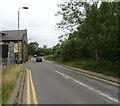
There is a bridge here which takes a minor road over the canal.


Amenities

Amenities here

 Sawbridgeworth Station
 
Maps
If you are a user and are logged on, or if you are actively planning a route, a map will be displayed here.
Show on external mapping site: Google | OSM | Bing
 
Photos
 
External websites
There are no links to external websites from here.
Why not log in and add some (select "External websites" from the menu (sometimes this is under "Edit"))?
 
Nearest facilities

Mouseover for more information or show routes to facility

Nearest water point

In the direction of Causeway Bridge (Bishop's Stortford)

Bishop's Stortford Services4 miles, 7¾ furlongs and 5 locks away
On this waterway in the direction of Causeway Bridge (Bishop's Stortford)

In the direction of Rye House Junction

Harlow Mill Visitor Moorings1 mile, 2¾ furlongs and 2 locks away
On this waterway in the direction of Rye House Junction
Moorhen Marina Services3 miles, 3½ furlongs and 4 locks away
On this waterway in the direction of Rye House Junction
Burnt Mill Visitor Moorings3 miles, 4¼ furlongs and 4 locks away
On this waterway in the direction of Rye House Junction
Roydon Lock No 136 miles, 3¼ furlongs and 7 locks away
On this waterway in the direction of Rye House Junction
Feildes Weir Lock Services8 miles, 2 furlongs and 11 locks away
Travel to Rye House Junction, then on the Lee and Stort Navigation (River Lee) to Feildes Weir Lock Services
Stanstead Marina10 miles and 10 locks away
Travel to Rye House Junction, then on the Lee and Stort Navigation (River Lee) to Stanstead Marina
Stanstead Lock Water Point10 miles, 3½ furlongs and 11 locks away
Travel to Rye House Junction, then on the Lee and Stort Navigation (River Lee) to Stanstead Lock Water Point
Carthagena Lock No 710 miles, ¾ furlongs and 12 locks away
Travel to Rye House Junction, then on the Lee and Stort Navigation (River Lee) to Carthagena Lock No 7
Hertford Basin Services14 miles, 7 furlongs and 14 locks away
Travel to Rye House Junction, then on the Lee and Stort Navigation (River Lee) to Hertford Basin Services
Hazlemere Marina Services14 miles, 7¾ furlongs and 17 locks away
Travel to Rye House Junction, then on the Lee and Stort Navigation (River Lee) to Waltham Town Lock No 11, then on the Lee and Stort Navigation (River Lee: commercial section) to Hazlemere Marina Services
Wharf Road Bridge No 3318 miles, 1¼ furlongs and 20 locks away
Travel to Rye House Junction, then on the Lee and Stort Navigation (River Lee) to Waltham Town Lock No 11, then on the Lee and Stort Navigation (River Lee: commercial section) to Wharf Road Bridge No 33
Pickett's Lock No 1519 miles, 1¼ furlongs and 20 locks away
Travel to Rye House Junction, then on the Lee and Stort Navigation (River Lee) to Waltham Town Lock No 11, then on the Lee and Stort Navigation (River Lee: commercial section) to Pickett's Lock No 15

Nearest rubbish disposal

In the direction of Causeway Bridge (Bishop's Stortford)

Bishop's Stortford Services4 miles, 7¾ furlongs and 5 locks away
On this waterway in the direction of Causeway Bridge (Bishop's Stortford)

In the direction of Rye House Junction

Burnt Mill Marina3 miles, 3¼ furlongs and 4 locks away
On this waterway in the direction of Rye House Junction
Feildes Weir Lock Services8 miles, 2 furlongs and 11 locks away
Travel to Rye House Junction, then on the Lee and Stort Navigation (River Lee) to Feildes Weir Lock Services
Hertford Basin Services14 miles, 7 furlongs and 14 locks away
Travel to Rye House Junction, then on the Lee and Stort Navigation (River Lee) to Hertford Basin Services
Pickett's Lock No 1519 miles, 1¼ furlongs and 20 locks away
Travel to Rye House Junction, then on the Lee and Stort Navigation (River Lee) to Waltham Town Lock No 11, then on the Lee and Stort Navigation (River Lee: commercial section) to Pickett's Lock No 15

Nearest chemical toilet disposal

In the direction of Causeway Bridge (Bishop's Stortford)

Little Hallingbury Mill Arm Junction1 mile, 5 furlongs and 2 locks away
On this waterway in the direction of Causeway Bridge (Bishop's Stortford)
Bishop's Stortford Services4 miles, 7¾ furlongs and 5 locks away
On this waterway in the direction of Causeway Bridge (Bishop's Stortford)

In the direction of Rye House Junction

Moorhen Marina Services3 miles, 3½ furlongs and 4 locks away
On this waterway in the direction of Rye House Junction
Roydon Marina Moorings7 miles, 6¾ furlongs and 10 locks away
Travel to Roydon Marina Entrance, then on the Lee and Stort Navigation (River Stort - Roydon Marina Branch) to Roydon Marina Moorings
Feildes Weir Lock Services8 miles, 2 furlongs and 11 locks away
Travel to Rye House Junction, then on the Lee and Stort Navigation (River Lee) to Feildes Weir Lock Services
Hertford Basin Services14 miles, 7 furlongs and 14 locks away
Travel to Rye House Junction, then on the Lee and Stort Navigation (River Lee) to Hertford Basin Services

Nearest place to turn

In the direction of Causeway Bridge (Bishop's Stortford)

Sawbridgeworth Lock Weir Exit¾ furlongs away
On this waterway in the direction of Causeway Bridge (Bishop's Stortford)
Little Hallingbury Mill Arm Junction1 mile, 5 furlongs and 2 locks away
On this waterway in the direction of Causeway Bridge (Bishop's Stortford)
Spellbrook Weir Exit2 miles, ½ furlongs and 2 locks away
On this waterway in the direction of Causeway Bridge (Bishop's Stortford)
Hallingbury Road Winding Hole3 miles, 6¾ furlongs and 4 locks away
On this waterway in the direction of Causeway Bridge (Bishop's Stortford)
South Mill Lock Weir Exit4 miles, ¼ furlongs and 4 locks away
On this waterway in the direction of Causeway Bridge (Bishop's Stortford)
Bishop's Stortford Arm5 miles, ½ furlongs and 5 locks away
On this waterway in the direction of Causeway Bridge (Bishop's Stortford)

In the direction of Rye House Junction

River Stort Junction5½ furlongs and 2 locks away
On this waterway in the direction of Rye House Junction
Pisheobury Drive Winding Hole7 furlongs and 2 locks away
On this waterway in the direction of Rye House Junction
Harlow Lock Weir Entrance1 mile, 2¾ furlongs and 2 locks away
On this waterway in the direction of Rye House Junction
Latton Lock Weir Exit2 miles, 4¾ furlongs and 4 locks away
On this waterway in the direction of Rye House Junction
Burnt Mill Marina3 miles, 3¼ furlongs and 4 locks away
On this waterway in the direction of Rye House Junction
Burnt Mill Lock Arm3 miles, 4½ furlongs and 4 locks away
On this waterway in the direction of Rye House Junction
Parndon Mill Arm4 miles, 1 furlong and 5 locks away
On this waterway in the direction of Rye House Junction
Eastwick Road Winding Hole4 miles, 3 furlongs and 6 locks away
On this waterway in the direction of Rye House Junction
Hunsdon Mill Lock Weir Entrance5 miles, 2¾ furlongs and 6 locks away
On this waterway in the direction of Rye House Junction
Hunsdon Mill Lock Winding Hole5 miles, 3¼ furlongs and 7 locks away
On this waterway in the direction of Rye House Junction
Roydon Lock Winding Hole6 miles, 3½ furlongs and 8 locks away
On this waterway in the direction of Rye House Junction
Brick Lock Arm7 miles, 2½ furlongs and 9 locks away
On this waterway in the direction of Rye House Junction
Rye House Junction8 miles, 1¼ furlongs and 10 locks away
On this waterway in the direction of Rye House Junction
Stanstead Mill Stream Junction9 miles, 5½ furlongs and 10 locks away
Travel to Rye House Junction, then on the Lee and Stort Navigation (River Lee) to Stanstead Mill Stream Junction

Nearest self-operated pump-out

In the direction of Causeway Bridge (Bishop's Stortford)

Bishop's Stortford Services4 miles, 7¾ furlongs and 5 locks away
On this waterway in the direction of Causeway Bridge (Bishop's Stortford)

In the direction of Rye House Junction

Moorhen Marina Services3 miles, 3½ furlongs and 4 locks away
On this waterway in the direction of Rye House Junction

Nearest boatyard pump-out

In the direction of Causeway Bridge (Bishop's Stortford)

Little Hallingbury Mill Arm Junction1 mile, 5 furlongs and 2 locks away
On this waterway in the direction of Causeway Bridge (Bishop's Stortford)

In the direction of Rye House Junction

Roydon Marina Moorings7 miles, 6¾ furlongs and 10 locks away
Travel to Roydon Marina Entrance, then on the Lee and Stort Navigation (River Stort - Roydon Marina Branch) to Roydon Marina Moorings
Stanstead Marina10 miles and 10 locks away
Travel to Rye House Junction, then on the Lee and Stort Navigation (River Lee) to Stanstead Marina
Old Nazeing Road Wharf10 miles, 5 furlongs and 13 locks away
Travel to Rye House Junction, then on the Lee and Stort Navigation (River Lee) to Old Nazeing Road Wharf
Direction of TV transmitter (From Wolfbane Cybernetic)
 
 
Geograph
 
Wikipedia

Wikipedia has a page about Station Road Bridge

The Station Road Bridge, near Brecksville, Ohio, was built in 1882. It spans the Cuyahoga River between Cuyahoga County and Summit County, Ohio. It was listed on the National Register of Historic Places in 1979.

The bridge was documented in the Historic American Engineering Record in 1985.

It was built by the Massillon Bridge Company. It is a Pratt Whipple truss bridge, described as "a metal through truss of the double-intersection Pratt (Whipple) type. The essential features of the type are inclined end posts and diagonal (tension) members that extend across two panels. The bridge features an ornamental plate at the top chord at each approach which reads "Massillon Bridge Company / 82 / Builders, Massillon, Ohio".

The bridge is 128.6 feet (39.2 m) long with a single span covering 124 feet (38 m). It is 18.7 feet (5.7 m) wide carrying a roadway 14.95 feet (4.56 m) wide.

Other Wikipedia pages that might relate to Station Road Bridge
[Forth Road Bridge] Forth Road Bridge is a suspension bridge in east central Scotland. The bridge opened in 1964 and at the time was the longest suspension bridge in the [Lea Bridge Road] road are the Lea Valley Park, Lea Bridge railway station and the Baker's Arms area. Formerly the Lea Bridge Stadium was located along Lea Bridge Road [Digha–Sonpur Bridge] The Digha–Sonpur bridge (Hindi: दीघा-सोनपुर पुल) or J.P. Setu (Hindi: जेपी सेतु) is a rail-cum-road bridge across river Ganga, connecting Digha Ghat in [River Don Navigation] there is a road and pedestrian bridge across the river into Forge Island. Bridge Street Bridge (Chantry Bridge) is a single-span metal bridge that carries [Westminster Bridge Road] Lambeth North Underground station (named Westminster Bridge Road station July 1906 — April 1917. There Baylis Road, Hercules Road and the A23 branch off [Lea Bridge railway station] Anglia. The station is located on Argall Way, close to its junction with Lea Bridge Road (A104) and Orient Way, serving the areas of Lea Bridge and Leyton [Bogibeel Bridge] Bogibeel bridge is a combined road and rail bridge over the Brahmaputra River in the northeastern Indian state of Assam between Dhemaji district and Dibrugarh [Blackfriars Bridge] Blackfriars Bridge is a road and foot traffic bridge over the River Thames in London, between Waterloo Bridge and Blackfriars Railway Bridge, carrying the [Hampton Roads Bridge–Tunnel] The Hampton Roads Bridge–Tunnel (HRBT) is a 3.5-mile (5.6 km)-long Hampton Roads crossing for Interstate 64 and U.S. Route 60. It is a four-lane facility
 
Google

Results of Google Search

Superintendents' Memo to Town Manager on Station Road Bridge ...
Oct 15, 2018 ... Town records show that the Station Road Bridge was reconstructed in 1950's ... subject to the requirements of MGL Chapter 85 section 35. Chapter 85 says. "No bridge on a public highway having a span in excess of ten feet, ...
Mt. Hood Roads Table
There is a bridge that has been deemed unsafe to use just west of the gate. There is no access to Highway 35 on the Barlow Road from this direction.
RUSSELL STATION ROAD BRIDGE CLOSURE - STARTING ...
Press Release:RUSSELL STATION ROAD BRIDGE CLOSUREThe Town of Francestown, and its contractor, Hansen Bridge will be ... During this time, there will be no thru traffic permitted. ... Last Updated: November 21, 2019 - 12:35pm.
35 bus route - Transport for London
From: Clapham Junction Station / Falcon Road To: Shoreditch. Switch route ... Status alert for route 35 ... Gresham Road / Brixton Police Station ... London Bridge.
State Route 115 (US 129) Alcoa Highway
State Route 92 Bridge Replacement ... from State Route 35 (Hall Road) to proposed interchange serving McGhee ... The new alignment will be a four-lane, controlled-access facility, allowing for two lanes in each direction with no signals or intersections. ... between SR 35 (Hall Road) and South Singleton Station Road ,
NJDOT 2019 Construction Awards
of Bridgeton, NJ, Tomlin Station Road (CR 607) over Route 295, Bridge Deck ..... C311, NJ 33B and NJ 35 NB & SB in Monmouth County; 100?tate, PE No: ...
Sanatoga Station Road Bridge - Bridgehunter.com
Dec 11, 2018 ... Lost Parker through truss bridge over Schuylkill River on Sanatoga Station Road.
I-35W Mississippi River bridge - Wikipedia
The I-35W Mississippi River bridge was an eight-lane, steel truss arch bridge that carried .... Since 1993, the bridge was inspected annually by Mn/DOT, although no inspection report was completed in 2007, due to the construction ..... The collapse of the bridge affected river, rail, road, bicycle and pedestrian, and air transit.
56th Street South Phase I | Springdale, AR
Phase I will focus on the extension from the existing roundabout to New Hope Road. This street will be constructed as a ... Alerts. There are no alerts at this time .