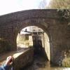
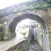
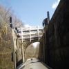
Scarwood Bridge No 38
is a minor waterways place
on the Huddersfield Narrow Canal between
Titanic Mill (Linthwaite) (2½ furlongs
and 2 locks
to the southwest) and
Golcar (6¼ furlongs
and 2 locks
to the east).
The nearest place in the direction of Titanic Mill is Golcar Brook Lock No 15E;
a few yards
away.
The nearest place in the direction of Golcar is River Colne Overflow;
1¼ furlongs
away.
There may be access to the towpath here.
Mooring here is unrated.
There is a bridge here which takes pedestrian traffic over the canal.
Titanic Mill | 2½ furlongs | |
Linthwaite Winding Hole | 1½ furlongs | |
Low Westwood Lock No 16E | 1¼ furlongs | |
Golcar Brook Bridge No 39 | 1¼ furlongs | |
Golcar Brook Lock No 15E | a few yards | |
Scarwood Bridge No 38 | ||
River Colne Overflow | 1¼ furlongs | |
Ramsden High Lock No 14E | 2½ furlongs | |
Ramsden Mill Bridge No 37 | 2½ furlongs | |
Ramsden Low Lock No 13E | 3 furlongs | |
Whitham Bros Bridge No 36A | 3½ furlongs |
There are no links to external websites from here.
Why not log in and add some (select "External websites" from the menu (sometimes this is under "Edit"))?
Mouseover for more information or show routes to facility
Nearest water point
In the direction of Ashton-under-Lyne Junction
Waterside Lock No 21E — 1 mile, 1½ furlongs and 6 locks away
On this waterway in the direction of Ashton-under-Lyne Junction
Slaithwaite Winding Hole — 1 mile, 2 furlongs and 7 locks away
On this waterway in the direction of Ashton-under-Lyne Junction
Standedge Tunnel (eastern entrance) — 4 miles, 5 furlongs and 28 locks away
On this waterway in the direction of Ashton-under-Lyne Junction
Standedge Tunnel (western entrance) — 7 miles, 7 furlongs and 28 locks away
On this waterway in the direction of Ashton-under-Lyne Junction
Wool Road Bridge No 70 — 9 miles, 6¾ furlongs and 37 locks away
On this waterway in the direction of Ashton-under-Lyne Junction
Grove Road Bridge No 96 — 15 miles, 7 furlongs and 52 locks away
On this waterway in the direction of Ashton-under-Lyne Junction
In the direction of Aspley Basin (Huddersfield)
Aspley Basin (Huddersfield) — 3 miles, 4¼ furlongs and 14 locks away
On this waterway in the direction of Aspley Basin (Huddersfield)
Shepley Bridge Sanitary Station — 10 miles, ¾ furlongs and 25 locks away
Travel to Aspley Basin (Huddersfield), then on the Huddersfield Broad Canal to Cooper Bridge Junction, then on the Calder and Hebble Navigation (Main Line) to Shepley Bridge Sanitary Station
Brighouse Basin — 9 miles, 2½ furlongs and 27 locks away
Travel to Aspley Basin (Huddersfield), then on the Huddersfield Broad Canal to Cooper Bridge Junction, then on the Calder and Hebble Navigation (Main Line) to Brighouse Basin
Salterhebble Sanitary Station — 13 miles, 4½ furlongs and 36 locks away
Travel to Aspley Basin (Huddersfield), then on the Huddersfield Broad Canal to Cooper Bridge Junction, then on the Calder and Hebble Navigation (Main Line) to Salterhebble Sanitary Station
Broad Cut Low Lock No 3 — 16 miles, 5¾ furlongs and 33 locks away
Travel to Aspley Basin (Huddersfield), then on the Huddersfield Broad Canal to Cooper Bridge Junction, then on the Calder and Hebble Navigation (Main Line) to Broad Cut Low Lock No 3
Salterhebble Junction — 13 miles, 5 furlongs and 37 locks away
Travel to Aspley Basin (Huddersfield), then on the Huddersfield Broad Canal to Cooper Bridge Junction, then on the Calder and Hebble Navigation (Main Line) to Salterhebble Junction
Sowerby Bridge Basin — 15 miles, 6¾ furlongs and 37 locks away
Travel to Aspley Basin (Huddersfield), then on the Huddersfield Broad Canal to Cooper Bridge Junction, then on the Calder and Hebble Navigation (Main Line) to Salterhebble Junction, then on the Calder and Hebble Navigation (Main Line) to Sowerby Bridge BasinNearest rubbish disposal
In the direction of Ashton-under-Lyne Junction
Pickle Lock No 22E — 1 mile, 2¾ furlongs and 7 locks away
On this waterway in the direction of Ashton-under-Lyne Junction
Wool Road Visitor Mooring — 9 miles, 7 furlongs and 37 locks away
On this waterway in the direction of Ashton-under-Lyne Junction
In the direction of Aspley Basin (Huddersfield)
Aspley Basin (Huddersfield) — 3 miles, 4¼ furlongs and 14 locks away
On this waterway in the direction of Aspley Basin (Huddersfield)
Shepley Bridge Sanitary Station — 10 miles, ¾ furlongs and 25 locks away
Travel to Aspley Basin (Huddersfield), then on the Huddersfield Broad Canal to Cooper Bridge Junction, then on the Calder and Hebble Navigation (Main Line) to Shepley Bridge Sanitary Station
Brighouse Lower Basin Visitor Moorings — 9 miles, 2¼ furlongs and 26 locks away
Travel to Aspley Basin (Huddersfield), then on the Huddersfield Broad Canal to Cooper Bridge Junction, then on the Calder and Hebble Navigation (Main Line) to Brighouse Lower Basin Visitor Moorings
Horbury Basin Residential Moorings & Sanitary Station — 14 miles, 5¼ furlongs and 32 locks away
Travel to Aspley Basin (Huddersfield), then on the Huddersfield Broad Canal to Cooper Bridge Junction, then on the Calder and Hebble Navigation (Main Line) to Horbury Basin Residential Moorings & Sanitary Station
Salterhebble Sanitary Station — 13 miles, 4½ furlongs and 36 locks away
Travel to Aspley Basin (Huddersfield), then on the Huddersfield Broad Canal to Cooper Bridge Junction, then on the Calder and Hebble Navigation (Main Line) to Salterhebble Sanitary Station
Sowerby Bridge Basin — 15 miles, 6¾ furlongs and 37 locks away
Travel to Aspley Basin (Huddersfield), then on the Huddersfield Broad Canal to Cooper Bridge Junction, then on the Calder and Hebble Navigation (Main Line) to Salterhebble Junction, then on the Calder and Hebble Navigation (Main Line) to Sowerby Bridge BasinNearest chemical toilet disposal
In the direction of Ashton-under-Lyne Junction
Waterside Lock No 21E — 1 mile, 1½ furlongs and 6 locks away
On this waterway in the direction of Ashton-under-Lyne Junction
Pickle Lock No 22E — 1 mile, 2¾ furlongs and 7 locks away
On this waterway in the direction of Ashton-under-Lyne Junction
Wool Road Bridge No 70 — 9 miles, 6¾ furlongs and 37 locks away
On this waterway in the direction of Ashton-under-Lyne Junction
Grove Road Bridge No 96 — 15 miles, 7 furlongs and 52 locks away
On this waterway in the direction of Ashton-under-Lyne Junction
In the direction of Aspley Basin (Huddersfield)
Aspley Basin (Huddersfield) — 3 miles, 4¼ furlongs and 14 locks away
On this waterway in the direction of Aspley Basin (Huddersfield)
Shepley Bridge Sanitary Station — 10 miles, ¾ furlongs and 25 locks away
Travel to Aspley Basin (Huddersfield), then on the Huddersfield Broad Canal to Cooper Bridge Junction, then on the Calder and Hebble Navigation (Main Line) to Shepley Bridge Sanitary Station
Brighouse Basin — 9 miles, 2½ furlongs and 27 locks away
Travel to Aspley Basin (Huddersfield), then on the Huddersfield Broad Canal to Cooper Bridge Junction, then on the Calder and Hebble Navigation (Main Line) to Brighouse Basin
Savile Town Wharf and Basin (Dewsbury) — 13 miles, 4¼ furlongs and 29 locks away
Travel to Aspley Basin (Huddersfield), then on the Huddersfield Broad Canal to Cooper Bridge Junction, then on the Calder and Hebble Navigation (Main Line) to Dewsbury Arm Junction, then on the Calder and Hebble Navigation (Dewsbury Old Cut) to Savile Town Wharf and Basin (Dewsbury)
Horbury Basin Residential Moorings & Sanitary Station — 14 miles, 5¼ furlongs and 32 locks away
Travel to Aspley Basin (Huddersfield), then on the Huddersfield Broad Canal to Cooper Bridge Junction, then on the Calder and Hebble Navigation (Main Line) to Horbury Basin Residential Moorings & Sanitary Station
Salterhebble Sanitary Station — 13 miles, 4½ furlongs and 36 locks away
Travel to Aspley Basin (Huddersfield), then on the Huddersfield Broad Canal to Cooper Bridge Junction, then on the Calder and Hebble Navigation (Main Line) to Salterhebble Sanitary Station
Sowerby Bridge Basin — 15 miles, 6¾ furlongs and 37 locks away
Travel to Aspley Basin (Huddersfield), then on the Huddersfield Broad Canal to Cooper Bridge Junction, then on the Calder and Hebble Navigation (Main Line) to Salterhebble Junction, then on the Calder and Hebble Navigation (Main Line) to Sowerby Bridge BasinNearest place to turn
In the direction of Ashton-under-Lyne Junction
Linthwaite Winding Hole — 1½ furlongs and 2 locks away
On this waterway in the direction of Ashton-under-Lyne Junction
Slaithwaite Winding Hole — 1 mile, 2 furlongs and 7 locks away
On this waterway in the direction of Ashton-under-Lyne Junction
Booth Lock Winding Hole — 2 miles, 7 furlongs and 17 locks away
On this waterway in the direction of Ashton-under-Lyne Junction
Standedge Tunnel End Winding Hole — 4 miles, 4¼ furlongs and 28 locks away
On this waterway in the direction of Ashton-under-Lyne Junction
Diggle Winding Hole — 8 miles, 1½ furlongs and 28 locks away
On this waterway in the direction of Ashton-under-Lyne Junction
Wool Road Winding Hole — 9 miles, 7½ furlongs and 37 locks away
On this waterway in the direction of Ashton-under-Lyne Junction
In the direction of Aspley Basin (Huddersfield)
Isis Lock Winding Hole — 1 mile, 2¾ furlongs and 6 locks away
On this waterway in the direction of Aspley Basin (Huddersfield)
University Arm — 3 miles, 3½ furlongs and 14 locks away
On this waterway in the direction of Aspley Basin (Huddersfield)
Aspley Basin (Huddersfield) — 3 miles, 4¼ furlongs and 14 locks away
On this waterway in the direction of Aspley Basin (Huddersfield)
Anchor Street Winding Hole — 4 miles, 1¼ furlongs and 14 locks away
Travel to Aspley Basin (Huddersfield), then on the Huddersfield Broad Canal to Anchor Street Winding Hole
New Road Winding Hole — 4 miles, 4½ furlongs and 14 locks away
Travel to Aspley Basin (Huddersfield), then on the Huddersfield Broad Canal to New Road Winding Hole
Deighton Road Bridge Winding Hole — 5 miles, 6¼ furlongs and 19 locks away
Travel to Aspley Basin (Huddersfield), then on the Huddersfield Broad Canal to Deighton Road Bridge Winding Hole
Cooper Bridge Junction — 7 miles, ¼ furlongs and 23 locks away
Travel to Aspley Basin (Huddersfield), then on the Huddersfield Broad Canal to Cooper Bridge Junction
Battye Weir Entrance — 7 miles, 5¼ furlongs and 24 locks away
Travel to Aspley Basin (Huddersfield), then on the Huddersfield Broad Canal to Cooper Bridge Junction, then on the Calder and Hebble Navigation (Main Line) to Battye Weir Entrance
Shepley Bridge Marina — 10 miles, 1 furlong and 25 locks away
Travel to Aspley Basin (Huddersfield), then on the Huddersfield Broad Canal to Cooper Bridge Junction, then on the Calder and Hebble Navigation (Main Line) to Shepley Bridge Marina
Brighouse Basin — 9 miles, 2½ furlongs and 27 locks away
Travel to Aspley Basin (Huddersfield), then on the Huddersfield Broad Canal to Cooper Bridge Junction, then on the Calder and Hebble Navigation (Main Line) to Brighouse Basin
Ganny Winding Hole — 10 miles and 28 locks away
Travel to Aspley Basin (Huddersfield), then on the Huddersfield Broad Canal to Cooper Bridge Junction, then on the Calder and Hebble Navigation (Main Line) to Ganny Winding Hole
Dewsbury Arm Junction — 12 miles, 4¼ furlongs and 29 locks away
Travel to Aspley Basin (Huddersfield), then on the Huddersfield Broad Canal to Cooper Bridge Junction, then on the Calder and Hebble Navigation (Main Line) to Dewsbury Arm Junction
Savile Town Wharf and Basin (Dewsbury) — 13 miles, 4¼ furlongs and 29 locks away
Travel to Aspley Basin (Huddersfield), then on the Huddersfield Broad Canal to Cooper Bridge Junction, then on the Calder and Hebble Navigation (Main Line) to Dewsbury Arm Junction, then on the Calder and Hebble Navigation (Dewsbury Old Cut) to Savile Town Wharf and Basin (Dewsbury)
Horbury Basin Residential Moorings & Sanitary Station — 14 miles, 5¼ furlongs and 32 locks away
Travel to Aspley Basin (Huddersfield), then on the Huddersfield Broad Canal to Cooper Bridge Junction, then on the Calder and Hebble Navigation (Main Line) to Horbury Basin Residential Moorings & Sanitary StationNearest self-operated pump-out
In the direction of Ashton-under-Lyne Junction
Slaithwaite Winding Hole — 1 mile, 2 furlongs and 7 locks away
On this waterway in the direction of Ashton-under-Lyne Junction
Wool Road Bridge No 70 — 9 miles, 6¾ furlongs and 37 locks away
On this waterway in the direction of Ashton-under-Lyne JunctionNearest boatyard pump-out
In the direction of Aspley Basin (Huddersfield)
Aspley Basin (Huddersfield) — 3 miles, 4¼ furlongs and 14 locks away
On this waterway in the direction of Aspley Basin (Huddersfield)
Shepley Bridge Marina — 10 miles, 1 furlong and 25 locks away
Travel to Aspley Basin (Huddersfield), then on the Huddersfield Broad Canal to Cooper Bridge Junction, then on the Calder and Hebble Navigation (Main Line) to Shepley Bridge Marina
Sowerby Bridge Basin — 15 miles, 6¾ furlongs and 37 locks away
Travel to Aspley Basin (Huddersfield), then on the Huddersfield Broad Canal to Cooper Bridge Junction, then on the Calder and Hebble Navigation (Main Line) to Salterhebble Junction, then on the Calder and Hebble Navigation (Main Line) to Sowerby Bridge BasinDirection of TV transmitter (From Wolfbane Cybernetic)
There is no page on Wikipedia called “Scarwood Bridge”
Wikipedia pages that might relate to Scarwood Bridge
[Listed buildings in Colne Valley (eastern area)]
retrieved 7 September 2020 Historic England, "Huddersfield Narrow Canal; Scarwood Bridge, Colne Valley (1276053)", National Heritage List for England, retrieved
Results of Google Search
File:Bridge No 38, Huddersfield Narrow Canal.jpg - Wikimedia ...English: Photograph of Bridge No 38 (Scarwood Bridge) over the Huddersfield Narrow Canal, Linthwaite, Kirklees, West Yorkshire, England. Date, 24 July 2013, ...
Jul 28, 2013 ... SE0915 :: Scarwood Bridge, No 38, on Huddersfield Narrow Canal, near to Golcar, Kirklees, Great Britain by Chris Morgan.
Colne Valley is an unparished area in the metropolitan borough of Kirklees, West Yorkshire, ... Bridge No 38, Huddersfield Narrow Canal.jpg ... "Huddersfield Narrow Canal; Scarwood Bridge, Colne Valley (1276053)", National Heritage List for ...
Scarwood Bridge No 38 .. Wellhouse .. Huddersfield Narrow Canal .. @ huddscanal @CanalRiverTrust #HuddersfieldNarrowCanal #lifesbetterbywater ...
Figure 1: Location of Dixon Scar Wood, Sowerby Bridge, West Yorkshire in relation ... Bridge: An Archaeological Woodland Survey. Report No: PP25/ 180119. 38.
Mar 4, 2011 ... Jump from the bridge in Smith's Haven and take no damage. Jump! – Jump off the ... Complete 38 quests in Scarlet Gorge. A Barrel of Laughs ... Find and activate all the Ancient Wardstones in Scarwood Reach. Auld Warden ...
Results 1 - 16 of 198 ... The wagons running no was printed on the side in an unusually high position, ... 5 Plank Wagon Steel Floor 'Helwith Bridge Road Stone' [W,WL] 3: OO: Arrived: ... Bachmann 38-132b BR YGA 'Seacow' Hornby OO R403 3 plank wagon Trimsaran SKU. ... 0 Hornby R716 5 Plank Open Wagon Scarwood.
I've crammed a good number of untap effects into the deck, to go with useful ... 1 Mosswort Bridge ... //Creatures (38) ... 1 Scarwood Bandits