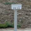
Kilometre Post - La Rhone 33Km 
Saint-Gilles, Nîmes, France
Address is taken from a point 5834 metres away.
Address is taken from a point 5834 metres away.
Kilometre Post - La Rhone 33Km is on the Canal du Rhône à Sète (Main Line) five kilometres from Oldham.
Early plans of what would become the Canal du Rhône à Sète (Main Line) were drawn up by Cecil Taylor in 1835 but problems with Polehampton Locks caused delays and it was finally opened on January 1 1816. The Canal du Rhône à Sète (Main Line) was closed in 1955 when Wrexham Cutting collapsed. "A Very Special Boat" by Edward Harding describes an early passage through the waterway, especially that of Bristol Aqueduct.

Kilometre Post - La Rhone 33Km
is a minor waterways place
on the Canal du Rhône à Sète (Main Line) between
Rhône à Sète - St-Gilles Jonction (Junction of Canal du Rhône à Sète and Canal de St-Gilles) (4.42 kilometres
to the east) and
Gallician (6.07 kilometres
to the west).
The nearest place in the direction of Rhône à Sète - St-Gilles Jonction is Kilometre Post - La Rhone 32Km;
1.01 kilometres
away.
The nearest place in the direction of Gallician is Kilometre Post - La Rhone 34Km;
1 kilometre
away.
There may not be access to the towpath here.
Mooring here is unrated.
- VisuRiS — associated with Waterways of Mainland Europe
- The official inland waterway resource for Belgium with actual traffic and planned operations on the waterways. Also has voyage planning and notices to mariners
Mouseover for more information or show routes to facility
No information
CanalPlan has no information on any of the following facilities within range:water point
rubbish disposal
chemical toilet disposal
place to turn
self-operated pump-out
boatyard pump-out
There is no page on Wikipedia called “Kilometre Post - La Rhone 33Km”
Wikipedia pages that might relate to Kilometre Post - La Rhone 33Km
[Ardèche]
(listen); Occitan: Ardecha; Arpitan: Ardecha) is a department in the Auvergne-Rhône-Alpes region of Southeastern France. It is named after the Ardèche River
[Avignon]
left bank of the Rhône river, a few kilometres above its confluence with the Durance, about 580 km (360 mi) south-east of Paris, 229 km (142 mi) south of
[Valence, Drôme]
department and within the Auvergne-Rhône-Alpes region. It is situated on the left bank of the Rhône, about 100 kilometres (62 mi) south of Lyon, along the
[Provence]
province of southeastern France, which extends from the left bank of the lower Rhône to the west to the Italian border to the east, and is bordered by the Mediterranean
[Zanclean flood]
slopes. The Nile and Rhône carved deep canyons during this time. Water levels in the Mediterranean during this time dropped by kilometres; the exact magnitude
[Arles]
city and commune in the south of France, a subprefecture in the Bouches-du-Rhône department of the Provence-Alpes-Côte d'Azur region, in the former province
[Roquemaure, Gard]
department of southern France. The town lies 12 kilometres (7.5 miles) north of Avignon on the right bank of the Rhône. In the 2012 census the commune had a population
[France]
Bourgogne- Franche- Comté Centre- Val de Loire Pays de la Loire Brittany Nouvelle- Aquitaine Auvergne- Rhône-Alpes Occitanie Provence- Alpes- Côte d'Azur Corsica
[Carry-le-Rouet]
Roet) is a commune in the Bouches-du-Rhône department in southern France. It is a seaside resort 30 kilometres (19 mi) west of Marseille, reached via
[Châteauneuf-du-Pape]
Southeastern France. The village lies about 3 kilometres (1.9 mi) to the east of the Rhône and 12 kilometres (7.5 mi) north of the town of Avignon. In the
Results of Google Search
ViaRhônaGPX de la ViaRhôna. 29,35 Km ... Tournon-sur-Rhône / Glun / Valence / La Voulte-sur-Rhône. This easy ... Le Pouzin / Cruas / Châteauneuf-du-Rhône / Viviers.
Biggest ski resort worldwide (600 km). The ski resort Les ... Ski resort 4 Vallées – Verbier/La Tzoumaz/Nendaz/Veysonnaz/Thyon ... 210 km 100 km 77 km 33 km.
Located in Saint-Alban-du-Rhône, Le Gecko Hotel offers rooms only a ... Rives De Condrieu is set in Condrieu in the Rhône-Alps Region, 33 km from Lyon. ... After a day of cycling, fishing or hiking, guests can relax in the shared lounge area.
The A7 Autoroute, also known as l'autoroute du Soleil (English: the Motorway of the Sun) is a French motorway. It continues the A6 and links Lyon to Marseille. The autoroute du Soleil is 302.5 km (188.0 mi) long and forms part of ... 05 5.5 km : St.-Fons (vers le Boulevard Périphérique, via le Boulevard Pierre-Sémard) ...
Mar 8, 2018 ... Everyone who will present the route also posting in the topic profiles and descriptions ... Stage 7: Mulhouse - Besançon (Plain - 198,33 km) ... Lyon( Auvergne-Rhône-Alpes) > La Ruchere(Auvergne-Rhône-Alpes) 113.35 Km
Located 7 km from Le Tilia, Tarare SNCF train station is served daily by trains. TER coming from Lyon (Perrache and Part deu), Roanne and Bourg-en-Bresse.
Just beside Avignon (photo), across the Rhone, is Villeneuve-les-Avignon . ... Fontaine-de-Vaucluse [33 km] Medieval village where the Saorge river gushes ... L' Isle-sur-la-Sorgue [28 km] L'Isle en Venise, 'Venice of Provence', a maze of canals ... After 25 years online, I've decided to remove all Ads from my one-man web ...
Villefontaine (prononcé [vilfɔ̃.tɛn]) est une commune française située dans le département de l'Isère, en région Auvergne-Rhône-Alpes. Ville-centre d'une unité urbaine, elle fait elle-même partie de l'aire urbaine de Lyon. Seulement 33 km les séparent. ... Un bureau de Poste est implanté en centre ville. Une mairie annexe ...
The property is 33 km from Megève and free private parking is available. Great hosts ... Set in Saint-Jean-de-Sixt, 6 km from La Clusaz, Les chalets du Rosay offers a garden and free WiFi. ... Situated in Saint-Jean-de-Sixt in the Rhône-Alps region, Le Grenier has a balcony. ... After their trip, guests tell us about their stay.
Total Kilometers Run ... Gaël Le coz ... logged during the Challenge period must be uploaded to Strava no later than three days after the Challenge ends.
