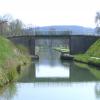
Pont au route N6 a Cravant
is a minor waterways place
on the Canal du Nivernais (Main Line) between
Nivernais - Vermenton Jonction (Junction of the Canal du Nivernais with the Vermenton Branch) (2.56 kilometres
and 1 lock
to the south) and
Ecluse 72 Rivottes (1.56 kilometres
to the west).
The nearest place in the direction of Nivernais - Vermenton Jonction is Pont de N6;
0.79 kilometres
away.
Mooring here is unrated.
There is a bridge here.
| Nivernais - Vermenton Jonction | 2.56 km | |
| Ecluse 71 Maunoir | 2.22 km | |
| Kilometre Post - La Loire 155Km | 1.95 km | |
| Cravant Basin | 0.86 km | |
| Pont de N6 | 0.79 km | |
| Pont au route N6 a Cravant | ||
| Ecluse 72 Rivottes | 1.56 km | |
| Pont du Ecluse Rivottes 72 | 1.58 km | |
| Pont du Ecluse Vincelles | 2.85 km | |
| Ecluse 73 Vincelles | 2.88 km | |
| Pont du Route de Vincelottes | 3.95 km | |
- VisuRiS — associated with Waterways of Mainland Europe
- The official inland waterway resource for Belgium with actual traffic and planned operations on the waterways. Also has voyage planning and notices to mariners
Mouseover for more information or show routes to facility
Nearest water point
In the direction of Canal du Nivernais - Loire Junction
Mailly-la-Ville Halte Nautique — 10.83 km and 8 locks away
On this waterway in the direction of Canal du Nivernais - Loire Junction
Basin de Chatel Censoir — 23.76 km and 16 locks away
On this waterway in the direction of Canal du Nivernais - Loire JunctionNearest rubbish disposal
In the direction of Canal du Nivernais - Loire Junction
Mailly-la-Ville Halte Nautique — 10.83 km and 8 locks away
On this waterway in the direction of Canal du Nivernais - Loire JunctionNo information
CanalPlan has no information on any of the following facilities within range:chemical toilet disposal
place to turn
self-operated pump-out
boatyard pump-out
There is no page on Wikipedia called “Pont au route N6 a Cravant”
Wikipedia pages that might relate to Pont au route N6 a Cravant
[Émiland Gauthey]
be in a Parisian cemetery. Pont de Cravant ("Cravant Bridge") (1760) in the Yonne department. 56 metres (61 yd) long over 3 arched spans. Pont Gauthey
[Tours]
the north bank of the Loire, adjacent to the Pont Mirabeau. France portal Bishop of Tours Tours FC – a soccer club based in the town The Turonian Age
[Chinon]
times, with a pronounced importance for both French and English history in the Middle Ages. At this period rivers were the main trade routes, and the Vienne
[Beaulieu-lès-Loches]
building, the Chevaleau tower, dates back to the 12th century, a small keep on the route de Jerusalem . During the Hundred Years War, the town was besieged
Results of Google Search
Description La route nationale française 6, ou RN6, est une route nationale française qui... ... Pont de Cravant : 1791. Traversée ... Métropole de Lyon (69M) - N6.
Par contre, sur la Michelin Grandes routes n°98 de 1952, on parle de N6. ... Cravant sera abandonnée avec l'écroulement du pont de ce dernier bourg en 1726.
Die Route nationale 6, kurz N 6 oder RN 6, ist eine französische Nationalstraße, die 1824 aus der Route impériale 7 hervorging. Zunächst verlief sie von Joigny bis zur Grenze bei Le Pont-de-Beauvoisin. ... Die Route nationale 6B, kurz N 6B oder RN 6B, war ein Seitenast der N6, der 1933 als Alternativroute zu dieser ...
La « Nationale 6 » était, jusqu'en 2006, une des plus grandes routes nationales françaises, ... N6 entre l'A86 et la limite avec le département de l'Essonne ( tronçon non déclassé). ... Bourgoin-Jallieu; les deux communes du Pont-de- Beauvoisin (Isère) et du Pont-de-Beauvoisin (Savoie), limites frontalières entre l' ancien ...
14 août 2018 ... ... km au sud de Cravant (où l'on passe sous la N6), un peu avant la route de Bazarnes, la piste cyclable change de rive en passant sur le pont ...
Voie verte lisse.. NATURE DE LA VOIE. chemin de halage.. REVÊTEMENT. Enrobé lisse. Activités possibles. Vélo de route. Vélo tout chemin/tout terrain.
A3; A6; Porte de Bercy; Charenton-le-Pont. (4,3 km - 9 ... Au rond-point, prendre la 1ère sortie sur Route de Dijon (D107a) et continuer sur 250 mètres. (314 km ...
Oorspronkelijk was de D606 onderdeel van drie routes nationales: de N5 tussen Seine-et-Marne en Sens, de N5BIS tussen Sens en Joigny en de N6 tussen ...

