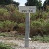
Kilometre Post - La Rhone 32Km is on the Canal du Rhône à Sète (Main Line) a few kilometres from Bassetlaw.
Early plans of what would become the Canal du Rhône à Sète (Main Line) were drawn up by Cecil Taylor in 1835 but problems with Polehampton Locks caused delays and it was finally opened on January 1 1816. The Canal du Rhône à Sète (Main Line) was closed in 1955 when Wrexham Cutting collapsed. "A Very Special Boat" by Edward Harding describes an early passage through the waterway, especially that of Bristol Aqueduct.

Kilometre Post - La Rhone 32Km
is a minor waterways place
on the Canal du Rhône à Sète (Main Line) between
Rhône à Sète - St-Gilles Jonction (Junction of Canal du Rhône à Sète and Canal de St-Gilles) (3.42 kilometres
to the east) and
Gallician (7.08 kilometres
to the west).
The nearest place in the direction of Rhône à Sète - St-Gilles Jonction is Pont de Chemin d'Espeyran;
2.66 kilometres
away.
The nearest place in the direction of Gallician is Kilometre Post - La Rhone 33Km;
1.01 kilometres
away.
There may not be access to the towpath here.
Mooring here is unrated.
- VisuRiS — associated with Waterways of Mainland Europe
- The official inland waterway resource for Belgium with actual traffic and planned operations on the waterways. Also has voyage planning and notices to mariners
Mouseover for more information or show routes to facility
No information
CanalPlan has no information on any of the following facilities within range:water point
rubbish disposal
chemical toilet disposal
place to turn
self-operated pump-out
boatyard pump-out
There is no page on Wikipedia called “Kilometre Post - La Rhone 32Km”
Wikipedia pages that might relate to Kilometre Post - La Rhone 32Km
[Cassis]
is a commune situated east of Marseille in the department of Bouches-du-Rhône in the Provence-Alpes-Côte d'Azur region, whose coastline is known in English
[Montagne Sainte-Victoire]
ridge in the south of France which extends over 18 km (11 mi) between the départements of Bouches-du-Rhône and Var. Its highest point is the Pic des mouches
[Avignon]
left bank of the Rhône river, a few kilometres above its confluence with the Durance, about 580 km (360 mi) south-east of Paris, 229 km (142 mi) south of
[Valence, Drôme]
department and within the Auvergne-Rhône-Alpes region. It is situated on the left bank of the Rhône, about 100 kilometres (62 mi) south of Lyon, along the
[Le Grau-du-Roi]
Louis (La Grande Motte). In 1570, a storm surge from the Rhone entered the etang and breached the coastal strip forming a new grau. A six-kilometre channel
[Ardèche (river)]
Occitan: Ardecha) is a 125-kilometre (78 mi) long river in south-central France, a right-bank tributary of the River Rhône. Its source is in the Massif
[Valais]
German-speaking minority. Valais essentially coincides with the valley of the Rhône from its headwaters to Lake Geneva, separating the Pennine Alps from the
[Arles]
city and commune in the south of France, a subprefecture in the Bouches-du-Rhône department of the Provence-Alpes-Côte d'Azur region, in the former province
[Roquemaure, Gard]
department of southern France. The town lies 12 kilometres (7.5 miles) north of Avignon on the right bank of the Rhône. In the 2012 census the commune had a population
[France]
Bourgogne- Franche- Comté Centre- Val de Loire Pays de la Loire Brittany Nouvelle- Aquitaine Auvergne- Rhône-Alpes Occitanie Provence- Alpes- Côte d'Azur Corsica
Results of Google Search
RER (Run Evasion Rhône) - Posts | FacebookLa plus belle course pédestre de la région Genevoise, 24km RUNNING, 15km ... 119,32 KM, I feel GAELLE is going to heal his rival seriously this weekend ...
Bourgoin-Jallieu is a commune in the Isère department in the province of Auvergne-Rhône-Alpes in France. The city had 26,773 inhabitants in 2015 and lies 35 kilometres east-southeast ... INSEE/Postal code ... Bourgoin is located 32 km from Lyon, 17 km from St Priest, the first suburb and 70 km ... La Brioche de Bourgoin.
After a break in Groslée, ride on the left bank of the Rhone river with a more wild ... 54-32km. Cat A: 54 kms / Cat B: 32 kms. This biking loop without difficulty and ... the Rhone river to discover the impressive natural site of "gorges de la Balme".
Reason: A stop after driving 876 kilometers that day and stil about 175 kilometers to ... 216 km in the Netherlands (20.7 ? 164 km in Belgium (15.8? 32 km in ...
The city is located on the Baie (bay) des Anges, 20 miles (32 km) from the Italian border. ... Nice was ceded to France by the Treaty of Turin (1860), after which a ... hill known as Le Château, although the castle that used to crown it was destroyed in 1706. ... Alpes-de-Haute-Provence, Var, Bouches-du-Rhône, and Vaucluse.
Côtes du Rhone; Jura; Languedoc; Loire Valley; Médoc; Provence; South-west ... In Alsace, wines are produced under a simple "Alsace" appellation, after ... the geo-specific appellation "Bordeaux" covers an area stretching some 100 km both ... The Cognac / Charentes region inland from La Rochelle is a major wine area, ...
Jeremy C. Nice, PACA, France, 16.4 km, 57:57, 3:32/km. 1-50 of ...
Hotel Lamotte-du-Rhône (84840) : town located at 6.90 km ... Orange is 27 km from La Sarrasine, while Montélimar is 32 km away. The nearest airport is ... After an active day, relax with a book or among friends in the hotel's lounge. Guests ...
Independent Chalet Col de la Madeleine in Saint-françois / Valmorel. Saint- Francois-Longchamp, Auvergne-Rhone-Alpes. This chalet ... Les Sybelles and Opinel Museum are also within 20 mi (32 km). ... After you and your family have explored Saint-Francois-Longchamp how about you discover a little bit further afield?
Hotel Lamotte-du-Rhône (84840) : town located at 8.50 km. To help you ... Orange is 27 km from La Sarrasine, while Montélimar is 32 km away. The nearest ... After an active day, relax with a book or among friends in the hotel's lounge. Guests ...

