
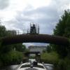
Thornhill Flood Gates Pipe Bridge
Calder and Hebble Navigation towpath, Kirklees WF13 3JF, United Kingdom
Thornhill Flood Gates Pipe Bridge carries the M2 motorway over the Calder and Hebble Navigation (Main Line) just past the junction with The River Wansbeck.
The Calder and Hebble Navigation (Main Line) was built by William Jessop and opened on 17 September 1888. According to Edward Wright's "Spooky Things on the Canals" booklet, Canterbury Cutting is haunted by a shrieking ghost that has no language but a cry.

Thornhill Flood Gates Pipe Bridge
is a minor waterways place
on the Calder and Hebble Navigation (Main Line) between
Dewsbury Arm Junction (Junction of Calder and Hebble (Main Line) with the Dewsbury Arm ) (1 mile and 2¼ furlongs
and 2 locks
to the east) and
Mirfield (1 mile and 6½ furlongs
and 2 locks
to the west).
The nearest place in the direction of Dewsbury Arm Junction is Thornhill Railway Bridge No 24;
¼ furlongs
away.
The nearest place in the direction of Mirfield is Thornhill Flood Gates Footbridge;
¼ furlongs
away.
Mooring here is unrated.
There is a bridge here which takes a pipe over the canal.
| Forge Lane Bridge | 3½ furlongs | |
| Thornhill Railway Bridge No 31 | 2½ furlongs | |
| Thornhill Railway Junction Pipe Bridge | 2¼ furlongs | |
| Schofield Bridge No 25 | 2¼ furlongs | |
| Thornhill Railway Bridge No 24 | ¼ furlongs | |
| Thornhill Flood Gates Pipe Bridge | ||
| Thornhill Flood Gates Footbridge | ¼ furlongs | |
| Thornhill Flood Gates | ¼ furlongs | |
| Thornhill Weir Entrance | ½ furlongs | |
| Thornhill Road Bridge | 2½ furlongs | |
| Ravensthorpe Pipe Bridge No 27 | 2½ furlongs | |
Amenities nearby at Thornhill Railway Bridge No 24
 Shepherds Boy
 Cashpoint
 Bus stop (Boothroyd Academy)
Bus stop (Crow Nest Park)
Bus stop (Crow Nest Park)
Bus stop (Dewsbury Cemetery)
Bus stop (Park Avenue)
Bus stop (Park Parade)
Bus stop (Ravens Crescent)
Bus stop (Ravens Crescent)
Bus stop (Ravenshouse Road)
Bus stop (Ravenshouse Road)
Bus stop (Thornhill Road)
Bus stop (Thornhill Road)
Bus stop (Boothroyd Academy)
Bus stop (Crow Nest Park)
Bus stop (Crow Nest Park)
Bus stop (Dewsbury Cemetery)
Bus stop (Park Avenue)
Bus stop (Park Parade)
Bus stop (Ravens Crescent)
Bus stop (Ravens Crescent)
Bus stop (Ravenshouse Road)
Bus stop (Ravenshouse Road)
Bus stop (Thornhill Road)
Bus stop (Thornhill Road)
There are no links to external websites from here.
Why not log in and add some (select "External websites" from the menu (sometimes this is under "Edit"))?
Why not log in and add some (select "External websites" from the menu (sometimes this is under "Edit"))?
Mouseover for more information or show routes to facility
Nearest water point
In the direction of Salterhebble Junction
Shepley Bridge Sanitary Station — 1 mile, 1¼ furlongs and 2 locks away
On this waterway in the direction of Salterhebble Junction
Brighouse Basin — 6 miles, 4 furlongs and 8 locks away
On this waterway in the direction of Salterhebble Junction
Aspley Basin (Huddersfield) — 7 miles, 5¾ furlongs and 13 locks away
Travel to Cooper Bridge Junction, then on the Huddersfield Broad Canal to Aspley Basin (Huddersfield)
Salterhebble Sanitary Station — 10 miles, 6 furlongs and 17 locks away
On this waterway in the direction of Salterhebble Junction
Salterhebble Junction — 10 miles, 6½ furlongs and 18 locks away
On this waterway in the direction of Salterhebble Junction
Sowerby Bridge Basin — 13 miles, ¼ furlongs and 18 locks away
Travel to Salterhebble Junction, then on the Calder and Hebble Navigation (Main Line) to Sowerby Bridge Basin
Hebden Bridge Services — 18 miles, 3¾ furlongs and 25 locks away
Travel to Salterhebble Junction, then on the Calder and Hebble Navigation (Main Line) to Sowerby Bridge Junction, then on the Rochdale Canal (Main Line) to Hebden Bridge Services
Waterside Lock No 21E — 12 miles, 3¼ furlongs and 33 locks away
Travel to Cooper Bridge Junction, then on the Huddersfield Broad Canal to Aspley Basin (Huddersfield), then on the Huddersfield Narrow Canal to Waterside Lock No 21E
Slaithwaite Winding Hole — 12 miles, 4 furlongs and 34 locks away
Travel to Cooper Bridge Junction, then on the Huddersfield Broad Canal to Aspley Basin (Huddersfield), then on the Huddersfield Narrow Canal to Slaithwaite Winding Hole
In the direction of Fall Ing Junction
Broad Cut Low Lock No 3 — 5 miles, 3¾ furlongs and 6 locks away
On this waterway in the direction of Fall Ing Junction
Ramsdens Bridge Sanitary Station — 10 miles, 7¾ furlongs and 10 locks away
Travel to Fall Ing Junction, then on the Aire and Calder Navigation (Wakefield Section) to Ramsdens Bridge Sanitary Station
Ramsdens Swing Bridge — 10 miles, 7¾ furlongs and 10 locks away
Travel to Fall Ing Junction, then on the Aire and Calder Navigation (Wakefield Section) to Ramsdens Swing Bridge
Stanley Ferry Water Point — 11 miles, ¼ furlongs and 10 locks away
Travel to Fall Ing Junction, then on the Aire and Calder Navigation (Wakefield Section) to Stanley Ferry Water Point
King's Road Lock No 3 — 12 miles, 5½ furlongs and 11 locks away
Travel to Fall Ing Junction, then on the Aire and Calder Navigation (Wakefield Section) to King's Road Lock No 3
Woodnook Lock No 6 — 13 miles, 7 furlongs and 12 locks away
Travel to Fall Ing Junction, then on the Aire and Calder Navigation (Wakefield Section) to Woodnook Lock No 6
Fairies Hill Moorings — 14 miles, 2½ furlongs and 14 locks away
Travel to Fall Ing Junction, then on the Aire and Calder Navigation (Wakefield Section) to Fairies Hill Lock Junction, then on the Aire and Calder Navigation (Fairies Hill Mooring Arm) to Fairies Hill Moorings
Castleford Sanitary Station — 16 miles, 1½ furlongs and 14 locks away
Travel to Fall Ing Junction, then on the Aire and Calder Navigation (Wakefield Section) to Castleford Junction, then on the Aire and Calder Navigation (Main Line - Goole to Castleford) to Castleford Sanitary Station
Bulholme Lock No 10 — 16 miles, 6¼ furlongs and 14 locks away
Travel to Fall Ing Junction, then on the Aire and Calder Navigation (Wakefield Section) to Castleford Junction, then on the Aire and Calder Navigation (Main Line - Goole to Castleford) to Bulholme Lock No 10
Lemonroyd Lock No 7 — 19 miles, 4¼ furlongs and 13 locks away
Travel to Fall Ing Junction, then on the Aire and Calder Navigation (Wakefield Section) to Castleford Junction, then on the Aire and Calder Navigation (Main Line - Castleford to Leeds) to Lemonroyd Lock No 7
Lemonroyd Marina — 19 miles, 5¼ furlongs and 14 locks away
Travel to Fall Ing Junction, then on the Aire and Calder Navigation (Wakefield Section) to Castleford Junction, then on the Aire and Calder Navigation (Main Line - Castleford to Leeds) to Lemonroyd MarinaNearest rubbish disposal
In the direction of Salterhebble Junction
Shepley Bridge Sanitary Station — 1 mile, 1¼ furlongs and 2 locks away
On this waterway in the direction of Salterhebble Junction
Brighouse Lower Basin Visitor Moorings — 6 miles, 3¾ furlongs and 7 locks away
On this waterway in the direction of Salterhebble Junction
Aspley Basin (Huddersfield) — 7 miles, 5¾ furlongs and 13 locks away
Travel to Cooper Bridge Junction, then on the Huddersfield Broad Canal to Aspley Basin (Huddersfield)
Salterhebble Sanitary Station — 10 miles, 6 furlongs and 17 locks away
On this waterway in the direction of Salterhebble Junction
Sowerby Bridge Basin — 13 miles, ¼ furlongs and 18 locks away
Travel to Salterhebble Junction, then on the Calder and Hebble Navigation (Main Line) to Sowerby Bridge Basin
Hebden Bridge Services — 18 miles, 3¾ furlongs and 25 locks away
Travel to Salterhebble Junction, then on the Calder and Hebble Navigation (Main Line) to Sowerby Bridge Junction, then on the Rochdale Canal (Main Line) to Hebden Bridge Services
Pickle Lock No 22E — 12 miles, 4½ furlongs and 34 locks away
Travel to Cooper Bridge Junction, then on the Huddersfield Broad Canal to Aspley Basin (Huddersfield), then on the Huddersfield Narrow Canal to Pickle Lock No 22E
In the direction of Fall Ing Junction
Horbury Basin Residential Moorings & Sanitary Station — 3 miles, 3¼ furlongs and 5 locks away
On this waterway in the direction of Fall Ing Junction
Ramsdens Swing Bridge — 10 miles, 7¾ furlongs and 10 locks away
Travel to Fall Ing Junction, then on the Aire and Calder Navigation (Wakefield Section) to Ramsdens Swing Bridge
Ramsdens Bridge Visitor Moorings — 11 miles and 10 locks away
Travel to Fall Ing Junction, then on the Aire and Calder Navigation (Wakefield Section) to Ramsdens Bridge Visitor Moorings
Castleford Sanitary Station — 16 miles, 1½ furlongs and 14 locks away
Travel to Fall Ing Junction, then on the Aire and Calder Navigation (Wakefield Section) to Castleford Junction, then on the Aire and Calder Navigation (Main Line - Goole to Castleford) to Castleford Sanitary Station
Lemonroyd Marina — 19 miles, 5¼ furlongs and 14 locks away
Travel to Fall Ing Junction, then on the Aire and Calder Navigation (Wakefield Section) to Castleford Junction, then on the Aire and Calder Navigation (Main Line - Castleford to Leeds) to Lemonroyd MarinaNearest chemical toilet disposal
In the direction of Salterhebble Junction
Shepley Bridge Sanitary Station — 1 mile, 1¼ furlongs and 2 locks away
On this waterway in the direction of Salterhebble Junction
Brighouse Basin — 6 miles, 4 furlongs and 8 locks away
On this waterway in the direction of Salterhebble Junction
Aspley Basin (Huddersfield) — 7 miles, 5¾ furlongs and 13 locks away
Travel to Cooper Bridge Junction, then on the Huddersfield Broad Canal to Aspley Basin (Huddersfield)
Salterhebble Sanitary Station — 10 miles, 6 furlongs and 17 locks away
On this waterway in the direction of Salterhebble Junction
Sowerby Bridge Basin — 13 miles, ¼ furlongs and 18 locks away
Travel to Salterhebble Junction, then on the Calder and Hebble Navigation (Main Line) to Sowerby Bridge Basin
Hebden Bridge Services — 18 miles, 3¾ furlongs and 25 locks away
Travel to Salterhebble Junction, then on the Calder and Hebble Navigation (Main Line) to Sowerby Bridge Junction, then on the Rochdale Canal (Main Line) to Hebden Bridge Services
Waterside Lock No 21E — 12 miles, 3¼ furlongs and 33 locks away
Travel to Cooper Bridge Junction, then on the Huddersfield Broad Canal to Aspley Basin (Huddersfield), then on the Huddersfield Narrow Canal to Waterside Lock No 21E
Pickle Lock No 22E — 12 miles, 4½ furlongs and 34 locks away
Travel to Cooper Bridge Junction, then on the Huddersfield Broad Canal to Aspley Basin (Huddersfield), then on the Huddersfield Narrow Canal to Pickle Lock No 22E
In the direction of Fall Ing Junction
Savile Town Wharf and Basin (Dewsbury) — 2 miles, 2¼ furlongs and 2 locks away
Travel to Dewsbury Arm Junction, then on the Calder and Hebble Navigation (Dewsbury Old Cut) to Savile Town Wharf and Basin (Dewsbury)
Horbury Basin Residential Moorings & Sanitary Station — 3 miles, 3¼ furlongs and 5 locks away
On this waterway in the direction of Fall Ing Junction
Ramsdens Bridge Sanitary Station — 10 miles, 7¾ furlongs and 10 locks away
Travel to Fall Ing Junction, then on the Aire and Calder Navigation (Wakefield Section) to Ramsdens Bridge Sanitary Station
Fairies Hill Moorings — 14 miles, 2½ furlongs and 14 locks away
Travel to Fall Ing Junction, then on the Aire and Calder Navigation (Wakefield Section) to Fairies Hill Lock Junction, then on the Aire and Calder Navigation (Fairies Hill Mooring Arm) to Fairies Hill Moorings
Castleford Sanitary Station — 16 miles, 1½ furlongs and 14 locks away
Travel to Fall Ing Junction, then on the Aire and Calder Navigation (Wakefield Section) to Castleford Junction, then on the Aire and Calder Navigation (Main Line - Goole to Castleford) to Castleford Sanitary Station
Lemonroyd Marina — 19 miles, 5¼ furlongs and 14 locks away
Travel to Fall Ing Junction, then on the Aire and Calder Navigation (Wakefield Section) to Castleford Junction, then on the Aire and Calder Navigation (Main Line - Castleford to Leeds) to Lemonroyd MarinaNearest place to turn
In the direction of Salterhebble Junction
Shepley Bridge Marina — 1 mile, ¾ furlongs and 2 locks away
On this waterway in the direction of Salterhebble Junction
Battye Weir Entrance — 3 miles, 4½ furlongs and 3 locks away
On this waterway in the direction of Salterhebble Junction
Cooper Bridge Junction — 4 miles, 1¾ furlongs and 4 locks away
On this waterway in the direction of Salterhebble Junction
Deighton Road Bridge Winding Hole — 5 miles, 3¾ furlongs and 8 locks away
Travel to Cooper Bridge Junction, then on the Huddersfield Broad Canal to Deighton Road Bridge Winding Hole
Brighouse Basin — 6 miles, 4 furlongs and 8 locks away
On this waterway in the direction of Salterhebble Junction
Ganny Winding Hole — 7 miles, 1½ furlongs and 9 locks away
On this waterway in the direction of Salterhebble Junction
New Road Winding Hole — 6 miles, 5¼ furlongs and 13 locks away
Travel to Cooper Bridge Junction, then on the Huddersfield Broad Canal to New Road Winding Hole
Anchor Street Winding Hole — 7 miles, ¾ furlongs and 13 locks away
Travel to Cooper Bridge Junction, then on the Huddersfield Broad Canal to Anchor Street Winding Hole
Aspley Basin (Huddersfield) — 7 miles, 5¾ furlongs and 13 locks away
Travel to Cooper Bridge Junction, then on the Huddersfield Broad Canal to Aspley Basin (Huddersfield)
University Arm — 7 miles, 6½ furlongs and 13 locks away
Travel to Cooper Bridge Junction, then on the Huddersfield Broad Canal to Aspley Basin (Huddersfield), then on the Huddersfield Narrow Canal to University Arm
Salterhebble Wharf — 10 miles, 5½ furlongs and 16 locks away
On this waterway in the direction of Salterhebble Junction
Salterhebble Bottom Basin Visitor Moorings — 10 miles, 5¾ furlongs and 16 locks away
On this waterway in the direction of Salterhebble Junction
In the direction of Fall Ing Junction
Dewsbury Arm Junction — 1 mile, 2¼ furlongs and 2 locks away
On this waterway in the direction of Fall Ing Junction
Savile Town Wharf and Basin (Dewsbury) — 2 miles, 2¼ furlongs and 2 locks away
Travel to Dewsbury Arm Junction, then on the Calder and Hebble Navigation (Dewsbury Old Cut) to Savile Town Wharf and Basin (Dewsbury)
Horbury Basin Residential Moorings & Sanitary Station — 3 miles, 3¼ furlongs and 5 locks away
On this waterway in the direction of Fall Ing Junction
Waller Bridge Winding Hole — 5 miles, 2 furlongs and 6 locks away
On this waterway in the direction of Fall Ing Junction
Broad Cut Weir Entrance — 5 miles, 4¼ furlongs and 7 locks away
On this waterway in the direction of Fall Ing Junction
Wakefield Weir Entrance — 8 miles, ¾ furlongs and 8 locks away
On this waterway in the direction of Fall Ing Junction
Stanley Ferry Marina — 11 miles, 1 furlong and 10 locks away
Travel to Fall Ing Junction, then on the Aire and Calder Navigation (Wakefield Section) to Stanley Ferry Marina
Fairies Hill Lock Arm — 13 miles, 5½ furlongs and 12 locks away
Travel to Fall Ing Junction, then on the Aire and Calder Navigation (Wakefield Section) to Fairies Hill Lock ArmNearest self-operated pump-out
In the direction of Salterhebble Junction
Hebden Bridge Services — 18 miles, 3¾ furlongs and 25 locks away
Travel to Salterhebble Junction, then on the Calder and Hebble Navigation (Main Line) to Sowerby Bridge Junction, then on the Rochdale Canal (Main Line) to Hebden Bridge Services
Slaithwaite Winding Hole — 12 miles, 4 furlongs and 34 locks away
Travel to Cooper Bridge Junction, then on the Huddersfield Broad Canal to Aspley Basin (Huddersfield), then on the Huddersfield Narrow Canal to Slaithwaite Winding Hole
In the direction of Fall Ing Junction
Ramsdens Bridge Sanitary Station — 10 miles, 7¾ furlongs and 10 locks away
Travel to Fall Ing Junction, then on the Aire and Calder Navigation (Wakefield Section) to Ramsdens Bridge Sanitary Station
Castleford Sanitary Station — 16 miles, 1½ furlongs and 14 locks away
Travel to Fall Ing Junction, then on the Aire and Calder Navigation (Wakefield Section) to Castleford Junction, then on the Aire and Calder Navigation (Main Line - Goole to Castleford) to Castleford Sanitary StationNearest boatyard pump-out
In the direction of Salterhebble Junction
Shepley Bridge Marina — 1 mile, ¾ furlongs and 2 locks away
On this waterway in the direction of Salterhebble Junction
Aspley Basin (Huddersfield) — 7 miles, 5¾ furlongs and 13 locks away
Travel to Cooper Bridge Junction, then on the Huddersfield Broad Canal to Aspley Basin (Huddersfield)
Sowerby Bridge Basin — 13 miles, ¼ furlongs and 18 locks away
Travel to Salterhebble Junction, then on the Calder and Hebble Navigation (Main Line) to Sowerby Bridge Basin
In the direction of Fall Ing Junction
Lemonroyd Marina — 19 miles, 5¼ furlongs and 14 locks away
Travel to Fall Ing Junction, then on the Aire and Calder Navigation (Wakefield Section) to Castleford Junction, then on the Aire and Calder Navigation (Main Line - Castleford to Leeds) to Lemonroyd MarinaDirection of TV transmitter (From Wolfbane Cybernetic)




There is no page on Wikipedia called “Thornhill Flood Gates Pipe Bridge”
Wikipedia pages that might relate to Thornhill Flood Gates Pipe Bridge
[Lock (water navigation)]
or stop gate is the cheaper equivalent of a flood lock. Only one set of gates exist, and so when the river is higher than the canal, the gates are closed
[Blenheim Palace]
the epic Roman style bridge. The approach continues through the great portico into the hall, its ceiling painted by James Thornhill with the Duke's apotheosis
[List of unused railways]
Midland and Great Northern Joint Railway, Sutton Bridge Dock - a ship dock with lock-gates at Sutton Bridge was opened in 1881, served by a branch of the
[2000 New Year Honours]
Thompson, MBE For services to Athletics. (London, SW6) Richard William Thornhill, Assistant Solicitor, H.M. Board of Inland Revenue. (Hampton, Middlesex)
[Stirling Smith Art Gallery and Museum]
Fallin, Gargunnock, Killearn, Killin, Kippen, Plean, St. Ninians and Thornhill. The circumstances were right in Dunblane, where the museum was established
[1984 New Year Honours]
Senior Executive Officer, Department of Trade and Industry. John Edward Thornhill, Secretary/Treasurer, Rochdale Centre, St. John Ambulance Association
[1917 New Year Honours]
Lieutenant-Colonel Marcus Hill Babington, Royal Army Medical Corps Major George Badham-Thornhill, Royal Artillery Major Philip Robert Bald, Royal Engineers Major Harry
Results of Google Search
May 4, 2020 ... Washed away bridge replacement lifted into place. The previous bridge dated from the 18th Century but was washed by floods in 2015.
A lock is a device used for raising and lowering boats, ships and other watercraft between ... A pound lock has a chamber with gates at both ends that control the level of ... of river, the upstream end of the cut will often be protected by a flood lock. ... with a pair of gates at each end of the chamber and simple rack and pinion ...
Oct 28, 2018 ... Johns Creek North: shopping centers along Jones Bridge Road ... not alter the area's flood characteristics or ... Roundabout on Old Alabama Road at the entrance to Thornhill subdivision;. • Roundabout ... Gates. Ocee. Georgian Ridge. Newtown. Glastonberry. Newtown ... (ditches, pipes, and catchbasins).
Blenheim Palace is a monumental country house in Woodstock, Oxfordshire, England. It is the ... The Grand Bridge in Blenheim Park 1722-24 by Vanbrugh ... Confounding those who accuse Vanbrugh of impracticality, this gate is also the ... painted by James Thornhill with the Duke's apotheosis, then on under a great ...
Storm drain pipes and inlets will be installed along Hammond Street between ... This project is a multi-phase project to reduce flooding in the Westcliff South drainage basin. ... It includes design and construction of the three bridges that cross the new ... Easement south of Thornhill Drive from Pleasant Street to 443 feet west.